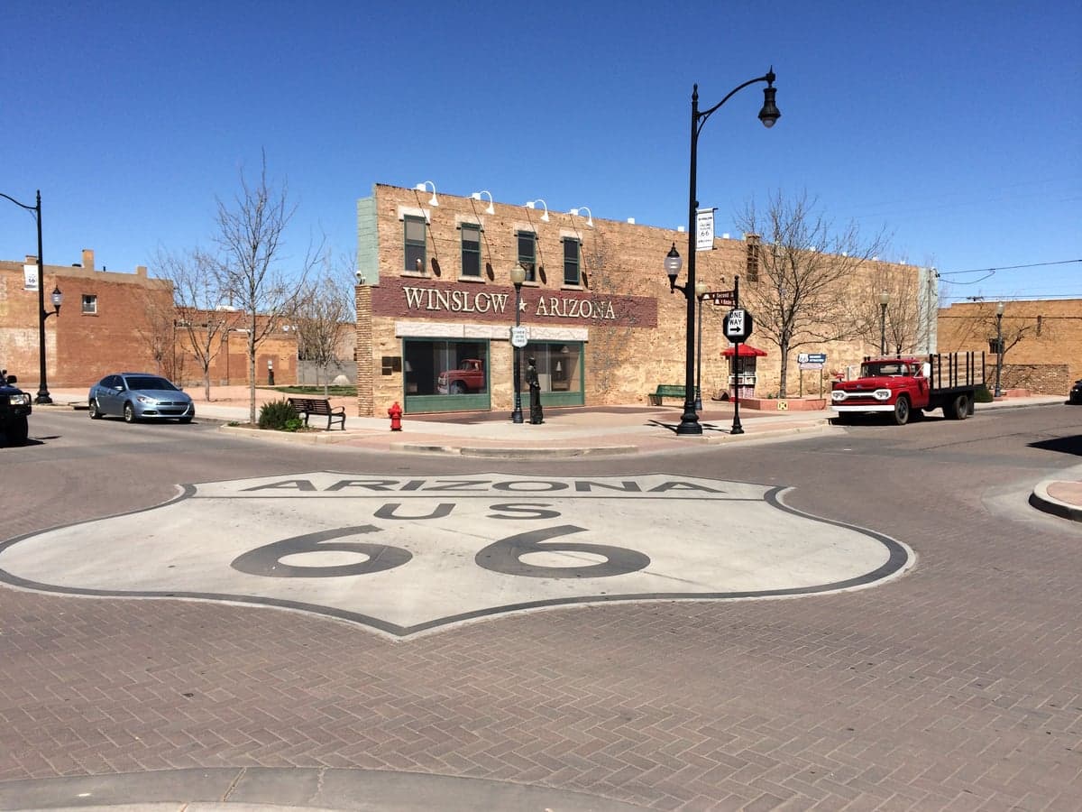
Photo: Wikipedia
Strategic Assessment of Winslow, AZ
Workable tactical position. Some exposure to population density or targets, but generally defensible in a crisis.
What does the Strategic Assessment tell us?
Our Strategic Assessment grades tactical survivability of an area. Major population centers, military targets, fallout zones, natural disasters, and border exposure all drive risk — lower exposure means a more defensible position in a crisis.
This is heavily inspired by Joel Skousen's Strategic Relocation book. Highly recommended you checkout the book ($)What does this tell us?
Our Strategic Assessment grades tactical survivability of an area. Major population centers, military targets, fallout zones, natural disasters, and border exposure all drive risk — lower exposure means a more defensible position in a crisis.
This is heavily inspired by Joel Skousen's Strategic Relocation book. Highly recommended you checkout the book ($)Strategic Pillars

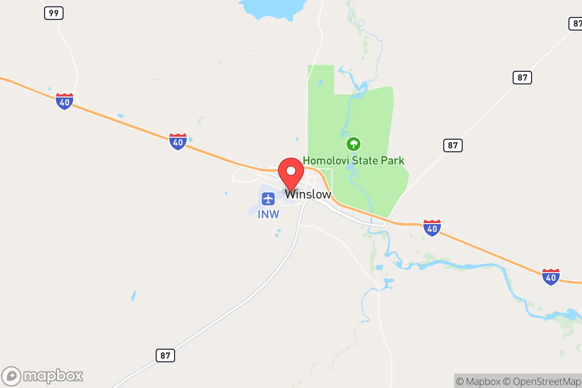
Key Distances
Regional Safe Places
Below is our recommended "safe zones" in Arizona and the surrounding area based on our strategic heuristics. For most people, it's unrealistic to live in a “safe zone” full-time due to work, family or other personal reasons. They tend to be more rural. However, many of these areas are perfect for second homes and retreat properties that double as a vacation home or even a short-term rental.
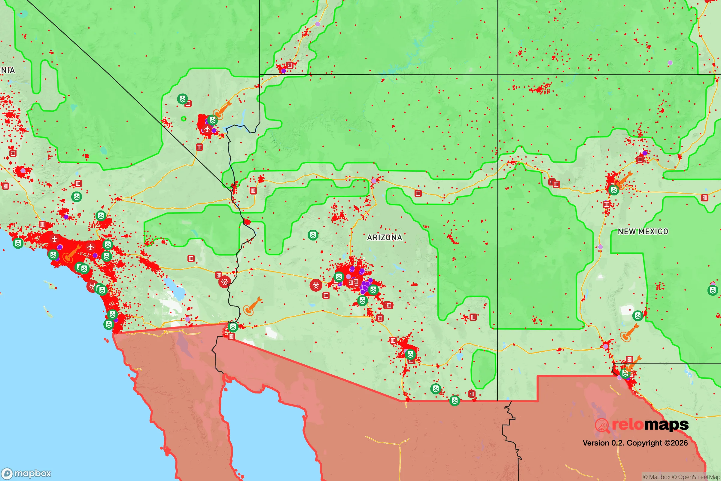
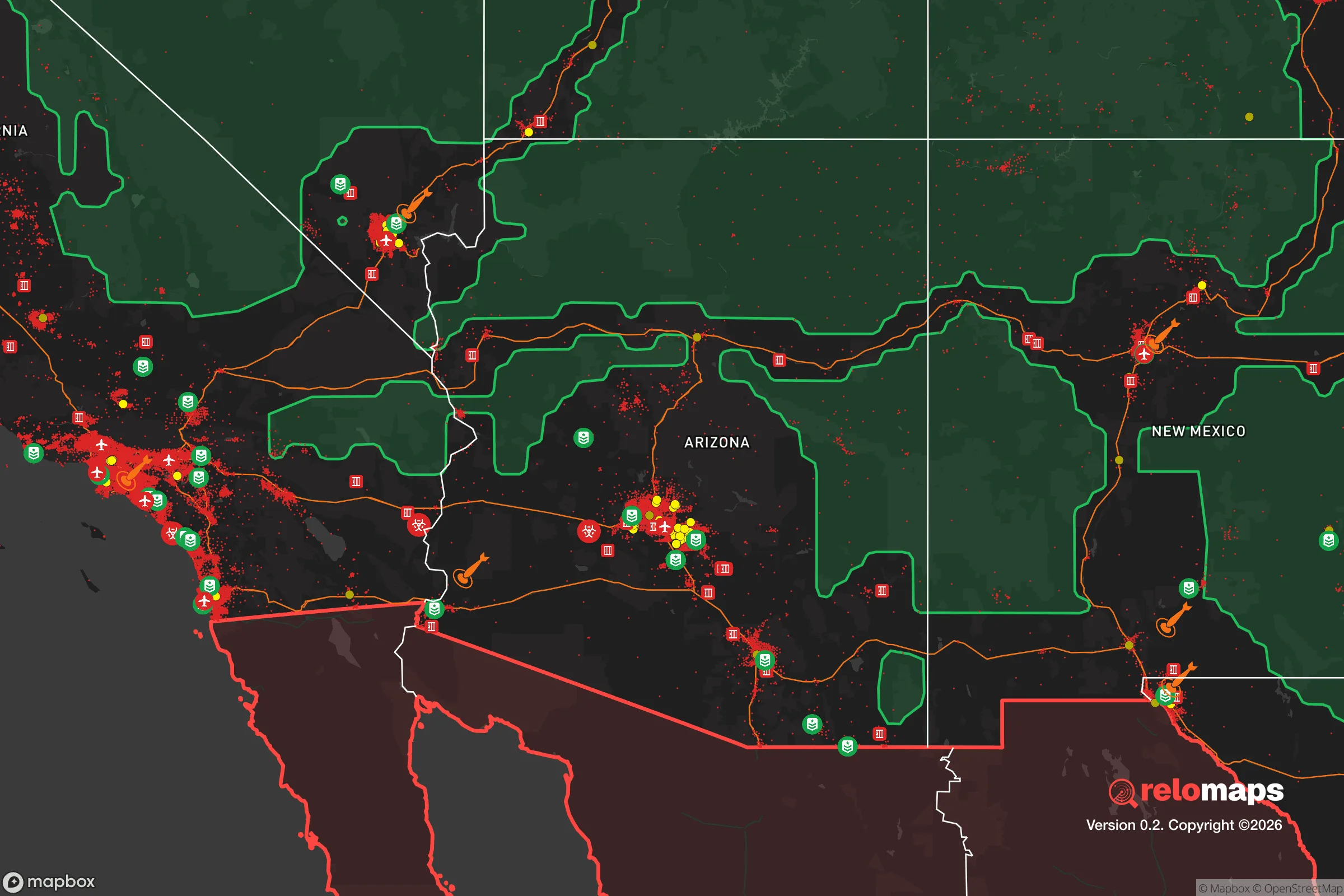


Important Note: For informational purposes only. This does not mean nothing bad ever happens in the green zones. Please use common sense. This is based on public data and modeled with AI. We tried to take a conservative approach but mistakes happen. We update this regularly as new information becomes available.
Solar Generator Recommendations
Backup power matters more here than in safer locations. We've picked three solar generators across budgets and capacity tiers — start with the budget unit if you only need a few essentials, or step up if you want to run a fridge and HVAC for days at a time.

Jackery Portable Power Station Explorer 300
Budget OptionPower on the Go: Weighing only 11 lbs, it's convenient to set up and store with book-sized foldable solar panels

BLUETTI Portable Power Station AC180
Designed for both indoor and outdoor scenarios, AC180 is highly capable as it has a robost capacity and continuous output power.

EF ECOFLOW DELTA Pro Ultra Power Station
Upgraded PickEcoFlow DELTA Pro Ultra is a whole-home energy system designed to grow with your family. Integrated with the Smart Home Panel 2, it scales to meet your evolving energy needs — keeping your home powered, intelligent, and secure through every stage of life.
We earn a commission, at no additional cost to you.
Strategic Assessment Analysis
Winslow, Arizona, occupies a strategic niche in the high desert that rewards careful planning but punishes complacency. Sitting at roughly 4,900 feet on the Colorado Plateau, the town offers a blend of isolation and accessibility that makes it a serious contender for anyone evaluating relocation through a lens of disaster readiness and self-sufficiency. Its position along Interstate 40 and the BNSF transcontinental rail line provides logistical advantages, while its distance from major metropolitan hubs reduces exposure to the cascading failures that can follow a large-scale event.
Geographic position and natural advantages for long-term stability
Winslow's location in northeastern Arizona places it in a zone of relative geologic and climatic stability. The town sits on the southern edge of the Colorado Plateau, a region not prone to the seismic activity that threatens California or the Gulf Coast's hurricane corridors. The local terrain is characterized by broad mesas, dry washes, and open rangeland, which offers natural defensibility through visibility and limited approach vectors. The elevation provides a moderate four-season climate, with summer highs rarely exceeding the low 90s and winter lows that stay above zero, reducing the risk of extreme temperature events that can stress infrastructure. Water access is a genuine advantage here: the Little Colorado River runs along the town's southern edge, and the underlying Coconino and Kaibab aquifers provide groundwater that is deeper than in many desert communities but still viable for well drilling in outlying areas. The region's low population density—roughly 9,000 residents in Winslow proper and fewer than 70,000 in all of Navajo County—means that competition for resources during a crisis would be less intense than in Phoenix or Flagstaff. The surrounding landscape also supports limited but meaningful hunting opportunities, with mule deer and pronghorn populations in the nearby forests and grasslands.
Risk exposure and proximity to fallout-relevant landmarks
No strategic assessment of Winslow is complete without acknowledging its proximity to critical infrastructure that could become a liability. The town lies roughly 60 miles east of Flagstaff, which itself sits near the San Francisco Peaks volcanic field—an active but low-threat system. More immediately relevant to a disaster-readiness audience is Winslow's position relative to transportation and energy corridors. Interstate 40 is a major transcontinental artery, and the BNSF rail line running through town carries hazardous materials, including crude oil and chemicals, on a daily basis. A derailment or accident involving these shipments could pose a localized contamination risk, though the open terrain helps disperse airborne threats faster than a canyon or urban setting would. The nearest significant military installation is the Navajo Army Depot, located about 30 miles south near Bellemont, which stores conventional munitions but is not a high-priority target in a conflict scenario. Winslow's distance from major population centers—over 150 miles from Phoenix, 200 miles from Albuquerque, and 300 miles from Las Vegas—reduces its exposure to fallout from a nuclear event targeting those cities. Prevailing westerly winds in the region mean that fallout from a strike on Los Angeles or San Diego would largely bypass this area, though a strike on Phoenix would pose a more direct threat depending on wind direction. The town's small size and low profile make it an unlikely primary target, which is a significant advantage in any strategic relocation calculus.
Practical resilience for relocators: food, water, energy, and defensibility
For someone serious about self-sufficiency, Winslow offers a mixed but workable picture. The local growing season runs roughly from mid-May to early October, which is short but sufficient for cold-hardy crops like potatoes, carrots, beans, and squash. The soil is alkaline and sandy, requiring amendment with organic matter and consistent irrigation to produce reliable yields. Rainwater harvesting is viable here, with the area averaging about 7 inches of precipitation annually—low, but concentrated in the summer monsoon season, which allows for catchment from roof surfaces. A household with adequate storage tanks and filtration could supplement municipal water or well water significantly. The town's municipal water supply comes from the Little Colorado River and local wells, and while the system is generally reliable, a prolonged power outage would disrupt pumping. This makes backup power for well pumps a critical consideration for anyone living outside city limits. Solar energy is a strong option: Winslow averages over 280 sunny days per year, and the high elevation reduces atmospheric interference, making photovoltaic panels more efficient than at lower altitudes. Net metering is available through Arizona Public Service, but those planning for grid-down scenarios should budget for battery storage and a backup generator. Defensibility is a mixed factor. The open terrain makes it difficult to approach a property unnoticed, but it also means that a determined group could be seen from a distance. The local population skews older and more transient, with a significant portion of residents working in tourism, transportation, and retail—industries that would be among the first to collapse in a prolonged crisis. This could lead to out-migration rather than in-migration during a disaster, which reduces the risk of resource competition but also means fewer skilled tradespeople available for mutual aid. The Navajo County Sheriff's Office and Winslow Police Department maintain a visible presence, but response times in rural areas can exceed 30 minutes, reinforcing the need for personal preparedness.
The overall strategic picture for Winslow is one of moderate resilience with clear trade-offs. Its geographic isolation, stable climate, and access to water and solar energy make it a defensible location for a household willing to invest in infrastructure and develop practical skills. The primary risks come from its position along major transportation corridors and the potential for localized industrial accidents, but these are manageable with situational awareness and contingency planning. For a relocator who values distance from urban chaos and has the means to establish a self-sufficient homestead, Winslow represents a viable option that balances accessibility with security. It is not a fortress, but it is a place where a prepared family can build a sustainable life without the constant background noise of metropolitan vulnerability.

* Values derived from national, state, county, city and local statistics and may differ in a specific area. Last updated: 2026-10-24T16:23:51.000Z
Narrative content on this page is AI-generated and may contain mistakes. Verify any details that matter before acting on them.
ReloMaps may earn a commission from affiliate links at no extra cost to you.

