
Strategic Assessment of Whiterock, TX
Meaningful friction. Expect exposure to either population pressure, blast zones, or natural disaster risk. Consider buying a retreat property.
What does the Strategic Assessment tell us?
Our Strategic Assessment grades tactical survivability of an area. Major population centers, military targets, fallout zones, natural disasters, and border exposure all drive risk — lower exposure means a more defensible position in a crisis.
This is heavily inspired by Joel Skousen's Strategic Relocation book. Highly recommended you checkout the book ($)What does this tell us?
Our Strategic Assessment grades tactical survivability of an area. Major population centers, military targets, fallout zones, natural disasters, and border exposure all drive risk — lower exposure means a more defensible position in a crisis.
This is heavily inspired by Joel Skousen's Strategic Relocation book. Highly recommended you checkout the book ($)Strategic Pillars

Key Distances
Regional Safe Places
Below is our recommended "safe zones" in Texas and the surrounding area based on our strategic heuristics. For most people, it's unrealistic to live in a “safe zone” full-time due to work, family or other personal reasons. They tend to be more rural. However, many of these areas are perfect for second homes and retreat properties that double as a vacation home or even a short-term rental.

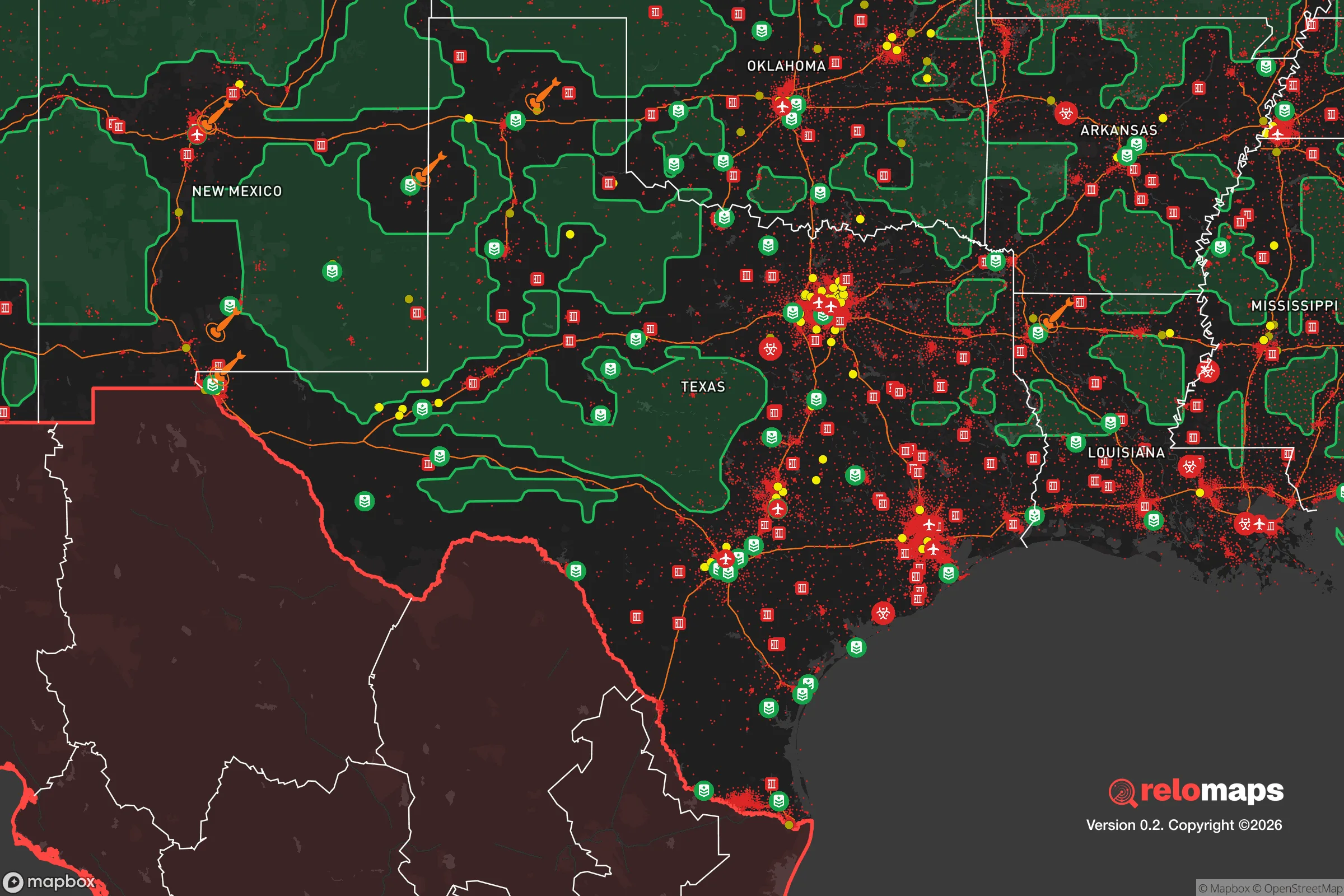


Important Note: For informational purposes only. This does not mean nothing bad ever happens in the green zones. Please use common sense. This is based on public data and modeled with AI. We tried to take a conservative approach but mistakes happen. We update this regularly as new information becomes available.
Solar Generator Recommendations
Backup power matters more here than in safer locations. We've picked three solar generators across budgets and capacity tiers — start with the budget unit if you only need a few essentials, or step up if you want to run a fridge and HVAC for days at a time.

Jackery Portable Power Station Explorer 300
Budget OptionPower on the Go: Weighing only 11 lbs, it's convenient to set up and store with book-sized foldable solar panels

BLUETTI Portable Power Station AC180
Designed for both indoor and outdoor scenarios, AC180 is highly capable as it has a robost capacity and continuous output power.

EF ECOFLOW DELTA Pro Ultra Power Station
Upgraded PickEcoFlow DELTA Pro Ultra is a whole-home energy system designed to grow with your family. Integrated with the Smart Home Panel 2, it scales to meet your evolving energy needs — keeping your home powered, intelligent, and secure through every stage of life.
We earn a commission, at no additional cost to you.
Strategic Assessment Analysis
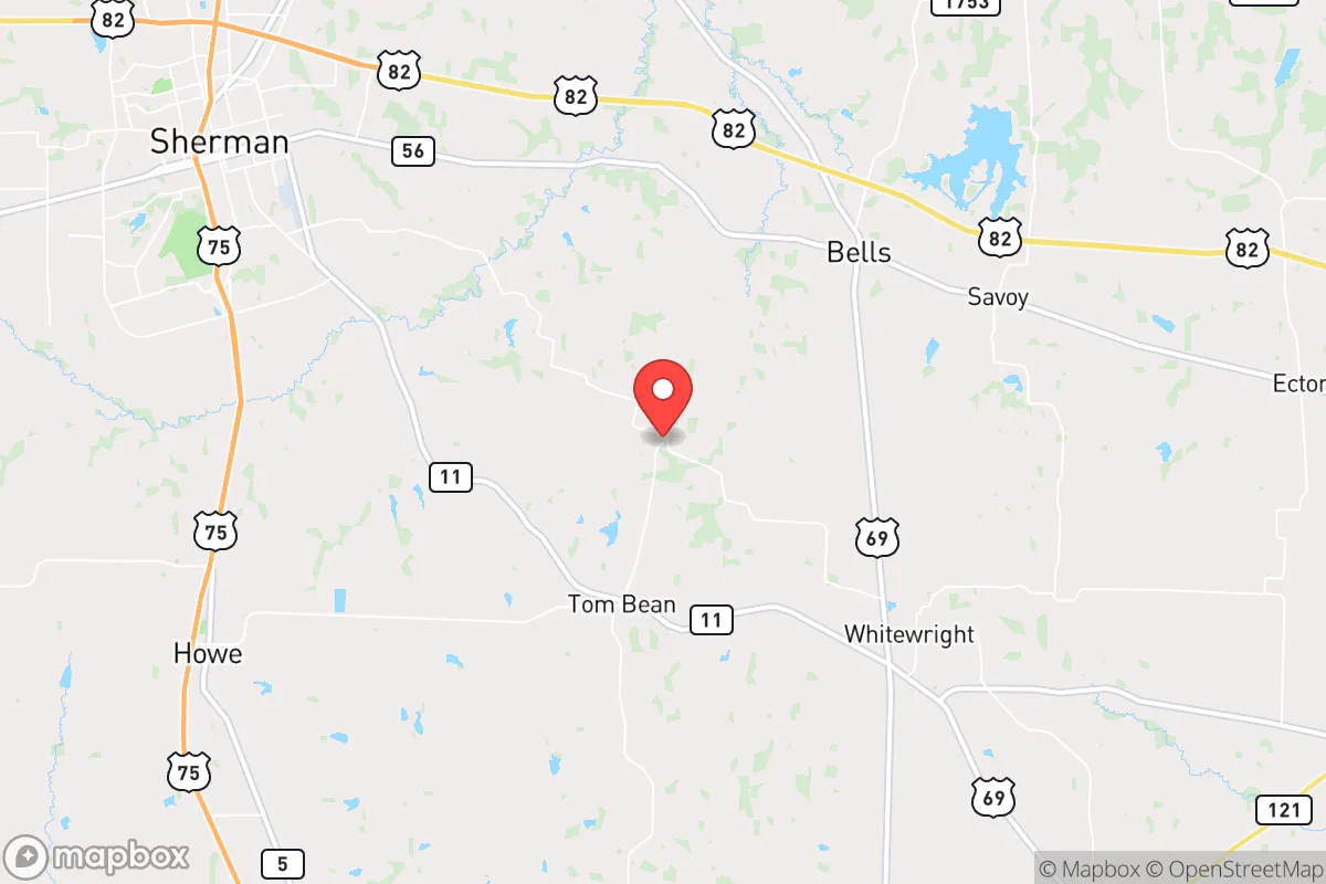
Whiterock, Texas, occupies a strategic position in the state’s rural heartland that offers a compelling blend of isolation and accessibility for the disaster-conscious relocator. Situated roughly 45 miles northeast of Dallas’s urban core and about 30 miles from the smaller city of Greenville, the area sits in a zone that is far enough from major metropolitan targets to avoid the worst of a man-made or natural catastrophe, yet close enough to supply chains and medical infrastructure for everyday life. The region’s resilience is rooted in its low population density, its position outside the primary hurricane and tornado corridors, and its access to the water and agricultural resources of the upper Trinity River basin. For a family or individual prioritizing self-sufficiency and strategic depth, Whiterock presents a credible base of operations, provided the specific risks and practical realities are understood.
Geographic position and natural advantages for long-term stability
Whiterock’s location in Hunt County places it on the western edge of the Piney Woods region, a transitional zone between the Blackland Prairie and the East Texas forests. This geography provides several natural advantages. The area sits on a relatively stable geological platform, with no significant fault lines nearby, meaning earthquake risk is negligible. The local topography is gently rolling, with elevations around 500–600 feet, which offers natural drainage and reduces the risk of catastrophic flooding that plagues low-lying areas closer to the coast. The region’s clay-loam soils, while not ideal for large-scale row cropping without amendment, are suitable for pasture, orchards, and small-scale vegetable production. The climate is humid subtropical, with an average of 40–45 inches of rainfall annually, distributed fairly evenly throughout the year. This reliable precipitation is a critical asset for off-grid water collection and small-scale agriculture, reducing dependence on municipal water systems that could fail in a crisis. The area’s position also places it outside the 100-mile blast radius of any major strategic target, such as the Dallas-Fort Worth metroplex’s defense installations, major airports, or the nuclear reactor at Comanche Peak (about 100 miles southwest). For a relocator, this means a lower probability of direct physical destruction from a targeted strike or industrial accident, while still being within a day’s drive of major medical centers in Dallas or Plano for routine needs.
Risks, exposures, and proximity to fallout-relevant landmarks
No location is without vulnerabilities, and Whiterock’s primary risks are tied to its proximity to the Dallas-Fort Worth metroplex and the transportation corridors that feed it. The single greatest man-made risk is the potential for fallout or secondary effects from a major event in the Dallas area. While Whiterock is outside the immediate blast zone, prevailing winds in North Texas typically blow from the south and southwest, meaning that fallout from a nuclear detonation or a large-scale chemical release at a facility like the Valero refinery in Dallas could drift toward the region. The area is also within 50 miles of the Sherman-Denison corridor, which hosts a major rail line and interstate highway (US-75) that are critical logistics arteries. In a crisis, these routes could become chokepoints for refugees fleeing the cities, potentially bringing security risks and resource competition. Natural hazards are more manageable but still present. Hunt County lies in the southern edge of “Tornado Alley,” and while the frequency of violent tornadoes is lower than in Oklahoma or northern Texas, the area does experience severe thunderstorms with damaging winds and hail. The 2015 Memorial Day weekend floods, which devastated parts of Hunt County, are a reminder that even with good drainage, low-lying areas near the South Fork of the Sabine River can see rapid water rise. Wildfire risk is low compared to West Texas, but dry summers can create conditions for grass fires, especially in the rural areas where volunteer fire departments may have limited response times. For the strategic relocator, the key takeaway is that Whiterock’s risks are primarily secondary and logistical, not direct and catastrophic, making it a defensible choice if proper preparations are made.
Practical resilience for a relocator: food, water, energy, and defensibility
Whiterock’s practical resilience is where the area truly shines for the self-sufficiency-minded individual. Water availability is a strong point: the area sits atop the Carrizo-Wilcox Aquifer, one of the largest and most productive groundwater sources in Texas. Many rural properties have private wells that can provide a reliable, off-grid water supply, though well depths typically range from 200 to 500 feet, and a backup hand pump or solar-powered pump is a wise investment. Surface water is also accessible via the South Fork of the Sabine River and several smaller creeks, but these are subject to seasonal variation and potential contamination from upstream agricultural runoff. For food production, the growing season is long—typically 230–240 frost-free days—allowing for two crop cycles per year. The local soil, while heavy, can be improved with compost and cover cropping, and the area’s history as a cotton and livestock region means that pasture for goats, sheep, or cattle is readily available. Hunt County has a strong agricultural extension office through Texas A&M AgriLife, offering resources for new farmers. Energy resilience is achievable: the region has good solar insolation (about 5.0–5.5 peak sun hours per day), and many rural properties have the space for a ground-mounted solar array with battery storage. Natural gas is available in some areas, but propane is more common for off-grid heating and cooking. Defensibility is a mixed bag. The area’s low population density—about 80 people per square mile in the county, with much lower density in the unincorporated areas around Whiterock itself—means fewer neighbors to rely on, but also fewer potential threats. The terrain is open enough to provide good lines of sight, but wooded areas along creeks offer cover. A well-chosen property with a long driveway, a perimeter fence, and a defensible water source (like a pond or well) can be made quite secure. The nearest law enforcement is the Hunt County Sheriff’s Office, with response times in rural areas often exceeding 20 minutes, so personal security and community mutual aid networks are essential. For the relocator, the practical takeaway is that Whiterock offers a solid foundation for self-sufficiency, but it requires upfront investment in water, energy, and security infrastructure to realize its full potential.
Overall, Whiterock presents a balanced strategic picture for the disaster-conscious relocator. It is not a hardened bunker location, nor is it a remote wilderness retreat. Instead, it is a working rural area that offers a realistic middle ground: close enough to urban resources for normal life, far enough to avoid the worst of a crisis, and with the natural resources to support a semi-autonomous lifestyle. The area’s resilience is built on its water availability, agricultural potential, and low target value, but it is tempered by the risks of fallout drift from the Dallas metroplex and the logistical challenges of rural living. For a family or individual willing to invest in well water, solar power, and a strong local network, Whiterock can serve as a credible long-term base. The key is to treat it as a strategic asset, not a magical safe zone—prepare for the risks, leverage the advantages, and build relationships with the existing community. In a state where many relocation options are either too exposed or too remote, Whiterock strikes a pragmatic balance that deserves serious consideration.

* Values derived from national, state, county, city and local statistics and may differ in a specific area. Last updated: 2026-07-24T16:17:11.000Z
Narrative content on this page is AI-generated and may contain mistakes. Verify any details that matter before acting on them.
ReloMaps may earn a commission from affiliate links at no extra cost to you.

