
Photo: Wikipedia
Strategic Assessment of Wheaton, IL
Multiple tactical vulnerabilities. Population density, target proximity, or disaster risk are likely compounding. A retreat property and exit planning is required.
What does the Strategic Assessment tell us?
Our Strategic Assessment grades tactical survivability of an area. Major population centers, military targets, fallout zones, natural disasters, and border exposure all drive risk — lower exposure means a more defensible position in a crisis.
This is heavily inspired by Joel Skousen's Strategic Relocation book. Highly recommended you checkout the book ($)What does this tell us?
Our Strategic Assessment grades tactical survivability of an area. Major population centers, military targets, fallout zones, natural disasters, and border exposure all drive risk — lower exposure means a more defensible position in a crisis.
This is heavily inspired by Joel Skousen's Strategic Relocation book. Highly recommended you checkout the book ($)Strategic Pillars

Key Distances
Regional Safe Places
Below is our recommended "safe zones" in Illinois and the surrounding area based on our strategic heuristics. For most people, it's unrealistic to live in a “safe zone” full-time due to work, family or other personal reasons. They tend to be more rural. However, many of these areas are perfect for second homes and retreat properties that double as a vacation home or even a short-term rental.
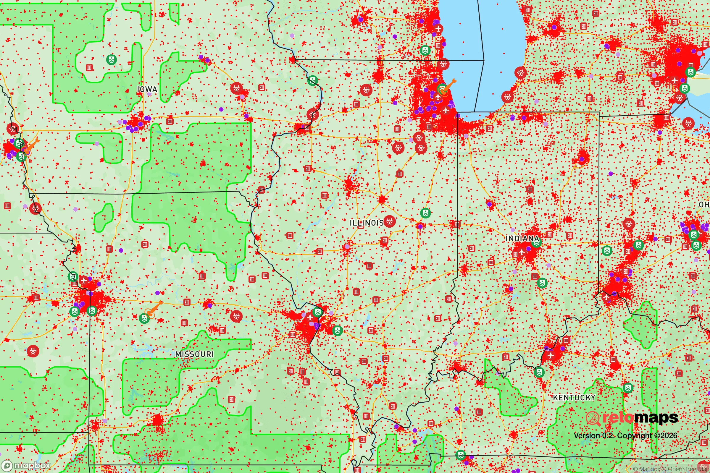
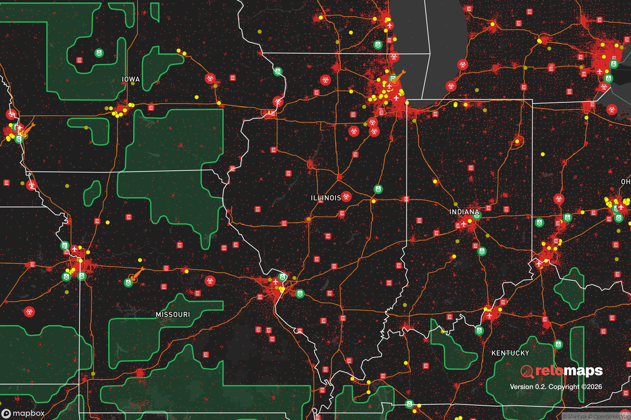
Important Note: For informational purposes only. This does not mean nothing bad ever happens in the green zones. Please use common sense. This is based on public data and modeled with AI. We tried to take a conservative approach but mistakes happen. We update this regularly as new information becomes available.
Solar Generator Recommendations
Backup power matters more here than in safer locations. We've picked three solar generators across budgets and capacity tiers — start with the budget unit if you only need a few essentials, or step up if you want to run a fridge and HVAC for days at a time.

Jackery Portable Power Station Explorer 300
Budget OptionPower on the Go: Weighing only 11 lbs, it's convenient to set up and store with book-sized foldable solar panels

BLUETTI Portable Power Station AC180
Designed for both indoor and outdoor scenarios, AC180 is highly capable as it has a robost capacity and continuous output power.

EF ECOFLOW DELTA Pro Ultra Power Station
Upgraded PickEcoFlow DELTA Pro Ultra is a whole-home energy system designed to grow with your family. Integrated with the Smart Home Panel 2, it scales to meet your evolving energy needs — keeping your home powered, intelligent, and secure through every stage of life.
We earn a commission, at no additional cost to you.
Strategic Assessment Analysis
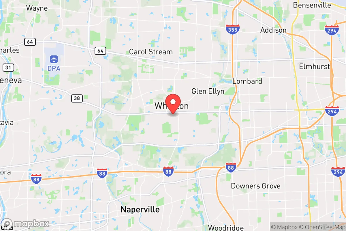
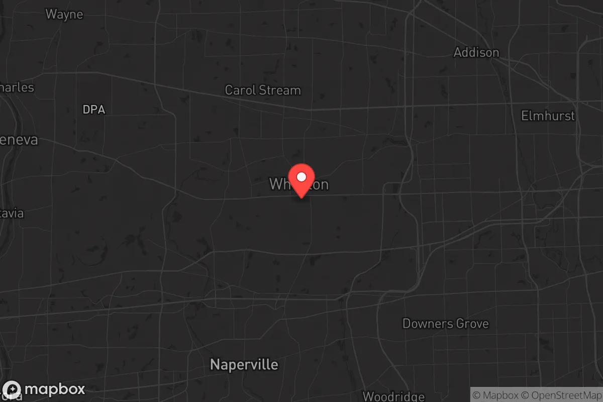
Wheaton, Illinois, sits in a precarious but potentially strategic pocket for those serious about resilience. Its location 25 miles west of Chicago offers a buffer from the immediate chaos of a major urban collapse, yet it remains close enough that fallout—whether nuclear, economic, or social—would reach you within hours. The town’s established infrastructure, strong local governance, and access to the DuPage County emergency network give it a baseline of stability, but the real question for a prepper-minded relocator is whether this suburb can sustain itself when the grid falters and the cities burn. The answer is mixed: Wheaton has genuine advantages in water access and community cohesion, but its density, reliance on regional supply chains, and proximity to high-value targets like O’Hare and Argonne National Laboratory introduce risks that cannot be ignored.
Geographic position and natural advantages for long-term survival
Wheaton’s geography is a double-edged sword. On the plus side, it sits on the St. Charles Moraine, a glacial ridge that provides slightly higher ground than the surrounding floodplains—useful if the Des Plaines River or the Fox River swells after a dam failure or heavy rain. The area is part of the DuPage River watershed, with several small creeks and ponds within a 10-minute drive, offering decentralized water sources for filtration if municipal supply is cut. The soil is fertile, and the growing season (roughly April to October) supports vegetable gardens and small orchards, though the clay-heavy earth requires raised beds or heavy amendment. Natural cover is moderate: the Danada Forest Preserve and Herrick Lake provide wooded areas for foraging, hunting small game, and temporary shelter, but these are public lands that would be crowded in a crisis. The town’s grid layout—mostly residential with commercial corridors along Roosevelt Road and Geneva Road—makes it easy to navigate on foot or bicycle, but the lack of true wilderness means you cannot simply disappear into the woods. For a relocator, the key natural advantage is access to Lake Michigan via the Chicago water system, but that pipeline is a single point of failure; a more resilient play is to identify private wells or rainwater catchment on the western edge of town, where lot sizes increase and suburban density drops.
Risks, exposures, and proximity to fallout-relevant landmarks
This is where Wheaton gives a prepper pause. The town is 12 miles from O’Hare International Airport, a primary target for any strategic strike or terrorist attack due to its role as a national logistics hub. The Argonne National Laboratory in Lemont, 15 miles southeast, conducts nuclear research and stores radioactive materials—a secondary fallout risk if compromised. The Will County nuclear plants (Braidwood and Dresden) are 40 miles southwest, within the fallout plume zone for prevailing winds. Closer to home, DuPage County’s emergency operations center is in Wheaton itself, which makes the town a likely staging area for FEMA or National Guard response—meaning it could become a magnet for refugees from Chicago, straining local resources. The Union Pacific West Line rail corridor runs through downtown, carrying freight and commuters; a derailment or hazmat spill on those tracks could contaminate the central business district. Civil unrest risk is moderate: Wheaton is politically conservative relative to the metro area (DuPage County voted +5 R in 2024), but it is surrounded by blue-leaning suburbs like Glen Ellyn and Lombard, and a mass evacuation from Chicago would push hundreds of thousands of people through the I-88 and I-355 corridors that border the town. Chokepoints at the Roosevelt Road bridge over the DuPage River and the Wheaton Metra station would become gridlocked within hours of a major event. The bottom line: Wheaton is not a primary target, but it sits in the blast shadow of several high-value assets, and its location on major evacuation routes makes it a likely transit zone for displaced populations.
Practical resilience for a relocator: food, water, energy, and defensibility
For a single individual or family looking to hunker down, Wheaton offers a mixed bag. Food security is decent in the short term: the town has multiple grocery stores (Jewel-Osco, Mariano’s, Aldi) within a 2-mile radius, but these would empty in 48 hours of panic. Long-term, the DuPage County Farm Bureau and local farmers’ markets (May–October) provide connections to regional growers, but most farmland is west of Wheaton in Kane County. A better play is to establish relationships with growers at the Wheaton French Market or the Bloomingdale Farmers Market (5 miles north) before a crisis. Water resilience is the biggest vulnerability: the town’s supply comes from Lake Michigan via the Chicago system, and a disruption to that pipeline would leave residents dependent on bottled water or local wells. The DuPage Water Commission maintains emergency storage, but capacity is limited to a few days for the county. A prepper should invest in a Berkey filter or similar gravity system and identify the nearest perennial stream (the West Branch of the DuPage River runs through the town’s western edge). Energy independence is achievable: many homes have natural gas hookups for heating and cooking, and solar panel installations are growing (DuPage County offers property tax exemptions for renewable systems). However, the grid is aging and prone to outages during summer storms; a generator with a 50-amp inlet is a must for anyone staying through winter. Defensibility is the weak point. Wheaton is a dense suburb with 7,000 people per square mile, and most homes sit on quarter-acre lots with neighbors 20 feet away. A single-family home on a corner lot with fenced backyard offers some perimeter control, but the town’s open layout and multiple access points make it hard to secure. The Wheaton Police Department is well-funded (response times under 5 minutes in normal times), but in a prolonged crisis, they would be overwhelmed. The best defensive strategy is to form a neighborhood watch or mutual-aid group with like-minded families—the town’s strong church network (Wheaton College, several large evangelical congregations) provides a ready-made social fabric for this.
The overall strategic picture for Wheaton is one of calculated risk. It is not a remote survivalist retreat—you are still within the Chicago metro’s gravitational pull, and the risks of fallout, refugee flows, and supply chain collapse are real. But for a relocator who wants to stay within driving distance of family or work in the Midwest, Wheaton offers a better-than-average baseline due to its water access, conservative local governance, and community institutions. The key is to treat it as a semi-urban staging point, not a final bug-out location. Stockpile for 90 days, build relationships with neighbors, and have a secondary plan to move west to Kane County or beyond if the situation deteriorates. Wheaton can work, but only if you go in with eyes open and a plan that accounts for its proximity to the very chaos you are trying to avoid.
* Values derived from national, state, county, city and local statistics and may differ in a specific area. Last updated: 2026-04-29T19:18:21.000Z
Narrative content on this page is AI-generated and may contain mistakes. Verify any details that matter before acting on them.
ReloMaps may earn a commission from affiliate links at no extra cost to you.