 Popular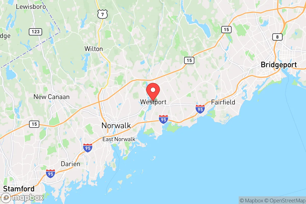
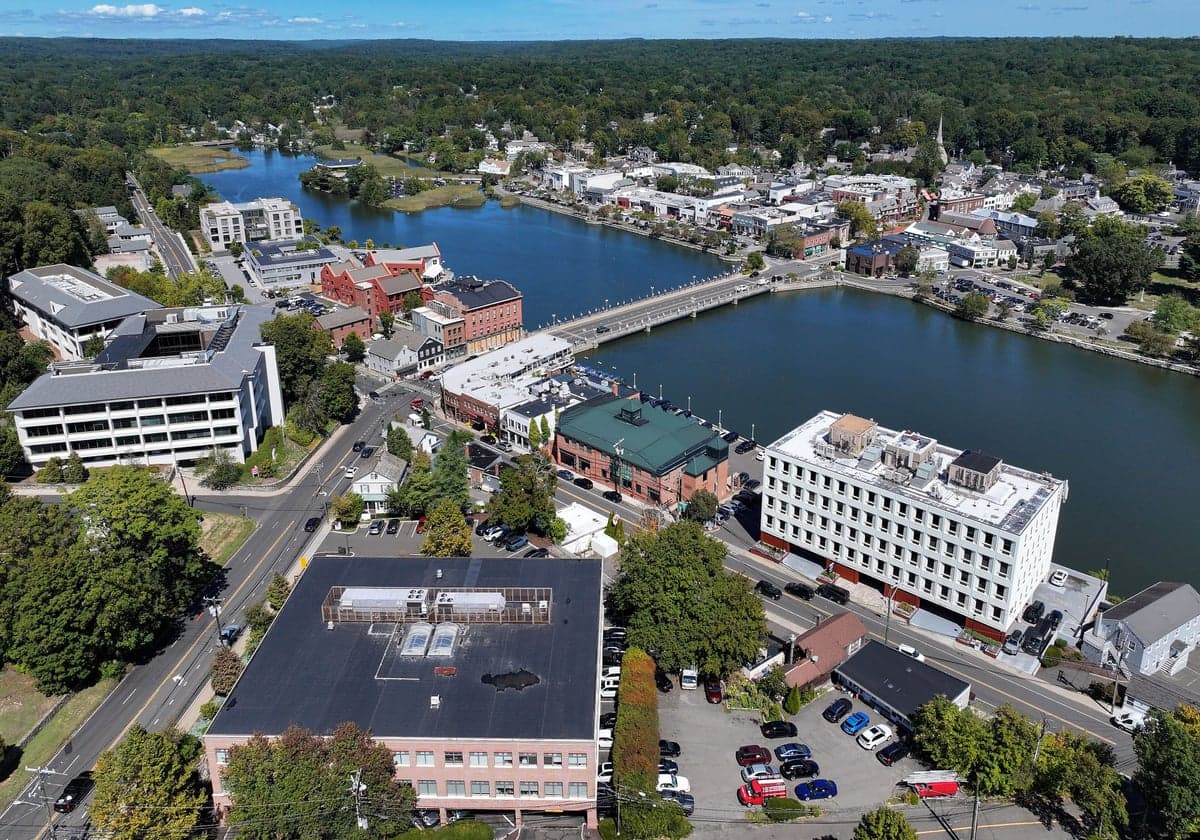
Photo: Wikipedia
Strategic Assessment of Westport, CT
Meaningful friction. Expect exposure to either population pressure, blast zones, or natural disaster risk. Consider buying a retreat property.
What does the Strategic Assessment tell us?
Our Strategic Assessment grades tactical survivability of an area. Major population centers, military targets, fallout zones, natural disasters, and border exposure all drive risk — lower exposure means a more defensible position in a crisis.
This is heavily inspired by Joel Skousen's Strategic Relocation book. Highly recommended you checkout the book ($)What does this tell us?
Our Strategic Assessment grades tactical survivability of an area. Major population centers, military targets, fallout zones, natural disasters, and border exposure all drive risk — lower exposure means a more defensible position in a crisis.
This is heavily inspired by Joel Skousen's Strategic Relocation book. Highly recommended you checkout the book ($)Strategic Pillars

Key Distances
Regional Safe Places
Below is our recommended "safe zones" in Connecticut and the surrounding area based on our strategic heuristics. For most people, it's unrealistic to live in a “safe zone” full-time due to work, family or other personal reasons. They tend to be more rural. However, many of these areas are perfect for second homes and retreat properties that double as a vacation home or even a short-term rental.




Important Note: For informational purposes only. This does not mean nothing bad ever happens in the green zones. Please use common sense. This is based on public data and modeled with AI. We tried to take a conservative approach but mistakes happen. We update this regularly as new information becomes available.
Solar Generator Recommendations
Backup power matters more here than in safer locations. We've picked three solar generators across budgets and capacity tiers — start with the budget unit if you only need a few essentials, or step up if you want to run a fridge and HVAC for days at a time.

Jackery Portable Power Station Explorer 300
Budget OptionPower on the Go: Weighing only 11 lbs, it's convenient to set up and store with book-sized foldable solar panels

BLUETTI Portable Power Station AC180
Designed for both indoor and outdoor scenarios, AC180 is highly capable as it has a robost capacity and continuous output power.

EF ECOFLOW DELTA Pro Ultra Power Station
Upgraded PickEcoFlow DELTA Pro Ultra is a whole-home energy system designed to grow with your family. Integrated with the Smart Home Panel 2, it scales to meet your evolving energy needs — keeping your home powered, intelligent, and secure through every stage of life.
We earn a commission, at no additional cost to you.
Strategic Assessment Analysis
Westport, Connecticut, is a study in strategic contradiction: a wealthy, leafy enclave with genuine natural advantages, yet one whose resilience profile is heavily shaped by its proximity to the New York metropolitan area. For a relocator thinking seriously about disaster readiness, Westport offers a strong baseline of community resources and geographic buffers, but it is not a standalone survival redoubt. Its true strategic value lies in its position—close enough to major infrastructure to matter, far enough to buy time—but that same proximity introduces vulnerabilities that demand a clear-eyed assessment.
Geographic position and natural advantages for disaster resilience
Westport sits on Long Island Sound in Fairfield County, roughly 50 miles northeast of Midtown Manhattan. That distance is significant: in a regional crisis, Westport is outside the immediate blast-and-fallout zone of a New York City–centric event, while still being within a practical driving range for those who need to evacuate inland. The town’s terrain is gently rolling, with elevations rising from the coastline to about 300 feet in the northern sections near the Weston border. This is not mountainous defensible terrain, but it does offer natural drainage and a variety of microclimates that can be leveraged for water collection and small-scale agriculture.
The town’s most underrated asset is its water supply. The Saugatuck River runs through the center of town, and the Aspetuck River forms part of the western boundary. Both feed into reservoirs managed by Aquarion Water Company, which serves most of the town. In a prolonged grid-down scenario, surface water is accessible, though treatment becomes a personal responsibility. The coastline itself provides a natural barrier to the south, and the town’s many inlets and coves—Compo Beach, Sherwood Island State Park—offer both recreational utility and potential evacuation-by-water routes, though they also expose the town to storm surge.
Forest cover is substantial, particularly in the northern and eastern sections. This provides natural cover, firewood, and wildlife habitat, but it also creates a wildfire fuel load in dry seasons. The town’s tree canopy is a double-edged sword: it buffers wind and provides shade, but falling limbs are a leading cause of power outages during nor’easters. Overall, the geography favors a prepared household—water, wood, and cover are all present—but the town’s low elevation along the coast and its dependence on suburban infrastructure mean that self-sufficiency requires deliberate effort, not just passive advantage.
Risks, exposures, and proximity to fallout-relevant landmarks
The most significant risk factor for Westport is not natural—it’s man-made. The town sits within the extended fallout and secondary-target envelope of the New York City metropolitan area. While a direct nuclear strike on Manhattan would not put Westport in the primary blast zone, prevailing westerly winds could carry fallout across Long Island Sound and into Fairfield County within hours. The Indian Point Energy Center, a now-decommissioned nuclear plant in Buchanan, New York, lies roughly 30 miles west-southwest; its spent fuel pools remain a credible radiological hazard in a major accident or attack scenario. Westport is also within 20 miles of the Millstone Nuclear Power Station in Waterford, Connecticut, to the east—a working plant that is a more immediate, if lower-probability, risk.
Beyond nuclear concerns, Westport’s transportation corridors are both a lifeline and a liability. The Metro-North New Haven Line runs through the town center, with the Westport station serving roughly 2,000 daily commuters. In a crisis, that rail line becomes a choke point—either for evacuation or for the movement of relief supplies. The Merritt Parkway (Route 15) and I-95 both pass through or near town, and both are notorious for congestion during routine commutes; a regional emergency would turn them into parking lots. The town’s bridges over the Saugatuck River and the railroad underpasses are single-point failures: if any are compromised, the town splits into isolated segments.
Natural risks are more predictable. Westport is vulnerable to nor’easters, which bring prolonged coastal flooding and wind damage. Hurricane Sandy in 2012 caused significant storm surge in the Compo Beach and Saugatuck Shores areas, with several homes destroyed and others condemned. The town’s flood maps show that the southern third of Westport is in a FEMA-designated Special Flood Hazard Area. Sea-level rise projections for 2050 suggest that the current 100-year flood zone will become a 10-year flood zone, meaning that coastal properties face a compounding, not static, risk. Tornadoes are rare but not unheard of; an EF-1 touched down in nearby Bridgeport in 2024. Winter storms are the most frequent disruption, with ice storms routinely knocking out power for days.
Practical resilience for a relocator: food, water, energy, and defensibility
For a relocator, Westport’s practical resilience is a mixed bag. On the positive side, the town has a robust local food network. The Westport Farmers Market operates year-round, and nearby organic farms—such as Sport Hill Farm and Wakeman Town Farm—provide fresh produce within a 10-minute drive. The town’s zoning allows for backyard chickens and small-scale beekeeping, and many residents maintain vegetable gardens. However, Westport is not agricultural land; the soil is rocky and acidic in places, and the growing season is short (roughly 150 days). A household seeking true food self-sufficiency would need to supplement with greenhouse growing and significant storage.
Water is more promising. The Aquarion system is well-maintained, but it is a centralized utility—vulnerable to both cyberattack and physical disruption. A prepared household should plan for at least two weeks of stored water, plus a means of purification (filtration, boiling, or chemical treatment). The Saugatuck and Aspetuck rivers are accessible from several public access points, but they are tidal in their lower reaches, meaning saltwater intrusion is a factor near the coast. Wells are rare in the town’s denser neighborhoods but common in the northern sections; a home with a private well is a significant resilience advantage.
Energy is the weakest link. Westport’s power grid is above-ground and tree-lined, and outages are frequent. Eversource, the utility, has a poor track record for restoration speed in major storms—some residents waited 10 days for power after Hurricane Isaias in 2020. Solar adoption is growing, but the town’s tree canopy limits rooftop generation in many areas. A serious relocator should budget for a whole-home generator or a substantial battery system (e.g., Tesla Powerwall or similar), plus a wood stove or fireplace for heat. Natural gas is piped to most of the town, which is an advantage for cooking and heating, but the pipeline network is a single point of failure in a seismic or sabotage event.
Defensibility is where Westport is weakest. The town is not gated, and its road network is porous, with dozens of entry points from Weston, Fairfield, Norwalk, and Wilton. The police department is well-funded and professional, but it is not a security force for a grid-down scenario. The town’s wealth makes it a potential looting target in a prolonged crisis, and its proximity to Bridgeport—a city with significant socioeconomic stress—means that a collapse scenario could draw desperate populations southward. A relocator should not view Westport as a defensible redoubt; it is a comfortable suburb with good infrastructure, not a survivalist compound.
The overall strategic picture for Westport is one of qualified resilience. It offers a high quality of life, strong community institutions, and genuine natural assets—water, cover, and a temperate climate—that support a prepared household. But its location within the New York metropolitan orbit introduces risks that cannot be engineered away: fallout exposure, transportation chokepoints, and a grid that fails under stress. For a relocator who is willing to invest in redundancy—solar, storage, water purification, and a defensible home site in the northern sections—Westport can be a workable base. For someone seeking true off-grid independence, it is not. The town is best understood as a high-functioning suburb with a resilience ceiling, not a bunker.

* Values derived from national, state, county, city and local statistics and may differ in a specific area. Last updated: 2026-09-07T05:38:19.000Z
Narrative content on this page is AI-generated and may contain mistakes. Verify any details that matter before acting on them.
ReloMaps may earn a commission from affiliate links at no extra cost to you.

