Photo: Wikipedia
Strategic Assessment of Randolph County
Workable tactical position. Some exposure to population density or targets, but generally defensible in a crisis.
What does the Strategic Assessment tell us?
Our Strategic Assessment grades tactical survivability of an area. Major population centers, military targets, fallout zones, natural disasters, and border exposure all drive risk — lower exposure means a more defensible position in a crisis.
This is heavily inspired by Joel Skousen's Strategic Relocation book. Highly recommended you checkout the book ($)What does this tell us?
Our Strategic Assessment grades tactical survivability of an area. Major population centers, military targets, fallout zones, natural disasters, and border exposure all drive risk — lower exposure means a more defensible position in a crisis.
This is heavily inspired by Joel Skousen's Strategic Relocation book. Highly recommended you checkout the book ($)Strategic Pillars

Key Distances
Strategic Assessment Analysis
Randolph County, West Virginia, offers a compelling mix of geographic isolation and strategic access that appeals to relocation-minded individuals and families prioritizing resilience and self-sufficiency. Nestled in the heart of the Allegheny Highlands, the county’s rugged terrain and low population density provide a natural buffer against the cascading failures that can plague urban centers, while its position along major east-west corridors ensures that relocators are not completely cut off from supply chains or medical care. For those serious about disaster readiness, Randolph County presents a balanced option—close enough to regional infrastructure to be practical, yet far enough from high-risk targets to offer genuine security.
Geographic position and natural advantages for self-sufficiency
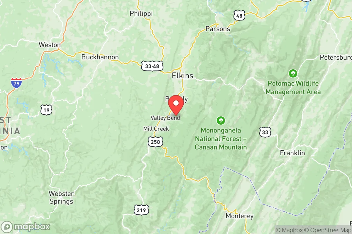
Randolph County’s geography is its strongest asset. The county sits at the headwaters of the Tygart Valley River and the Greenbrier River, giving it abundant freshwater resources that are less likely to be contaminated by upstream industrial activity. The surrounding Monongahela National Forest and the Otter Creek Wilderness Area create a natural buffer zone, limiting suburban sprawl and preserving wildlife corridors for hunting and foraging. The county seat, Elkins, is the primary hub, but smaller communities like Beverly and Huttonsville offer even greater isolation. Elevations range from roughly 1,500 to over 4,800 feet, which moderates summer heat and reduces wildfire risk compared to drier western states. The region’s heavy annual snowfall—averaging over 80 inches in higher elevations—provides a reliable water source in winter, though it also demands preparedness for cold-weather emergencies. For a relocator, the ability to tap into spring-fed streams and the presence of fertile valley soils in areas like the Tygart Valley make subsistence farming a realistic long-term option.
Risks, exposures, and proximity to fallout-relevant landmarks
While Randolph County is far from the obvious high-value targets like Washington, D.C., or the Hampton Roads naval complex, it is not without risk. The county lies roughly 150 miles southwest of the Pittsburgh metropolitan area, which includes the Bettis Atomic Power Laboratory in West Mifflin—a facility involved in naval nuclear propulsion. In a major conflict, prevailing winds from the northwest could carry fallout toward the Alleghenies, though the mountainous terrain would likely scatter and dilute any plume. Closer to home, the Mount Storm Power Station in neighboring Grant County is a coal-fired plant with large ash ponds; a failure or targeted strike could contaminate local waterways. The Davis Power Project in Tucker County, a pumped-storage hydroelectric facility, is a potential target for sabotage but poses less catastrophic risk than a nuclear plant. On the natural disaster front, Randolph County faces moderate earthquake risk—the 2011 Mineral, Virginia quake was felt here—but the primary concern is flash flooding in narrow valleys, particularly along the Tygart Valley River near Elkins. Winter ice storms can knock out power for days, and the county’s rural road network (especially routes like US-33 and US-250) can become impassable quickly. For a relocator, these risks are manageable with proper planning but should not be dismissed.
Practical resilience for a relocator: food, water, energy, and defensibility
Randolph County’s practical resilience hinges on its low population density—roughly 28,000 residents spread over 1,040 square miles—and its existing infrastructure for self-reliance. Food security is bolstered by a strong local farming community; the Randolph County Farmers Market in Elkins operates from May through October, and the county has a growing number of small-scale livestock operations. The West Virginia University Extension Service offers workshops on canning, gardening, and livestock management, which are valuable for newcomers. Water access is excellent: the county’s numerous springs and wells mean that a properly sited property can have a gravity-fed water system. The Elkins Water Works treats surface water from the Tygart Valley River, but a relocator should plan for a backup well or rainwater catchment. Energy resilience is mixed. The county is served by FirstEnergy (Mon Power), which relies on a mix of coal and natural gas; outages are common during winter storms. However, the mountainous terrain is ideal for small-scale hydroelectric systems, and solar potential is decent despite frequent cloud cover—south-facing slopes near Coalton or Dailey can yield 4-5 peak sun hours per day. Wood heating is ubiquitous, with abundant timber on public and private land. Defensibility is a strong point: the county’s hollows and ridges offer natural chokepoints, and the lack of major highways (only US-33 and US-250 serve as primary routes) means that unwanted traffic can be monitored. The Randolph County Sheriff’s Office is professional but thinly stretched, so a relocator should plan for neighborhood watch or community defense groups. The Elkins Regional Airport (KEKN) provides a potential evacuation route by air, though it is a small general aviation field.
The overall strategic picture for Randolph County is one of balanced opportunity. It avoids the extreme isolation of West Virginia’s most remote counties while sidestepping the vulnerability of areas near the I-81 corridor or the Washington, D.C., metroplex. For a family or individual willing to invest in off-grid infrastructure—solar panels, a well, a wood stove, and a year’s worth of food—the county offers a sustainable base that can weather both natural disasters and broader societal disruptions. The presence of Davis & Elkins College in Elkins adds a modest cultural and educational anchor, and the county’s proximity to the Greenbrier River Trail and the Allegheny Trail provides recreational opportunities that double as emergency travel routes. The trade-off is clear: you gain security and self-sufficiency, but you trade away the convenience of urban amenities and the safety net of dense emergency services. For the conservative-leaning relocator who values preparedness, local community, and a slower pace, Randolph County is a strong contender—provided you come ready to work for your resilience.

* Values derived from national, state, county, city and local statistics and may differ in a specific area. Last updated: 2026-07-30T14:01:10.000Z
Narrative content on this page is AI-generated and may contain mistakes. Verify any details that matter before acting on them.
ReloMaps may earn a commission from affiliate links at no extra cost to you.

