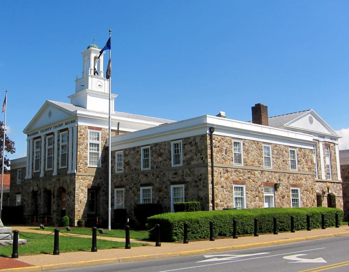
Photo: Wikipedia
Strategic Assessment of Warren County
Workable tactical position. Some exposure to population density or targets, but generally defensible in a crisis.
What does the Strategic Assessment tell us?
Our Strategic Assessment grades tactical survivability of an area. Major population centers, military targets, fallout zones, natural disasters, and border exposure all drive risk — lower exposure means a more defensible position in a crisis.
This is heavily inspired by Joel Skousen's Strategic Relocation book. Highly recommended you checkout the book ($)What does this tell us?
Our Strategic Assessment grades tactical survivability of an area. Major population centers, military targets, fallout zones, natural disasters, and border exposure all drive risk — lower exposure means a more defensible position in a crisis.
This is heavily inspired by Joel Skousen's Strategic Relocation book. Highly recommended you checkout the book ($)Strategic Pillars

Key Distances
Strategic Assessment Analysis
Warren County, Virginia, offers a compelling mix of strategic depth and everyday livability for those prioritizing resilience and self-sufficiency. Nestled in the northern Shenandoah Valley, the county benefits from being just far enough from the Washington D.C. metroplex to avoid its worst-case-scenario fallout, while still providing access to its economic and logistical networks. With the Shenandoah River as a natural barrier and the Blue Ridge Mountains as a defensive spine, the area presents a solid foundation for a relocator thinking seriously about disaster readiness, food security, and long-term stability.
Geographic position and natural advantages for long-term security
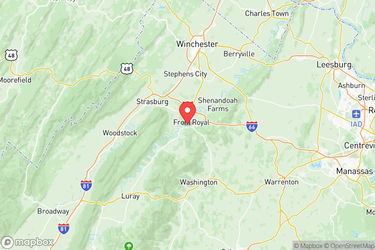
Warren County’s location is its strongest asset. The county sits at the confluence of the North and South Forks of the Shenandoah River, which merge near the town of Front Royal. This river system provides a reliable surface water source, a critical factor for any resilience plan. The Blue Ridge Mountains form the county’s eastern boundary, with Shenandoah National Park and the Appalachian Trail running along the ridge. This mountainous terrain acts as a natural buffer against storm tracks and provides a defensible high-ground option. The county’s position in the Shenandoah Valley also places it in a rain shadow effect relative to the eastern slopes, meaning it often receives less extreme precipitation than areas closer to the coast. For a relocator, this means a lower risk of hurricane-driven flooding compared to Tidewater Virginia, while still enjoying four distinct seasons and fertile valley soils. The town of Front Royal, the county seat, is the primary population center, but the surrounding rural areas—like the communities of Linden, Browntown, and the area around Lake Front Royal—offer significant acreage and privacy.
Risks, exposures, and proximity to fallout-relevant landmarks
No location is without risk, and Warren County’s proximity to the Washington D.C. metropolitan area is its most significant vulnerability. The county lies roughly 70 miles west of the nation’s capital, placing it within the potential fallout zone of a major event targeting D.C. or the Pentagon. While prevailing winds in the region typically blow from west to east, a nuclear or radiological incident could still deposit fallout across the Shenandoah Valley depending on weather patterns. Additionally, the county is within a 100-mile radius of several high-value military installations, including Fort Belvoir (about 70 miles east) and Quantico Marine Corps Base (about 60 miles east). These are primary targets in any conflict scenario. On the natural disaster front, the region is not immune to earthquakes—the 2011 Mineral, Virginia earthquake was felt strongly here—but the risk is low compared to the West Coast. Flooding along the Shenandoah River is a periodic concern, particularly in low-lying areas near Front Royal and along the river’s floodplain. The county’s mountainous terrain also creates localized flash flood risks during intense thunderstorms. For a relocator, the key takeaway is that Warren County’s primary man-made risk is its proximity to D.C., but its distance and mountain buffer provide a meaningful layer of protection compared to suburbs inside the Beltway.
Practical resilience for a relocator: food, water, energy, and defensibility
Warren County scores well on practical resilience metrics. The Shenandoah Valley is one of Virginia’s most productive agricultural regions, with Warren County itself hosting a mix of cattle farms, hay fields, and small-scale vegetable operations. The Front Royal Farmers Market operates seasonally, and local farms like Mackintosh Fruit Farm in nearby Berryville offer pick-your-own options and direct sales. For a relocator aiming for food self-sufficiency, the county’s growing season (roughly April through October) supports a wide range of crops, and the soil in the valley bottom is rich alluvial loam. Water access is excellent: the Shenandoah River is a perennial water source, and many rural properties have private wells. The county’s groundwater is generally good quality, though testing is recommended for new wells. For energy resilience, the region is served by Dominion Energy, but grid reliability in rural areas can be an issue during winter storms. Solar potential is moderate—the valley gets about 200 sunny days per year—but the mountainous terrain can create shading challenges on north-facing slopes. Wood heating is a viable backup, with ample hardwood forests on private land and in the George Washington National Forest to the west. Defensibility is a mixed picture. The county’s rural areas offer natural chokepoints along narrow valley roads, but the main corridors—U.S. Route 340 and Interstate 66—are major evacuation routes from D.C., meaning they could become congested in a crisis. The best defensive properties are those with a single access road, a reliable water source, and a commanding view of the valley floor. The area around Skyline Drive and the higher elevations of the Blue Ridge offer the most defensible positions, but they also come with harsher winters and limited road access.
The overall strategic picture for Warren County is one of balanced opportunity. It is not a remote wilderness—it is a working rural county with a small-town core in Front Royal and a growing exurban population. That means it has infrastructure (a hospital, grocery stores, hardware stores, and a county government) while still offering the space and resources for a serious self-sufficiency plan. The proximity to D.C. is a double-edged sword: it provides economic opportunity and access to major supply chains, but it also introduces a non-trivial risk of being caught in a regional crisis. For a relocator who values preparedness, Warren County’s combination of water access, agricultural potential, and mountain buffer makes it a strong candidate—provided they secure a property with a good well, a defensible access point, and a plan for managing the D.C.-area fallout risk. It is a place where a thoughtful, prepared individual or family can build a resilient life without feeling completely cut off from the modern world.

* Values derived from national, state, county, city and local statistics and may differ in a specific area. Last updated: 2026-06-27T23:26:15.000Z
Narrative content on this page is AI-generated and may contain mistakes. Verify any details that matter before acting on them.
ReloMaps may earn a commission from affiliate links at no extra cost to you.

