
Photo: Wikipedia
Strategic Assessment of Henrico County
Meaningful friction. Expect exposure to either population pressure, blast zones, or natural disaster risk. Consider buying a retreat property.
What does the Strategic Assessment tell us?
Our Strategic Assessment grades tactical survivability of an area. Major population centers, military targets, fallout zones, natural disasters, and border exposure all drive risk — lower exposure means a more defensible position in a crisis.
This is heavily inspired by Joel Skousen's Strategic Relocation book. Highly recommended you checkout the book ($)What does this tell us?
Our Strategic Assessment grades tactical survivability of an area. Major population centers, military targets, fallout zones, natural disasters, and border exposure all drive risk — lower exposure means a more defensible position in a crisis.
This is heavily inspired by Joel Skousen's Strategic Relocation book. Highly recommended you checkout the book ($)Strategic Pillars

Key Distances
Strategic Assessment Analysis
Henrico County, Virginia, offers a strategic balance of proximity to Richmond’s economic engine and a buffer from its densest urban risks, making it a resilient choice for relocation-minded individuals and families. Its location along the Fall Line—where the Piedmont meets the Coastal Plain—provides natural advantages in water access and defensible terrain, while its distance from major military installations and industrial targets reduces exposure to primary fallout zones. For a reader prioritizing disaster readiness and self-sufficiency, Henrico’s mix of suburban stability, agricultural capacity, and moderate population density creates a practical foundation for long-term security.
Geographic position and natural advantages for self-sufficiency
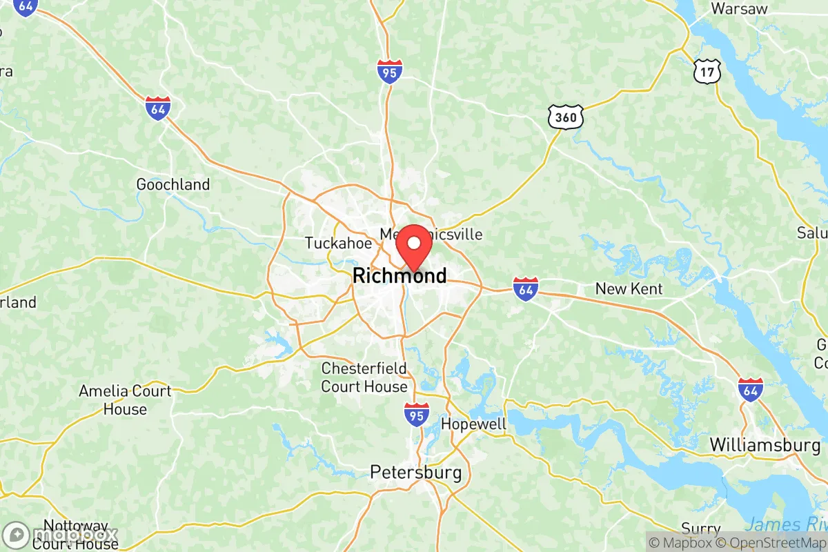
Henrico County wraps around Richmond’s northern, eastern, and western flanks, placing it within a 30-minute drive of the state capital yet far enough from its core to avoid the worst of urban congestion and target risk. The county sits astride the James River, which provides a reliable freshwater source for both municipal supply and potential off-grid use—critical for any resilience plan. The terrain is gently rolling, with elevations ranging from 50 to 300 feet, offering natural drainage and defensible high ground in areas like the western end near Short Pump. Soils in the county’s rural eastern sections, such as around Varina and Sandston, support small-scale agriculture, with local farms producing corn, soybeans, and hay. This agricultural base, combined with the county’s 104 square miles of forested land, gives relocators options for food production and timber resources. The James River also connects to the Chesapeake Bay via the Hampton Roads port complex, but Henrico’s inland position—roughly 100 miles from the coast—shields it from hurricane storm surge and sea-level rise, a distinct advantage over Tidewater communities.
Risks, exposures, and proximity to fallout-relevant landmarks
Henrico’s primary risk exposure comes from its proximity to Richmond’s industrial and transportation infrastructure, not from direct military targets. The county borders Richmond International Airport (RIC) in Sandston, a civilian hub that could become a secondary target in a conflict scenario, though it lacks the strategic value of a major air base. More concerning is the county’s location near the I-95 corridor, a critical north-south logistics artery that runs through the eastern edge of Henrico. A disruption at the I-95/I-64 interchange in nearby Richmond could choke supply chains for weeks, as seen during the January 2022 snowstorm that stranded drivers for over 24 hours. The county also sits within 50 miles of Fort Gregg-Adams (formerly Fort Lee) in Prince George County, an Army logistics and sustainment center that could be a high-value target. However, Henrico itself hosts no major military bases, refineries, or nuclear power plants—the closest nuclear facility is the Surry Power Station, 60 miles southeast. The county’s industrial parks, concentrated around the Innsbrook area and along the I-64 corridor, house data centers and light manufacturing, not heavy industry. This profile makes Henrico a moderate-risk area: not a primary target, but vulnerable to secondary effects like refugee influx from Richmond or supply chain interruptions.
Practical resilience for a relocator: food, water, energy, and defensibility
Henrico’s practical resilience hinges on its water access, energy infrastructure, and community layout. The James River provides a year-round water source, and the county’s public water system draws from it via the Henrico Water Treatment Plant in Varina, which has backup generators for emergency operations. For off-grid setups, shallow groundwater is accessible in most areas, with well depths averaging 100-200 feet in the western parts of the county. The energy grid is served by Dominion Energy, with natural gas and coal plants within 30 miles, but the county’s growing solar capacity—including the 20-megawatt Henrico Solar Farm near Sandston—offers some distributed generation. Relocators should note that the grid is vulnerable to ice storms and hurricanes, with outages lasting 3-7 days in severe events. Food resilience is moderate: the county has 15 farmers’ markets and a network of CSAs, but most grocery supply relies on truck deliveries from Richmond’s distribution centers. For long-term self-sufficiency, the rural eastern sections—particularly around the community of Montrose—offer larger parcels (2-10 acres) suitable for gardening and small livestock. Defensibility is a mixed picture: Henrico’s suburban sprawl, with its cul-de-sacs and interconnected neighborhoods, makes perimeter security difficult, but the county’s 300+ parks and greenways provide natural chokepoints and escape routes. The western areas near Short Pump and Tuckahoe have higher population density (2,500+ per square mile) and less defensible terrain, while the eastern rural zones offer more isolation. The county’s emergency management system is well-regarded, with a dedicated Office of Emergency Management that conducts regular drills and maintains a 72-hour supply cache for critical facilities.
Overall, Henrico County presents a solid strategic option for the resilience-minded relocator who values proximity to urban resources without living in a primary target zone. Its James River water access, moderate agricultural potential, and distance from major military and industrial sites reduce the most acute risks, while its suburban infrastructure provides a baseline of services and community support. The trade-offs are clear: you gain defensible terrain and water security but face exposure to I-95 corridor disruptions and potential refugee flows from Richmond. For a family or individual willing to invest in off-grid water and food systems, and to choose a property in the county’s eastern or northern rural pockets, Henrico offers a realistic balance of preparedness and livability—a place where you can build self-sufficiency without abandoning the conveniences of modern life.

* Values derived from national, state, county, city and local statistics and may differ in a specific area. Last updated: 2026-11-16T15:20:58.000Z
Narrative content on this page is AI-generated and may contain mistakes. Verify any details that matter before acting on them.
ReloMaps may earn a commission from affiliate links at no extra cost to you.

