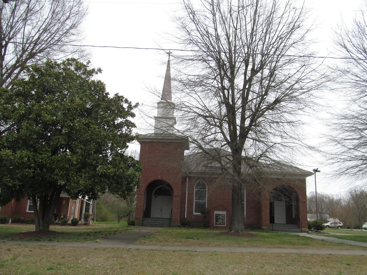
Photo: Wikipedia
Strategic Assessment of Virgilina, VA
Workable tactical position. Some exposure to population density or targets, but generally defensible in a crisis.
What does the Strategic Assessment tell us?
Our Strategic Assessment grades tactical survivability of an area. Major population centers, military targets, fallout zones, natural disasters, and border exposure all drive risk — lower exposure means a more defensible position in a crisis.
This is heavily inspired by Joel Skousen's Strategic Relocation book. Highly recommended you checkout the book ($)What does this tell us?
Our Strategic Assessment grades tactical survivability of an area. Major population centers, military targets, fallout zones, natural disasters, and border exposure all drive risk — lower exposure means a more defensible position in a crisis.
This is heavily inspired by Joel Skousen's Strategic Relocation book. Highly recommended you checkout the book ($)Strategic Pillars

Key Distances
Regional Safe Places
Below is our recommended "safe zones" in Virginia and the surrounding area based on our strategic heuristics. For most people, it's unrealistic to live in a “safe zone” full-time due to work, family or other personal reasons. They tend to be more rural. However, many of these areas are perfect for second homes and retreat properties that double as a vacation home or even a short-term rental.
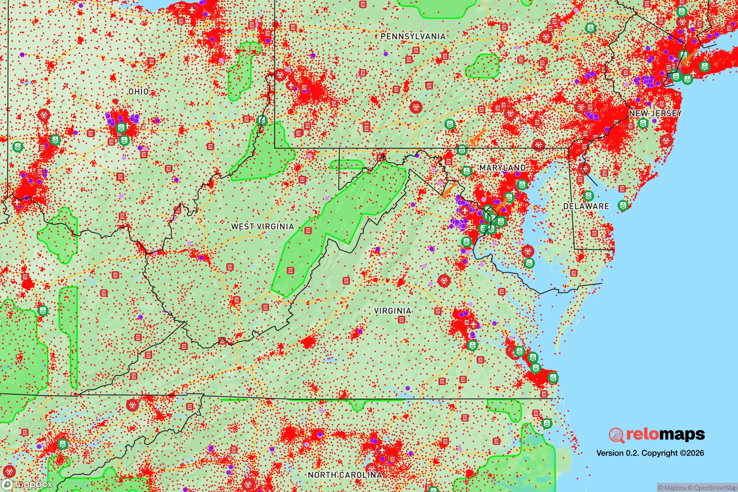
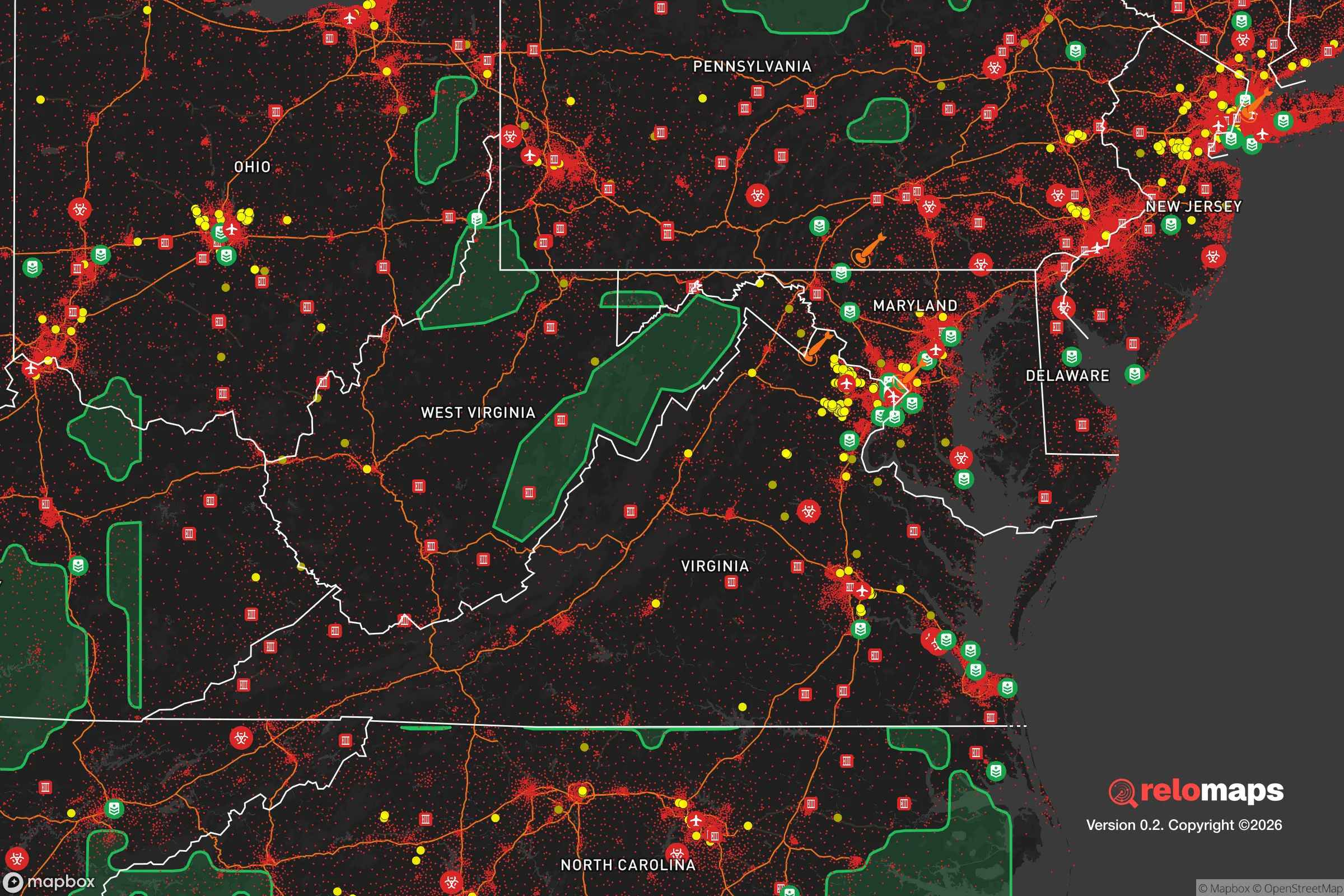


Important Note: For informational purposes only. This does not mean nothing bad ever happens in the green zones. Please use common sense. This is based on public data and modeled with AI. We tried to take a conservative approach but mistakes happen. We update this regularly as new information becomes available.
Solar Generator Recommendations
Backup power matters more here than in safer locations. We've picked three solar generators across budgets and capacity tiers — start with the budget unit if you only need a few essentials, or step up if you want to run a fridge and HVAC for days at a time.

Jackery Portable Power Station Explorer 300
Budget OptionPower on the Go: Weighing only 11 lbs, it's convenient to set up and store with book-sized foldable solar panels

BLUETTI Portable Power Station AC180
Designed for both indoor and outdoor scenarios, AC180 is highly capable as it has a robost capacity and continuous output power.

EF ECOFLOW DELTA Pro Ultra Power Station
Upgraded PickEcoFlow DELTA Pro Ultra is a whole-home energy system designed to grow with your family. Integrated with the Smart Home Panel 2, it scales to meet your evolving energy needs — keeping your home powered, intelligent, and secure through every stage of life.
We earn a commission, at no additional cost to you.
Strategic Assessment Analysis
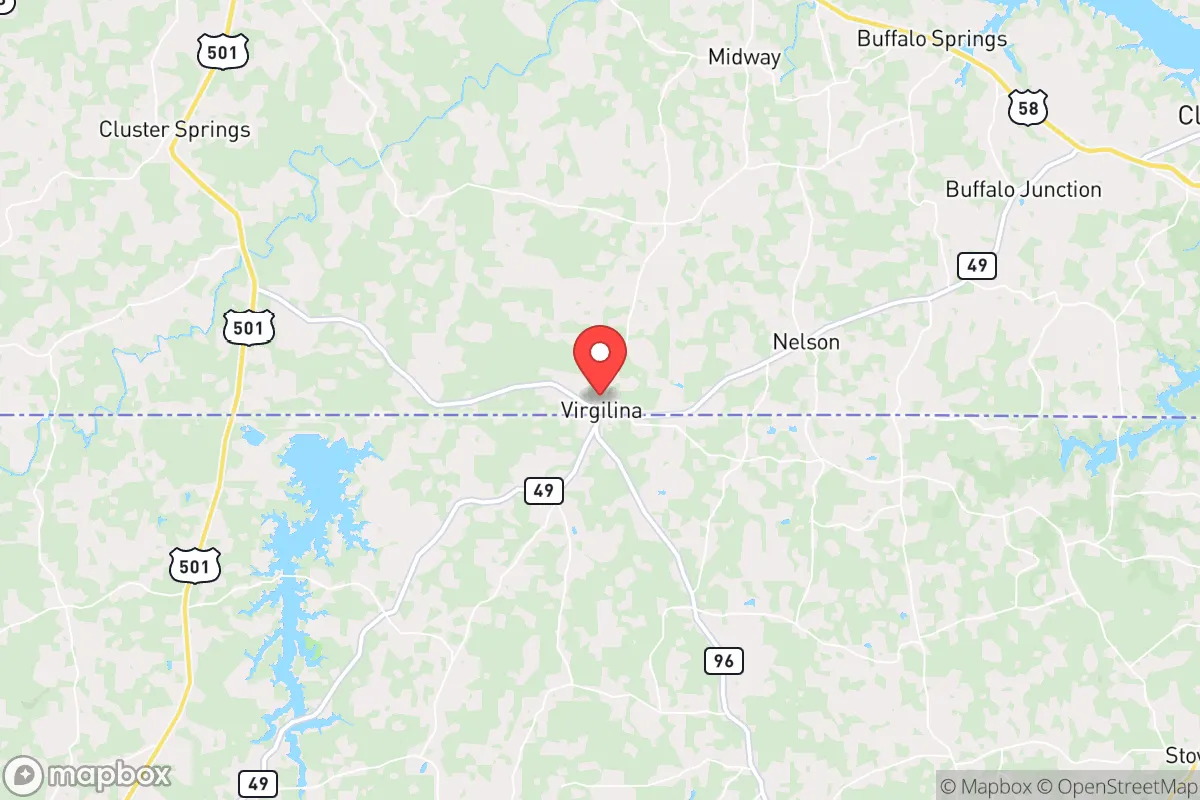
Virgilina, Virginia, offers a compelling strategic profile for the relocation-minded reader prioritizing resilience and self-sufficiency, largely due to its position in the far southern Piedmont region near the North Carolina border. This small town, with a population under 200, sits in a zone that balances relative isolation from major metropolitan blast zones with access to the natural resources of the John H. Kerr Reservoir (Buggs Island Lake) and the vast, sparsely populated forests of Halifax and Mecklenburg counties. Its low population density, distance from high-value military and industrial targets, and location within a region known for moderate climate and abundant water make it a location worth serious consideration for those planning for long-term stability.
Geographic position and natural advantages for long-term stability
Virgilina’s primary strategic asset is its location roughly 25 miles northwest of the Virginia-North Carolina border, placing it in a corridor that is far enough from the Interstate 95 and US 58 corridors to avoid the worst of evacuation chokepoints, yet close enough to access supplies if needed. The town sits on the edge of the Piedmont plateau, where the terrain is gently rolling and well-drained, reducing flood risk compared to coastal or river-bottom areas. The surrounding Halifax County is heavily forested—over 60% tree cover—which provides natural cover, firewood, and wildlife habitat. The proximity to the John H. Kerr Reservoir, a 50,000-acre U.S. Army Corps of Engineers project, offers a massive, reliable freshwater source that is less susceptible to drought than smaller streams. The area’s moderate climate, with average annual rainfall around 45 inches and a growing season of roughly 200 days, supports year-round gardening and small-scale agriculture, a key advantage for a self-sufficient household.
Risk exposure and proximity to fallout-relevant landmarks
While Virgilina avoids the worst of coastal hurricane storm surge and the seismic risks of the New Madrid zone, it is not without vulnerabilities. The primary man-made risk stems from its proximity to the John H. Kerr Dam and the adjacent power generation facilities, including the 700-megawatt pumped-storage hydroelectric plant at Bath County, about 40 miles to the northwest. A catastrophic failure at either facility would be a low-probability, high-consequence event, but the town’s elevation (roughly 500 feet above sea level) and distance from the dam itself place it outside the immediate inundation zone. More relevant to the strategic reader: Virgilina is roughly 80 miles from the Richmond-Petersburg metropolitan area and 90 miles from the Raleigh-Durham Research Triangle, both of which contain military installations (Fort Gregg-Adams, Fort Liberty) and industrial infrastructure that could be primary or secondary targets in a conflict. The prevailing wind patterns in this region are from the west and southwest, meaning that fallout from a strike on Richmond or the Hampton Roads naval complex would likely track eastward, not toward Virgilina. However, a strike on the Raleigh-Durham area or the nuclear power plants at Harris (30 miles south of Raleigh) or Surry (60 miles east) could pose a moderate fallout risk depending on wind direction. The area’s low population density and lack of major highways make it an unlikely target for direct attack, but the reader should plan for the possibility of displaced populations from the I-85 and I-95 corridors moving westward in a crisis.
Practical resilience for a relocator: food, water, energy, and defensibility
For the individual or family looking to establish a self-sufficient homestead, Virgilina offers a strong baseline. The local water table is generally high, and many properties in the area rely on private wells, with typical depths of 100-300 feet yielding reliable water. The Kerr Reservoir provides a backup surface water source, though treatment would be necessary. The region’s clay-loam soils are workable for gardening, and the long growing season allows for two crop cycles of cool- and warm-season vegetables. Local agriculture is dominated by tobacco, soybeans, and timber, but small-scale livestock (chickens, goats, cattle) is common among residents. The area’s energy infrastructure is a mixed bag: the local electric grid is served by Dominion Energy and Mecklenburg Electric Cooperative, both of which have experienced outages during ice storms and summer thunderstorms. Solar potential is good, with an average of 4.5 peak sun hours per day, and off-grid solar systems are feasible given the lack of restrictive zoning in unincorporated Halifax County. Defensibility is a relative strength: the town’s layout is compact, with a single main road (Virginia Route 96) providing access, and the surrounding rural roads are easily monitored. The nearest law enforcement presence is the Halifax County Sheriff’s Office, based 20 miles away in Halifax, meaning response times in a crisis would be long. The local population is predominantly older and long-established, which can be a double-edged sword—neighbors may be helpful or insular. The reader should plan to build relationships early, as rural Virginia communities value familiarity and reciprocity. The nearest hospital with emergency services is in South Boston, 25 miles away, and the closest trauma center is in Danville, 40 miles away, so medical self-sufficiency is a must.
Overall, Virgilina presents a balanced strategic picture for the relocation-minded reader. It avoids the worst of coastal and urban risks while offering abundant water, arable land, and a low-profile location that is unlikely to attract attention in a national crisis. The trade-offs are real: limited local services, a long drive to major medical care, and the need to invest in off-grid energy and water systems. For a single individual or family willing to put in the work of building a self-sufficient homestead and integrating into a small, rural community, Virgilina offers a defensible, resource-rich base of operations. It is not a bug-out location for a weekend prepper—it is a place to build a life that is already somewhat resilient by default, and can be made more so with deliberate planning.

* Values derived from national, state, county, city and local statistics and may differ in a specific area. Last updated: 2026-10-24T15:25:54.000Z
Narrative content on this page is AI-generated and may contain mistakes. Verify any details that matter before acting on them.
ReloMaps may earn a commission from affiliate links at no extra cost to you.

