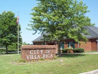
Photo: Wikipedia
Strategic Assessment of Villa Rica, GA
Meaningful friction. Expect exposure to either population pressure, blast zones, or natural disaster risk. Consider buying a retreat property.
What does the Strategic Assessment tell us?
Our Strategic Assessment grades tactical survivability of an area. Major population centers, military targets, fallout zones, natural disasters, and border exposure all drive risk — lower exposure means a more defensible position in a crisis.
This is heavily inspired by Joel Skousen's Strategic Relocation book. Highly recommended you checkout the book ($)What does this tell us?
Our Strategic Assessment grades tactical survivability of an area. Major population centers, military targets, fallout zones, natural disasters, and border exposure all drive risk — lower exposure means a more defensible position in a crisis.
This is heavily inspired by Joel Skousen's Strategic Relocation book. Highly recommended you checkout the book ($)Strategic Pillars

Key Distances
Regional Safe Places
Below is our recommended "safe zones" in Georgia and the surrounding area based on our strategic heuristics. For most people, it's unrealistic to live in a “safe zone” full-time due to work, family or other personal reasons. They tend to be more rural. However, many of these areas are perfect for second homes and retreat properties that double as a vacation home or even a short-term rental.
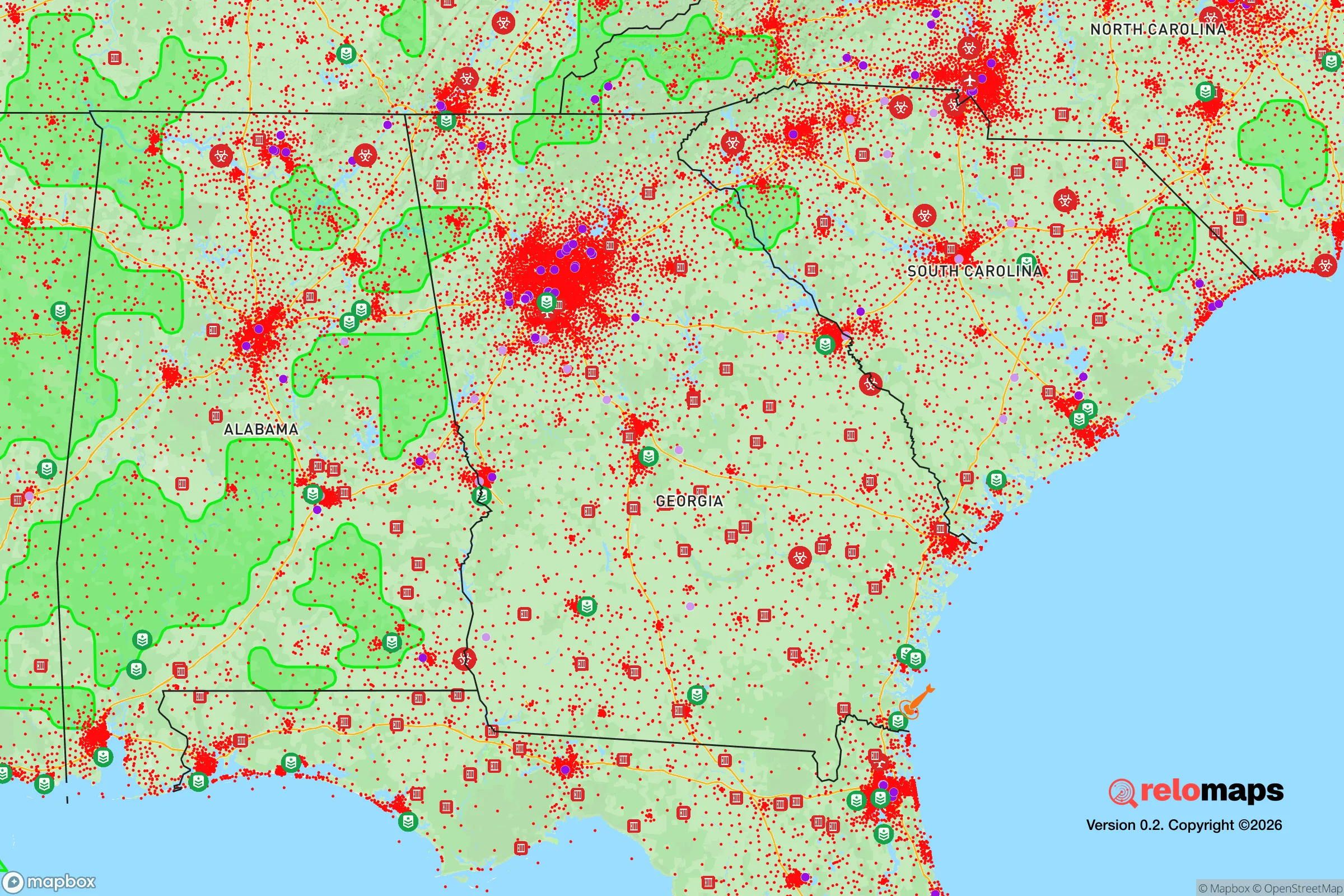
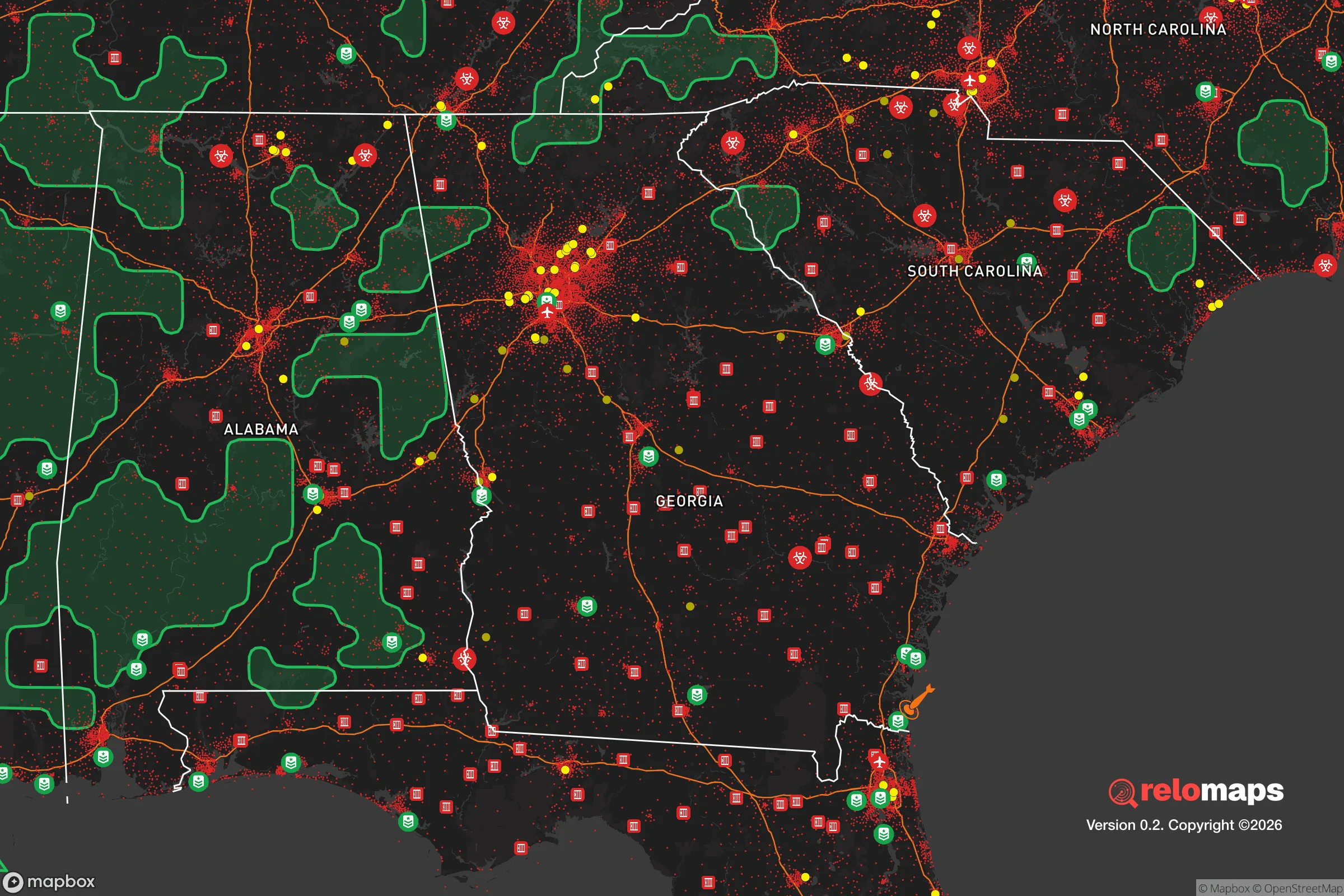


Important Note: For informational purposes only. This does not mean nothing bad ever happens in the green zones. Please use common sense. This is based on public data and modeled with AI. We tried to take a conservative approach but mistakes happen. We update this regularly as new information becomes available.
Solar Generator Recommendations
Backup power matters more here than in safer locations. We've picked three solar generators across budgets and capacity tiers — start with the budget unit if you only need a few essentials, or step up if you want to run a fridge and HVAC for days at a time.

Jackery Portable Power Station Explorer 300
Budget OptionPower on the Go: Weighing only 11 lbs, it's convenient to set up and store with book-sized foldable solar panels

BLUETTI Portable Power Station AC180
Designed for both indoor and outdoor scenarios, AC180 is highly capable as it has a robost capacity and continuous output power.

EF ECOFLOW DELTA Pro Ultra Power Station
Upgraded PickEcoFlow DELTA Pro Ultra is a whole-home energy system designed to grow with your family. Integrated with the Smart Home Panel 2, it scales to meet your evolving energy needs — keeping your home powered, intelligent, and secure through every stage of life.
We earn a commission, at no additional cost to you.
Strategic Assessment Analysis
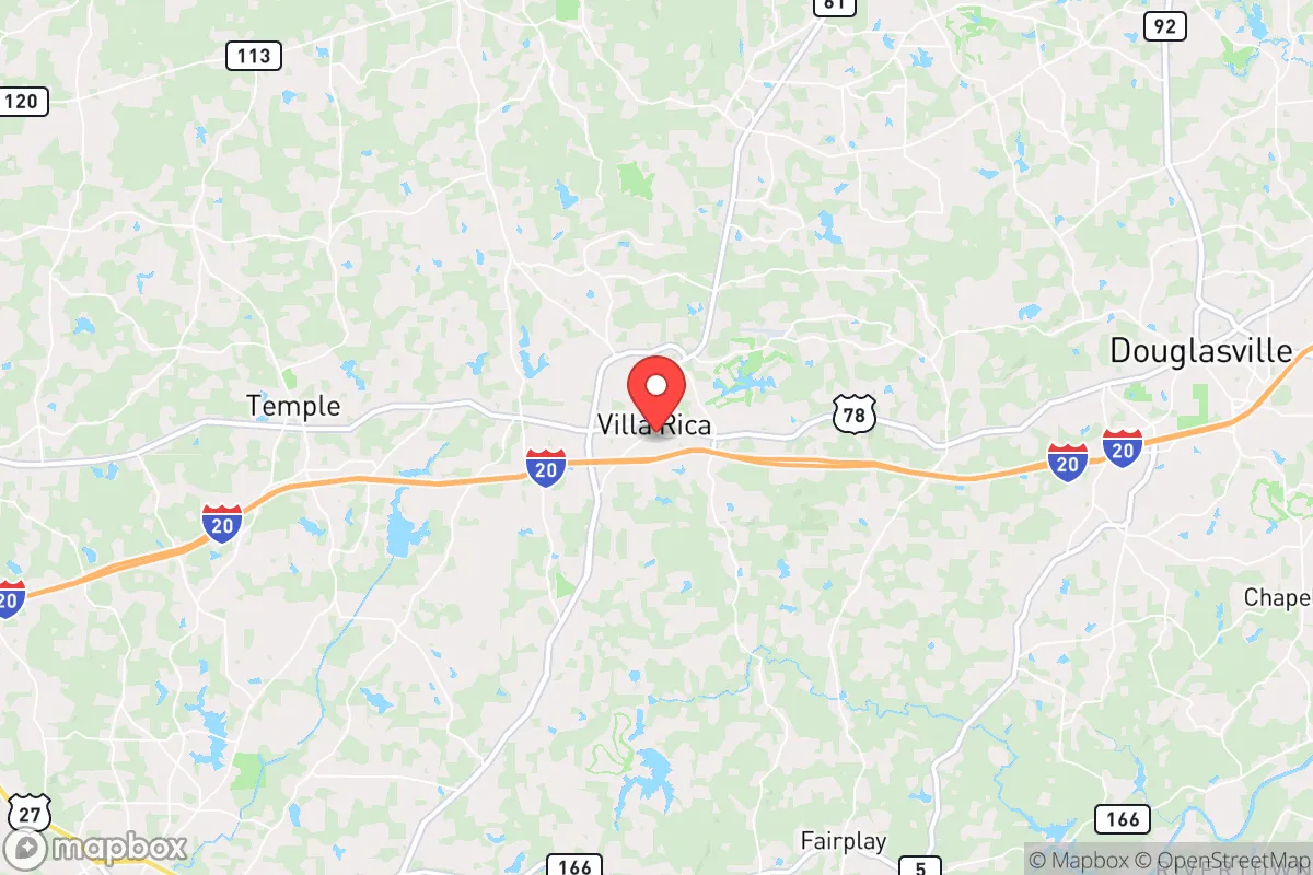
Villa Rica, Georgia, offers a compelling mix of strategic depth and practical resilience for the relocation-minded reader, balancing proximity to Atlanta’s economic engine with a geography that provides meaningful buffers against both natural and man-made disruptions. Its position along the I-20 corridor, roughly 30 miles west of downtown Atlanta and 15 miles east of Carrollton, places it in a sweet spot: close enough to urban resources for supply runs and employment, yet far enough to avoid the worst of a metropolitan collapse scenario. The city’s historical identity as a gold-mining hub and its modern growth as a bedroom community for Atlanta’s western suburbs give it a sturdy, self-reliant character that aligns well with preparedness-minded values.
Geographic position and natural advantages for self-sufficiency
Villa Rica sits in the Piedmont region of western Georgia, a landscape of rolling hills, mixed hardwood forests, and clay-based soils that offer both defensive and agricultural potential. The area’s elevation—roughly 1,100 feet above sea level—provides a slight thermal and hydrological advantage over the lower-lying parts of the metro region, reducing flood risk and offering better drainage for gardens or livestock. The nearby Pine Mountain range, while modest, creates a natural barrier to the south that can slow movement and provide concealment for those seeking to operate off-grid. The region’s water resources are a standout: the Little Tallapoosa River runs just north of town, and the larger Tallapoosa River system feeds into the Alabama border, offering reliable surface water for filtration or irrigation. Groundwater access is generally good in the area, with many rural properties drawing from private wells that tap into the Piedmont aquifer at depths of 100–300 feet. For a relocator focused on self-sufficiency, the combination of defensible terrain, ample water, and a moderate climate (growing season of roughly 220 days) makes Villa Rica a viable base for long-term resilience, especially compared to the flat, flood-prone coastal plain or the congested northern suburbs.
Risks, exposures, and proximity to fallout-relevant landmarks
The primary man-made risk for Villa Rica is its proximity to Atlanta’s Hartsfield-Jackson International Airport, roughly 35 miles east, and the broader I-20 corridor, which is a high-value target in any conflict scenario involving infrastructure strikes. While Villa Rica itself is not a primary target, its location along I-20 means it could become a choke point for evacuation traffic or a staging area for military or relief convoys. The city is also within 50 miles of the Vogtle Electric Generating Plant (a nuclear facility near Augusta), though prevailing winds typically carry fallout eastward, reducing direct risk. More immediate is the potential for a radiological release from a smaller incident—such as a transport accident on I-20—given the volume of hazardous materials moving through the corridor. Natural risks are moderate: the area is in Seismic Zone 1 (very low earthquake risk), and tornado activity is below the state average, though severe thunderstorms and occasional ice storms can disrupt power for days. Flooding is limited to low-lying areas near the Little Tallapoosa, but most of Villa Rica’s residential development sits on higher ground. The biggest practical exposure is the city’s reliance on the Atlanta metro for medical care, specialized supplies, and fuel distribution—a disruption to the I-20 corridor would quickly strain local resources. For the relocator, this means stockpiling at least two weeks of supplies and having a secondary route (e.g., US-78 or GA-61) to bypass a blocked I-20.
Practical resilience for a relocator: food, water, energy, and defensibility
Villa Rica’s practical resilience is a mixed bag, but the fundamentals are solid for those willing to invest in infrastructure. Water is the strongest asset: the city’s municipal supply comes from the Little Tallapoosa River and the Bear Creek Reservoir, but more importantly, the surrounding county (Carroll) has a high percentage of homes on private wells. For a relocator, buying a property with an existing well or drilling one (costing roughly $5,000–$10,000) provides a reliable, grid-independent water source. Rainwater catchment is also viable, with average annual rainfall of 50 inches. Food production is feasible but requires effort: the clay soil needs amendment with compost or raised beds, and the local growing season supports warm-weather crops like tomatoes, peppers, and squash, as well as cool-weather staples like kale and carrots. The area has a strong agricultural heritage, with several local farms and a farmers’ market in downtown Villa Rica, but large-scale commercial agriculture is limited—meaning a relocator should plan to produce a significant portion of their own calories or establish relationships with nearby growers. Energy is a vulnerability: the grid is served by Georgia Power, and outages during storms are common, lasting 4–12 hours on average. Solar potential is good (roughly 4.5 peak sun hours per day), and many rural properties already have backup generators. The city’s natural gas infrastructure is limited to developed areas, so propane tanks are a common alternative for heating and cooking. Defensibility is moderate: the rolling terrain and forest cover provide natural concealment, and the low population density (roughly 1,200 people per square mile in the city, much lower in the county) reduces the risk of civil unrest compared to denser suburbs. However, the I-20 corridor means transient traffic is high, and a collapse scenario could bring desperate people from Atlanta west along the highway. A relocator should prioritize a property with a long driveway, good sightlines, and a buffer of at least 10–20 acres to maintain operational security. The local law enforcement presence is adequate but not overwhelming—the Carroll County Sheriff’s Office and Villa Rica Police Department are professional but stretched thin in a crisis.
The overall strategic picture for Villa Rica is one of cautious optimism for the prepared relocator. It offers a rare combination of access to urban resources (medical, employment, supply chains) and a geography that supports independent living, without the extreme isolation or harsh climate of more remote options. The key trade-off is the I-20 corridor: it’s both a lifeline and a liability. For a family or individual willing to invest in a well, solar panels, and a defensible property, Villa Rica provides a solid foundation for long-term resilience. The city’s conservative-leaning culture and growing community of like-minded homesteaders add social resilience, with local churches and civic groups often organizing emergency response networks. The biggest gap is the lack of a robust local food system—most groceries are trucked in from Atlanta—so a relocator should prioritize building a pantry and learning to preserve food. In a worst-case scenario, Villa Rica’s position as a secondary hub on I-20 could make it a target for refugees, but its natural advantages and the preparedness of its residents give it a better-than-average chance of weathering disruptions. For the reader who values both self-sufficiency and proximity to civilization, Villa Rica is a strong candidate—provided they treat the I-20 corridor as a threat to be managed, not ignored.

* Values derived from national, state, county, city and local statistics and may differ in a specific area. Last updated: 2026-10-17T00:01:56.000Z
Narrative content on this page is AI-generated and may contain mistakes. Verify any details that matter before acting on them.
ReloMaps may earn a commission from affiliate links at no extra cost to you.

