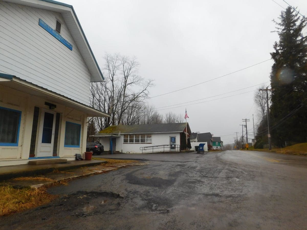
Photo: Wikipedia
Strategic Assessment of Union Dale, PA
Meaningful friction. Expect exposure to either population pressure, blast zones, or natural disaster risk. Consider buying a retreat property.
What does the Strategic Assessment tell us?
Our Strategic Assessment grades tactical survivability of an area. Major population centers, military targets, fallout zones, natural disasters, and border exposure all drive risk — lower exposure means a more defensible position in a crisis.
This is heavily inspired by Joel Skousen's Strategic Relocation book. Highly recommended you checkout the book ($)What does this tell us?
Our Strategic Assessment grades tactical survivability of an area. Major population centers, military targets, fallout zones, natural disasters, and border exposure all drive risk — lower exposure means a more defensible position in a crisis.
This is heavily inspired by Joel Skousen's Strategic Relocation book. Highly recommended you checkout the book ($)Strategic Pillars

Key Distances
Regional Safe Places
Below is our recommended "safe zones" in Pennsylvania and the surrounding area based on our strategic heuristics. For most people, it's unrealistic to live in a “safe zone” full-time due to work, family or other personal reasons. They tend to be more rural. However, many of these areas are perfect for second homes and retreat properties that double as a vacation home or even a short-term rental.
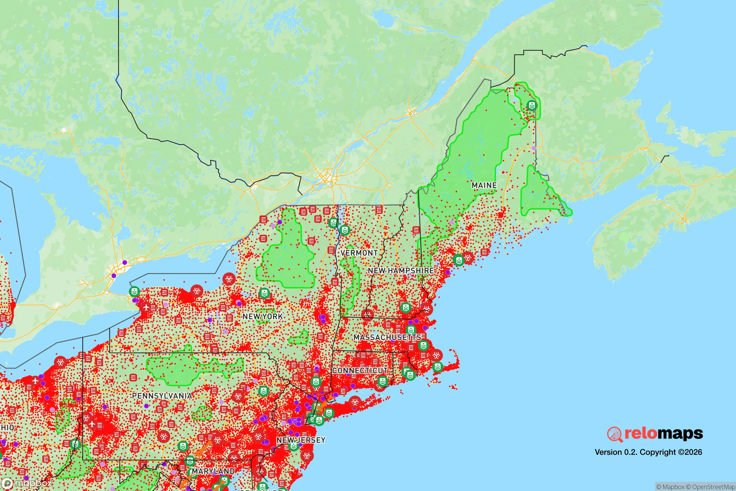
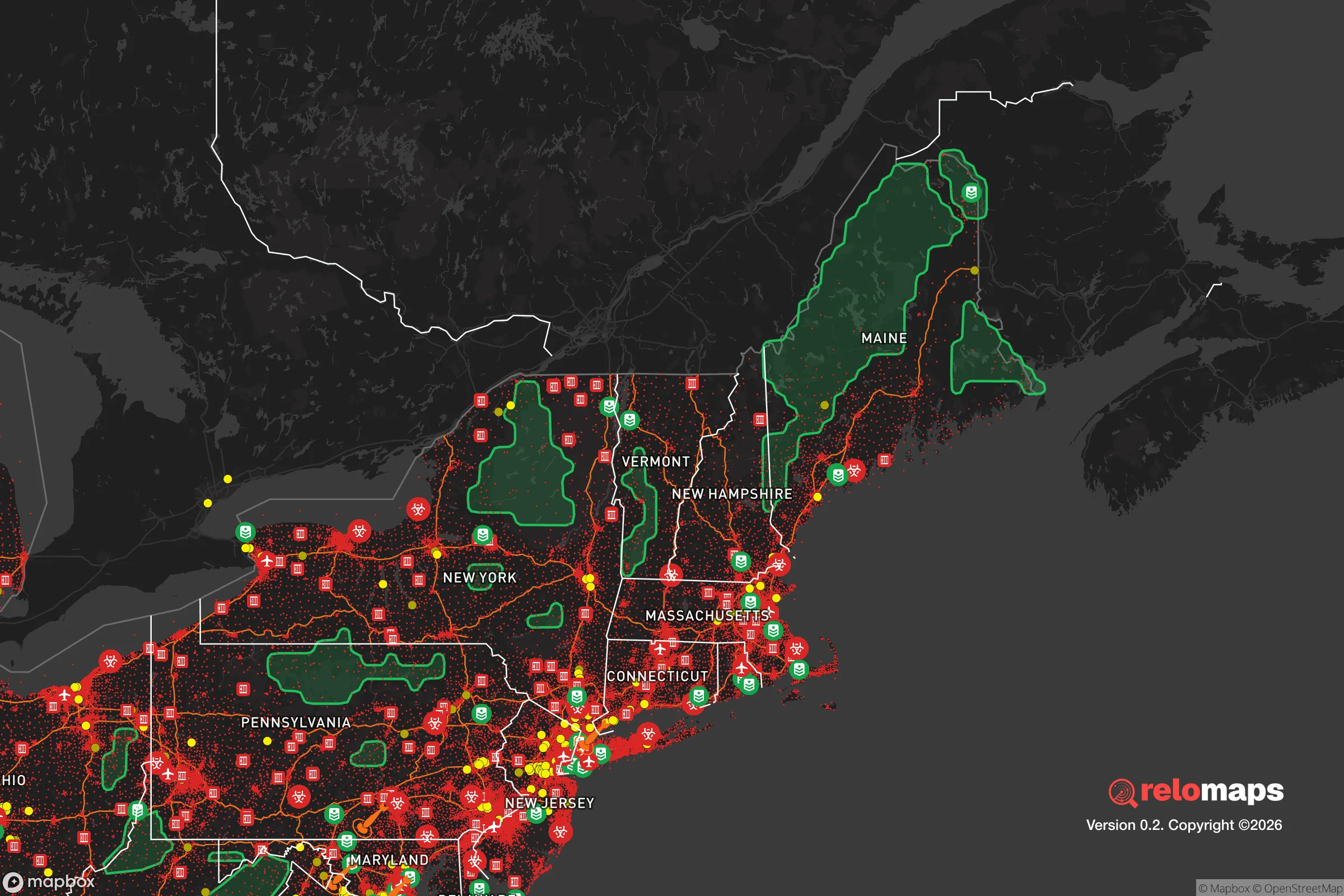


Important Note: For informational purposes only. This does not mean nothing bad ever happens in the green zones. Please use common sense. This is based on public data and modeled with AI. We tried to take a conservative approach but mistakes happen. We update this regularly as new information becomes available.
Solar Generator Recommendations
Backup power matters more here than in safer locations. We've picked three solar generators across budgets and capacity tiers — start with the budget unit if you only need a few essentials, or step up if you want to run a fridge and HVAC for days at a time.
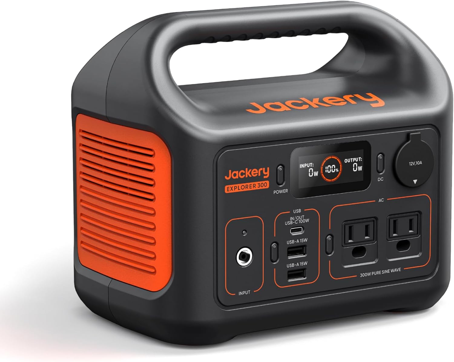
Jackery Portable Power Station Explorer 300
Budget OptionPower on the Go: Weighing only 11 lbs, it's convenient to set up and store with book-sized foldable solar panels

BLUETTI Portable Power Station AC180
Designed for both indoor and outdoor scenarios, AC180 is highly capable as it has a robost capacity and continuous output power.

EF ECOFLOW DELTA Pro Ultra Power Station
Upgraded PickEcoFlow DELTA Pro Ultra is a whole-home energy system designed to grow with your family. Integrated with the Smart Home Panel 2, it scales to meet your evolving energy needs — keeping your home powered, intelligent, and secure through every stage of life.
We earn a commission, at no additional cost to you.
Strategic Assessment Analysis
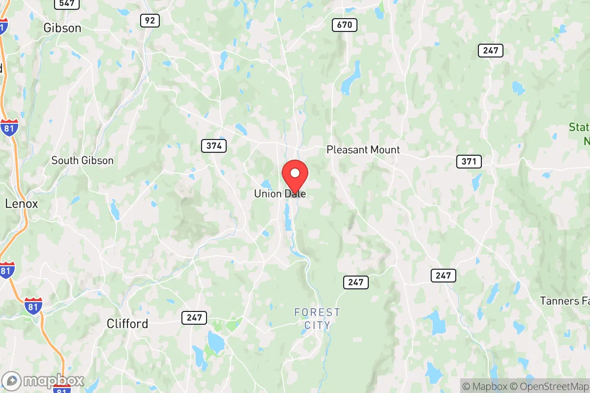
Union Dale, Pennsylvania, sits in a part of Susquehanna County that most people drive through on the way to somewhere else—and that is precisely its strategic value. For a relocator weighing disaster readiness and self-sufficiency, this small borough (roughly 300 residents) offers a combination of low population density, rugged terrain, and distance from primary target zones that is hard to match in the Northeast corridor. The area’s resilience profile is built on obscurity and geography, not infrastructure or wealth, so the honest assessment is this: Union Dale gives you a strong starting position, but you will be responsible for your own preparedness in nearly every category that matters.
Geographic position and natural advantages for long-term self-sufficiency
Union Dale’s location in the Endless Mountains region of northeastern Pennsylvania is its single greatest asset. The borough sits at roughly 1,500 feet elevation in the Allegheny Plateau, surrounded by the rolling, forested hills of Susquehanna County. This is not prime farmland—the soils are thin and rocky—but it is prime cover. The terrain breaks up sight lines, limits population density, and creates natural chokepoints on the few roads that enter the area. For someone thinking about defensibility, that is a meaningful advantage over flat, open country.
The hydrology is a quiet plus. Union Dale is near the headwaters of the Lackawanna River, which flows south toward Scranton, and the area is dotted with small creeks, springs, and wetlands. Surface water is abundant, though it requires filtration and treatment in a grid-down scenario. The broader region sits over the Marcellus Shale formation, which means natural gas extraction is active nearby—a double-edged sword for resilience, as it brings industrial traffic but also local energy infrastructure that may be repurposed in an emergency. The climate is a northern continental one: cold, snowy winters (averaging 60–80 inches annually) and mild summers. That snowpack is a natural water reservoir in spring, but it also makes winter mobility a genuine challenge for anyone not equipped for it.
The forest cover is the underrated advantage. Susquehanna County is roughly 60% forested, and the land around Union Dale is a mix of second-growth hardwood and mixed conifer. That means firewood, building material, and wildlife habitat are all within walking distance. The county’s deer population is healthy, turkey and small game are present, and the Lackawanna River watershed supports trout. For a family looking to supplement food supplies, this is a workable environment—not a hunter’s paradise like the Midwest, but a legitimate source of protein for those who put in the time.
Risks, exposures, and proximity to fallout-relevant landmarks
The honest risk assessment for Union Dale starts with what is not nearby, which is most things that matter in a major conflict scenario. The borough is roughly 25 miles north of Scranton, 40 miles southwest of Binghamton, New York, and about 130 miles from both New York City and Philadelphia. In a nuclear exchange, those cities are plausible targets; Union Dale is far enough away to avoid blast effects and most prompt fallout, but close enough that prevailing westerly winds could deposit measurable fallout within hours. The I-81 corridor, which runs about 15 miles west of the borough, is a critical logistics artery and a plausible secondary target or chokepoint in a conventional conflict.
Natural risks are more immediate and more predictable. The region sits in a moderate seismic zone—no major fault lines, but minor tremors are not unknown. The bigger concern is winter weather: ice storms, heavy snow, and prolonged cold snaps can knock out power for days or weeks, and the rural road network is slow to clear. Flooding is a localized risk along the Lackawanna and its tributaries, though Union Dale’s elevation mitigates the worst of it. Wildfire risk is low but not zero, given the forest cover and dry fall conditions.
The industrial exposure is worth noting. The Marcellus Shale gas fields bring truck traffic, compressor stations, and pipeline infrastructure into the area. A pipeline rupture or well-site incident could create a localized hazard, though these are rare and typically contained. More relevant for a preparedness-minded relocator: the region’s power grid is rural and aging, with above-ground lines that are vulnerable to both storms and deliberate disruption. The nearest major medical facility is in Scranton (Geisinger Community Medical Center or Moses Taylor Hospital), roughly 30–40 minutes away by car—a significant gap in a mass-casualty or grid-down scenario.
Practical resilience for a relocator: food, water, energy, and defensibility
Food security in Union Dale is a do-it-yourself proposition. The growing season is short—roughly 120–140 frost-free days—but adequate for cold-hardy crops like potatoes, root vegetables, brassicas, and some grains. The soil requires amendment, and most serious gardeners in the region use raised beds or hoop houses to extend the season. Local food infrastructure is thin: the nearest full-service grocery is in Carbondale (about 10 miles south) or Forest City (about 6 miles east), and both are small-town supermarkets, not bulk suppliers. A relocator should plan on a minimum of three months of stored food, ideally more, and should establish relationships with local farmers early—the county has a modest but real network of small farms, CSAs, and livestock operations.
Water is the area’s quiet strength. Private wells are the norm in Susquehanna County, and the water table is generally reliable at moderate depths (100–300 feet). A well with a hand pump or a solar-powered backup pump is a realistic and affordable upgrade. Surface water from creeks and springs is plentiful but requires filtration—the region has no major industrial contamination, but agricultural runoff and wildlife-borne pathogens are real concerns. Rainwater catchment is viable, given the region’s 40+ inches of annual precipitation, though winter freezing requires indoor storage or heated collection systems.
Energy resilience is the weak link. The grid is unreliable in winter storms, and natural gas service is available in the borough but not guaranteed in a prolonged outage. Wood heat is the most practical primary or backup option—the forest cover provides ample fuel, and most older homes in the area have or can accommodate a wood stove. Solar is viable but not ideal: the region gets roughly 200 sunny days per year, and winter cloud cover significantly reduces output. A hybrid approach—solar for summer, wood for winter, and a small generator for emergencies—is the realistic baseline. Propane is a common backup fuel in the area, and a 500-gallon tank with a standby generator is a reasonable investment for a family planning to stay through a bad winter.
Defensibility is where Union Dale’s geography shines. The borough is small, with a limited number of access roads, and the surrounding hills provide natural observation points. The nearest neighbors are spread out, which means both privacy and a slower warning network. However, this is not a compound-friendly area—the terrain limits large-scale agriculture and makes perimeter security labor-intensive. The realistic posture is one of low visibility: a modest home, a well-stocked pantry, and a network of trusted neighbors. The county’s culture is rural and self-reliant, and the local population skews older and conservative, which means a prepared newcomer is more likely to be welcomed than resented.
The overall strategic picture for Union Dale is favorable for a relocator who wants to be left alone and is willing to work for self-sufficiency. It is not the most remote option in Pennsylvania—Tioga and Potter counties offer deeper wilderness—but it is closer to supply lines and medical care than those alternatives. The trade-off is clear: you trade the convenience of suburban infrastructure for the security of geographic obscurity. For a family or individual serious about disaster readiness, Union Dale offers a defensible, water-rich, forested position within a day’s drive of the Northeast’s major population centers—close enough to matter, far enough to survive. The work is on you, but the starting position is sound.

* Values derived from national, state, county, city and local statistics and may differ in a specific area. Last updated: 2026-11-01T22:27:26.000Z
Narrative content on this page is AI-generated and may contain mistakes. Verify any details that matter before acting on them.
ReloMaps may earn a commission from affiliate links at no extra cost to you.

