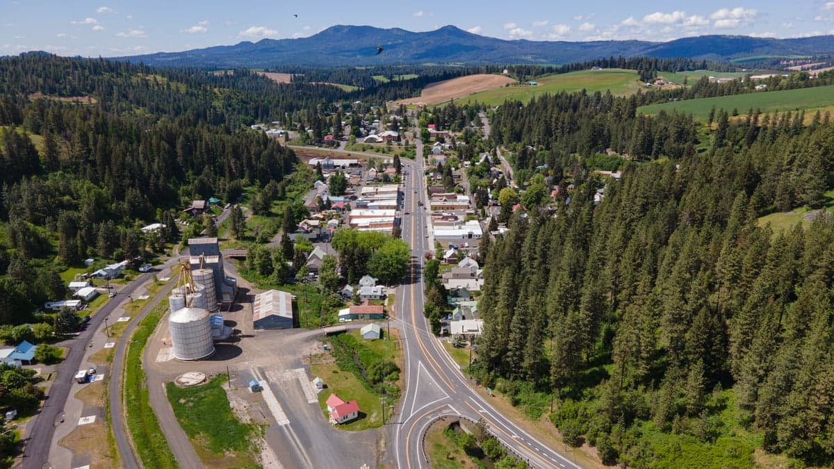
Photo: Wikipedia
Strategic Assessment of Troy, ID
Strong survivability profile. Good buffer from population centers, with manageable environmental and tactical risks.
What does the Strategic Assessment tell us?
Our Strategic Assessment grades tactical survivability of an area. Major population centers, military targets, fallout zones, natural disasters, and border exposure all drive risk — lower exposure means a more defensible position in a crisis.
This is heavily inspired by Joel Skousen's Strategic Relocation book. Highly recommended you checkout the book ($)What does this tell us?
Our Strategic Assessment grades tactical survivability of an area. Major population centers, military targets, fallout zones, natural disasters, and border exposure all drive risk — lower exposure means a more defensible position in a crisis.
This is heavily inspired by Joel Skousen's Strategic Relocation book. Highly recommended you checkout the book ($)Strategic Pillars

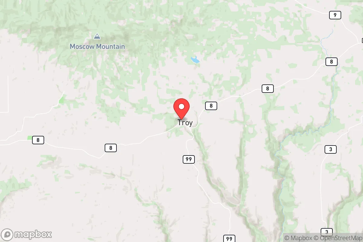
Key Distances
Regional Safe Places
Below is our recommended "safe zones" in Idaho and the surrounding area based on our strategic heuristics. For most people, it's unrealistic to live in a “safe zone” full-time due to work, family or other personal reasons. They tend to be more rural. However, many of these areas are perfect for second homes and retreat properties that double as a vacation home or even a short-term rental.
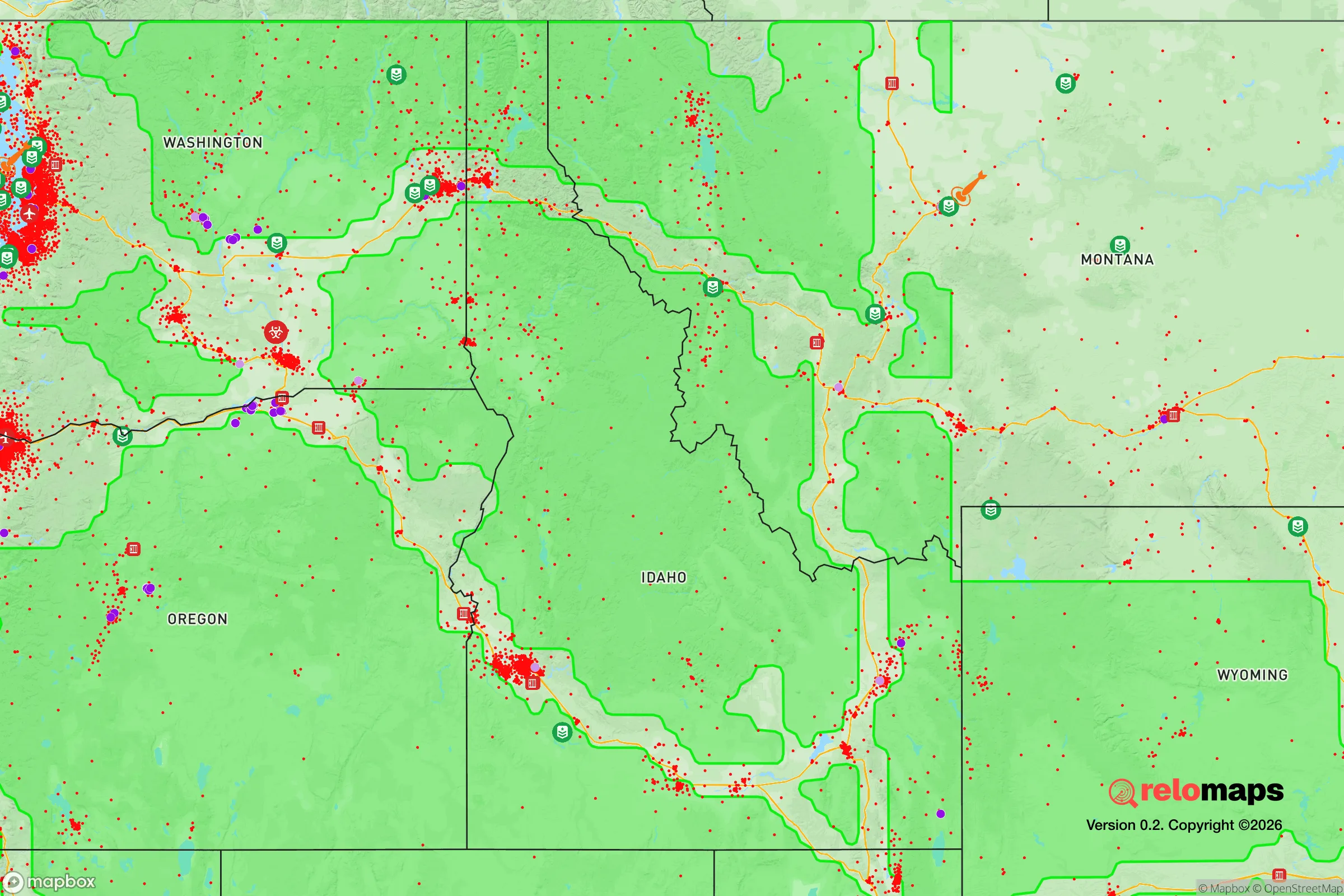
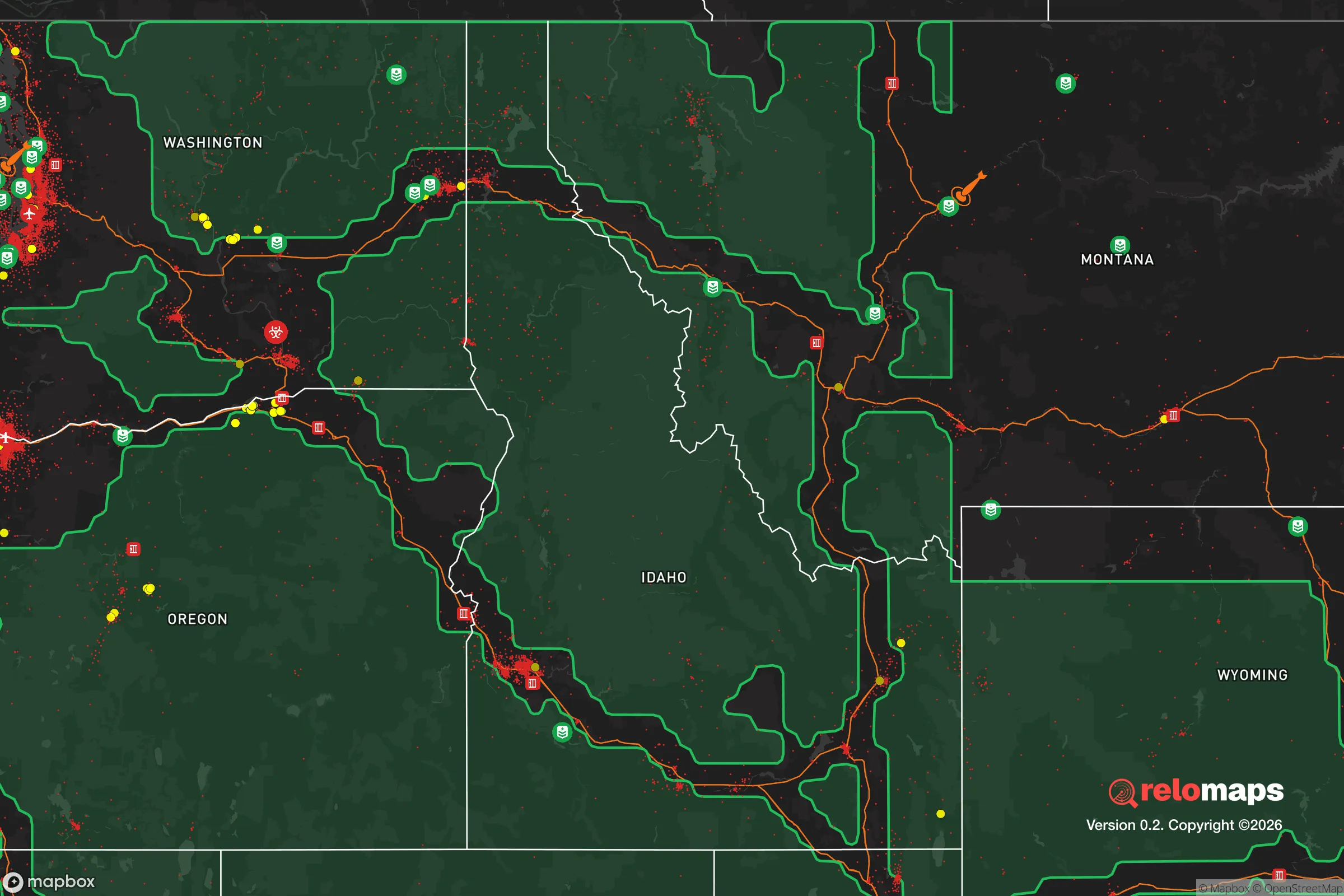


Important Note: For informational purposes only. This does not mean nothing bad ever happens in the green zones. Please use common sense. This is based on public data and modeled with AI. We tried to take a conservative approach but mistakes happen. We update this regularly as new information becomes available.
Solar Generator Recommendations
Backup power matters more here than in safer locations. We've picked three solar generators across budgets and capacity tiers — start with the budget unit if you only need a few essentials, or step up if you want to run a fridge and HVAC for days at a time.

Jackery Portable Power Station Explorer 300
Budget OptionPower on the Go: Weighing only 11 lbs, it's convenient to set up and store with book-sized foldable solar panels

BLUETTI Portable Power Station AC180
Designed for both indoor and outdoor scenarios, AC180 is highly capable as it has a robost capacity and continuous output power.

EF ECOFLOW DELTA Pro Ultra Power Station
Upgraded PickEcoFlow DELTA Pro Ultra is a whole-home energy system designed to grow with your family. Integrated with the Smart Home Panel 2, it scales to meet your evolving energy needs — keeping your home powered, intelligent, and secure through every stage of life.
We earn a commission, at no additional cost to you.
Strategic Assessment Analysis
Troy, Idaho, offers a compelling strategic position for those prioritizing disaster readiness and self-sufficiency, balancing genuine geographic advantages with real-world exposure to regional risks. Located in Latah County, roughly 10 miles north of Moscow and 30 miles south of Coeur d'Alene, this small town of about 900 residents sits in the Palouse region—a landscape of rolling hills and fertile soils that provides both natural beauty and practical self-reliance potential. For a relocator thinking seriously about resilience, Troy presents a mixed picture: strong local food production capacity and low population density are offset by proximity to larger population centers and infrastructure that could become liabilities in a crisis.
Geographic position and natural advantages for self-reliance
Troy's location in the Palouse gives it a significant edge for long-term self-sufficiency. The surrounding area is among the most productive agricultural regions in the United States, with deep, fertile loess soils that support wheat, barley, lentils, and peas. For someone looking to establish a garden or small farm, the growing season runs roughly 120–140 days, with annual precipitation averaging 20–25 inches—enough to support dryland farming without heavy irrigation. The town sits at an elevation of about 2,500 feet, which moderates summer temperatures and reduces wildfire risk compared to lower-elevation areas in the West. The nearby Clearwater and Snake River drainages provide reliable water sources, though most residential properties rely on wells. Troy's position on the eastern edge of the Palouse, near the foothills of the Rocky Mountains, offers defensible terrain: the surrounding hills provide natural sightlines and chokepoints, while the town itself is set back from major highways (US-95 runs about 5 miles west). This distance from primary transit corridors reduces exposure to refugee flows or supply chain disruptions that might affect towns directly on the highway. The nearest city of significant size, Moscow (population 26,000), is close enough for resource access but far enough that its problems—civil unrest, resource competition—are unlikely to spill over directly into Troy.
Risks, exposures, and proximity to fallout-relevant landmarks
No strategic assessment is complete without acknowledging the area's vulnerabilities. Troy's primary risk exposure comes from its proximity to several high-value targets in the Pacific Northwest. The town lies roughly 90 miles from Fairchild Air Force Base near Spokane, Washington, which houses KC-135 tankers and is a potential nuclear target in a major conflict. Spokane itself (population 230,000) is about 100 miles northwest, and its transportation hub status—including rail lines and Interstate 90—makes it a secondary target. The Port of Lewiston, 40 miles south, handles barge traffic on the Snake River and could be a strategic asset in a crisis, drawing unwanted attention. Wildfire risk is moderate but real: the 2020 Pearl Hill Fire burned over 200,000 acres in the region, and while Troy itself was not directly threatened, smoke and evacuation orders affected the area. Earthquake risk is low, as the region sits on stable continental crust. Flooding is minimal due to the town's elevation, though low-lying areas near the Potlatch River (5 miles east) could see localized issues. The biggest man-made risk is likely the town's dependence on a single major road (State Highway 8) for access to medical care and supplies; a bridge failure or landslide could isolate Troy for days. For a relocator, the key takeaway is that while Troy avoids the worst fallout risks of coastal cities, it is not remote enough to be considered a true "bug-out" location—it's a middle-ground option with manageable but real exposure.
Practical resilience for a relocator: food, water, energy, and defensibility
For someone moving to Troy with self-sufficiency in mind, the practical picture is encouraging but requires preparation. Food production is the area's strongest suit: the Palouse's agricultural bounty means local farmers' markets and co-ops (like the Moscow Food Co-op) are well-stocked, and the soil quality allows for productive home gardens. Seed banks and livestock feed are readily available from local suppliers like Latah County Grain Growers. Water is generally reliable from private wells, with groundwater depths averaging 50–150 feet in the area; a hand pump or solar-powered well system is a smart investment. The town's municipal water system draws from the Potlatch River, but this is vulnerable to power outages—a backup generator for well pumps is essential. Energy comes from Avista Utilities, which serves the region with a mix of hydroelectric (60%) and natural gas (30%). The grid is moderately reliable, but winter storms can cause outages lasting 1–3 days. Solar potential is decent: the area averages 200 sunny days per year, though winter cloud cover reduces output. Wood heating is common and practical, with firewood available from national forests (St. Joe and Clearwater) within a 30-minute drive. Defensibility is mixed: Troy's small size and low crime rate (Latah County's violent crime rate is about 1.5 per 1,000 residents, well below national averages) mean that social cohesion is high, but the town lacks natural barriers like rivers or mountains that would slow an organized threat. The surrounding hills provide good observation points, and the town's layout—a compact grid with few entry points—makes it relatively easy to monitor. For a family, the local school (Troy Elementary and Troy High School, serving about 400 students) is a community anchor that would likely function as a coordination point in a crisis. The nearest hospital is in Moscow (Gritman Medical Center, 25 beds), which is adequate for routine care but not for major trauma—a serious consideration for those with medical dependencies.
Overall, Troy, Idaho presents a solid strategic option for a relocator focused on resilience, but it is not a remote fortress. Its strengths lie in agricultural self-sufficiency, moderate climate, and low population density, while its weaknesses include proximity to regional targets and dependence on a single road for external access. For a single individual or family willing to invest in well water backup, solar or wood heat, and a food storage plan, Troy offers a realistic balance of safety and access—a place where you can live comfortably day-to-day while being reasonably prepared for most contingencies. The town's conservative-leaning culture (Latah County voted +12 R in 2024) aligns with the self-reliance mindset, and the local community is generally welcoming to newcomers who contribute. The bottom line: Troy is a good base for a resilience-minded household, but it requires active preparation rather than passive reliance on geography alone.

* Values derived from national, state, county, city and local statistics and may differ in a specific area. Last updated: 2026-07-30T14:47:14.000Z
Narrative content on this page is AI-generated and may contain mistakes. Verify any details that matter before acting on them.
ReloMaps may earn a commission from affiliate links at no extra cost to you.

