Photo: Wikipedia
Strategic Assessment of Trinidad, CA
Workable tactical position. Some exposure to population density or targets, but generally defensible in a crisis.
What does the Strategic Assessment tell us?
Our Strategic Assessment grades tactical survivability of an area. Major population centers, military targets, fallout zones, natural disasters, and border exposure all drive risk — lower exposure means a more defensible position in a crisis.
This is heavily inspired by Joel Skousen's Strategic Relocation book. Highly recommended you checkout the book ($)What does this tell us?
Our Strategic Assessment grades tactical survivability of an area. Major population centers, military targets, fallout zones, natural disasters, and border exposure all drive risk — lower exposure means a more defensible position in a crisis.
This is heavily inspired by Joel Skousen's Strategic Relocation book. Highly recommended you checkout the book ($)Strategic Pillars

Key Distances
Regional Safe Places
Below is our recommended "safe zones" in California and the surrounding area based on our strategic heuristics. For most people, it's unrealistic to live in a “safe zone” full-time due to work, family or other personal reasons. They tend to be more rural. However, many of these areas are perfect for second homes and retreat properties that double as a vacation home or even a short-term rental.

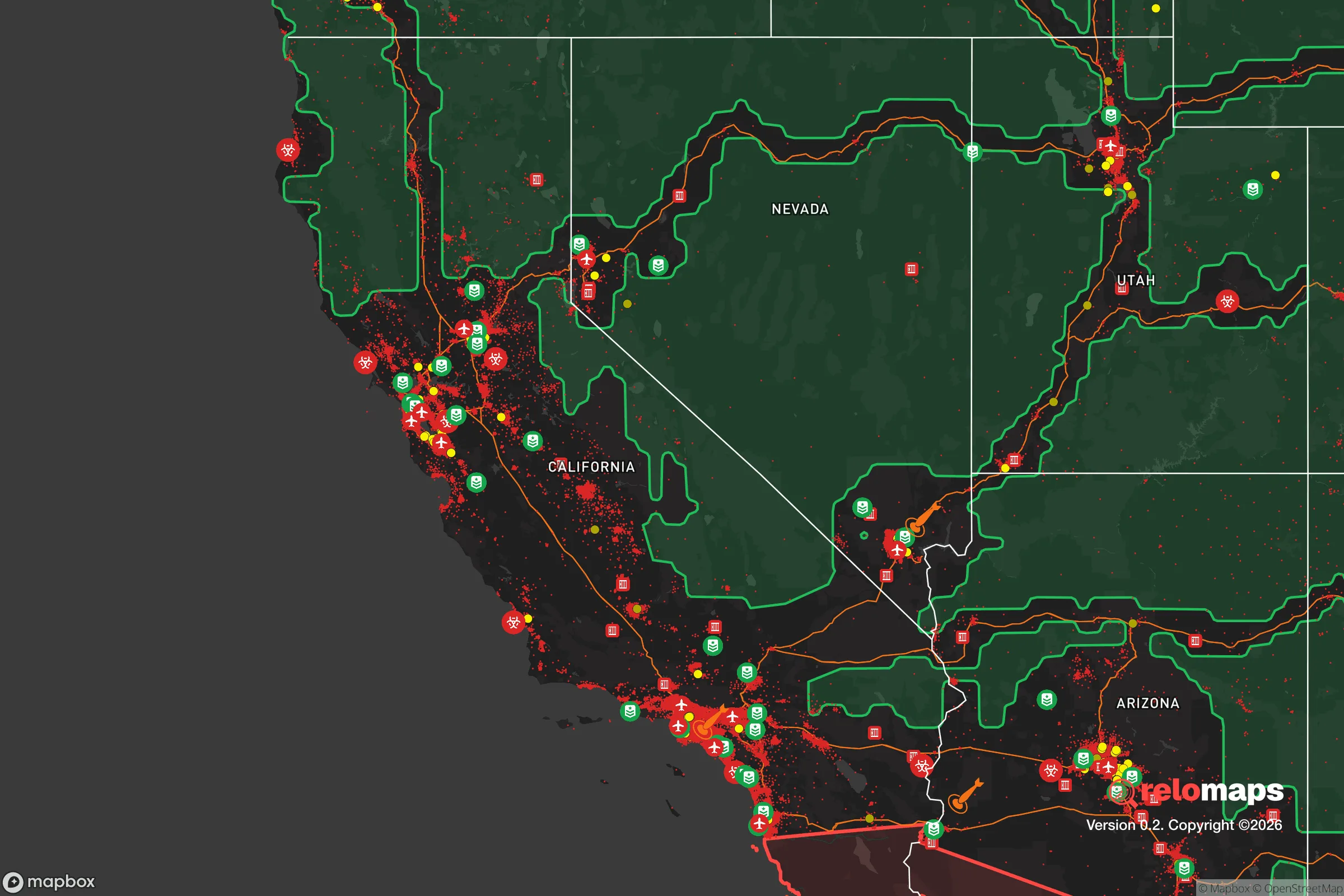


Important Note: For informational purposes only. This does not mean nothing bad ever happens in the green zones. Please use common sense. This is based on public data and modeled with AI. We tried to take a conservative approach but mistakes happen. We update this regularly as new information becomes available.
Solar Generator Recommendations
Backup power matters more here than in safer locations. We've picked three solar generators across budgets and capacity tiers — start with the budget unit if you only need a few essentials, or step up if you want to run a fridge and HVAC for days at a time.

Jackery Portable Power Station Explorer 300
Budget OptionPower on the Go: Weighing only 11 lbs, it's convenient to set up and store with book-sized foldable solar panels

BLUETTI Portable Power Station AC180
Designed for both indoor and outdoor scenarios, AC180 is highly capable as it has a robost capacity and continuous output power.

EF ECOFLOW DELTA Pro Ultra Power Station
Upgraded PickEcoFlow DELTA Pro Ultra is a whole-home energy system designed to grow with your family. Integrated with the Smart Home Panel 2, it scales to meet your evolving energy needs — keeping your home powered, intelligent, and secure through every stage of life.
We earn a commission, at no additional cost to you.
Strategic Assessment Analysis
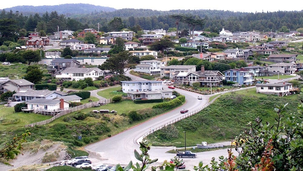
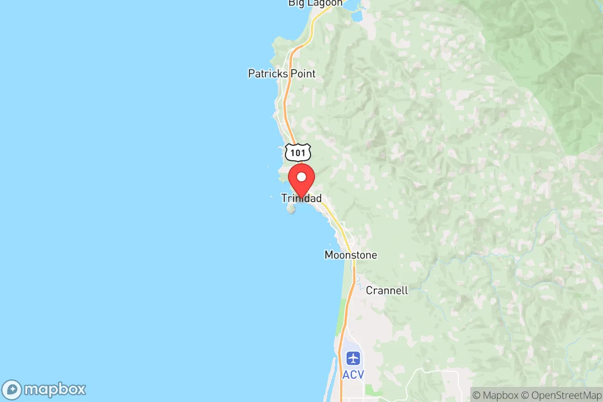
Trinidad, California, offers a compelling mix of natural isolation and practical access that makes it a serious candidate for a relocation focused on resilience and self-sufficiency. Perched on a rugged headland in Humboldt County, this small coastal town of roughly 350 year-round residents sits about 25 miles north of Eureka and 20 miles south of the Oregon border, placing it far from major urban centers while still within reach of essential services. Its position on a bluff above the Pacific, combined with limited road access and a low population density, provides a natural buffer against many of the cascading risks that plague more connected areas, though the trade-offs in exposure to seismic activity and coastal hazards demand careful consideration.
Geographic position and natural advantages for long-term security
Trinidad’s primary strategic asset is its location on a peninsula that juts into the Pacific, offering a 270-degree view of the ocean and a narrow land connection to the mainland. This geography creates a natural chokepoint: the only road in and out is Highway 101, which runs along a narrow coastal shelf prone to landslides but also easily monitored and, in a crisis, defensible. The town sits on a marine terrace about 100 feet above sea level, which provides a significant elevation advantage over the immediate coastline—most tsunami inundation zones in the area are confined to the harbor and beach areas below the bluff, leaving the residential core largely above the danger line. The surrounding landscape is dominated by dense redwood forests and steep, undeveloped terrain, which limits sprawl and preserves a high degree of natural cover. For a relocator, this means a low-visibility footprint: Trinidad is not a destination for mass evacuation or a target for looting, simply because there are few resources to attract large numbers of people. The nearest city of any size, Eureka, is a 30-minute drive south, but its population of about 26,000 is small enough that it doesn’t generate the kind of regional instability seen near larger metros. The area’s maritime climate, with cool summers and mild, wet winters, also reduces the risk of wildfire compared to inland California—though it’s not immune, as the 2023 Lost Fire near Orick demonstrated.
Risks, exposures, and proximity to fallout-relevant landmarks
The most significant risk in Trinidad is seismic activity. The town lies within the Cascadia subduction zone, which means a major earthquake (magnitude 8.0 or greater) is a geological certainty, though the timing is unpredictable. A full-rupture event would likely cause severe ground shaking, liquefaction in low-lying areas, and a tsunami that could impact the harbor and beach zones within 15 to 30 minutes. However, the elevated bluff where most homes sit provides a natural refuge—residents would only need to move a few hundred feet inland or uphill to be safe from the wave. The real concern is post-quake isolation: landslides along Highway 101 could cut off road access for weeks or months, as happened after the 2022 Ferndale earthquake (magnitude 6.4), which closed the highway for several days. This makes self-sufficiency in food, water, and medical supplies critical, not optional. Regarding man-made risks, Trinidad’s distance from major strategic targets is a strong positive. The nearest significant military installation is the Coast Guard Air Station in Humboldt Bay, about 25 miles south, which is a low-priority target. The closest major population center is the San Francisco Bay Area, roughly 250 miles south—well outside the immediate fallout zone for any plausible nuclear event. The Humboldt Bay Nuclear Power Plant, decommissioned in 1976, is no longer a risk. The primary fallout-relevant concern is the potential for a dirty bomb or industrial accident at the Port of Humboldt Bay, but prevailing winds blow onshore, which would push any contamination out to sea rather than toward Trinidad. In short, the area is about as far from high-value targets as one can get in coastal California while still having access to a functioning regional economy.
Practical resilience for a relocator: food, water, energy, and defensibility
For a relocator serious about self-sufficiency, Trinidad offers a mixed but workable picture. Water is the strongest asset: the town draws from the Trinidad Municipal Water System, which sources from Luffenholtz Creek and has a storage capacity of about 1.5 million gallons, supplemented by a backup well. The area receives 60-80 inches of rain annually, meaning rainwater catchment is highly viable for off-grid setups. Most properties have access to groundwater, though wells can be expensive to drill in the rocky terrain. Food production is feasible but limited: the cool, foggy climate is excellent for berries, leafy greens, and root vegetables, but warm-season crops like tomatoes or peppers require a greenhouse. The ocean provides a reliable protein source—Trinidad’s harbor is one of the few safe harbors between San Francisco and Coos Bay, and local fishermen regularly catch salmon, rockfish, crab, and halibut. Foraging for mushrooms (chanterelles, morels) and seaweed is common, and deer hunting is legal in nearby national forest lands. However, the growing season is short (roughly April to October), and the soil is acidic and rocky, so serious food storage and preservation skills are necessary. Energy is a vulnerability: the grid is served by PG&E, which has a history of Public Safety Power Shutoffs during dry, windy conditions. Solar is viable but requires battery storage due to frequent coastal cloud cover; a small wind turbine can supplement, as the area is consistently breezy. Propane is widely available for heating and cooking. Defensibility is excellent: the town’s layout on a bluff with only two main access roads (Highway 101 and Scenic Drive) means a small group could effectively control entry points. The dense forest provides cover and makes surveillance difficult. The local community is tight-knit and self-reliant—the Trinidad Rancheria, a federally recognized Yurok tribe, has a strong presence and a history of mutual aid. Crime is low, with property crime rates about half the national average, and the Humboldt County Sheriff’s Office has a substation in town. For a family or individual, the key trade-off is isolation versus access: you can be self-sufficient here, but you’ll need to invest in infrastructure and skills before a crisis hits.
The overall strategic picture for Trinidad is one of high natural resilience offset by moderate logistical fragility. The town’s geographic isolation, low population, and elevation above tsunami zones make it a strong candidate for those seeking to avoid the risks of urban centers and major infrastructure targets. The primary vulnerabilities—seismic risk, road dependency, and a short growing season—are manageable with preparation, particularly if you prioritize water storage, seismic retrofitting, and a robust food preservation system. For a relocator with a conservative leaning who values self-reliance and community cohesion, Trinidad offers a rare combination of natural beauty, defensible terrain, and practical access to the ocean’s resources. It is not a place for those who need constant connectivity or urban amenities, but for those willing to invest in preparedness, it provides a solid foundation for long-term security in an increasingly uncertain world.

* Values derived from national, state, county, city and local statistics and may differ in a specific area. Last updated: 2026-10-29T04:50:54.000Z
Narrative content on this page is AI-generated and may contain mistakes. Verify any details that matter before acting on them.
ReloMaps may earn a commission from affiliate links at no extra cost to you.

