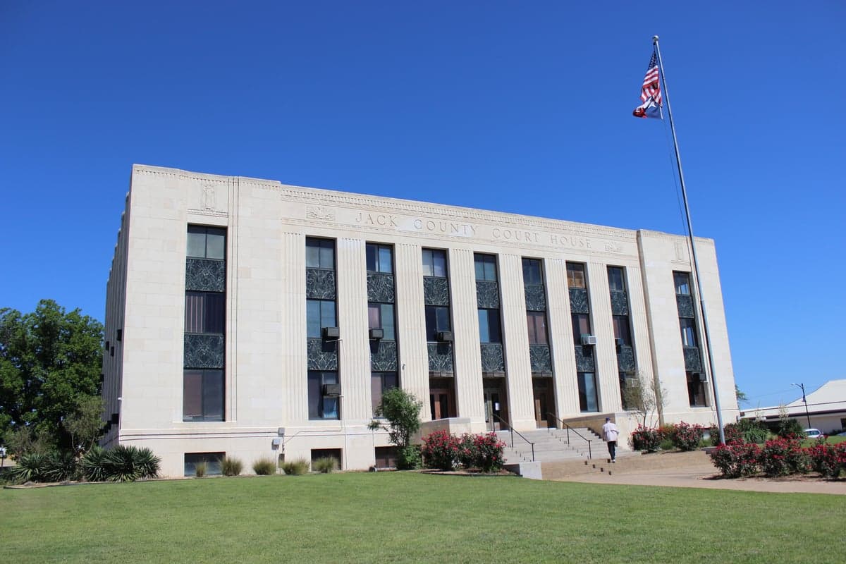
Photo: Wikipedia
Strategic Assessment of Jack County
Strong survivability profile. Good buffer from population centers, with manageable environmental and tactical risks.
What does the Strategic Assessment tell us?
Our Strategic Assessment grades tactical survivability of an area. Major population centers, military targets, fallout zones, natural disasters, and border exposure all drive risk — lower exposure means a more defensible position in a crisis.
This is heavily inspired by Joel Skousen's Strategic Relocation book. Highly recommended you checkout the book ($)What does this tell us?
Our Strategic Assessment grades tactical survivability of an area. Major population centers, military targets, fallout zones, natural disasters, and border exposure all drive risk — lower exposure means a more defensible position in a crisis.
This is heavily inspired by Joel Skousen's Strategic Relocation book. Highly recommended you checkout the book ($)Strategic Pillars

Key Distances
Strategic Assessment Analysis
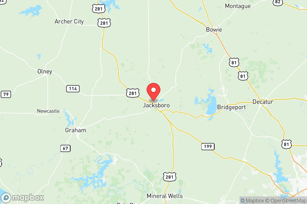
Jack County, Texas, offers a compelling mix of geographic isolation and practical self-sufficiency that appeals to relocators prioritizing resilience and preparedness. Located about 60 miles northwest of Fort Worth, the county seat of Jacksboro sits at the intersection of U.S. 281 and U.S. 380, providing solid regional access without the congestion or target density of the Dallas-Fort Worth metroplex. The area's low population density—roughly 8,500 residents spread over 911 square miles—means fewer neighbors, less infrastructure strain, and a quieter baseline for anyone serious about disaster readiness and long-term sustainability.
Strategic location and natural defensive advantages
Jack County's position in the Cross Timbers region gives it a natural edge for self-reliant living. The terrain is a mix of rolling hills, oak and mesquite woodlands, and limestone-based soils that support grazing and limited agriculture. Unlike the flat, exposed plains to the west or the flood-prone bottomlands to the east, this area offers natural cover and drainage advantages. The county is bisected by the West Fork of the Trinity River, which provides a reliable surface water source, and several smaller creeks like Keechi Creek and Rock Creek offer additional water catchment potential. For a relocator thinking about defensibility, the patchwork of wooded draws and elevated ridgelines around towns like Bryson and Jermyn creates natural chokepoints and observation points. The nearest major military installation is Fort Cavazos (formerly Fort Hood) roughly 120 miles south, well outside any immediate blast or fallout zone from a conventional or nuclear event targeting that facility. Similarly, the Dallas-Fort Worth metroplex, with its major airports, defense contractors, and population density, is far enough away to avoid direct blast effects while still being close enough for supply runs under normal conditions.
Exposure to natural hazards and man-made risks
Jack County is not immune to risks, but its exposure profile is moderate compared to other parts of Texas. The primary natural hazard is wildfire, particularly during drought years when the combination of dry grasses, juniper, and oak brush can fuel fast-moving grass fires. The 2011 Texas wildfire season saw significant burns in the region, and residents in rural areas should maintain defensible space and a reliable water source for firefighting. Tornado risk is present but lower than in the Dallas-Fort Worth corridor; Jack County averages fewer than five tornado warnings per year, and most are short-lived EF0-EF1 events. Flash flooding along the West Fork of the Trinity and its tributaries is a seasonal concern, especially in low-lying areas near Jacksboro and along Highway 281. From a man-made risk standpoint, the county's primary exposure is its proximity to the Barnett Shale natural gas fields. There are active gas wells and compressor stations scattered throughout the county, particularly around the Lake Jacksboro area and near the town of Perrin. While these are not high-risk targets in a conflict scenario, a wellhead failure or pipeline rupture could create localized hazards. The nearest major industrial target is the DFW metroplex, roughly 60 miles southeast, which includes the Dallas Love Field airport, the DFW International Airport, and the defense-related supply chains in Fort Worth. Fallout modeling for a surface burst at DFW would place Jack County on the edge of the moderate fallout zone depending on wind direction, but the distance and intervening terrain provide meaningful attenuation. There are no nuclear power plants, major refineries, or large-scale chemical facilities within 50 miles of the county line.
Practical resilience for daily life and crisis scenarios
For a relocator focused on food, water, energy, and defensibility, Jack County offers a workable baseline that requires active improvement rather than a complete overhaul. Water is the strongest asset: the county sits atop the Trinity Aquifer, and private wells are common in rural areas, with typical depths of 200-400 feet producing adequate yields for household use and small-scale irrigation. Surface water from the West Fork of the Trinity and Lake Jacksboro—a 1,000-acre reservoir on the county's southern edge—provides a secondary supply, though access is controlled by the city of Jacksboro and the Brazos River Authority. Rainwater catchment is viable, with the region averaging 30-32 inches of precipitation annually, concentrated in spring and fall. Food production is limited by soil quality; the clay-heavy, alkaline soils are better suited for livestock grazing than row crops. Hay production, cattle ranching, and small-scale goat or sheep operations are the most practical agricultural pursuits. The county has a handful of local farms and ranches selling beef, eggs, and produce at the Jacksboro Farmers Market, but year-round food self-sufficiency would require greenhouse infrastructure and soil amendment. Energy resilience is mixed: Oncor Electric Delivery serves the county, and outages are common during ice storms and high-wind events, typically lasting 4-12 hours. Solar potential is good, with an average of 220 sunny days per year, and off-grid solar setups are feasible for most rural properties. Natural gas is available in and around Jacksboro, but rural properties rely on propane or heating oil. Defensibility is the county's strongest resilience feature: low population density, limited through-traffic on secondary roads, and the natural screening of the Cross Timbers make it easy to monitor approach routes. The county has a sheriff's office with about 12 deputies covering the entire area, so response times in rural areas can exceed 30 minutes. Neighbor networks and community preparedness groups are active in the Bryson and Perrin areas, and the Jacksboro area has a well-regarded volunteer fire department network.
The overall strategic picture for Jack County is one of moderate-to-strong resilience with manageable trade-offs. It avoids the high-risk proximity to major military and industrial targets that plagues counties closer to DFW or the Gulf Coast, while still offering access to regional medical care, supply chains, and transportation corridors. The water availability and defensible terrain are genuine advantages that are hard to find in more populated parts of North Texas. The main downsides are the wildfire risk, the limited local food production capacity, and the need for proactive energy backup. For a relocator who values distance from fallout-relevant landmarks, a slower pace, and the ability to build self-sufficiency over time, Jack County ranks as a solid choice in the region—not a fortress, but a place where a prepared household can thrive without constant exposure to the vulnerabilities of urban and suburban Texas.

* Values derived from national, state, county, city and local statistics and may differ in a specific area. Last updated: 2026-07-03T21:30:21.000Z
Narrative content on this page is AI-generated and may contain mistakes. Verify any details that matter before acting on them.
ReloMaps may earn a commission from affiliate links at no extra cost to you.

