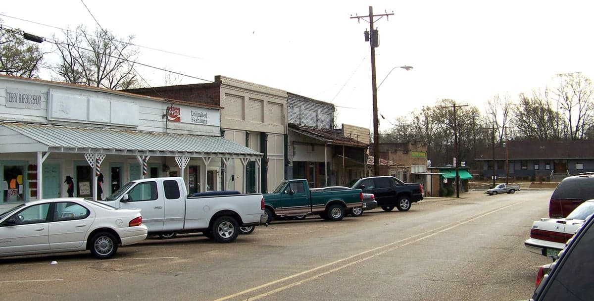
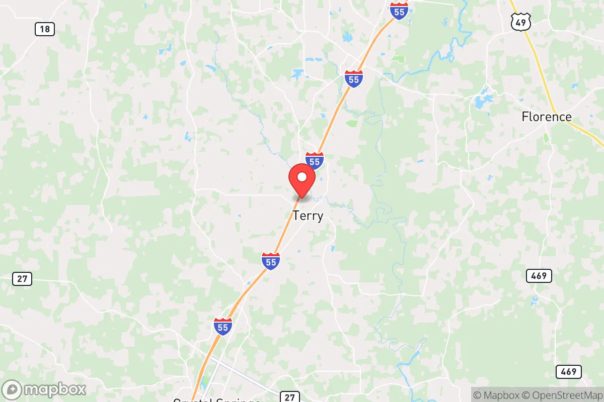
Photo: Wikipedia
Strategic Assessment of Terry, MS
Deep buffer from population centers and strategic targets. Low natural disaster risk and minimal exposure to border or coastal threats.
What does the Strategic Assessment tell us?
Our Strategic Assessment grades tactical survivability of an area. Major population centers, military targets, fallout zones, natural disasters, and border exposure all drive risk — lower exposure means a more defensible position in a crisis.
This is heavily inspired by Joel Skousen's Strategic Relocation book. Highly recommended you checkout the book ($)What does this tell us?
Our Strategic Assessment grades tactical survivability of an area. Major population centers, military targets, fallout zones, natural disasters, and border exposure all drive risk — lower exposure means a more defensible position in a crisis.
This is heavily inspired by Joel Skousen's Strategic Relocation book. Highly recommended you checkout the book ($)Strategic Pillars

Key Distances
Regional Safe Places
Below is our recommended "safe zones" in Mississippi and the surrounding area based on our strategic heuristics. For most people, it's unrealistic to live in a “safe zone” full-time due to work, family or other personal reasons. They tend to be more rural. However, many of these areas are perfect for second homes and retreat properties that double as a vacation home or even a short-term rental.
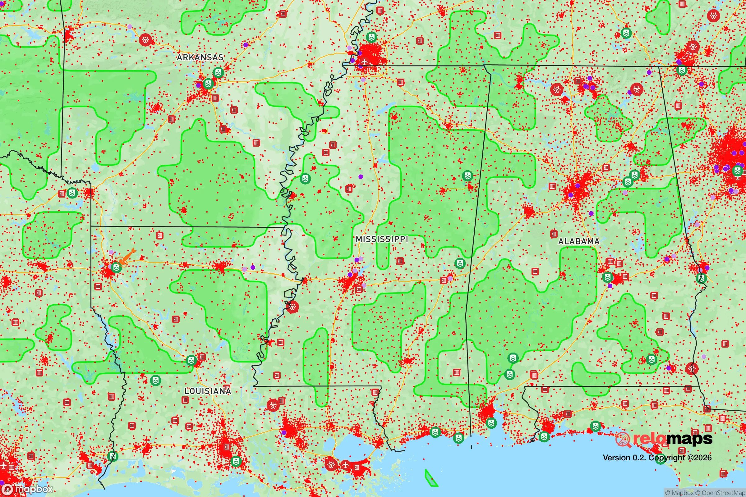
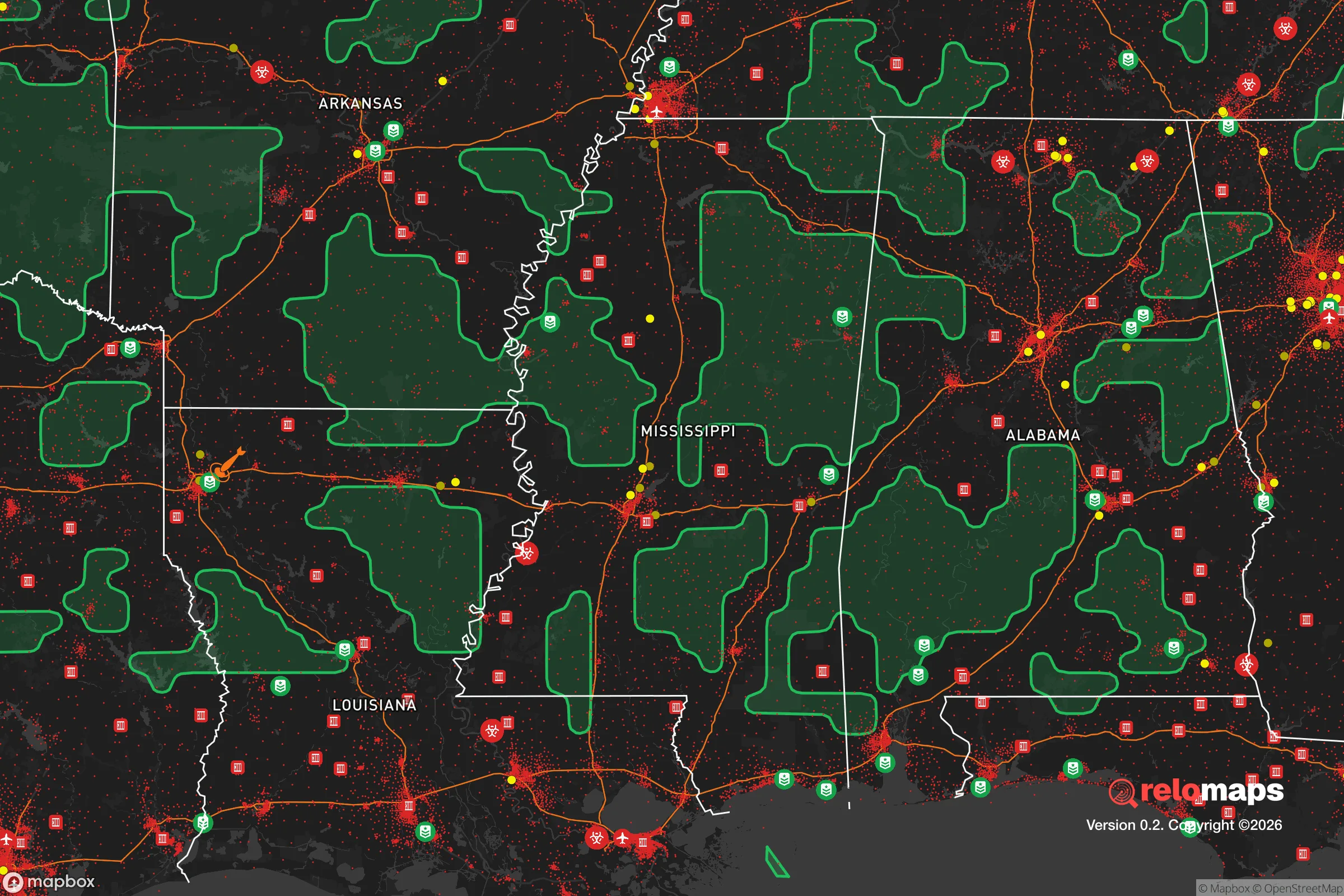


Important Note: For informational purposes only. This does not mean nothing bad ever happens in the green zones. Please use common sense. This is based on public data and modeled with AI. We tried to take a conservative approach but mistakes happen. We update this regularly as new information becomes available.
Solar Generator Recommendations
Backup power matters more here than in safer locations. We've picked three solar generators across budgets and capacity tiers — start with the budget unit if you only need a few essentials, or step up if you want to run a fridge and HVAC for days at a time.

Jackery Portable Power Station Explorer 300
Budget OptionPower on the Go: Weighing only 11 lbs, it's convenient to set up and store with book-sized foldable solar panels

BLUETTI Portable Power Station AC180
Designed for both indoor and outdoor scenarios, AC180 is highly capable as it has a robost capacity and continuous output power.

EF ECOFLOW DELTA Pro Ultra Power Station
Upgraded PickEcoFlow DELTA Pro Ultra is a whole-home energy system designed to grow with your family. Integrated with the Smart Home Panel 2, it scales to meet your evolving energy needs — keeping your home powered, intelligent, and secure through every stage of life.
We earn a commission, at no additional cost to you.
Strategic Assessment Analysis
Terry, Mississippi, sits in a sweet spot that few relocation guides talk about: close enough to Jackson to matter economically, but far enough from the urban core to offer genuine strategic depth. For a reader weighing disaster readiness and self-sufficiency, Terry’s value isn’t in flash—it’s in the quiet math of distance, soil, and infrastructure that most people overlook until they need it. The town’s resilience profile is defined by its position in Hinds County’s southern tier, where suburban pressure fades into working farmland and timber stands, and where the practical realities of Mississippi life—heat, water, and road networks—shape what self-reliance actually looks like.
Geographic position and natural advantages for long-term stability
Terry sits roughly 20 miles south of downtown Jackson, just off Interstate 55, which is the spine of central Mississippi. That proximity is a double-edged sword in a resilience context, but the specific location matters more than the raw distance. The town is positioned on the Jackson Prairie belt, a band of gently rolling terrain that drains better than the Delta flatlands to the west and avoids the deep clay soils that plague construction and septic systems elsewhere in the region. For a relocator thinking about a home that can handle heavy rain events, that drainage profile is a quiet but significant advantage.
The area’s natural assets are understated. Terry sits within the Pearl River watershed, but not in the floodplain itself—most of the town’s residential and agricultural land sits on elevations that keep it out of the 100-year flood zone, unlike parts of Byram and Florence to the north and east. The surrounding countryside is a mix of pasture, pine plantation, and mixed hardwood, which means timber is both a local industry and a practical resource. For a household thinking about firewood, building materials, or simply a property that isn’t exposed on all sides, the tree cover provides natural windbreaks and privacy that open-field subdivisions lack.
Water is the region’s quiet strength. The Sparta Aquifer, which supplies much of central Mississippi’s groundwater, runs beneath this part of Hinds County, and well depths in the Terry area typically hit good yields at 200–400 feet. Municipal water comes from the city of Jackson’s system in some pockets, but many rural parcels in the Terry zip code (39190) are on private wells, which is a meaningful resilience advantage when municipal systems strain under pressure. The climate is humid subtropical, with about 55 inches of annual rainfall—enough that rainwater catchment is a viable supplement, not a desperate measure.
Risks, exposures, and proximity to fallout-relevant landmarks
No honest strategic assessment ignores the negatives. Terry’s primary exposure is its proximity to Jackson, which is both a resource and a liability. In a major regional disruption—hurricane, extended power outage, or civil unrest—Jackson’s population of roughly 150,000 would push south along I-55, and Terry sits directly in that path. The town itself is not a target in any plausible scenario, but it is a corridor, and corridors experience traffic, looting pressure, and resource competition during evacuations.
The man-made risk profile is moderate but worth mapping. The Mississippi Chemical Corporation facility in Yazoo City, about 45 miles northwest, and the Entergy nuclear plant at Grand Gulf, roughly 50 miles southwest near Port Gibson, are the two largest industrial landmarks within a day’s drive. Grand Gulf is a single-unit boiling water reactor, and while its safety record is solid, a worst-case event would put Terry outside the immediate plume zone but inside the broader fallout shadow depending on wind direction. More practically, the I-55 corridor carries constant hazardous materials traffic—fuel, ammonia, and industrial chemicals—and a tanker incident on the interstate could close the road for hours, which matters for anyone planning evacuation routes.
Natural hazards are the more frequent concern. Tornado risk is real; Hinds County sits in the Dixie Alley zone where nighttime and winter tornadoes are more common than the Great Plains. The April 2011 outbreak that devastated Smithville and Philadelphia, Mississippi, passed within 50 miles of Terry, and the 2020 Easter tornado outbreak produced a long-track EF-4 that crossed central Mississippi. Flash flooding is localized but recurrent, particularly along the smaller creeks that feed the Pearl River. Hurricane risk is indirect—Terry is 120 miles from the Gulf Coast—but the 2005 Hurricane Katrina aftermath demonstrated that inland Mississippi towns absorb evacuees, fuel shortages, and supply chain disruptions for weeks after landfall.
Practical resilience for a relocator: food, water, energy, and defensibility
For a household serious about self-sufficiency, Terry’s practical profile is better than most suburban options in the Southeast. The soil is the starting point. The area’s silt-loam and sandy-loam soils, where not heavily developed, are workable for vegetable production, and the long growing season—roughly 240 frost-free days—supports two or three crop cycles per year. The Hinds County extension service and the Terry Farmers Market provide local knowledge and community connection, which matters more than any single piece of gear. A one-acre homestead in the Terry area can realistically produce a meaningful share of a family’s vegetables, eggs, and small livestock feed, provided the operator manages for Mississippi’s heat and humidity.
Energy resilience is a mixed picture. Entergy Mississippi serves most of the area, and the grid is typical of the rural South—overhead lines, vulnerable to treefall, and prone to multi-day outages during severe weather. However, the region’s solar potential is solid, with about 4.5 peak sun hours per day, and Hinds County has no restrictive solar ordinances that would block a residential array. Propane is widely available through local suppliers like Terry Gas and Appliance, and wood heat is a realistic option given the timber density. For defensibility, the terrain is the asset: the rolling hills and tree lines provide natural sight barriers, and the low-density development pattern means neighbors are close enough to help but far enough to avoid entanglement.
Food and supply logistics are straightforward. Terry has a small grocery (Terry Food Mart) and is 15 minutes from larger retail in Byram and Pearl, but the real resilience play is the local agricultural network—there are working farms, livestock operations, and a strong hunting culture in the surrounding area. The Hinds County Sheriff’s Office covers Terry, with a substation in the town, and response times in the rural southern part of the county run 10–15 minutes, which is acceptable but not fast. The town’s small footprint—roughly 1,100 residents—means community cohesion is a practical resource; neighbors know each other, and the volunteer fire department and local churches function as informal mutual aid networks.
The overall strategic picture for Terry is one of moderate-to-good resilience with a clear-eyed understanding of its limits. It is not a remote mountain redoubt, and it does not offer the isolation that some disaster-preparedness literature treats as ideal. What it offers instead is a workable middle path: affordable land, reliable water, productive soil, and a position that is far enough from Jackson’s core to avoid the worst of urban collapse scenarios but close enough to access hospitals, hardware stores, and supply chains during normal times. The risks—tornadoes, corridor traffic, and the shadow of regional industrial facilities—are manageable with basic preparation. For a family or individual who wants a defensible, productive property within a reasonable drive of a mid-sized city, Terry is a legitimate candidate that deserves a serious look, not a passing glance.

* Values derived from national, state, county, city and local statistics and may differ in a specific area. Last updated: 2026-10-27T04:33:10.000Z
Narrative content on this page is AI-generated and may contain mistakes. Verify any details that matter before acting on them.
ReloMaps may earn a commission from affiliate links at no extra cost to you.

