
Photo: Wikipedia
Strategic Assessment of Shelby County
Multiple tactical vulnerabilities. Population density, target proximity, or disaster risk are likely compounding. A retreat property and exit planning is required.
What does the Strategic Assessment tell us?
Our Strategic Assessment grades tactical survivability of an area. Major population centers, military targets, fallout zones, natural disasters, and border exposure all drive risk — lower exposure means a more defensible position in a crisis.
This is heavily inspired by Joel Skousen's Strategic Relocation book. Highly recommended you checkout the book ($)What does this tell us?
Our Strategic Assessment grades tactical survivability of an area. Major population centers, military targets, fallout zones, natural disasters, and border exposure all drive risk — lower exposure means a more defensible position in a crisis.
This is heavily inspired by Joel Skousen's Strategic Relocation book. Highly recommended you checkout the book ($)Strategic Pillars

Key Distances
Strategic Assessment Analysis
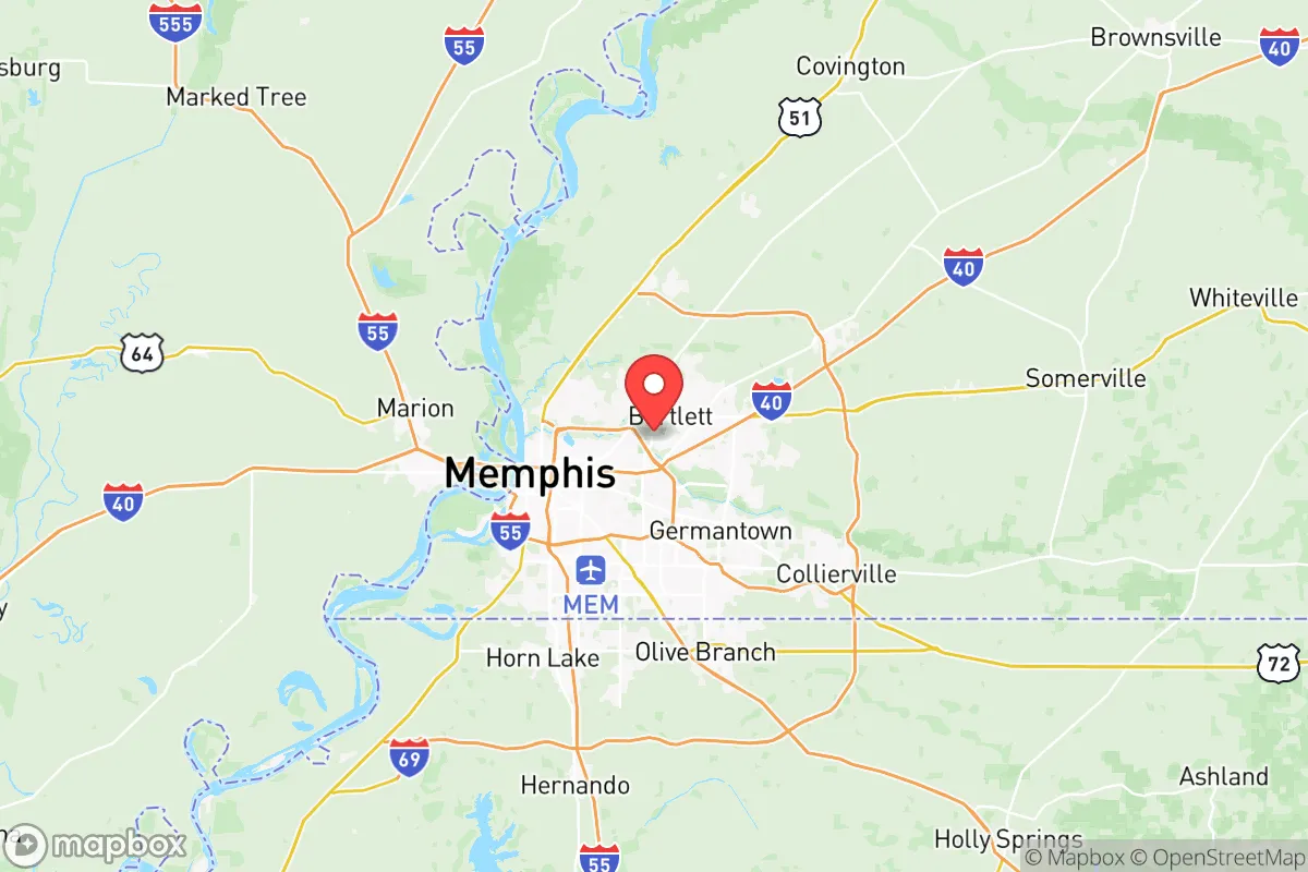
Shelby County, Tennessee, anchored by Memphis, presents a complex strategic picture for the relocation-minded reader focused on resilience. Its location on the Mississippi River and the I-40/I-55 corridor offers significant logistical advantages, but its position as a major urban, industrial, and transportation hub introduces distinct vulnerabilities that a serious preparedness-minded individual must weigh. This assessment breaks down the area's geographic strengths, its exposure to natural and man-made risks, and the practical realities of daily life for someone prioritizing self-sufficiency and disaster readiness.
Geographic position and natural advantages for long-term stability
Shelby County's primary geographic asset is its position on the eastern bank of the Mississippi River, which provides a massive, reliable freshwater source and a historic transportation artery. The region sits within the Mississippi Alluvial Plain, offering relatively flat, fertile land that historically supported agriculture, though much of the county is now urbanized. The climate is humid subtropical, with a long growing season that supports backyard gardens and small-scale farming from April through October. The area is not prone to hurricanes (the Gulf Coast is over 400 miles south), and while tornadoes are a real threat, the county's flat terrain means warning times are generally adequate. The presence of the Memphis Sand Aquifer, one of the purest and most productive groundwater sources in the United States, is a critical long-term advantage. This aquifer supplies the entire county with high-quality drinking water without the need for extensive treatment, a significant resilience factor compared to regions reliant on surface water or desalination. For a relocator, the ability to drill a private well tapping into this aquifer is a tangible, defensible water security strategy.
Risks, exposures, and proximity to fallout-relevant landmarks
The same factors that make Shelby County a transportation and industrial powerhouse also create its most significant strategic liabilities. Memphis is a national logistics hub, home to the FedEx SuperHub at Memphis International Airport, the world's busiest cargo airport. This concentration of air freight, combined with the massive Port of Memphis on the Mississippi River, makes the county a high-value target in any conflict scenario. The county is also ringed by critical infrastructure: the Valero Memphis Refinery (a major petroleum processing facility) and the Allen Fossil Plant (a coal-fired power plant) are both within the urban area. Furthermore, the Tennessee Valley Authority (TVA) nuclear plant at Browns Ferry is roughly 100 miles to the southeast in Alabama, within a plausible fallout zone depending on wind patterns. For a preparedness-minded reader, proximity to these landmarks is a net negative. A major accident, terrorist attack, or military strike on any of these facilities could render large portions of the county uninhabitable or severely disrupt supply chains. The county's flat terrain also means that a chemical or radiological release could spread widely with little natural barrier. While the risk of a direct nuclear strike on Memphis is lower than on cities like Washington D.C. or New York, the concentration of high-value industrial targets makes it a secondary-tier risk that a strategic relocator should not ignore.
Practical resilience for a relocator: food, water, energy, and defensibility
For someone moving to Shelby County with self-sufficiency in mind, the practical picture is mixed. Water security is a clear strength, as the Memphis Sand Aquifer provides abundant, clean groundwater. Drilling a private well is feasible in many suburban and rural parts of the county, such as in the areas around Germantown, Collierville, or Arlington, where lot sizes are larger. Food security is moderate. The region has a strong agricultural base, with row crops (corn, soybeans, cotton) dominating the rural landscape, but local food production for direct consumption is less developed than in some other parts of the country. Farmers' markets exist in Memphis and its suburbs, but year-round local food availability is limited. A serious gardener can produce a significant portion of their own vegetables during the growing season, but winter production requires a greenhouse. Energy security is a vulnerability. The grid is primarily served by TVA, which relies on a mix of coal, natural gas, nuclear, and hydro. While generally reliable, the system is centralized and vulnerable to both natural disasters (ice storms, tornadoes) and man-made disruptions. Solar is viable, with the region averaging around 215 sunny days per year, but net metering policies in Tennessee are less favorable than in some other states. Defensibility is the weakest link. The county is flat, open, and crisscrossed by major highways and rail lines, making it difficult to secure a property against a determined threat. The urban core of Memphis has significant crime challenges, which pushes many relocators to the suburbs. However, even suburban areas like Bartlett or Lakeland are not easily defensible in a grid-down scenario. The best option for a relocator seeking defensibility would be a rural property in the far eastern part of the county, near the Fayette County line, where larger acreage and more natural cover are available.
The overall strategic picture for Shelby County is one of high potential reward paired with high, concentrated risk. The region's water abundance, agricultural potential, and logistical connectivity are genuine assets for a long-term resilience plan. However, the concentration of critical infrastructure—the FedEx hub, the refinery, the port, and the proximity to a nuclear plant—creates a vulnerability profile that is difficult to mitigate. For a relocator who can secure a well-watered, defensible property in the eastern suburbs or rural fringe, and who is willing to invest in solar backup and food storage, Shelby County offers a viable base of operations. For those seeking a low-profile, low-target location with minimal industrial exposure, the risks likely outweigh the benefits. The decision hinges on whether the relocator values the region's natural advantages enough to accept the man-made liabilities that come with living in a major American logistics and industrial hub.

* Values derived from national, state, county, city and local statistics and may differ in a specific area. Last updated: 2026-08-23T18:59:44.000Z
Narrative content on this page is AI-generated and may contain mistakes. Verify any details that matter before acting on them.
ReloMaps may earn a commission from affiliate links at no extra cost to you.

