Photo: Wikipedia
Strategic Assessment of South River, NJ
High tactical risk. This location is likely close to major population centers, strategic targets, or sits in a high-disaster corridor. A retreat property and careful exit planning is required.
What does the Strategic Assessment tell us?
Our Strategic Assessment grades tactical survivability of an area. Major population centers, military targets, fallout zones, natural disasters, and border exposure all drive risk — lower exposure means a more defensible position in a crisis.
This is heavily inspired by Joel Skousen's Strategic Relocation book. Highly recommended you checkout the book ($)What does this tell us?
Our Strategic Assessment grades tactical survivability of an area. Major population centers, military targets, fallout zones, natural disasters, and border exposure all drive risk — lower exposure means a more defensible position in a crisis.
This is heavily inspired by Joel Skousen's Strategic Relocation book. Highly recommended you checkout the book ($)Strategic Pillars

Key Distances
Regional Safe Places
Below is our recommended "safe zones" in New Jersey and the surrounding area based on our strategic heuristics. For most people, it's unrealistic to live in a “safe zone” full-time due to work, family or other personal reasons. They tend to be more rural. However, many of these areas are perfect for second homes and retreat properties that double as a vacation home or even a short-term rental.
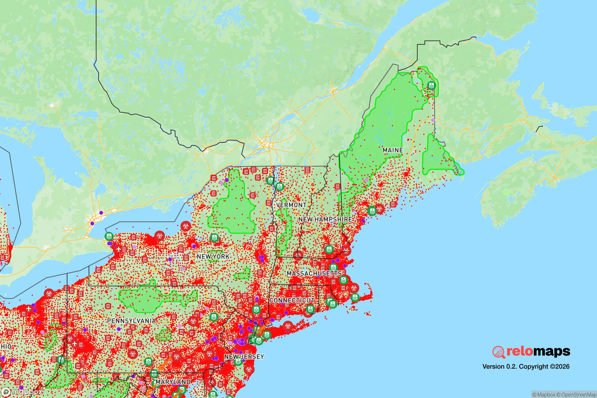
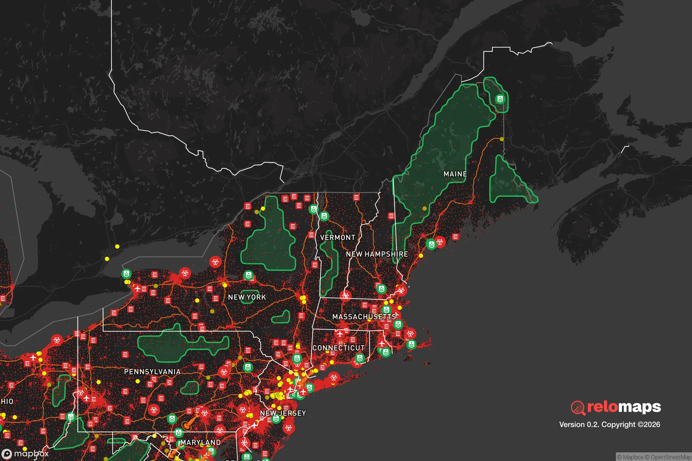


Important Note: For informational purposes only. This does not mean nothing bad ever happens in the green zones. Please use common sense. This is based on public data and modeled with AI. We tried to take a conservative approach but mistakes happen. We update this regularly as new information becomes available.
Solar Generator Recommendations
Backup power matters more here than in safer locations. We've picked three solar generators across budgets and capacity tiers — start with the budget unit if you only need a few essentials, or step up if you want to run a fridge and HVAC for days at a time.

Jackery Portable Power Station Explorer 300
Budget OptionPower on the Go: Weighing only 11 lbs, it's convenient to set up and store with book-sized foldable solar panels

BLUETTI Portable Power Station AC180
Designed for both indoor and outdoor scenarios, AC180 is highly capable as it has a robost capacity and continuous output power.

EF ECOFLOW DELTA Pro Ultra Power Station
Upgraded PickEcoFlow DELTA Pro Ultra is a whole-home energy system designed to grow with your family. Integrated with the Smart Home Panel 2, it scales to meet your evolving energy needs — keeping your home powered, intelligent, and secure through every stage of life.
We earn a commission, at no additional cost to you.
Strategic Assessment Analysis
South River, New Jersey, presents a mixed strategic picture for the relocation-minded reader focused on resilience and self-sufficiency. While its location in the densely populated Northeast corridor introduces significant vulnerabilities, the borough’s specific geography and local infrastructure offer a few underappreciated defensive advantages. For a single individual or family weighing disaster readiness against access to employment and services, South River is best understood as a location with moderate baseline resilience that requires active, not passive, preparedness.
Geographic position and natural advantages for a strategic relocation
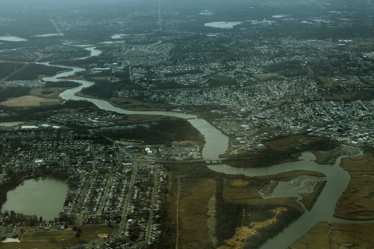
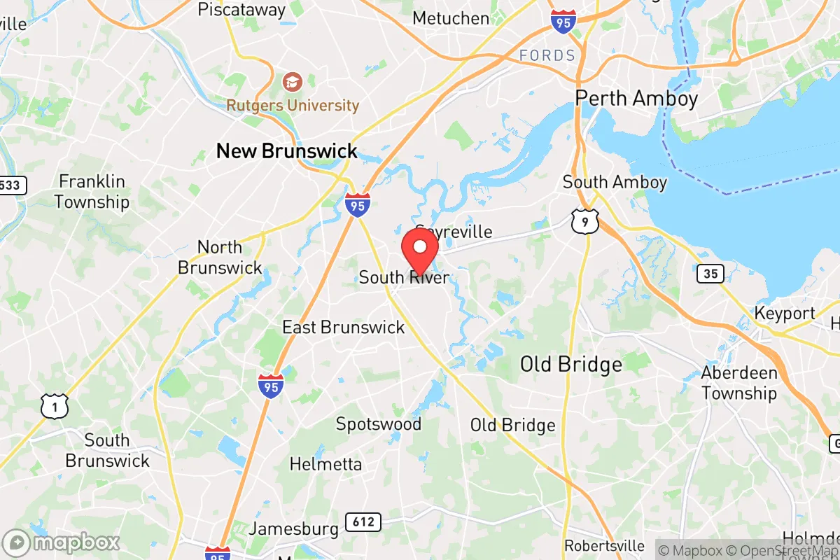
South River sits in Middlesex County, roughly 35 miles southwest of New York City and 45 miles northeast of Philadelphia. Its most notable geographic asset is its position along the South River, a tributary of the Raritan River, which provides a natural water source and a modest buffer from the densest urban sprawl. The borough itself is relatively compact at about 2.7 square miles, which limits the amount of open land for self-sufficient food production but also means a tighter community footprint that can be easier to organize and defend in a crisis. The area is part of the Piedmont region, characterized by rolling hills and mixed hardwood forests, offering some natural cover and a moderate climate that supports year-round gardening. The proximity to the Raritan Bay and the Atlantic Ocean, about 15 miles east, provides access to marine resources, though it also places the area within the storm surge risk zone for major hurricane events. For a relocator, the key natural advantage is the presence of the river and the relatively fertile soil of the Raritan Valley, which historically supported agriculture. However, the borough’s small size and dense development pattern mean that any serious self-sufficiency plan would require securing land or cooperative arrangements outside the immediate municipal boundaries.
Risks, exposures, and proximity to fallout-relevant landmarks
The most significant strategic drawback of South River is its location within the broader New York metropolitan area, a high-priority target for any large-scale conflict or terrorist event. The borough lies roughly 20 miles from the Port of Newark and Elizabeth, one of the busiest container ports on the East Coast, and within 30 miles of several major oil refineries in Linden and Perth Amboy. These industrial complexes are not only potential targets themselves but also sources of hazardous material releases in the event of an accident or attack. Additionally, South River is approximately 25 miles from the Indian Point Energy Center in Buchanan, New York, a nuclear power plant that has been a subject of ongoing safety debates. While Indian Point’s reactors are scheduled for decommissioning, the spent fuel stored on site remains a long-term radiological risk. The borough’s position along the South River also places it in a floodplain; the area has experienced significant flooding from tropical storms and nor’easters, most notably during Hurricane Irene in 2011 and Superstorm Sandy in 2012. For a relocator concerned with fallout and man-made disasters, the concentration of critical infrastructure and population density within a 50-mile radius creates a scenario where evacuation routes—primarily Routes 18, 9, and the New Jersey Turnpike—could become quickly congested or compromised. The proximity to Joint Base McGuire-Dix-Lakehurst, about 25 miles south, adds another layer of strategic significance, as that installation would be a likely command-and-control node during any national emergency.
Practical resilience for a relocator: food, water, energy, and defensibility
For the individual or family looking to establish a resilient household in South River, the practical challenges are substantial but not insurmountable. The borough’s water supply comes from the Middlesex Water Company, a regional utility that draws from the Delaware River and local groundwater sources. This centralized system is vulnerable to contamination and disruption, meaning a relocator should plan for at least a two-week supply of stored water or a reliable well and filtration system—though private wells are rare within the borough limits. Food resilience is hampered by the lack of arable land within the municipality; community gardens exist but are limited in scale. However, the surrounding Middlesex County has a strong agricultural heritage, with farms in nearby Monroe Township and Cranbury offering opportunities for CSA memberships, bulk purchasing, and cooperative growing arrangements. Energy resilience is a mixed picture: the grid is reliable under normal conditions but has shown vulnerability during severe weather, with outages lasting several days after Sandy. Solar panel adoption is growing but remains below the state average, and natural gas service is widespread, which is a plus for heating but a risk during seismic events or infrastructure failures. Defensibility is perhaps South River’s weakest point for a relocator. The borough’s dense street grid, multiple access points, and proximity to major highways make it difficult to secure in a prolonged crisis. The local police department is professional but small, and mutual aid agreements with neighboring towns would be strained during a regional emergency. For a relocator prioritizing security, a more rural or suburban property with a single access road and greater setback from main thoroughfares would be preferable. That said, the borough’s strong sense of community and active neighborhood watch programs provide a social resilience that can be more valuable than physical barriers in many scenarios.
The overall strategic picture for South River is one of calculated trade-offs. It offers proximity to employment, healthcare, and supply chains that are essential for modern life, but those same connections create exposure to the risks of a densely populated and strategically significant region. For a relocator who is serious about disaster readiness, South River demands a higher level of personal preparedness than a more remote location would require. Stockpiling supplies, building community networks, and having a clear evacuation plan for the most likely scenarios—flooding, extended power outages, and regional infrastructure disruption—are not optional but essential. The borough’s natural water access and moderate climate are genuine assets, but they are offset by the challenges of limited land, centralized utilities, and proximity to high-value targets. For the single individual or family willing to invest in active resilience measures and maintain a low profile, South River can be a viable base of operations. For those seeking a location that offers inherent defensive advantages and a high degree of self-sufficiency without constant vigilance, the strategic calculus leans toward looking further inland or to less densely settled parts of the state.

* Values derived from national, state, county, city and local statistics and may differ in a specific area. Last updated: 2026-11-13T09:04:19.000Z
Narrative content on this page is AI-generated and may contain mistakes. Verify any details that matter before acting on them.
ReloMaps may earn a commission from affiliate links at no extra cost to you.

