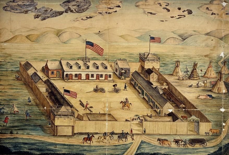
Photo: Wikipedia
Strategic Assessment of Stanley County
Deep buffer from population centers and strategic targets. Low natural disaster risk and minimal exposure to border or coastal threats.
What does the Strategic Assessment tell us?
Our Strategic Assessment grades tactical survivability of an area. Major population centers, military targets, fallout zones, natural disasters, and border exposure all drive risk — lower exposure means a more defensible position in a crisis.
This is heavily inspired by Joel Skousen's Strategic Relocation book. Highly recommended you checkout the book ($)What does this tell us?
Our Strategic Assessment grades tactical survivability of an area. Major population centers, military targets, fallout zones, natural disasters, and border exposure all drive risk — lower exposure means a more defensible position in a crisis.
This is heavily inspired by Joel Skousen's Strategic Relocation book. Highly recommended you checkout the book ($)Strategic Pillars

Key Distances
Strategic Assessment Analysis
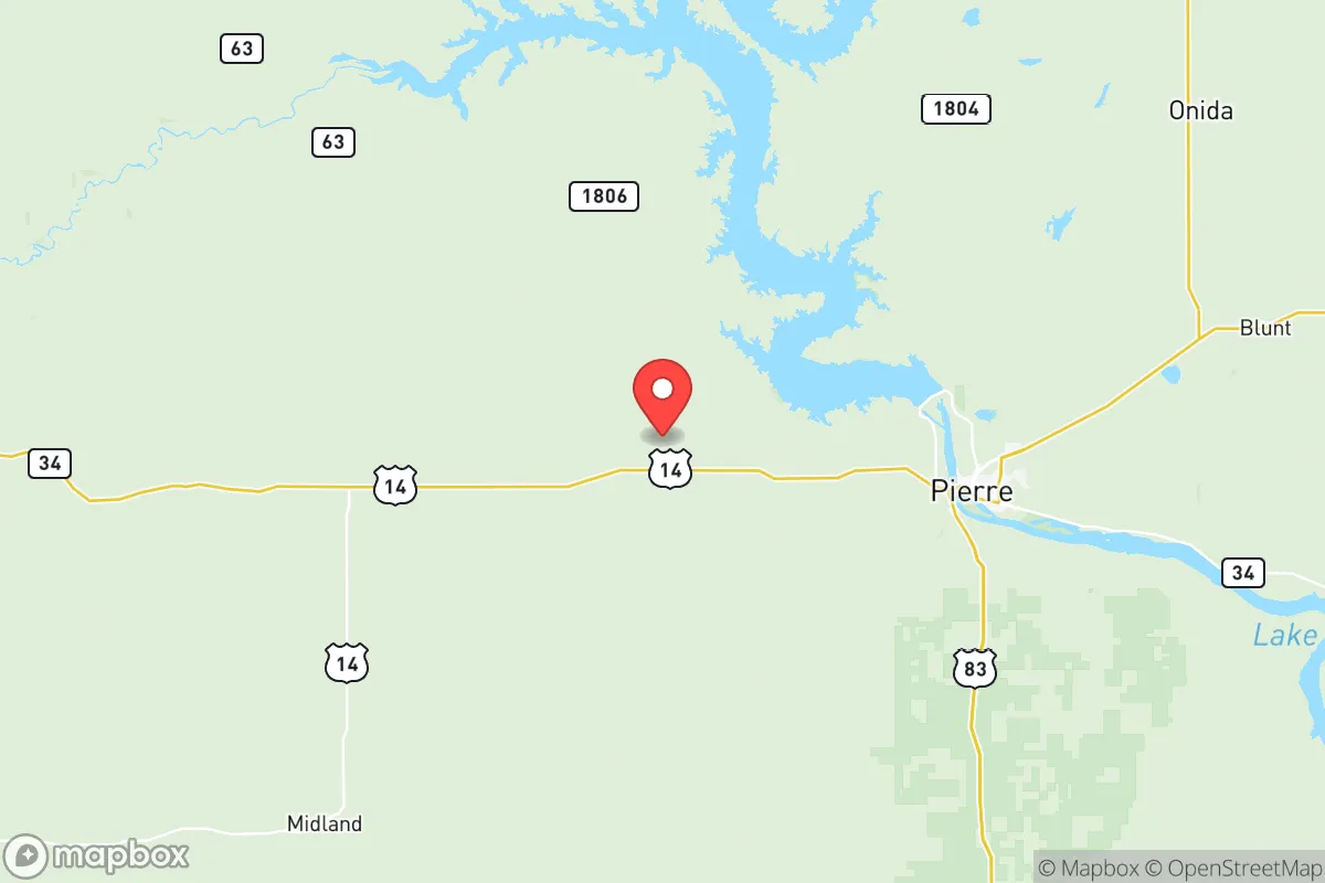
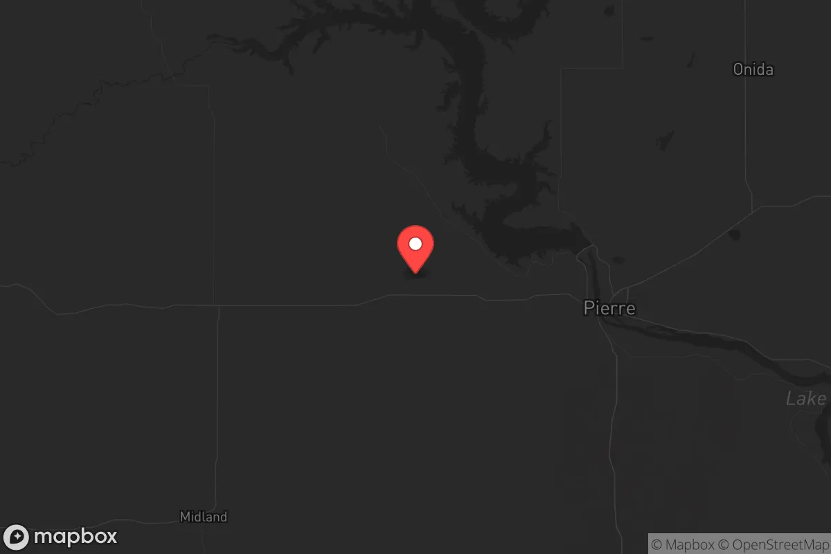
Stanley County, South Dakota, offers a strategic relocation option for those prioritizing resilience, low population density, and distance from major metropolitan vulnerabilities. With fewer than 3,000 residents spread across its 1,444 square miles, the county provides a buffer from the cascading risks of urban centers—civil unrest, supply chain disruptions, and mass casualty events—while maintaining access to essential infrastructure along the Missouri River corridor. Its position in central South Dakota, roughly 100 miles from the nearest significant population hub (Rapid City), means fallout from coastal or inland industrial targets is unlikely to reach here in meaningful concentrations, making it a viable long-term holding area for prepared individuals and families.
Geographic position and natural advantages for long-term security
Stanley County sits at the confluence of the Missouri and Bad Rivers, with the state capital Pierre directly across the river to the east. This riverine boundary provides a natural defensive barrier and a reliable freshwater source—critical for any extended disruption scenario. The county’s terrain is a mix of rolling prairie, buttes, and river breaks, offering both agricultural potential and defensible positions. The nearby Fort Pierre National Grassland, covering over 115,000 acres, provides public land for foraging, hunting, and low-visibility movement if needed. The area’s elevation (around 1,600 feet) and dry climate reduce risks from flooding (outside the immediate river floodplain) and limit the spread of airborne contaminants compared to wetter, more forested regions. For a relocator, the key advantage is the ability to see threats from miles away—open terrain means no surprise approaches, and the sparse population (roughly 2 people per square mile) ensures few eyes on your operations.
Risks, exposures, and proximity to fallout-relevant landmarks
No area is without risk, and Stanley County’s vulnerabilities are worth weighing. The most significant nearby landmark is the Oahe Dam, located just north of the county line on the Missouri River. This massive hydroelectric and flood-control structure is a critical piece of national infrastructure—and a potential target for sabotage or attack. A breach or deliberate destruction would inundate low-lying areas along the river, including parts of Pierre and Fort Pierre, and could disrupt power and water supplies for hundreds of miles. While the dam is hardened and guarded, a determined adversary could still cause catastrophic failure. Additionally, the Ellsworth Air Force Base, home to B-1B bombers and nuclear-capable assets, sits about 90 miles west near Rapid City. In a conflict scenario, Ellsworth is a high-priority target; prevailing winds from the west could carry fallout across central South Dakota, though Stanley County’s distance and the base’s location in a different wind corridor reduce—but don’t eliminate—this risk. The county itself has no major industrial facilities, refineries, or ports, which is a net positive: there are no local targets that would draw attack or cause secondary disasters. The nearest refinery is in Mandan, North Dakota, over 200 miles north. For a prepper, the calculus is clear: the risks here are manageable with basic preparation, unlike the existential threats near Houston’s refinery corridor or Fort Hood’s military footprint.
Practical resilience for a relocator: food, water, energy, and defensibility
Water is the first concern, and Stanley County has it in abundance. The Missouri River runs along its eastern border, providing a year-round, high-volume source that can be filtered or treated with simple methods. Groundwater is also accessible via wells, with the Madison Aquifer underlying much of the region. For food, the county’s agricultural base—primarily cattle ranching and hay production—means local food networks exist, though they’re not as dense as in the Corn Belt. A relocator should plan to establish a garden (short growing season, about 120 days) and secure relationships with local ranchers for meat and dairy. The Fort Pierre National Grassland offers hunting opportunities for deer, pronghorn, and small game, supplementing stored supplies. Energy is a mixed bag: the grid is reliable in normal times but vulnerable to EMP or cyberattack. Solar is viable here—the area averages over 200 sunny days per year—and wind is constant, making small-scale wind turbines a practical backup. Wood for heating is limited due to the lack of dense forests, so propane or coal storage is advisable. Defensibility is strong: the open landscape means any approaching group is visible from miles away, and the river provides a natural barrier to the east. Property can be selected with clear sightlines and limited access points, and the low population means few neighbors to worry about. The county seat, Fort Pierre, has a small police force and a sheriff’s office, but in a collapse scenario, you’re largely on your own—which is the point for most relocators here.
The overall strategic picture for Stanley County
Stanley County isn’t a bug-out location for the unprepared—it’s a long-term homesteading play for those who can invest in infrastructure and accept isolation. Its strengths are clear: abundant water, low population, no local targets, and terrain that favors the defender. Its weaknesses—proximity to Oahe Dam, distance from medical and supply chains, and a short growing season—are manageable with planning. For a conservative-leaning individual or family looking to step away from the volatility of coastal cities, the cultural and political environment here is a natural fit: the county voted overwhelmingly Republican in recent elections, and the local ethos is self-reliance, not government dependency. If you’re serious about resilience, Stanley County deserves a hard look—but come with a well-stocked pantry, a water filtration system, and a willingness to be your own first responder. The trade-off for safety is solitude, and here, that’s the whole point.
* Values derived from national, state, county, city and local statistics and may differ in a specific area. Last updated: 2026-05-28T01:33:28.000Z
Narrative content on this page is AI-generated and may contain mistakes. Verify any details that matter before acting on them.
ReloMaps may earn a commission from affiliate links at no extra cost to you.