Photo: Wikipedia
Strategic Assessment of Silverthorne, CO
Workable tactical position. Some exposure to population density or targets, but generally defensible in a crisis.
What does the Strategic Assessment tell us?
Our Strategic Assessment grades tactical survivability of an area. Major population centers, military targets, fallout zones, natural disasters, and border exposure all drive risk — lower exposure means a more defensible position in a crisis.
This is heavily inspired by Joel Skousen's Strategic Relocation book. Highly recommended you checkout the book ($)What does this tell us?
Our Strategic Assessment grades tactical survivability of an area. Major population centers, military targets, fallout zones, natural disasters, and border exposure all drive risk — lower exposure means a more defensible position in a crisis.
This is heavily inspired by Joel Skousen's Strategic Relocation book. Highly recommended you checkout the book ($)Strategic Pillars

Key Distances
Regional Safe Places
Below is our recommended "safe zones" in Colorado and the surrounding area based on our strategic heuristics. For most people, it's unrealistic to live in a “safe zone” full-time due to work, family or other personal reasons. They tend to be more rural. However, many of these areas are perfect for second homes and retreat properties that double as a vacation home or even a short-term rental.
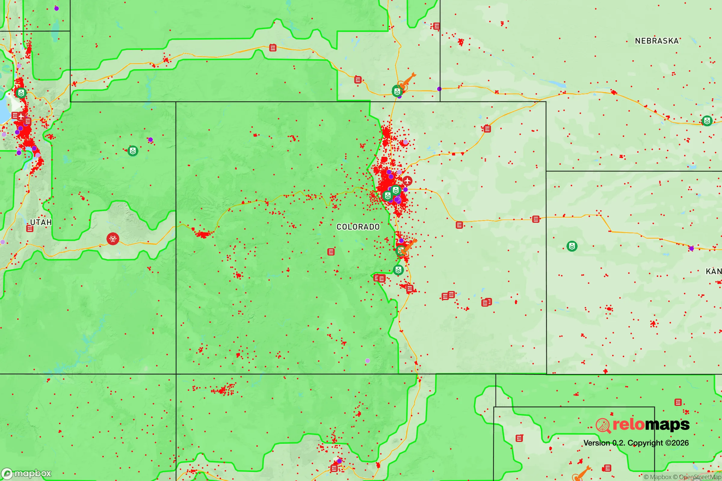
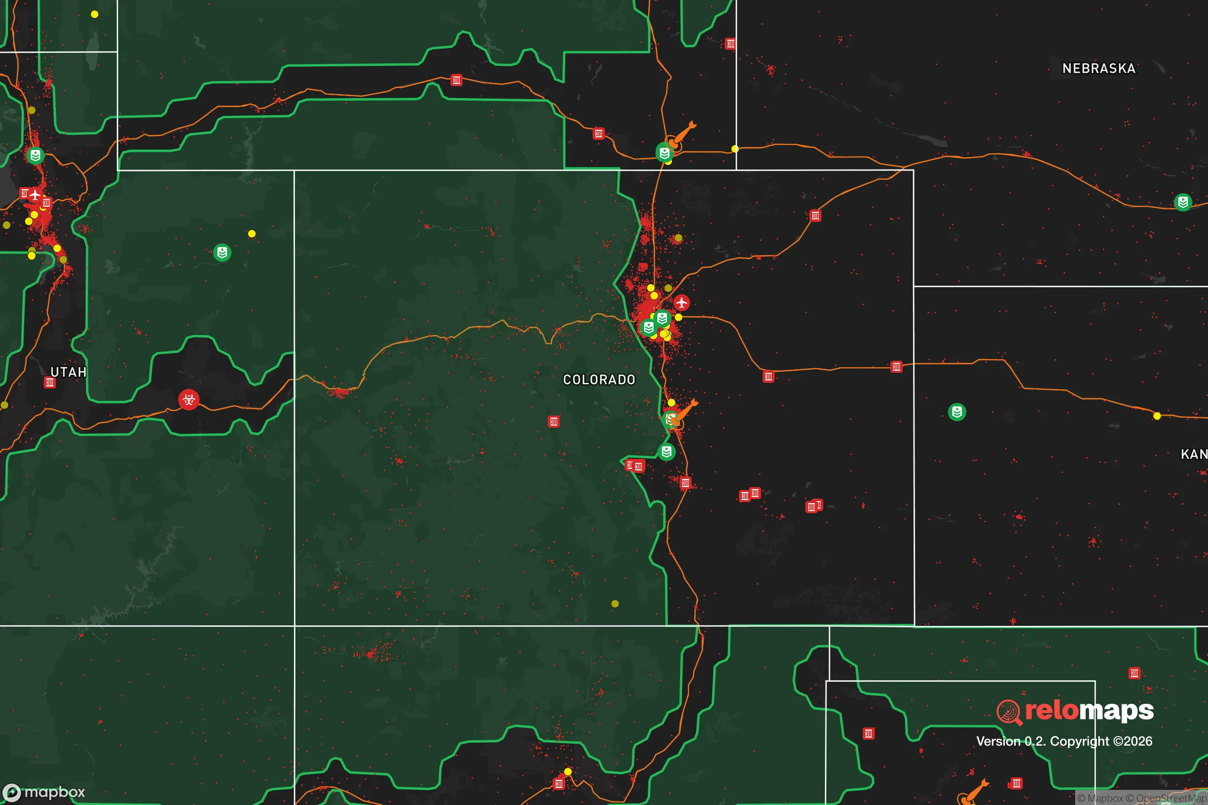


Important Note: For informational purposes only. This does not mean nothing bad ever happens in the green zones. Please use common sense. This is based on public data and modeled with AI. We tried to take a conservative approach but mistakes happen. We update this regularly as new information becomes available.
Solar Generator Recommendations
Backup power matters more here than in safer locations. We've picked three solar generators across budgets and capacity tiers — start with the budget unit if you only need a few essentials, or step up if you want to run a fridge and HVAC for days at a time.

Jackery Portable Power Station Explorer 300
Budget OptionPower on the Go: Weighing only 11 lbs, it's convenient to set up and store with book-sized foldable solar panels

BLUETTI Portable Power Station AC180
Designed for both indoor and outdoor scenarios, AC180 is highly capable as it has a robost capacity and continuous output power.

EF ECOFLOW DELTA Pro Ultra Power Station
Upgraded PickEcoFlow DELTA Pro Ultra is a whole-home energy system designed to grow with your family. Integrated with the Smart Home Panel 2, it scales to meet your evolving energy needs — keeping your home powered, intelligent, and secure through every stage of life.
We earn a commission, at no additional cost to you.
Strategic Assessment Analysis
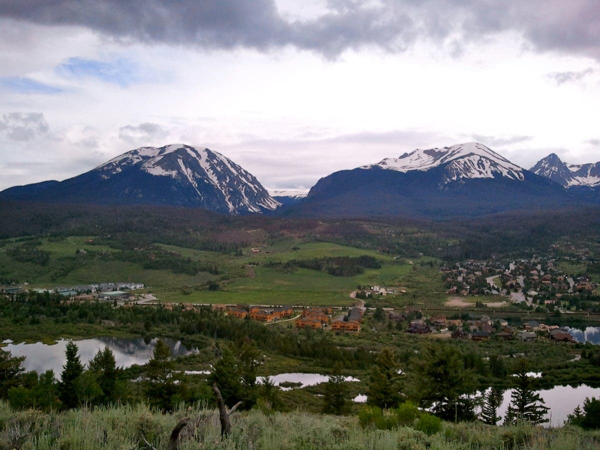
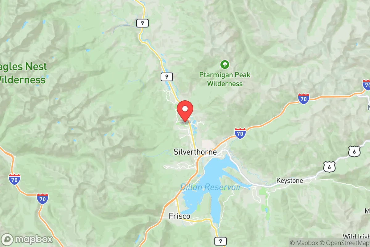
Silverthorne, Colorado, offers a compelling mix of high-altitude seclusion and practical accessibility that makes it a serious contender for a relocation focused on resilience and self-sufficiency. Situated at 9,000 feet in Summit County, the town sits in a natural mountain basin along the Blue River, providing a defensible position that is far removed from the major population corridors of the Front Range. Its location along Interstate 70, roughly 70 miles west of Denver, gives residents a strategic advantage: close enough to access critical supplies and services, yet far enough to avoid the immediate fallout of a major urban disruption.
Geographic position and natural advantages for long-term security
Silverthorne's primary resilience asset is its high-altitude, mountain-basin geography. The town is flanked by the Gore Range to the east and the Tenmile Range to the west, creating a natural barrier that limits easy access and provides a significant defensive buffer. This topography also offers a degree of natural shielding from electromagnetic pulse (EMP) events, as the surrounding peaks can attenuate some high-frequency radiation. The area's elevation means cooler summers and heavy winter snowpack, which is a double-edged sword: it provides a reliable water source through snowmelt but also imposes harsh winter conditions that require serious preparation. The Blue River, which runs through the heart of Silverthorne, is a perennial water source fed by the Gore Range snowpack, offering a consistent supply for drinking and irrigation even during dry spells. The nearby Dillon Reservoir, a 3,300-acre impoundment, serves as a massive strategic water reserve for the region, though its primary function is municipal supply for Denver, which could create tension during a prolonged crisis.
Risks, exposures, and proximity to fallout-relevant landmarks
While Silverthorne's isolation is a strength, it is not immune to risks. The town sits in a seismically active region, with the Gore Range fault system capable of producing moderate earthquakes (magnitude 5-6) that could destabilize slopes and trigger landslides, particularly along the I-70 corridor. Wildfire is the most immediate natural threat: the surrounding forests are dense with lodgepole pine and spruce, and the area has a history of large fires, such as the 2020 Grizzly Creek Fire that closed I-70 for weeks. The town's location in a valley means that smoke and ash from regional fires can settle in, degrading air quality for extended periods. From a man-made risk perspective, Silverthorne's proximity to the Front Range is a double-edged sword. Denver, Colorado Springs, and the Rocky Flats National Wildlife Refuge (a former nuclear weapons plant) are within 70-100 miles. In a major conflict or terrorist event targeting urban centers or military installations, Silverthorne could see an influx of refugees from the Front Range, straining local resources. The town is also near the Eisenhower Tunnel and the Continental Divide, which are critical infrastructure nodes that could become chokepoints or targets. However, the lack of major military bases, nuclear power plants, or large-scale industrial facilities within 50 miles reduces the risk of direct fallout exposure compared to areas closer to the Front Range.
Practical resilience for a relocator: food, water, energy, and defensibility
For a relocator serious about self-sufficiency, Silverthorne presents both opportunities and challenges. Water is the strongest asset: the Blue River and Dillon Reservoir provide abundant surface water, but access is regulated by the Summit County Water Authority and the Denver Water Board, which hold senior water rights. A private well is the most reliable option for long-term independence, though drilling at 9,000 feet can be expensive and yields vary. Food production is limited by the short growing season (roughly 60-90 frost-free days) and poor soil quality. High tunnels and cold frames can extend the season, but serious food self-sufficiency would require significant investment in greenhouse infrastructure or reliance on stored supplies. The local food system is thin: there are no major agricultural producers in Summit County, and most food is trucked in via I-70, which is vulnerable to closure from avalanches, rockslides, or accidents. Energy is a mixed picture. The grid is served by Xcel Energy, which relies on a mix of coal, natural gas, and renewables, but the high-altitude location makes solar power less efficient (about 20-30% less than at sea level) and snow cover can reduce panel output for weeks. Micro-hydro from the Blue River is a viable alternative for properties with year-round water flow. Defensibility is strong due to the terrain: the town has only a few main access points (I-70, CO-9 north to Kremmling, and CO-9 south to Breckenridge), which can be monitored and controlled with minimal manpower. The local population is small (about 4,900 year-round residents) and generally self-reliant, with a strong culture of outdoor skills and emergency preparedness. The Summit County Sheriff's Office and Silverthorne Police Department are professional and well-equipped, but response times in a widespread crisis could be slow due to the dispersed population and challenging terrain.
The overall strategic picture for Silverthorne is one of high potential with significant trade-offs. Its geographic isolation, defensible terrain, and abundant water make it one of the better options in Colorado for a relocator prioritizing resilience over convenience. The harsh winter climate, limited growing season, and dependence on a single highway for resupply are real constraints that require serious planning and investment. The proximity to the Front Range is a risk, but one that is mitigated by the natural barriers and distance. For a family or individual willing to invest in cold-weather infrastructure, water independence, and stored supplies, Silverthorne offers a strong foundation for long-term security. It is not a bug-out location for the unprepared, but a strategic base for those who understand the demands of high-altitude living and are committed to building a self-sufficient lifestyle. The key is to treat the town as a starting point, not a finished solution: the terrain gives you the advantage, but you must bring the skills, supplies, and mindset to make it work.

* Values derived from national, state, county, city and local statistics and may differ in a specific area. Last updated: 2026-08-03T16:05:47.000Z
Narrative content on this page is AI-generated and may contain mistakes. Verify any details that matter before acting on them.
ReloMaps may earn a commission from affiliate links at no extra cost to you.

