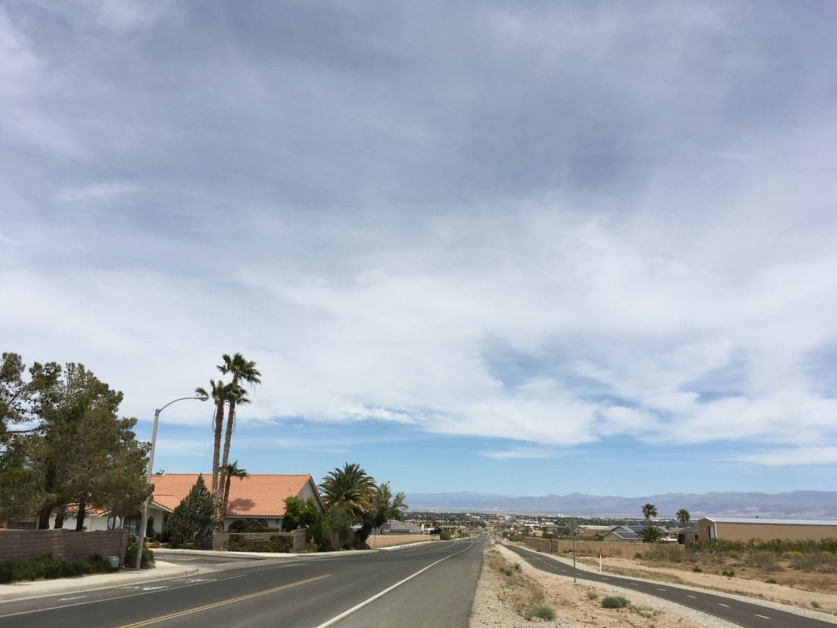
Photo: Wikipedia
Strategic Assessment of Ridgecrest, CA
Multiple tactical vulnerabilities. Population density, target proximity, or disaster risk are likely compounding. A retreat property and exit planning is required.
What does the Strategic Assessment tell us?
Our Strategic Assessment grades tactical survivability of an area. Major population centers, military targets, fallout zones, natural disasters, and border exposure all drive risk — lower exposure means a more defensible position in a crisis.
This is heavily inspired by Joel Skousen's Strategic Relocation book. Highly recommended you checkout the book ($)What does this tell us?
Our Strategic Assessment grades tactical survivability of an area. Major population centers, military targets, fallout zones, natural disasters, and border exposure all drive risk — lower exposure means a more defensible position in a crisis.
This is heavily inspired by Joel Skousen's Strategic Relocation book. Highly recommended you checkout the book ($)Strategic Pillars

Key Distances
Regional Safe Places
Below is our recommended "safe zones" in California and the surrounding area based on our strategic heuristics. For most people, it's unrealistic to live in a “safe zone” full-time due to work, family or other personal reasons. They tend to be more rural. However, many of these areas are perfect for second homes and retreat properties that double as a vacation home or even a short-term rental.




Important Note: For informational purposes only. This does not mean nothing bad ever happens in the green zones. Please use common sense. This is based on public data and modeled with AI. We tried to take a conservative approach but mistakes happen. We update this regularly as new information becomes available.
Solar Generator Recommendations
Backup power matters more here than in safer locations. We've picked three solar generators across budgets and capacity tiers — start with the budget unit if you only need a few essentials, or step up if you want to run a fridge and HVAC for days at a time.

Jackery Portable Power Station Explorer 300
Budget OptionPower on the Go: Weighing only 11 lbs, it's convenient to set up and store with book-sized foldable solar panels

BLUETTI Portable Power Station AC180
Designed for both indoor and outdoor scenarios, AC180 is highly capable as it has a robost capacity and continuous output power.

EF ECOFLOW DELTA Pro Ultra Power Station
Upgraded PickEcoFlow DELTA Pro Ultra is a whole-home energy system designed to grow with your family. Integrated with the Smart Home Panel 2, it scales to meet your evolving energy needs — keeping your home powered, intelligent, and secure through every stage of life.
We earn a commission, at no additional cost to you.
Strategic Assessment Analysis
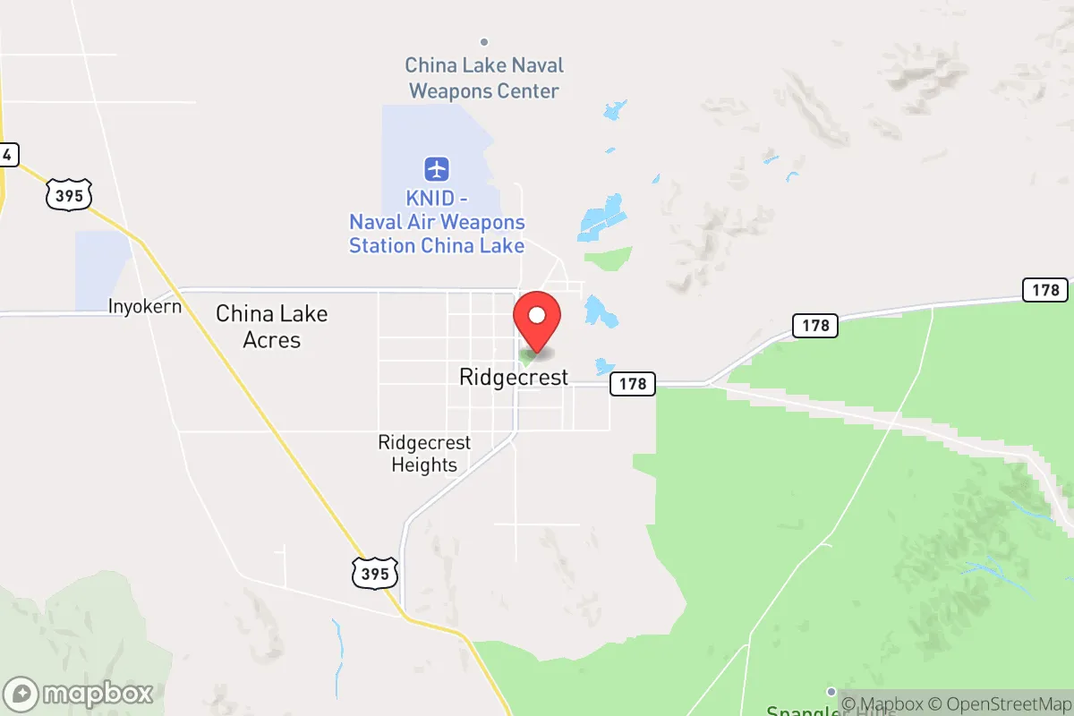
Ridgecrest, California, offers a distinctive strategic profile for those prioritizing resilience and self-sufficiency, largely due to its remote location in the Indian Wells Valley of the Mojave Desert. The city sits roughly 150 miles northeast of Los Angeles and 80 miles east of Bakersfield, placing it far from the major urban corridors that would be primary targets in a crisis. This isolation, combined with a high-desert climate and a community historically tied to the nearby Naval Air Weapons Station (NAWS) China Lake, creates a baseline of practical preparedness that is rare in modern California. For a relocator thinking seriously about disaster readiness, Ridgecrest presents a trade-off: significant geographic advantages in terms of distance from fallout-relevant landmarks, but real exposure to natural hazards like earthquakes and extreme heat, and a need to build local self-sufficiency in food, water, and energy.
Geographic position and natural advantages for long-term stability
Ridgecrest’s primary strategic asset is its distance from the state’s major population centers and critical infrastructure. The city is not located near any major ports, military command hubs (beyond the base itself), or dense urban targets like Los Angeles, San Diego, or the San Francisco Bay Area. In a scenario involving nuclear fallout or large-scale civil disruption, this remoteness dramatically reduces the risk of direct exposure to blast zones, fallout plumes, or secondary chaos. The surrounding terrain—the Sierra Nevada to the west, the Argus Range to the east, and the Coso Range to the north—provides natural barriers that further isolate the area. The high desert elevation, around 2,300 feet, offers a dry, stable climate with low humidity, which reduces corrosion and mold issues for stored supplies. The region also sits atop the Coso Volcanic Field, which, while geologically active, provides a source of geothermal energy that powers much of the local grid—a significant advantage for energy resilience. The area’s low population density (roughly 28,000 in the city proper, with sparse surrounding communities) means less competition for resources in a crisis, and the local economy’s reliance on the base and government contracts provides a stable, non-speculative employment base that is less prone to boom-and-bust cycles.
Risks, exposures, and proximity to fallout-relevant landmarks
The most significant risk for Ridgecrest is its location within a seismically active zone. The city sits near the Garlock Fault and experienced a 6.4 magnitude earthquake in July 2019, followed by a 7.1 magnitude quake the next day, which caused structural damage and disrupted utilities. This is not a theoretical risk—it is a recurring reality. The area also lies within the Indian Wells Valley groundwater basin, which is overdrafted and subject to subsidence, meaning the ground itself can shift unpredictably. For a relocator, this means any home or structure must be built or retrofitted to modern seismic codes, and water storage systems must be secured against shaking. Regarding man-made risks, the presence of NAWS China Lake is a double-edged sword. The base is a major research and testing facility for weapons systems, including the Navy's air-to-air missiles and electronic warfare systems. While the base itself is a potential target in a conflict, its remote location and hardened infrastructure make it less likely to be a primary strike point than, say, a major port or command center. However, the base’s activities involve handling explosives and propellants, so a catastrophic accident—though rare—could produce localized contamination. The nearest major fallout-relevant landmark is the San Onofre Nuclear Generating Station (now decommissioned) near San Diego, roughly 200 miles south, and the Diablo Canyon Power Plant near San Luis Obispo, about 180 miles west. Neither poses a direct fallout threat to Ridgecrest under normal conditions, but prevailing winds from the west could carry particulate matter from a major event at Diablo Canyon. More practically, the city’s isolation means that in a widespread crisis, emergency services and resupply from state or federal agencies would likely be delayed, as resources would be prioritized for larger population centers.
Practical resilience for a relocator: food, water, energy, and defensibility
For a relocator serious about self-sufficiency, Ridgecrest presents a mixed picture. Water is the single most critical vulnerability. The city relies entirely on groundwater from the Indian Wells Valley basin, which is being depleted faster than it recharges. The average annual rainfall is just 4-5 inches, so rainwater harvesting is not a viable primary source. A relocator would need to invest in deep-well drilling (if on a private parcel) or secure a reliable connection to the municipal supply, which is subject to drought restrictions. The local water district has implemented conservation measures, and new development is scrutinized for water availability. For food, the high desert climate makes traditional agriculture difficult without significant inputs. The growing season is short (April to October), and the soil is alkaline and low in organic matter. However, the area is known for its abundant solar resource—over 280 sunny days per year—which makes solar power a highly viable option for energy independence. Many homes already have rooftop solar, and the local grid is supported by the Coso Geothermal Plant, which provides a stable baseload. For defensibility, Ridgecrest’s layout is relatively compact, with a grid-like street pattern and a single main highway (US-395) connecting it to the rest of the state. This makes it easier to monitor access points than a sprawling suburban area, but also means that a single road closure (e.g., from a landslide or earthquake damage) could isolate the city. The local community is tight-knit, with a strong culture of mutual aid and preparedness stemming from the base population. There are active ham radio clubs, prepper groups, and a local chapter of the Civil Air Patrol. The nearest major medical facility is Ridgecrest Regional Hospital, which is a small but capable critical access hospital; for serious trauma, evacuation to Bakersfield or Loma Linda is required, which could be problematic in a crisis.
Overall, Ridgecrest offers a compelling strategic option for a relocator who values isolation and is willing to invest in water security and seismic resilience. Its distance from major urban targets and its stable, base-anchored economy provide a foundation for long-term stability, but the natural hazards and resource constraints demand serious preparation. The city is not a "bug-out" location—it is a real community with real infrastructure, and that is both its strength and its limitation. For a family or individual willing to retrofit a home, drill a well, and build a solar-plus-battery system, Ridgecrest can be a highly resilient base of operations. For those expecting to simply show up and be safe, the desert will be unforgiving. The key takeaway: Ridgecrest is a place where resilience is possible, but it must be earned through deliberate planning and investment, not assumed from geography alone.

* Values derived from national, state, county, city and local statistics and may differ in a specific area. Last updated: 2026-10-03T14:21:37.000Z
Narrative content on this page is AI-generated and may contain mistakes. Verify any details that matter before acting on them.
ReloMaps may earn a commission from affiliate links at no extra cost to you.

