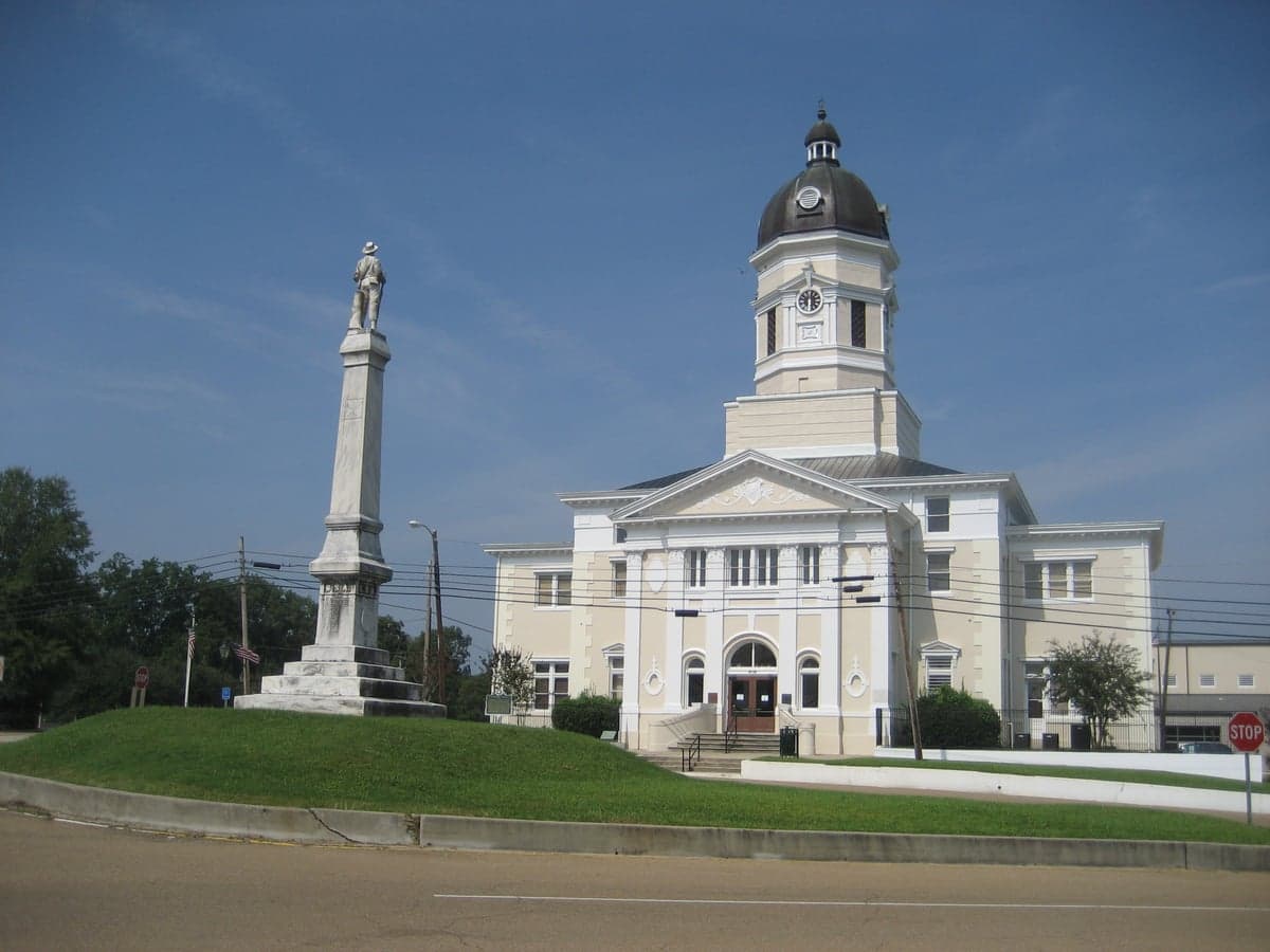
Photo: Wikipedia
Strategic Assessment of Port Gibson, MS
Strong survivability profile. Good buffer from population centers, with manageable environmental and tactical risks.
What does the Strategic Assessment tell us?
Our Strategic Assessment grades tactical survivability of an area. Major population centers, military targets, fallout zones, natural disasters, and border exposure all drive risk — lower exposure means a more defensible position in a crisis.
This is heavily inspired by Joel Skousen's Strategic Relocation book. Highly recommended you checkout the book ($)What does this tell us?
Our Strategic Assessment grades tactical survivability of an area. Major population centers, military targets, fallout zones, natural disasters, and border exposure all drive risk — lower exposure means a more defensible position in a crisis.
This is heavily inspired by Joel Skousen's Strategic Relocation book. Highly recommended you checkout the book ($)Strategic Pillars

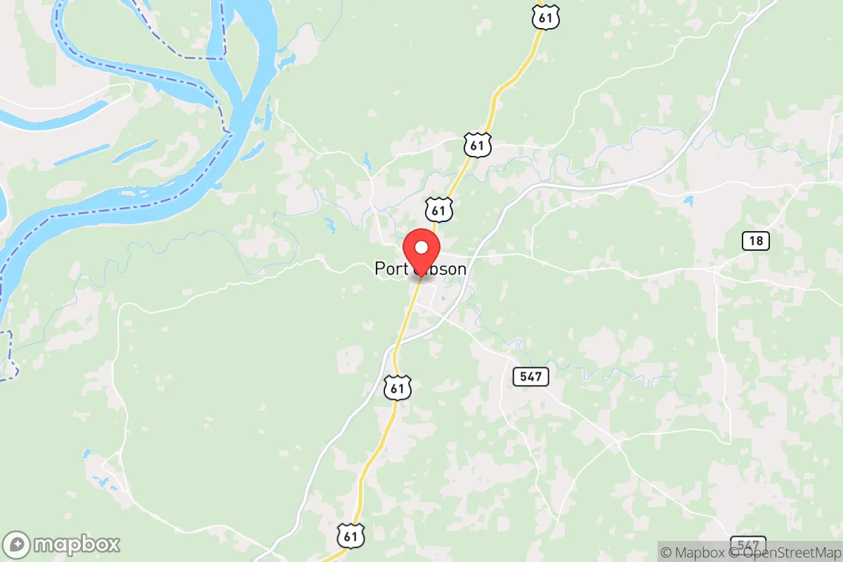
Key Distances
Regional Safe Places
Below is our recommended "safe zones" in Mississippi and the surrounding area based on our strategic heuristics. For most people, it's unrealistic to live in a “safe zone” full-time due to work, family or other personal reasons. They tend to be more rural. However, many of these areas are perfect for second homes and retreat properties that double as a vacation home or even a short-term rental.
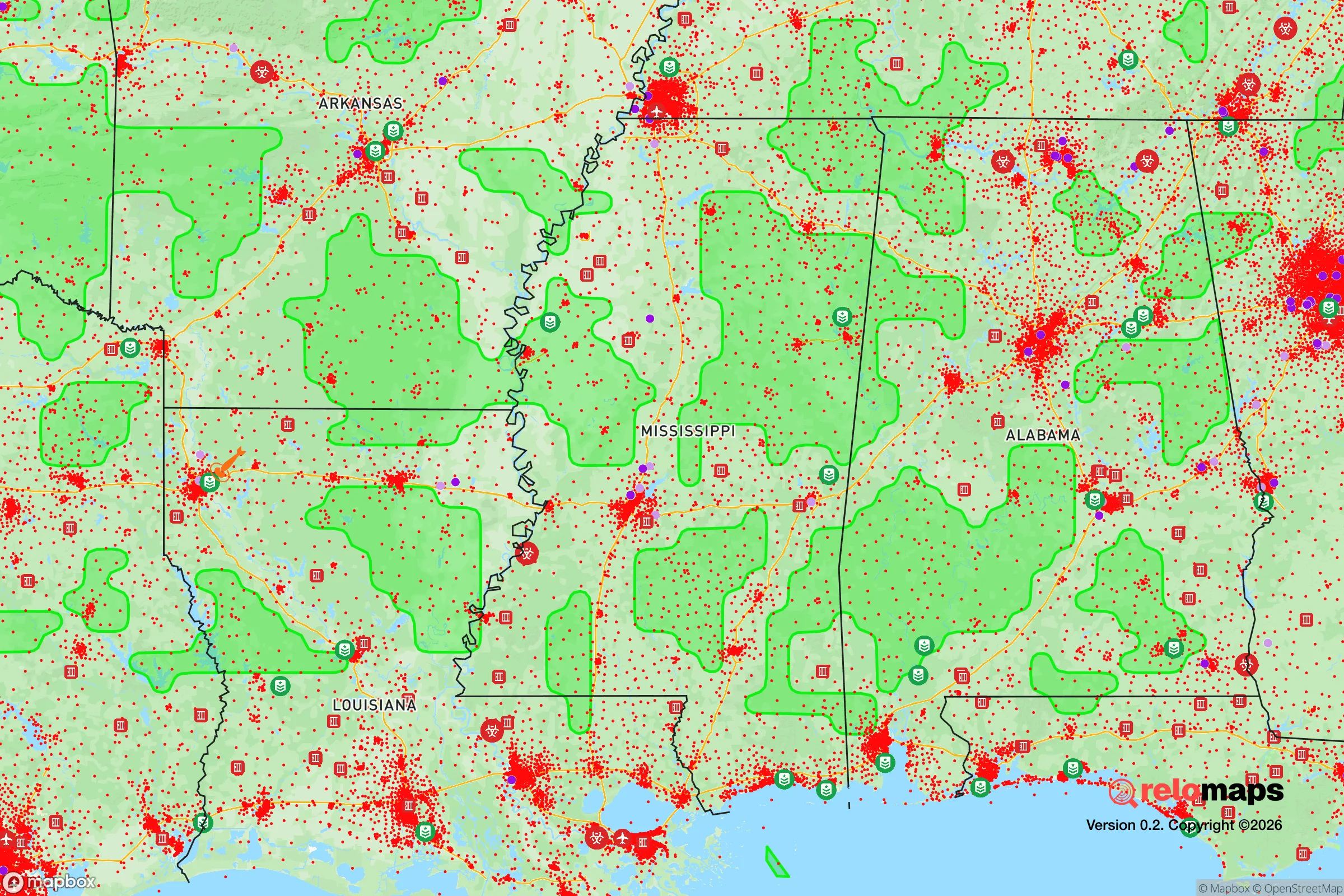
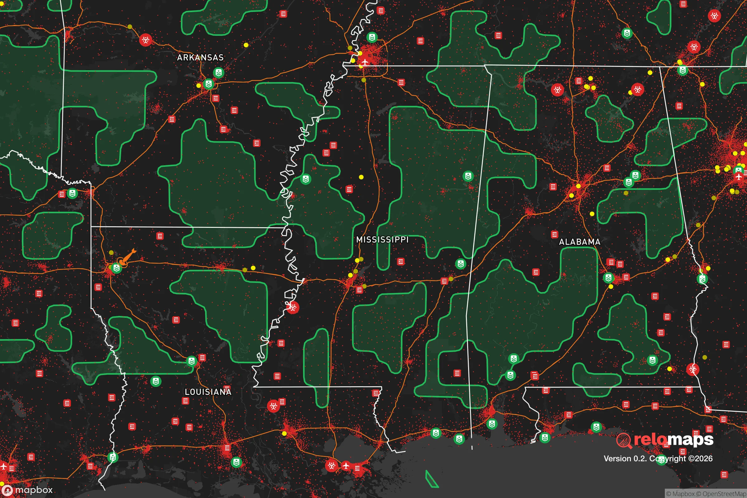


Important Note: For informational purposes only. This does not mean nothing bad ever happens in the green zones. Please use common sense. This is based on public data and modeled with AI. We tried to take a conservative approach but mistakes happen. We update this regularly as new information becomes available.
Solar Generator Recommendations
Backup power matters more here than in safer locations. We've picked three solar generators across budgets and capacity tiers — start with the budget unit if you only need a few essentials, or step up if you want to run a fridge and HVAC for days at a time.

Jackery Portable Power Station Explorer 300
Budget OptionPower on the Go: Weighing only 11 lbs, it's convenient to set up and store with book-sized foldable solar panels

BLUETTI Portable Power Station AC180
Designed for both indoor and outdoor scenarios, AC180 is highly capable as it has a robost capacity and continuous output power.

EF ECOFLOW DELTA Pro Ultra Power Station
Upgraded PickEcoFlow DELTA Pro Ultra is a whole-home energy system designed to grow with your family. Integrated with the Smart Home Panel 2, it scales to meet your evolving energy needs — keeping your home powered, intelligent, and secure through every stage of life.
We earn a commission, at no additional cost to you.
Strategic Assessment Analysis
Port Gibson, Mississippi, is a small river town whose strategic value lies in its position rather than its size. Sitting on the bluffs above the Mississippi River in Claiborne County, it offers a mix of genuine geographic advantages and real, non-negotiable risks for someone thinking seriously about long-term resilience. The town’s history as a Civil War target (“Too beautiful to burn”) speaks to its location, but for a modern relocator, the calculus is about proximity to threats, access to resources, and whether the land itself can sustain a self-sufficient household.
Geographic position and natural advantages for self-sufficiency
Port Gibson’s primary asset is its elevation and its position relative to the Mississippi River. The town sits on the loess bluffs, roughly 100 to 150 feet above the river floodplain, which is a meaningful advantage in a state where flooding is the most common natural disaster. While the lowlands around the river flood regularly, the bluffs themselves are historically high and dry, making them a better bet for a home site than the flat delta ground to the west. The surrounding terrain is rolling, wooded, and cut by numerous creeks and springs, which provides natural water sources, cover, and a degree of separation from the main transportation corridors.
The land itself is productive. Claiborne County is rural, with a population density of roughly 20 people per square mile, and much of the acreage is timberland or pasture. For a relocator interested in gardening, orchards, or small livestock, the growing season is long (about 240 days), and the soil on the bluffs, while needing amendment, is workable. The area is also far enough from the immediate river levee system that a catastrophic levee failure—a real scenario in the lower Mississippi—would not directly threaten the town itself, though it would cut off access to the west.
The practical isolation is a double-edged sword. Port Gibson is about 30 miles south of Vicksburg and roughly 50 miles north of Natchez, but it is not on a major interstate. U.S. Highway 61 runs through town, and the Natchez Trace Parkway passes nearby, but the lack of a four-lane highway means less through-traffic, fewer strangers, and a quieter baseline. That is a plus for defensibility and privacy, but it also means longer travel times for supplies, medical care, and employment.
Risks, exposures, and proximity to fallout-relevant landmarks
The most significant strategic weakness for Port Gibson is its proximity to the Mississippi River industrial corridor and the transportation networks that run along it. The river itself is a major artery for barge traffic carrying chemicals, fertilizers, and petroleum products. A spill or industrial accident on the river—or a derailment on the rail lines that parallel it—could contaminate local water sources or require evacuation. These are low-probability but high-consequence events, and they are part of the baseline risk profile for any river town.
More relevant for a disaster-readiness assessment is the area’s position relative to larger population and industrial targets. Port Gibson is roughly 60 miles from Jackson, Mississippi’s capital and largest city, and about 230 miles from the New Orleans metropolitan area. In a hypothetical major conflict or nuclear exchange, those cities are plausible targets, and Port Gibson sits within the range of fallout plumes depending on wind direction. The town is also near the Grand Gulf Nuclear Station, a single-unit nuclear power plant located about 10 miles south of Port Gibson in Claiborne County. While the plant has operated safely for decades, its presence means the area is within the 10-mile emergency planning zone, and a major incident there would require evacuation or sheltering-in-place. For a relocator specifically seeking to avoid fallout-relevant landmarks, this is a significant consideration that cannot be waved away.
Natural risks are more mundane but more frequent. The region experiences severe thunderstorms, tornadoes (Claiborne County is in the Dixie Alley corridor), and occasional ice storms in winter. Summer heat and humidity are extreme, which creates its own set of challenges for off-grid living, including food storage and heat-related health risks. Hurricanes rarely reach this far inland with full force, but the remnants of Gulf storms can bring prolonged heavy rain and flooding in low-lying areas.
Practical resilience for a relocator: food, water, energy, and defensibility
For a household looking to build practical resilience, Port Gibson offers a workable but not easy baseline. Water is the first consideration. The town’s municipal water system draws from wells, but a self-sufficient relocator should plan on a private well or a reliable surface water source with filtration. The creeks and springs in the surrounding hills are plentiful, but they are also vulnerable to agricultural runoff and upstream contamination. A drilled well, at typical depths of 100 to 300 feet in this region, is the most defensible option, though it requires electricity or a generator to pump.
Food production is viable but requires effort. The climate supports year-round gardening with season extension, and the local agricultural base means livestock feed, seeds, and farming supplies are available within a reasonable drive. The town itself has a small grocery store, but it is limited in selection and price; most residents do their major shopping in Vicksburg or Natchez. For long-term resilience, a household should plan to produce a significant portion of its own calories, as supply chain disruptions would hit the local store first and hardest.
Energy is a genuine vulnerability. The region is served by Entergy Mississippi, and power outages are common during severe weather, often lasting several days. Solar is viable—the area gets about 215 sunny days per year—but the hot, humid climate means battery degradation is a real issue, and tree cover on many lots limits solar exposure. A backup generator running on propane or diesel is the most practical near-term solution, with a wood stove for heating as a non-electric fallback. Firewood is abundant and cheap in Claiborne County, which is a meaningful advantage for winter resilience.
Defensibility is moderate. The town is small, and the surrounding countryside is sparsely populated, which reduces the risk of urban unrest spilling over. However, the road network is limited, and U.S. Highway 61 is a natural chokepoint that could become congested or blocked during an evacuation. A rural property with a long driveway, good sightlines, and a secondary access route is achievable at reasonable cost—land prices in Claiborne County are among the lowest in Mississippi—but the county’s poverty rate (around 30%) means that local resources and emergency services are stretched thin. In a prolonged crisis, residents should expect to rely primarily on themselves and their immediate neighbors.
The overall strategic picture for a resilience-minded relocator
Port Gibson is not a strategic sanctuary, but it is also not a strategic dead zone. It offers affordable land, abundant water, a long growing season, and genuine isolation from major urban centers—all of which are real assets for a self-sufficient household. The counterweights are the proximity to the Grand Gulf nuclear plant, the vulnerability of the river corridor, and the general fragility of the local economy and infrastructure. For a relocator who is willing to invest in a well, solar or generator backup, and a serious food-production setup, the area can support a resilient lifestyle. But it is not a place to move to without a plan. The land will provide, but it will not provide for free, and the risks are real enough that they should be weighed carefully before making the leap.

* Values derived from national, state, county, city and local statistics and may differ in a specific area. Last updated: 2026-10-27T04:39:57.000Z
Narrative content on this page is AI-generated and may contain mistakes. Verify any details that matter before acting on them.
ReloMaps may earn a commission from affiliate links at no extra cost to you.

