Photo: Wikipedia
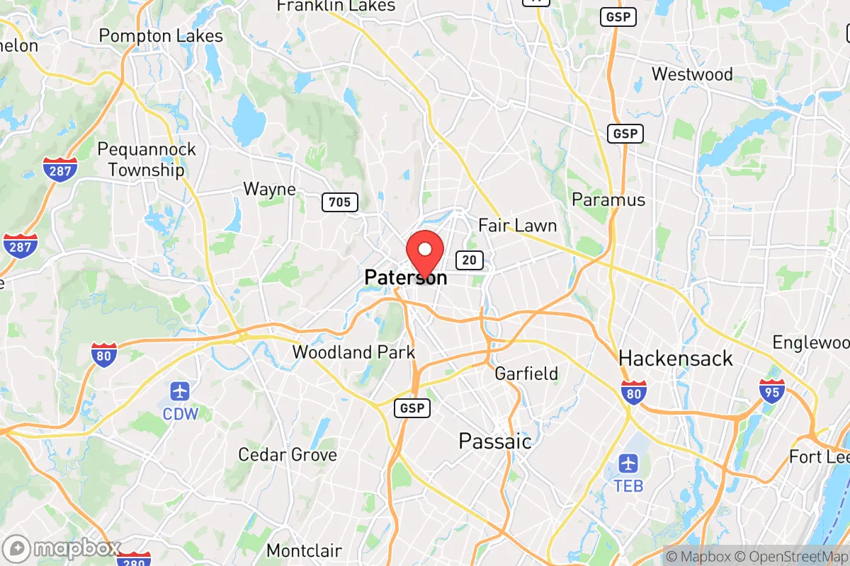
Strategic Assessment of Paterson, NJ
High tactical risk. This location is likely close to major population centers, strategic targets, or sits in a high-disaster corridor. A retreat property and careful exit planning is required.
What does the Strategic Assessment tell us?
Our Strategic Assessment grades tactical survivability of an area. Major population centers, military targets, fallout zones, natural disasters, and border exposure all drive risk — lower exposure means a more defensible position in a crisis.
This is heavily inspired by Joel Skousen's Strategic Relocation book. Highly recommended you checkout the book ($)What does this tell us?
Our Strategic Assessment grades tactical survivability of an area. Major population centers, military targets, fallout zones, natural disasters, and border exposure all drive risk — lower exposure means a more defensible position in a crisis.
This is heavily inspired by Joel Skousen's Strategic Relocation book. Highly recommended you checkout the book ($)Strategic Pillars

Key Distances
Regional Safe Places
Below is our recommended "safe zones" in New Jersey and the surrounding area based on our strategic heuristics. For most people, it's unrealistic to live in a “safe zone” full-time due to work, family or other personal reasons. They tend to be more rural. However, many of these areas are perfect for second homes and retreat properties that double as a vacation home or even a short-term rental.


Important Note: For informational purposes only. This does not mean nothing bad ever happens in the green zones. Please use common sense. This is based on public data and modeled with AI. We tried to take a conservative approach but mistakes happen. We update this regularly as new information becomes available.
Solar Generator Recommendations
Backup power matters more here than in safer locations. We've picked three solar generators across budgets and capacity tiers — start with the budget unit if you only need a few essentials, or step up if you want to run a fridge and HVAC for days at a time.

Jackery Portable Power Station Explorer 300
Budget OptionPower on the Go: Weighing only 11 lbs, it's convenient to set up and store with book-sized foldable solar panels

BLUETTI Portable Power Station AC180
Designed for both indoor and outdoor scenarios, AC180 is highly capable as it has a robost capacity and continuous output power.

EF ECOFLOW DELTA Pro Ultra Power Station
Upgraded PickEcoFlow DELTA Pro Ultra is a whole-home energy system designed to grow with your family. Integrated with the Smart Home Panel 2, it scales to meet your evolving energy needs — keeping your home powered, intelligent, and secure through every stage of life.
We earn a commission, at no additional cost to you.
Strategic Assessment Analysis
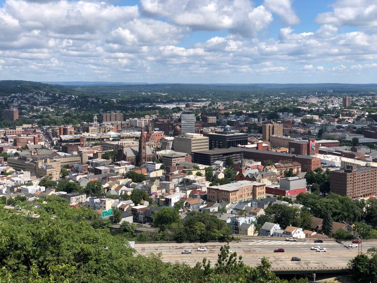
Paterson, New Jersey, presents a complex strategic picture for the conservative prepper or survivalist. Its historical resilience as an industrial powerhouse is now overshadowed by its location in one of the most densely populated and politically volatile corridors in the nation. While the city itself offers few natural advantages for long-term survival, its position relative to critical infrastructure, potential fallout zones, and escape routes demands a hard-nosed assessment for anyone considering it as a base of operations.
Geographic position and natural advantages in a crisis
Paterson sits in the Passaic River Valley, roughly 15 miles west of midtown Manhattan. Its most notable natural feature is the Great Falls of the Passaic River, a 77-foot waterfall that powered the city's 19th-century mills. In a grid-down scenario, this water source is a double-edged sword: it provides a reliable, gravity-fed water supply, but it also makes the city a target for anyone else seeking water. The surrounding terrain is the Piedmont region, characterized by low, rolling hills and the Watchung Mountains to the west. These ridges offer some limited defensible high ground, but the city itself is a flat, urban bowl. The primary natural advantage is the proximity to the Highlands region of northwestern New Jersey, a sparsely populated area of forests and lakes that could serve as a retreat zone. However, getting there requires navigating the congested I-80 corridor, which becomes a choke point in any evacuation scenario. For a relocator, the key takeaway is that Paterson's geography offers water but little else in terms of natural barriers or concealment.
Risks, exposures, and proximity to fallout-relevant landmarks
From a prepper's perspective, Paterson's location is a liability. The city is within the primary blast and fallout radius of several high-value targets. Newark Liberty International Airport, Port Newark-Elizabeth Marine Terminal, and the Port Authority of New York and New Jersey facilities are all within 15-20 miles, making them likely targets for a first-strike scenario involving conventional or nuclear weapons. The Lincoln Tunnel and Holland Tunnel entrances, along with the George Washington Bridge, are roughly 15-20 miles east. In a major event, Paterson would be downwind of any detonation in New York Harbor or Manhattan, depending on prevailing westerly winds. Additionally, the city is crisscrossed by major natural gas pipelines and high-voltage transmission lines feeding the New York metro area. A coordinated attack on the electrical grid would leave Paterson in the dark for weeks. The city's own industrial history has left a legacy of environmental contamination—the Passaic River is heavily polluted with dioxins and PCBs from the former Diamond Alkali plant. Any disruption to the water treatment system would make the Passaic River undrinkable for the foreseeable future. For the survivalist, the calculus is clear: Paterson is a high-risk zone due to its proximity to primary targets and its position in a downwind fallout corridor.
Practical resilience for a relocator: food, water, energy, and defensibility
Assessing Paterson's practical resilience requires a sober look at its current state. The city's water supply comes from the Passaic Valley Water Commission, which draws from the Passaic River. In a prolonged power outage, the pumps fail. While the Great Falls provide a raw water source, treating it for consumption without chemicals or boiling fuel is a major challenge. Food security is poor: Paterson is a food desert for many of its 150,000 residents, with limited grocery stores and a heavy reliance on bodegas and fast food. The city has a strong network of community gardens and urban farms, but these are small-scale and vulnerable to looting. Energy resilience is minimal. The grid is old and prone to outages even in mild weather. Natural gas is the primary heating fuel, but a pipeline disruption would leave residents without heat in winter. Solar potential is moderate, but rooftop space is limited in dense neighborhoods. Defensibility is the weakest point. Paterson is a compact, walkable city with narrow streets and a high population density. There are no natural defensive chokepoints within the city limits. The Great Falls area and the historic district offer some concealment, but the city is surrounded by highways and urban sprawl. A determined group would find it nearly impossible to secure a perimeter. For a single individual or family, the best strategy is not to hunker down in Paterson but to use it as a staging point for a retreat to the northwest. Stockpiling supplies in a secure location outside the city, such as in the Highlands or near the Delaware Water Gap, is the only viable long-term plan.
The overall strategic picture for the conservative relocator
Paterson, New Jersey, is not a survivalist destination. It is a high-risk, high-density urban environment with poor defensibility, contaminated water sources, and proximity to multiple high-value targets. Its one strategic asset—the Great Falls—is a magnet for competition in a crisis. For the conservative prepper concerned with civic unrest, mass casualty events, and national-scale disasters, Paterson represents a trap. The city's location on the I-80 corridor makes it a natural evacuation route, but that same corridor will be clogged with refugees from New York City. The wise move is to treat Paterson as a place to avoid, not a place to build. If you already live there, your priority should be establishing a retreat location in the less populated, more defensible terrain of northwestern New Jersey or northeastern Pennsylvania. Do not plan to ride out a major event in Paterson. The risks far outweigh any perceived advantages. The city's history of resilience is a testament to its people, but in a world of cascading failures, geography and logistics win. Paterson's geography is a liability, and its logistics are a nightmare. Plan accordingly.
* Values derived from national, state, county, city and local statistics and may differ in a specific area. Last updated: 2026-05-02T13:03:33.000Z
Narrative content on this page is AI-generated and may contain mistakes. Verify any details that matter before acting on them.
ReloMaps may earn a commission from affiliate links at no extra cost to you.