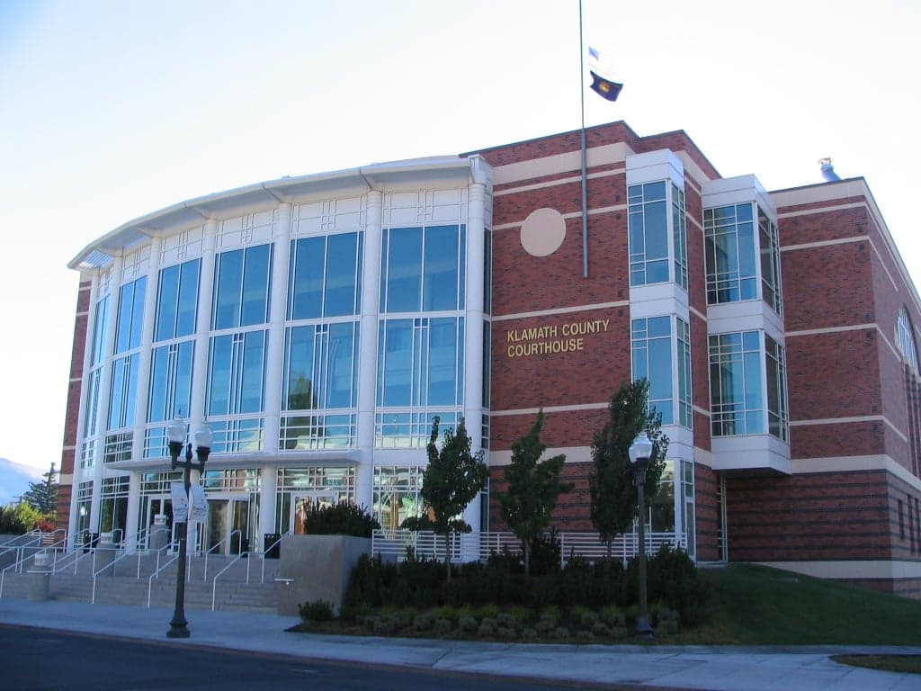
Photo: Wikipedia
Strategic Assessment of Klamath County
Strong survivability profile. Good buffer from population centers, with manageable environmental and tactical risks.
What does the Strategic Assessment tell us?
Our Strategic Assessment grades tactical survivability of an area. Major population centers, military targets, fallout zones, natural disasters, and border exposure all drive risk — lower exposure means a more defensible position in a crisis.
This is heavily inspired by Joel Skousen's Strategic Relocation book. Highly recommended you checkout the book ($)What does this tell us?
Our Strategic Assessment grades tactical survivability of an area. Major population centers, military targets, fallout zones, natural disasters, and border exposure all drive risk — lower exposure means a more defensible position in a crisis.
This is heavily inspired by Joel Skousen's Strategic Relocation book. Highly recommended you checkout the book ($)Strategic Pillars

Key Distances
Strategic Assessment Analysis
Klamath County, Oregon, occupies a strategic position in the Pacific Northwest that balances relative isolation with practical access to critical infrastructure, making it a serious consideration for those prioritizing resilience and self-sufficiency. Located along the eastern slope of the Cascade Range, the county sits far from the dense urban corridors of Portland, Seattle, and the San Francisco Bay Area, yet remains within a day's drive of major supply and medical hubs like Bend, Redding, and Medford. This geographic buffer — roughly 250 miles from Portland and 180 miles from Sacramento — reduces exposure to the immediate fallout and cascading disruptions that would likely follow a major event targeting high-value population centers or critical infrastructure along the I-5 corridor.
Geographic position and natural advantages for long-term stability
The county's defining feature is the Klamath Basin, a high-desert plateau at roughly 4,100 feet elevation, ringed by the Cascade Range to the west and the Basin and Range country to the east. This topography provides natural defensibility: the mountains create a physical barrier that slows movement and filters air currents, while the basin itself offers arable land and abundant surface water from Upper Klamath Lake, the largest freshwater lake in Oregon. The Klamath River, which originates here, and the numerous smaller lakes and reservoirs — including Agency Lake and Lake Ewauna — provide a distributed water supply less vulnerable to single-point contamination than a river-dependent system. The region's volcanic soils, though requiring careful management, support dryland farming and grazing, and the area already hosts a modest agricultural base producing hay, potatoes, and livestock. For a relocator thinking about food security, the ability to grow cool-season crops and raise small livestock on relatively affordable land (median acreage prices remain well below the Willamette Valley) is a tangible advantage. The nearby Fremont-Winema National Forests and the Klamath Marsh National Wildlife Refuge also offer hunting, fishing, and foraging opportunities, though these are public resources subject to access rules and seasonal variation.
Risks, exposures, and proximity to fallout-relevant landmarks
Klamath County is not without strategic vulnerabilities. The most significant man-made risk comes from the Klamath Falls area itself, which hosts the Klamath Falls Municipal Airport (a former Air Force base with a 10,000-foot runway capable of handling heavy military transport) and the Oregon Institute of Technology, a campus with research facilities that could be a secondary target in a conflict scenario. More broadly, the county sits roughly 120 miles east of the I-5 corridor, which carries the Union Pacific mainline and major natural gas pipelines connecting California to the Pacific Northwest. A disruption to that corridor — whether from earthquake, sabotage, or cascading failure — would cut off refined fuels and manufactured goods, but Klamath County's position on the other side of the Cascades means it would be less directly affected than communities along the I-5 itself. The Klamath Falls refinery (a small asphalt and specialty products facility) is a minor asset, not a major target. Natural hazards are more immediate: the region lies in a high desert with periodic drought, and the 2020 Bootleg Fire (the largest in Oregon's modern history) burned over 400,000 acres across the Fremont-Winema National Forest, demonstrating the wildfire risk that comes with dry summers and dense timber. The county also sits near the Klamath Graben, a seismically active zone capable of producing magnitude 6-7 earthquakes, though the risk is lower than along the Cascadia subduction zone to the west. For a relocator, the practical takeaway is that the area's primary risks are natural (wildfire, drought, moderate seismic activity) rather than man-made, and these are hazards that can be mitigated with proper site selection and building practices.
Practical resilience for a relocator: food, water, energy, and defensibility
For someone serious about self-sufficiency, Klamath County offers a mixed but workable picture. Water is the strongest asset: the Klamath Basin's groundwater and surface water rights are complex and heavily adjudicated, but property with senior water rights or a well on a productive aquifer can support household use, irrigation, and livestock. The Klamath Project, a federal irrigation system, delivers water to roughly 200,000 acres of farmland, though allocations have been cut during drought years, so reliance on project water alone is risky. Energy infrastructure is moderately resilient: the county is served by PacifiCorp, which draws from a mix of hydroelectric (the Klamath River dams), natural gas, and coal (the now-retired Boardman plant). The Klamath Falls area has a growing solar installation base, and the high desert's 300+ days of sunshine per year make off-grid solar a viable supplement. Wood heating is common, given the surrounding national forests, but air quality during wildfire season can make outdoor burning or wood stoves problematic. Defensibility is a function of terrain and community: the basin's open landscape offers good lines of sight, and the dispersed settlement pattern — with small towns like Merrill, Malin, Bonanza, and Chiloquin separated by farmland and forest — means that no single point of failure would cripple the entire county. The local culture leans toward self-reliance, with a strong hunting and firearms tradition, and the Klamath County Sheriff's Office maintains a visible presence in rural areas. However, the county's population of roughly 70,000 is spread thin, and emergency services response times in the far eastern or southern reaches can exceed 30 minutes. For a relocator, the key is to choose a property with defensible space (cleared vegetation, fire-resistant construction), a reliable water source, and proximity to a small town with a grocery store and hardware supply — Merrill and Bonanza are worth a look for their agricultural land and lower prices, while Chiloquin offers closer access to the national forest and fishing on the Williamson River.
The overall strategic picture for Klamath County is one of moderate resilience with clear trade-offs. It avoids the worst fallout risks of the I-5 corridor and the Portland metro area, and its water resources, agricultural potential, and low population density provide a foundation for long-term self-sufficiency. The downsides are real: wildfire risk, drought vulnerability, and a remote location that makes resupply difficult if the Cascades passes (Highway 97 and Highway 140) are blocked. For a relocator who is willing to invest in fire-hardening, secure a senior water right, and build a community network in a rural area with a conservative, independent-minded population, Klamath County offers a defensible base that is neither too close to the danger zones nor too far from the resources needed to thrive. It is not a bug-out location for the unprepared — it is a place to build a life with eyes open to the risks and the rewards.

* Values derived from national, state, county, city and local statistics and may differ in a specific area. Last updated: 2026-07-19T08:10:37.000Z
Narrative content on this page is AI-generated and may contain mistakes. Verify any details that matter before acting on them.
ReloMaps may earn a commission from affiliate links at no extra cost to you.

