Photo: Wikipedia
Strategic Assessment of Josephine County
Workable tactical position. Some exposure to population density or targets, but generally defensible in a crisis.
What does the Strategic Assessment tell us?
Our Strategic Assessment grades tactical survivability of an area. Major population centers, military targets, fallout zones, natural disasters, and border exposure all drive risk — lower exposure means a more defensible position in a crisis.
This is heavily inspired by Joel Skousen's Strategic Relocation book. Highly recommended you checkout the book ($)What does this tell us?
Our Strategic Assessment grades tactical survivability of an area. Major population centers, military targets, fallout zones, natural disasters, and border exposure all drive risk — lower exposure means a more defensible position in a crisis.
This is heavily inspired by Joel Skousen's Strategic Relocation book. Highly recommended you checkout the book ($)Strategic Pillars

Key Distances
Strategic Assessment Analysis
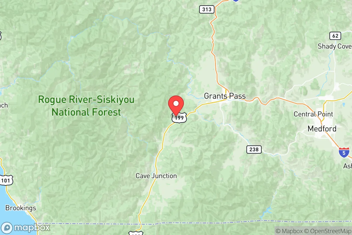
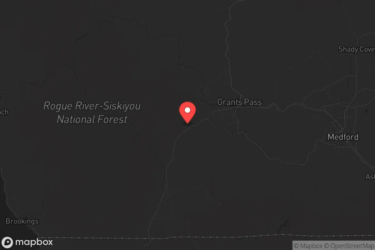
Josephine County, Oregon, sits in a sweet spot that’s hard to beat for a strategic relocation: far enough from major population centers to avoid the worst of civic unrest or fallout, but close enough to access critical supplies and medical care when needed. The county’s rugged terrain, low population density (roughly 88,000 residents spread over 1,640 square miles), and location in the Siskiyou Mountains give it natural buffers that most of the country lacks. For a conservative-leaning prepper or family looking to ride out the next decade’s volatility, this area offers a rare combination of defensibility, resource access, and distance from the most likely targets.
Geographic position and natural advantages for long-term security
Josephine County’s geography is its strongest card. The county is anchored by Grants Pass, the largest city (population ~39,000), which sits along the Rogue River and Interstate 5. That I-5 corridor is a double-edged sword—it provides a lifeline for trade and travel, but it’s also a potential chokepoint. The real value lies in the surrounding terrain: the Siskiyou National Forest and Kalmiopsis Wilderness cover vast stretches of the county, offering dense forest, steep ridges, and limited road access. This makes large-scale movement by outsiders difficult, which is exactly what you want if things go sideways. The county’s position in the Klamath Mountains also means it’s off the main seismic fault lines that threaten the Willamette Valley or Portland, though it’s not immune to smaller quakes. For a relocator, the key takeaway is that Josephine County is a natural fortress—hard to reach, harder to traverse, and with plenty of places to disappear into if needed.
Risks, exposures, and proximity to fallout-relevant landmarks
No area is perfect, and Josephine County has its own set of risks that a strategic relocator needs to weigh. The biggest concern is wildfire. The county has a history of major fires—the 2020 Almeda Fire destroyed over 2,500 structures in nearby Talent and Phoenix (just north in Jackson County), and the Slater Fire in 2020 burned 157,000 acres in the region. Fire season is real, and if you’re buying land, you need to factor in defensible space, water storage, and evacuation routes. On the plus side, the county’s distance from high-value targets is a major advantage. The nearest major military base is Camp Rilea near the coast (about 150 miles northwest), and the closest nuclear infrastructure is the Trojan Nuclear Plant site (decommissioned, but still a potential hazard) near Rainier, Oregon, roughly 200 miles north. No major refineries, ports, or military command centers are within 100 miles. The closest city that might see unrest or a mass casualty event is Medford (30 miles north, pop. 85,000), but that’s still small by national standards. For a prepper, the calculus is simple: Josephine County is far enough from the bullseyes to avoid the blast, but close enough to a regional hub (Medford) for resupply runs.
Practical resilience for a relocator: food, water, energy, and defensibility
When you’re thinking about daily life in a crisis, Josephine County delivers on the basics. Water is abundant—the Rogue River runs through the county, and numerous creeks and springs feed into it. The Applegate River and Illinois River also provide reliable sources, though you’ll want to test for heavy metals from old mining operations. Food production is viable: the Rogue Valley is known for its fertile soil, and small-scale farming is common. Grants Pass has a strong farmers’ market culture, and the county’s growing season (roughly 150 days) allows for decent yields of vegetables, fruit, and even some grains. Energy is a mixed bag. The grid is vulnerable to ice storms and fire-related outages, but solar potential is good—the area gets about 200 sunny days per year. Many off-grid properties already use solar with battery backup. Defensibility is where the county shines. The terrain naturally funnels movement along I-5 and Highway 199 (the Redwood Highway to Crescent City, CA). If you’re on a property with a single access road and a good vantage point, you can control who comes and goes. The Grants Pass area has a strong gun culture and a high rate of concealed carry permits, which aligns with a self-reliant mindset. For a family, the trade-off is that schools and healthcare are limited—the county has one hospital (Asante Three Rivers Medical Center) and a handful of clinics. If you have serious medical needs, you’ll want to be within an hour of Medford’s larger facilities.
The overall strategic picture for Josephine County is one of calculated trade-offs. It’s not a bug-out location for a weekend—it’s a place to build a life that can withstand shocks. The county’s conservative lean (it voted +25 points for Trump in 2020) means you’ll find like-minded neighbors, but it also means local government is less likely to impose heavy-handed restrictions during a crisis. The biggest threats are natural—wildfire, drought, and the occasional ice storm—not man-made chaos from urban centers. For a single individual or a family looking to get ahead of the curve, Josephine County offers a rare combination of isolation, resource availability, and community resilience. Just don’t expect a Walmart on every corner. You’ll need to bring skills, supplies, and a willingness to work the land. If that sounds like your plan, this is one of the better bets in the Pacific Northwest.
* Values derived from national, state, county, city and local statistics and may differ in a specific area. Last updated: 2026-06-01T12:03:19.000Z
Narrative content on this page is AI-generated and may contain mistakes. Verify any details that matter before acting on them.
ReloMaps may earn a commission from affiliate links at no extra cost to you.