
Photo: Wikipedia
Strategic Assessment of Lorain County
Meaningful friction. Expect exposure to either population pressure, blast zones, or natural disaster risk. Consider buying a retreat property.
What does the Strategic Assessment tell us?
Our Strategic Assessment grades tactical survivability of an area. Major population centers, military targets, fallout zones, natural disasters, and border exposure all drive risk — lower exposure means a more defensible position in a crisis.
This is heavily inspired by Joel Skousen's Strategic Relocation book. Highly recommended you checkout the book ($)What does this tell us?
Our Strategic Assessment grades tactical survivability of an area. Major population centers, military targets, fallout zones, natural disasters, and border exposure all drive risk — lower exposure means a more defensible position in a crisis.
This is heavily inspired by Joel Skousen's Strategic Relocation book. Highly recommended you checkout the book ($)Strategic Pillars

Key Distances
Strategic Assessment Analysis
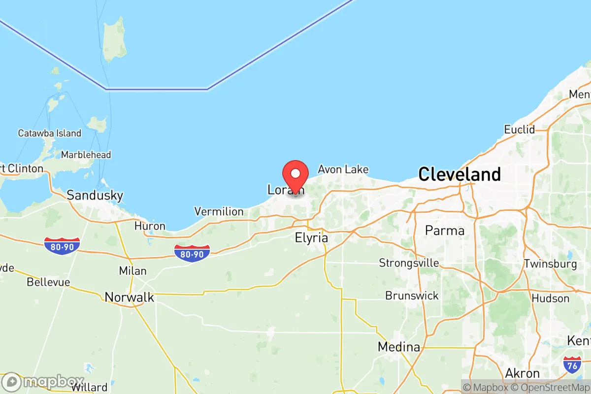
Lorain County, Ohio, offers a strategic blend of geographic resilience and practical self-sufficiency that appeals to relocation-minded individuals and families with a conservative, preparedness-oriented outlook. Situated along the Lake Erie shoreline, the county benefits from a moderate climate, abundant freshwater resources, and a position that is close enough to major economic hubs like Cleveland and Toledo for access, yet far enough to avoid the worst of urban congestion and fallout risks. Its industrial heritage, anchored by the city of Lorain and the steel mills along the Black River, provides a local economic backbone, while the rural townships and farmland in the southern and western parts of the county offer defensible, low-density living options.
Geographic position and natural advantages for long-term stability
Lorain County’s location is a key asset for anyone prioritizing long-term stability. The county sits on the southern shore of Lake Erie, which provides a virtually inexhaustible supply of fresh water—a critical resource in any disaster scenario. The lake also moderates temperatures, reducing the risk of extreme heat waves or prolonged drought compared to inland areas. The county’s terrain is mostly flat to gently rolling, with fertile soils that support agriculture, particularly in the southern townships like Wellington and Pittsfield. This agricultural capacity means local food production is viable, and the county is home to several active farms and farmers’ markets. The presence of the Lorain County Regional Airport and proximity to the Ohio Turnpike (I-80/I-90) and State Route 2 provide reliable transportation corridors for both evacuation and supply movement, without the choke points found in denser urban areas. The county’s position also places it outside the direct blast radius of major strategic targets like the Cleveland Hopkins International Airport or the Port of Toledo, while still being within a reasonable distance for occasional supply runs or medical access.
Risks, exposures, and proximity to fallout-relevant landmarks
No location is without risk, and Lorain County has several exposures that a strategic relocator must weigh. The most significant is its proximity to the Davis-Besse Nuclear Power Station, located just 20 miles east in Ottawa County. While the plant has a strong safety record, a major incident could create a fallout plume affecting eastern Lorain County, particularly areas like Avon Lake and Sheffield Lake. The county also lies within 50 miles of the Perry Nuclear Power Plant in Lake County, compounding the risk. Additionally, the industrial corridor along the Lake Erie shore—including the Lorain County Joint Vocational School District and the U.S. Steel Lorain Tubular Operations—could be a secondary target in a conflict, though these are not primary strategic assets. The county’s position along the Lake Erie shoreline also makes it vulnerable to lake-effect snowstorms, which can dump several feet of snow in a single event, potentially isolating rural areas for days. Flooding from the Black River and its tributaries is a recurring issue in low-lying parts of Lorain and Elyria. On the positive side, the county is far from major military bases like Fort Hood or Wright-Patterson Air Force Base, reducing the likelihood of being a direct target. The nearest major fallout risk is the Cleveland Hopkins International Airport (30 miles east), which could be a primary target, but prevailing westerly winds would carry fallout away from Lorain County in most scenarios.
Practical resilience for a relocator: food, water, energy, and defensibility
For a relocator focused on practical self-sufficiency, Lorain County offers a strong foundation. Water is abundant: Lake Erie provides an unlimited surface water source, and the county’s groundwater aquifers are generally reliable, though well drilling is necessary in rural areas. The county’s agricultural base means local food production is feasible, with several farms in the southern townships offering raw milk, eggs, and produce. The Lorain County Fairgrounds in Wellington hosts regular livestock and crop auctions, providing a local market for barter and trade. Energy resilience is mixed: the county is served by FirstEnergy’s grid, which is vulnerable to weather-related outages, but natural gas is widely available, and many rural properties have space for solar panels or small wind turbines. The county’s topography is not mountainous, but the rolling hills and wooded areas in the southern part of the county offer natural concealment and defensible positions. The Lorain County Metro Parks system, with over 30 parks and 100 miles of trails, provides both recreational opportunities and potential bug-out locations. Defensibility is enhanced by the county’s low population density outside the urban centers—townships like Camden, Rochester, and Huntington have fewer than 2,000 residents each, allowing for tight-knit community networks. The county’s law enforcement presence is robust, with the Lorain County Sheriff’s Office and local police departments maintaining a visible presence, but in a prolonged crisis, reliance on self-defense and community mutual aid would be essential. The Lorain County Emergency Management Agency has a solid reputation for disaster planning, including regular drills for nuclear and weather events, which adds a layer of institutional preparedness.
Overall, Lorain County presents a balanced strategic picture for the conservative relocator. Its greatest strengths are its abundant freshwater, agricultural capacity, and moderate distance from high-value targets. The primary weaknesses are the proximity to two nuclear power plants and the industrial shoreline, which introduce a non-zero risk of fallout exposure. For a family or individual willing to invest in a well, solar backup, and a defensible rural property in the southern townships, the county offers a viable long-term base with access to urban resources when needed. The key is to avoid the lakefront communities like Avon Lake and Sheffield Lake, which are closer to both the nuclear plants and the industrial corridor, and instead focus on the inland areas like Wellington, Pittsfield, or Camden. With careful planning, Lorain County can serve as a resilient, self-sufficient home base that balances risk and reward in a way that few other locations in the Midwest can match.

* Values derived from national, state, county, city and local statistics and may differ in a specific area. Last updated: 2026-07-14T07:26:33.000Z
Narrative content on this page is AI-generated and may contain mistakes. Verify any details that matter before acting on them.
ReloMaps may earn a commission from affiliate links at no extra cost to you.

