
Photo: Wikipedia
Strategic Assessment of Erie County
Workable tactical position. Some exposure to population density or targets, but generally defensible in a crisis.
What does the Strategic Assessment tell us?
Our Strategic Assessment grades tactical survivability of an area. Major population centers, military targets, fallout zones, natural disasters, and border exposure all drive risk — lower exposure means a more defensible position in a crisis.
This is heavily inspired by Joel Skousen's Strategic Relocation book. Highly recommended you checkout the book ($)What does this tell us?
Our Strategic Assessment grades tactical survivability of an area. Major population centers, military targets, fallout zones, natural disasters, and border exposure all drive risk — lower exposure means a more defensible position in a crisis.
This is heavily inspired by Joel Skousen's Strategic Relocation book. Highly recommended you checkout the book ($)Strategic Pillars

Key Distances
Strategic Assessment Analysis
Erie County, Ohio, offers a compelling mix of strategic advantages and real-world vulnerabilities for the relocation-minded reader focused on resilience and self-sufficiency. Its position on Lake Erie provides a massive freshwater resource and a natural buffer, while its distance from major metropolitan blast zones and heavy industrial targets gives it a meaningful edge over many Midwest locations. However, the county’s proximity to the Davis-Besse Nuclear Power Station and the region’s heavy reliance on just-in-time supply chains demand a clear-eyed assessment of both its strengths and its exposures.
Geographic position and natural advantages for long-term stability
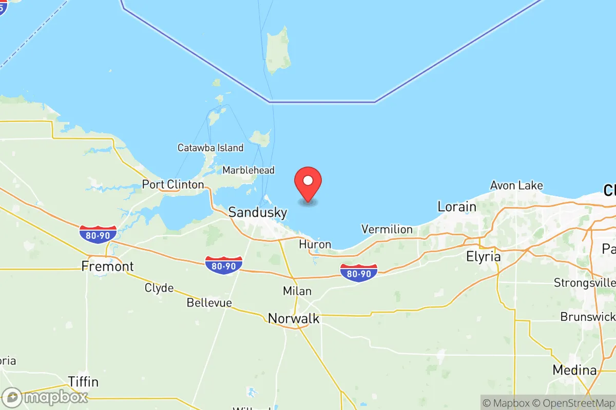
Erie County sits in a sweet spot of the Great Lakes region, roughly midway between Toledo and Cleveland, but far enough from both to avoid the worst of a major urban event. The county seat, Sandusky, is the population hub, but the area’s character is defined by smaller communities like Huron, Vermilion, and Milan, which offer a more dispersed population pattern. This lower density is a key resilience factor: it reduces the strain on local resources during a crisis and makes the area less of a target for coordinated disruption. The Lake Erie shoreline provides a moderating effect on temperatures, extending growing seasons slightly compared to inland areas, and the lake itself is a virtually inexhaustible source of fresh water. The region’s topography is mostly flat to gently rolling, with good drainage and fertile soils—ideal for small-scale agriculture and livestock. The Erie Islands, including Kelleys Island and South Bass Island, are part of the county’s geography, but for a relocator, the mainland’s access to the lake’s water and its natural windbreaks from prevailing westerlies are the more practical assets. The area’s position on the southern shore of Lake Erie also places it within a day’s drive of multiple major population centers, but with enough distance to avoid the immediate fallout of a major event in those cities.
Risks, exposures, and proximity to fallout-relevant landmarks
The most significant man-made risk in Erie County is the Davis-Besse Nuclear Power Station, located in Oak Harbor, just east of the county line in Ottawa County. While not inside Erie County, its 10-mile emergency planning zone extends into the county’s eastern townships, and a major incident there would directly affect areas like Port Clinton and the Lake Erie islands. For a relocator, this is a non-negotiable factor: you need to know your distance from the plant and have a plan for evacuation or sheltering in place. Beyond the nuclear risk, the county’s industrial base is modest compared to the heavy refining and chemical corridors near Toledo or Cleveland. The Cedar Point amusement park in Sandusky is a major seasonal economic driver, but it’s not a strategic target. The county does have a small port in Sandusky, handling bulk cargo like coal and limestone, but it’s not a critical national infrastructure node. Natural risks are more manageable: Lake Erie can produce intense lake-effect snow squalls, especially in the eastern part of the county, and the shoreline is subject to erosion and occasional flooding from storm surges. Tornado risk is present but not extreme—the area sits in a moderate-risk zone. The biggest practical exposure is the region’s reliance on the Ohio Turnpike (I-80/90) and the Norfolk Southern rail line that runs through the county. A disruption to either would choke supply chains quickly, making local food and fuel storage a priority.
Practical resilience for a relocator: food, water, energy, and defensibility
For a family or individual serious about self-sufficiency, Erie County offers a strong baseline. Water is the single biggest advantage: Lake Erie provides an essentially unlimited supply, but you’ll need a plan for treatment and pumping. Municipal water in Sandusky and Huron is treated and reliable, but a grid-down scenario means you’re dependent on backup power for well pumps or lake intake systems. The county’s agricultural base is solid—corn, soybeans, and wheat are the main crops, and there are numerous small farms and orchards, particularly around Milan and Berlin Heights. Local food production is viable, and the growing season runs from late April to early October, long enough for most vegetables and some grains. Energy resilience is mixed. The county is served by FirstEnergy and several rural electric cooperatives, but the grid is aging and vulnerable to weather events. Natural gas is available in most populated areas, but for off-grid living, solar is viable—the region gets about 4.5 peak sun hours per day, which is decent for the Midwest. Wood heating is practical given the area’s forest cover, especially in the southern part of the county. Defensibility is moderate: the flat terrain offers few natural chokepoints, but the lake provides a secure rear flank. The county’s road network is a grid of state routes and county roads, which can be monitored and controlled with effort. The presence of the Erie County Sheriff’s Office and local police departments in Sandusky, Huron, and Vermilion provides a law enforcement presence, but in a prolonged crisis, rural areas would likely see a reliance on community-based security. The county’s population of about 75,000 is small enough that social cohesion is possible, but large enough that anonymity is still an option—a balance that works well for a relocator who wants to integrate but not be immediately known.
The overall strategic picture for Erie County is one of moderate resilience with a clear, manageable risk profile. The lake gives you water, a climate buffer, and a natural defensive boundary. The distance from major urban and industrial targets is a real advantage, but the Davis-Besse plant is a shadow you cannot ignore. For a relocator willing to invest in water treatment, backup power, and a solid food storage plan, the county offers a livable, defensible base with access to both rural quiet and small-city amenities. It’s not a fortress, but it’s a place where a prepared family can ride out most disruptions with a good plan and a clear head. The key is to know your specific location relative to the nuclear plant, have a robust water and energy plan, and build relationships with the local farming community. If you do that, Erie County is a solid bet for long-term stability in an uncertain future.

* Values derived from national, state, county, city and local statistics and may differ in a specific area. Last updated: 2026-10-21T03:14:26.000Z
Narrative content on this page is AI-generated and may contain mistakes. Verify any details that matter before acting on them.
ReloMaps may earn a commission from affiliate links at no extra cost to you.

