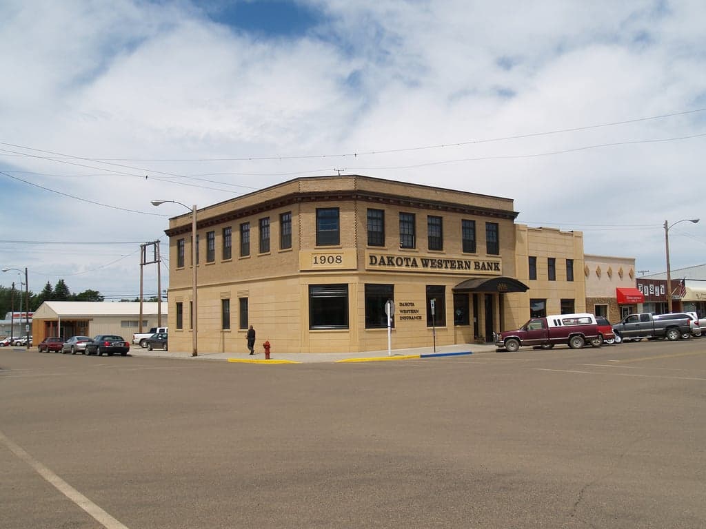
Photo: Wikipedia
Strategic Assessment of Bowman County
Deep buffer from population centers and strategic targets. Low natural disaster risk and minimal exposure to border or coastal threats.
What does the Strategic Assessment tell us?
Our Strategic Assessment grades tactical survivability of an area. Major population centers, military targets, fallout zones, natural disasters, and border exposure all drive risk — lower exposure means a more defensible position in a crisis.
This is heavily inspired by Joel Skousen's Strategic Relocation book. Highly recommended you checkout the book ($)What does this tell us?
Our Strategic Assessment grades tactical survivability of an area. Major population centers, military targets, fallout zones, natural disasters, and border exposure all drive risk — lower exposure means a more defensible position in a crisis.
This is heavily inspired by Joel Skousen's Strategic Relocation book. Highly recommended you checkout the book ($)Strategic Pillars

Key Distances
Strategic Assessment Analysis
Bowman County, North Dakota, offers a compelling strategic profile for relocators prioritizing resilience, self-sufficiency, and distance from major population centers. Situated in the far southwestern corner of the state, this county of roughly 3,000 residents combines low population density with a location that is both remote and well-connected by regional infrastructure. Its position near the Montana border and the Little Missouri River provides natural advantages for those seeking a defensible, resource-rich environment away from the vulnerabilities of urban corridors.
Geographic position and natural advantages for self-sufficiency
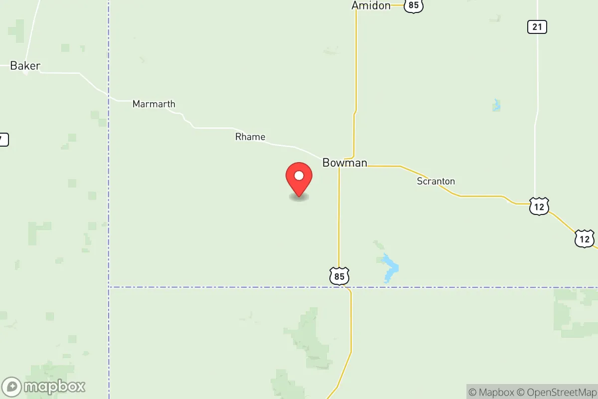
Bowman County sits at the intersection of U.S. Highway 85 and North Dakota Highway 12, placing it roughly 70 miles south of Dickinson, 50 miles north of the South Dakota border, and 30 miles east of Montana. This location offers a strategic balance: it is far enough from major cities to avoid the fallout risks associated with large population centers, yet close enough to access regional services in Bowman (the county seat, population ~1,600) and nearby communities like Scranton and Rhame. The county lies within the Little Missouri River watershed, providing reliable surface water sources for irrigation and livestock, while the underlying Fox Hills and Hell Creek aquifers offer groundwater reserves. The terrain is a mix of rolling plains, buttes, and river valleys, offering natural cover and defensible positions—particularly along the Little Missouri breaks. The area's cold, dry climate (average January highs around 20°F) reduces the risk of wildfires compared to western states, and its inland location eliminates hurricane and tsunami threats. For a relocator, the county's agricultural base—primarily wheat, barley, and cattle ranching—means local food production is a tangible reality, not just a theoretical advantage.
Risks, exposures, and proximity to fallout-relevant landmarks
Bowman County's primary risk profile is shaped by its proximity to energy infrastructure and military assets, though these are less concentrated than in other regions. The county itself hosts the Bowman County Refinery, a small crude oil processing facility near Bowman that processes Bakken crude—a potential target in a conflict scenario, but one that is isolated and low-profile compared to the massive refineries in Texas or Louisiana. More significantly, the county lies within 100 miles of the Minot Air Force Base (home to nuclear-capable B-52 bombers and intercontinental ballistic missile silos) and the Malmstrom Air Force Base in Montana (which operates Minuteman III ICBMs). While these bases are primary targets in a nuclear exchange, their distance (roughly 150 miles from Bowman County) places the area outside the immediate blast zones but within potential fallout patterns depending on wind direction. The county is also roughly 200 miles from the Fort Berthold Reservation, which hosts significant oil and gas infrastructure, and 250 miles from the Bismarck-Mandan metro area (population ~130,000), which includes a major rail hub and the state capitol. Natural risks are minimal: tornadoes are rare in this part of the state, and the region's low seismicity means earthquakes are not a concern. The primary man-made risk is a potential accident or attack at the Bowman County Refinery, though its small scale limits the hazard radius to a few miles.
Practical resilience for a relocator: food, water, energy, and defensibility
For a relocator focused on practical self-sufficiency, Bowman County offers strong fundamentals. Food security is supported by the county's agricultural output: local ranches produce beef, and grain elevators in Bowman and Scranton store wheat and barley. The Bowman Farmers Market operates seasonally, and the county's rural character means many residents maintain gardens and small livestock. Water access is reliable: the Little Missouri River and its tributaries provide surface water, while private wells tap into the Fox Hills aquifer at depths of 200-500 feet. The city of Bowman's municipal water system draws from groundwater, but rural properties typically have independent wells, reducing dependence on centralized infrastructure. Energy resilience is a mixed picture: the county is served by the Bowman County Refinery, which could supply fuel locally in a crisis, but the electrical grid is tied to the regional system (operated by Basin Electric Power Cooperative). Solar and wind potential are moderate—the area averages 200 sunny days per year and has consistent winds—making off-grid setups feasible with battery storage. Defensibility is enhanced by the county's low population density (roughly 3 people per square mile) and the natural cover provided by the Little Missouri breaks and buttes. The county's road network is sparse, with only two major highways, which limits access points for potential threats. However, the same remoteness means emergency services are limited: the Bowman County Sheriff's Office has a small staff, and the nearest hospital is in Bowman (a critical access facility with 25 beds). For a relocator, building a community network with neighbors is essential—the county's culture of mutual aid among ranchers and farmers is a real asset.
The overall strategic picture for Bowman County is one of moderate resilience with specific trade-offs. Its greatest strengths are its low population density, agricultural self-sufficiency, and distance from major urban targets—qualities that align with a conservative-leaning emphasis on local control and preparedness. The county's location near the Little Missouri River and its groundwater reserves provide a reliable water supply, while the local refinery offers a fuel source that many rural areas lack. However, the proximity to Minot and Malmstrom Air Force bases introduces a non-trivial fallout risk, and the county's small population means limited medical and emergency response capacity. For a relocator willing to invest in off-grid infrastructure (solar panels, well maintenance, food storage) and build local relationships, Bowman County represents a viable option for a resilient, self-sufficient lifestyle. It is not a fallout-free zone—no place in the continental U.S. is—but it offers a defensible, resource-rich environment that rewards preparation and community engagement. The key is to treat the county as a base for long-term sustainability rather than a short-term bug-out location, and to accept that its remoteness is both its greatest protection and its most significant limitation.

* Values derived from national, state, county, city and local statistics and may differ in a specific area. Last updated: 2026-08-14T01:08:23.000Z
Narrative content on this page is AI-generated and may contain mistakes. Verify any details that matter before acting on them.
ReloMaps may earn a commission from affiliate links at no extra cost to you.

