
Photo: Wikipedia
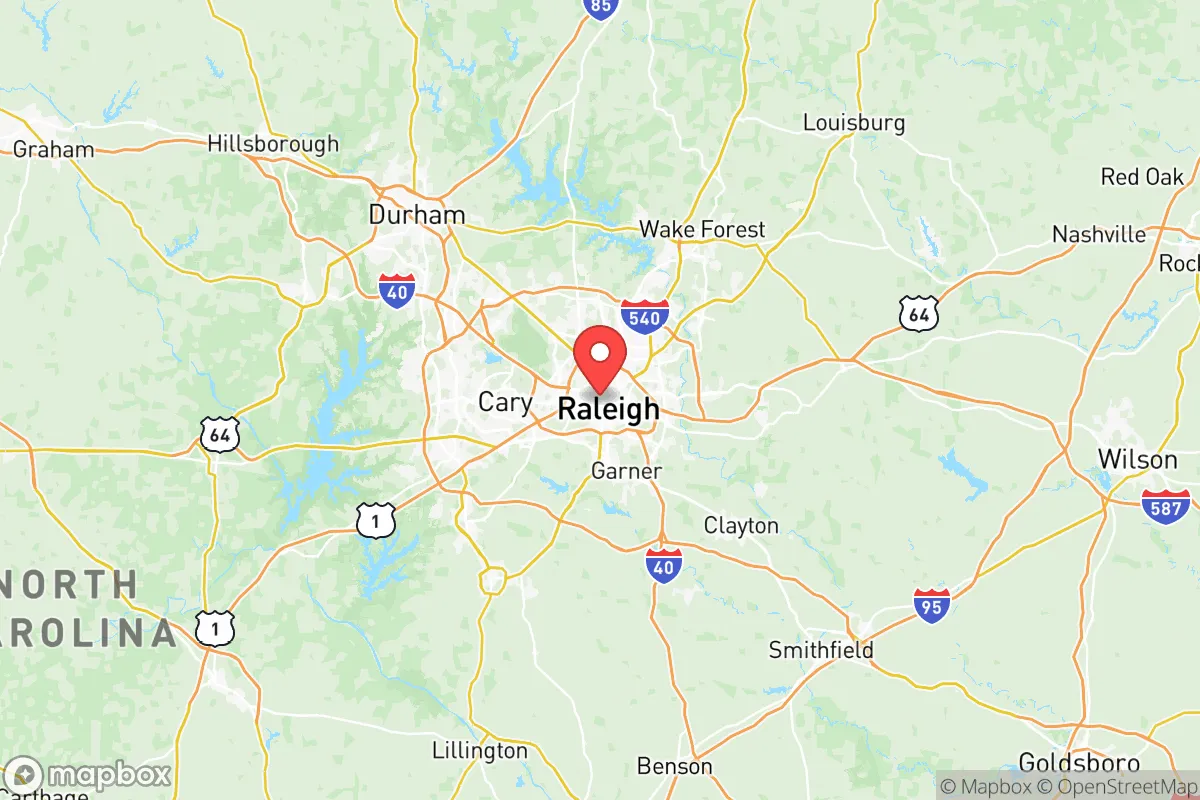
Strategic Assessment of Wake County
Multiple tactical vulnerabilities. Population density, target proximity, or disaster risk are likely compounding. A retreat property and exit planning is required.
What does the Strategic Assessment tell us?
Our Strategic Assessment grades tactical survivability of an area. Major population centers, military targets, fallout zones, natural disasters, and border exposure all drive risk — lower exposure means a more defensible position in a crisis.
This is heavily inspired by Joel Skousen's Strategic Relocation book. Highly recommended you checkout the book ($)What does this tell us?
Our Strategic Assessment grades tactical survivability of an area. Major population centers, military targets, fallout zones, natural disasters, and border exposure all drive risk — lower exposure means a more defensible position in a crisis.
This is heavily inspired by Joel Skousen's Strategic Relocation book. Highly recommended you checkout the book ($)Strategic Pillars

Key Distances
Strategic Assessment Analysis
Wake County offers a surprisingly strong mix of strategic depth and everyday livability for those thinking long-term about security and stability, but it’s not without its trade-offs. Centered on Raleigh, the county sits far enough inland to avoid hurricane storm surge and far enough from the major East Coast fault lines to dodge catastrophic seismic events. The real advantage here is that you’re close enough to the Research Triangle’s economic engine—home to Fort Liberty (formerly Fort Bragg) just an hour south and major federal infrastructure—while still being far enough from the immediate blast zones of coastal cities like Wilmington or Norfolk. For a relocator weighing civic unrest or supply-chain disruptions, Wake County’s position as a state capital and regional logistics hub gives it a resilience edge that many inland counties lack.
Geographic position and natural advantages for long-term stability
Wake County sits in the Piedmont region, a rolling plateau that’s historically been a buffer between the coastal plain and the mountains. This means you’re out of the hurricane flood zones that plague the coast—Raleigh’s elevation averages around 400 feet, and the county’s watershed drains into the Neuse River, which has a wide floodplain but rarely produces catastrophic flash flooding. The Falls Lake reservoir, just north of Raleigh, provides a reliable freshwater source that’s less vulnerable to saltwater intrusion than coastal aquifers. The climate is temperate, with four distinct seasons but no extreme cold snaps that would cripple off-grid heating. For a prepper mindset, the county’s natural advantages boil down to: no hurricanes, no earthquakes, no wildfires (the Piedmont’s hardwood forests are low-risk), and a growing season long enough to support serious gardening. The downside? You’re in a region that gets humid summers and occasional ice storms, but those are manageable with basic preparedness.
Risks, exposures, and proximity to fallout-relevant landmarks
Here’s where the analysis gets real. Wake County’s biggest strategic vulnerability is its proximity to Raleigh-Durham International Airport (RDU) and the Research Triangle Park (RTP)—both are high-value targets in a conflict scenario. RTP hosts major biotech and pharmaceutical facilities, including Pfizer and Merck operations, which could be secondary targets for disruption. The county also sits within 100 miles of Fort Liberty, one of the largest military installations in the world. While that base is a defensive asset, it also makes the region a potential staging area or target during large-scale unrest. Closer to home, the Shearon Harris Nuclear Plant in neighboring New Hill is about 20 miles southwest of downtown Raleigh. A worst-case event there would put much of southern Wake County in a potential evacuation zone. On the plus side, there are no major refineries, chemical plants, or ports in Wake County itself—the closest major industrial fallout risk is the Port of Morehead City about 150 miles east. For a relocator, the takeaway is: you’re not in a primary blast zone, but you’re close enough to secondary risks that a rural buffer within the county is worth considering.
Practical resilience for a relocator: food, water, energy, and defensibility
Wake County’s practical resilience is a mixed bag that depends heavily on where you settle within the county. The urban core of Raleigh and Cary is dense, with heavy reliance on grid power and municipal water—a recipe for chaos if the grid goes down. But the county’s northern and western fringes—areas like Wake Forest, Rolesville, and Apex—offer more defensible positions with well water potential, larger lots, and proximity to farmland. The Neuse River and Falls Lake provide surface water sources, but you’ll need filtration; the county’s groundwater is generally good but can have iron and manganese issues. For energy, the region has decent solar potential (about 200 sunny days per year), and many rural properties already have propane tanks for backup. Food resilience is solid: Wake County is surrounded by active agricultural counties—Johnston County to the east is a major pork and poultry producer, and Granville County to the north has row crops and livestock. Local farmers’ markets are abundant, and the county’s extension service is active. Defensibility is the weak point: Wake County is mostly flat to gently rolling, with no natural chokepoints like mountain passes. The best you can do is a rural property with a long driveway, good visibility, and neighbors you trust. For a single person or family, the sweet spot is a 5-10 acre parcel in the northern or western parts of the county, within 30 minutes of a hospital but far enough from major highways to avoid being a thoroughfare during unrest.
The overall strategic picture for Wake County is that it’s a solid B+ option for a conservative-leaning relocator who wants economic opportunity without being in the crosshairs of a major coastal city. You get state capital stability, a strong medical infrastructure (UNC Rex, Duke Health, WakeMed), and a population that’s politically mixed but leans center-right in the rural precincts. The risks are real—proximity to RDU, the nuclear plant, and Fort Liberty mean you’re not in a “bug out” paradise—but the county’s inland position, water resources, and agricultural buffer make it a viable long-term base. If you’re willing to trade absolute wilderness for access to jobs and healthcare, and you pick your spot carefully (think Zebulon or Wendell over downtown Raleigh), Wake County can work as a strategic relocation target. Just don’t expect to disappear—this is a county that will be part of any regional disruption, but it’s also one that has the infrastructure to recover faster than most.
* Values derived from national, state, county, city and local statistics and may differ in a specific area. Last updated: 2026-05-08T06:59:30.000Z
Narrative content on this page is AI-generated and may contain mistakes. Verify any details that matter before acting on them.
ReloMaps may earn a commission from affiliate links at no extra cost to you.