
Photo: Wikipedia
Strategic Assessment of Erie County
Multiple tactical vulnerabilities. Population density, target proximity, or disaster risk are likely compounding. A retreat property and exit planning is required.
What does the Strategic Assessment tell us?
Our Strategic Assessment grades tactical survivability of an area. Major population centers, military targets, fallout zones, natural disasters, and border exposure all drive risk — lower exposure means a more defensible position in a crisis.
This is heavily inspired by Joel Skousen's Strategic Relocation book. Highly recommended you checkout the book ($)What does this tell us?
Our Strategic Assessment grades tactical survivability of an area. Major population centers, military targets, fallout zones, natural disasters, and border exposure all drive risk — lower exposure means a more defensible position in a crisis.
This is heavily inspired by Joel Skousen's Strategic Relocation book. Highly recommended you checkout the book ($)Strategic Pillars

Key Distances
Strategic Assessment Analysis
Erie County, New York, offers a mixed resilience profile for the disaster-conscious relocator, combining the freshwater abundance of Lake Erie and a location on the Great Lakes Seaway with the strategic liabilities of being anchored by the Buffalo metro area and its industrial legacy. For a single individual or family weighing self-sufficiency against proximity to fallout-relevant infrastructure, this region demands a hard-nosed look at both its geographic advantages and its exposure to man-made risks. The county's position as a borderland and a gateway to Canada introduces unique security variables, while its rural southern townships provide a potential buffer not found in the dense urban core.
Geographic position and natural advantages for self-sufficient living
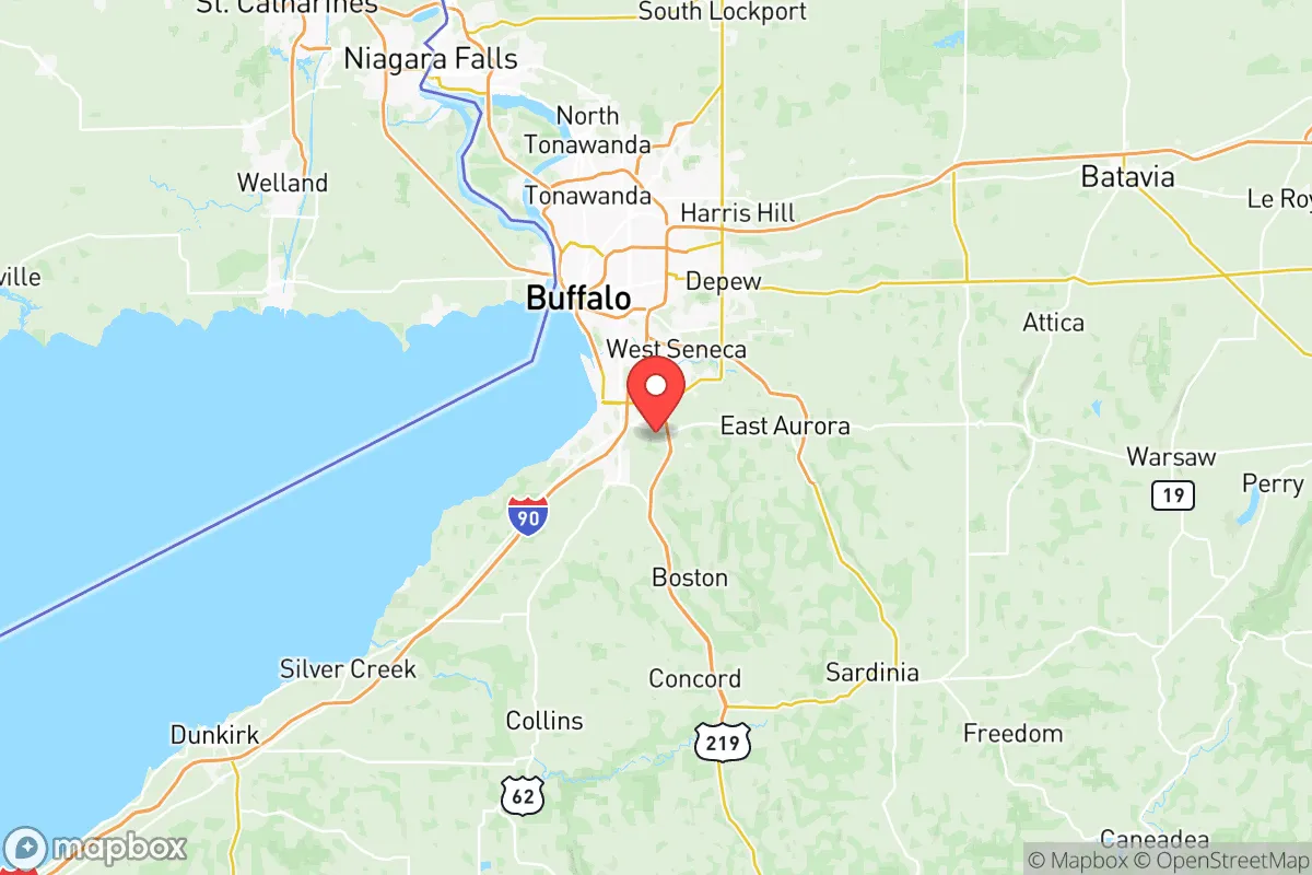
Erie County occupies the westernmost corner of New York state, cradled by the eastern shore of Lake Erie and forming a natural freshwater boundary with Ontario, Canada. This is a position of genuine hydrological strength: the lake provides a virtually inexhaustible surface water supply, and the county sits within the Lake Erie watershed, meaning groundwater recharge is generally reliable. The terrain varies from the flat, developed lake plain in the north—home to Buffalo and its suburbs—to the rolling hills and deeper soils of the rural south, encompassing towns like East Aurora and Holland. That southern tier offers a meaningful advantage for a relocator: lower population density, workable agricultural land, and a climate that, while cold, supports cool-season crops and pasture for livestock. The county also benefits from the moderation effect of Lake Erie, which lengthens the growing season in a narrow band along the shoreline relative to inland areas at the same latitude. For someone serious about food self-sufficiency, the loamy soils of the southern townships are far more viable than the clay-heavy urban ring. The Buffalo Niagara International Airport and the interstate corridors of I-90 and I-190 provide solid logistical connectivity without turning the area into a through-route for hazardous materials shipments to the same degree as major East Coast corridors.
Exposure to man-made risks and proximity to fallout-relevant landmarks
This is where the strategic picture gets complicated. Erie County hosts a concentration of industrial and grid-level infrastructure that a self-sufficiency-minded relocator must map carefully. The Buffalo-Niagara region historically anchored itself on heavy manufacturing, and remnants of that era remain standing. The former Bethlehem Steel site in Lackawanna—a massive brownfield along the lake—is a legacy contamination point and an industrial landmark that, while inactive, sits near active rail and port facilities. The Port of Buffalo handles bulk cargo, including road salt, aggregates, and occasionally hazardous materials, placing it on the Great Lakes St. Lawrence Seaway system. More significantly, the Niagara Power Project, located just north of the county line in Lewiston, is one of the largest hydroelectric facilities in the United States. While it provides cheap power, it also represents a critical infrastructure node that could be a primary or secondary target during any conflict involving cross-border or critical-energy sabotage. High-voltage transmission lines from the project run directly through northern Erie County. The Peace Bridge in Buffalo, a major international border crossing for commercial trucking, is a perennial traffic chokepoint and a terrorism-target consideration; daily Hazmat shipments crossing from Canada into the county include chemicals and industrial inputs that route through the urban core. Beyond these, the Buffalo metro area itself—population roughly 275,000 within the city and over 900,000 in the county—is dense enough to create significant vulnerability in a fallout or grid-collapse scenario. Evacuation routes out of the city are limited to a few radial highways, and the lake forms a natural barrier to the west. For the relocator, the takeaway is straightforward: the northern half of Erie County, especially within a 10-mile radius of Buffalo's industrial corridor and the border crossings, carries a higher risk profile. The rural southern townships are distinctly less exposed, but they still sit within 40 miles of these landmarks.
Practical resilience: food, water, energy, and defensibility for a relocator
For a family or individual willing to locate in the southern or eastern rural towns—think the areas around Springville, Holland, or the Wales area—Erie County offers genuine practical resilience in some categories. Water is the strongest asset: Lake Erie is a massive, reliable source, and the county's municipal water systems draw from it, but a private well in the southern townships tapping into the Onondaga Limestone aquifer is a viable and defensible alternative. Well depth typically ranges from 80 to 200 feet in those areas, with decent yields. Food resilience is middling but workable: the county has active agricultural production in dairy, grains, and vegetables, particularly in the southern half, but it is not the breadbasket of New York. Local food infrastructure is present—farmers' markets in East Aurora and a handful of farm-to-table operations—but not scalable for a significant population without effort. A household with a greenhouse and cold frames can extend the short growing season (USDA zones 5b to 6a) significantly. Energy resilience is mixed: while the grid is reliable day-to-day, the county lies in the Lake Effect snow belt, and winter storms routinely cause localized outages. Natural gas is widely available in the suburbs, but the rural south relies on propane or oil. Solar potential is suboptimal compared to the Southwest, but the long summer daylight hours on the lake plain make a ground-mounted system viable. Defensibility improves as you move away from the urban perimeter; the southern townships have low road density, limited through-traffic, and a culture of rural isolation that discourages casual foot traffic. Neighbor distances in those areas are 300 yards or more, which is a meaningful buffer in a security-conscious context. Noise discipline is easier to maintain than in the dense suburbs of Williamsville or Amherst, where properties are closer and sound carries.
The overall strategic picture for Erie County is one of gradient risk: the further you are willing to get from the urban core and the border infrastructure, the more the area tilts toward favorable resilience characteristics. The southern townships offer defensible land, a reliable freshwater horizon, and a climate that rewards preparation and adaptation. But any relocator must accept the reality that northern Erie County is entangled with a legacy industrial corridor, a major international border crossing, and a hydroelectric plant of national significance—assets that elevate the area's threat profile in a crisis. For a conservative-minded family that values self-sufficiency and has the capital to invest in a well, a robust heating system, and a small-holding lifestyle, Erie County's southern tier is a defensible bet. For anyone tied to the Buffalo suburbs or the lakefront, the strategic trade-offs are far less favorable, and the exposure to both natural winter hazards and man-made fallout risks is harder to justify. Know which side of that gradient you're choosing.

* Values derived from national, state, county, city and local statistics and may differ in a specific area. Last updated: 2026-06-20T16:41:43.000Z
Narrative content on this page is AI-generated and may contain mistakes. Verify any details that matter before acting on them.
ReloMaps may earn a commission from affiliate links at no extra cost to you.

