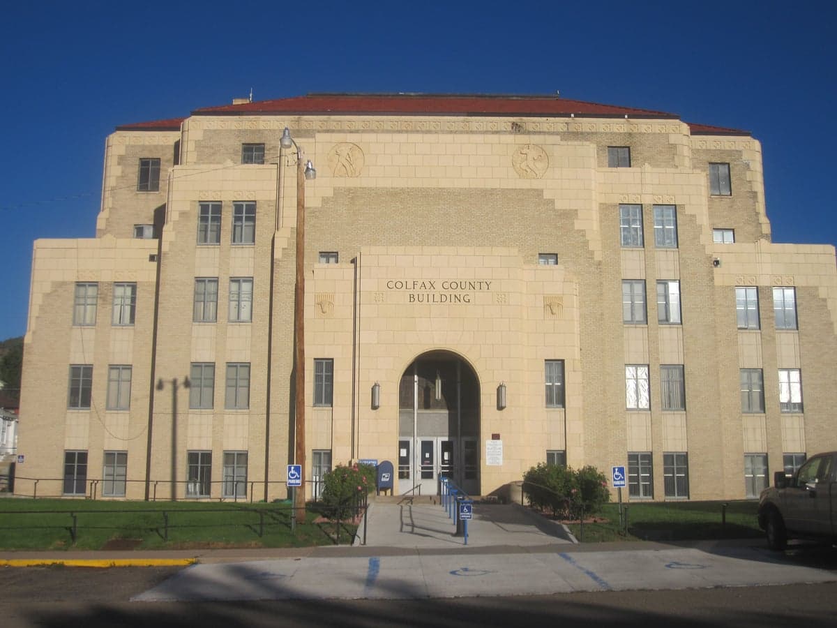
Photo: Wikipedia
Strategic Assessment of Colfax County
Strong survivability profile. Good buffer from population centers, with manageable environmental and tactical risks.
What does the Strategic Assessment tell us?
Our Strategic Assessment grades tactical survivability of an area. Major population centers, military targets, fallout zones, natural disasters, and border exposure all drive risk — lower exposure means a more defensible position in a crisis.
This is heavily inspired by Joel Skousen's Strategic Relocation book. Highly recommended you checkout the book ($)What does this tell us?
Our Strategic Assessment grades tactical survivability of an area. Major population centers, military targets, fallout zones, natural disasters, and border exposure all drive risk — lower exposure means a more defensible position in a crisis.
This is heavily inspired by Joel Skousen's Strategic Relocation book. Highly recommended you checkout the book ($)Strategic Pillars

Key Distances
Strategic Assessment Analysis
Colfax County, New Mexico, offers a compelling mix of geographic isolation and practical self-sufficiency for those prioritizing disaster readiness and long-term resilience. Located in the northeastern part of the state, the county sits far from major metropolitan targets like Denver or Albuquerque, yet remains within a manageable distance for supply runs or medical emergencies. Its low population density, high elevation, and access to the Sangre de Cristo Mountains provide natural buffers against both man-made and natural disruptions, making it a serious consideration for relocators focused on strategic security.
Geographic position and natural advantages for long-term security
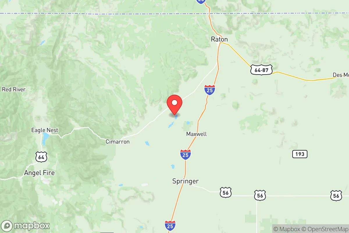
Colfax County's location is its primary strategic asset. The county seat, Raton, sits near the Colorado border along the I-25 corridor, while Cimarron and Eagle Nest lie deeper in the mountain valleys. This positioning places residents over 100 miles from any major population center, dramatically reducing exposure to fallout from a nuclear event or the cascading chaos of a city-wide grid failure. The terrain itself is a defensive asset: the eastern plains offer long sightlines, while the western portions of the county rise into the rugged Philmont Scout Ranch and Carson National Forest, providing natural cover and retreat options. Water is relatively abundant compared to other parts of the Southwest, with the Canadian River and multiple high-mountain lakes like Eagle Nest Lake offering reliable freshwater sources. The high elevation (Raton sits at 6,600 feet) also means cooler summers and less wildfire risk than lower-elevation desert areas, though winters are harsh and require serious preparation.
Risks, exposures, and proximity to fallout-relevant landmarks
While Colfax County is far from the highest-risk targets, it is not entirely free of exposure. The county lies roughly 150 miles from Los Alamos National Laboratory, a primary nuclear research facility that could be a target in a major conflict. Similarly, the Pueblo Chemical Depot in Colorado is about 120 miles north, and the Kirtland Air Force Base near Albuquerque is roughly 180 miles southwest. These distances are significant enough to reduce direct fallout risk, but prevailing wind patterns from the southwest could carry particulate matter into the region in a worst-case scenario. On the natural disaster front, the area faces moderate risks: flash flooding in arroyos, occasional severe winter storms that can close I-25 for days, and a low-to-moderate seismic risk. The county's primary vulnerability is its reliance on a single major highway (I-25) for resupply; a major blockage at Raton Pass could isolate the region for extended periods. For the disaster-conscious relocator, these are manageable risks that require planning rather than disqualifying concerns.
Practical resilience for a relocator: food, water, energy, and defensibility
Colfax County scores well on practical self-sufficiency metrics. Water is the strongest asset: the county sits atop the Raton Basin aquifer, and surface water from the Canadian River and mountain lakes is plentiful for those with proper rights or well access. Agricultural potential is limited by short growing seasons (Zone 5b-6a) and rocky soil, but small-scale livestock grazing and cold-hardy crops like potatoes, root vegetables, and hay are viable. The county has a strong ranching tradition, and local meat and dairy are available through regional producers. Energy resilience is moderate: the area is served by Tri-State Generation and Transmission, which relies on coal and natural gas, but solar potential is excellent due to high elevation and clear skies. Wood heating is common and practical given the surrounding forests. Defensibility is naturally strong: the mountainous terrain, limited road access (only a handful of paved routes into the county), and low population density make it easy to monitor approaches and maintain security. The Colfax County Sheriff's Office covers a vast area with limited resources, meaning residents are expected to be self-reliant. For a family or individual serious about preparedness, the county offers a realistic balance of isolation, resources, and manageable risk.
Overall, Colfax County presents a strong strategic picture for the disaster-conscious relocator. Its combination of distance from primary targets, abundant water, defensible terrain, and existing self-sufficiency infrastructure makes it one of the more viable options in the Mountain West. The trade-offs are real: harsh winters, limited medical facilities (the nearest trauma center is in Taos or Colorado Springs), and a thin local economy that requires either remote work or a pre-existing skillset. But for those willing to prepare and adapt, the county offers a level of natural resilience that few other locations in the continental United States can match. It is not a bug-out location for the unprepared; it is a long-term home for the serious strategist.

* Values derived from national, state, county, city and local statistics and may differ in a specific area. Last updated: 2026-07-21T14:43:19.000Z
Narrative content on this page is AI-generated and may contain mistakes. Verify any details that matter before acting on them.
ReloMaps may earn a commission from affiliate links at no extra cost to you.

