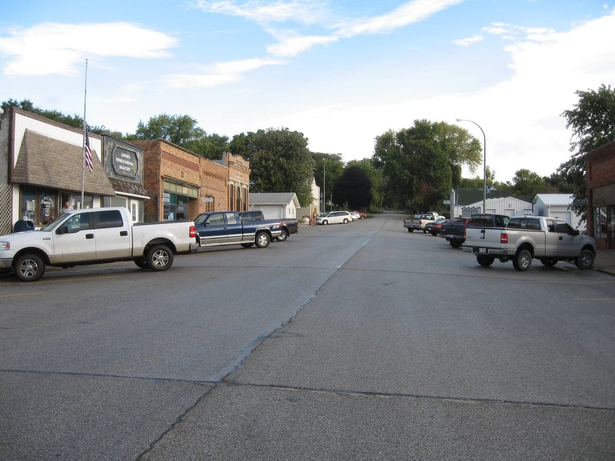
Photo: Wikipedia
Strategic Assessment of Moorhead, IA
Workable tactical position. Some exposure to population density or targets, but generally defensible in a crisis.
What does the Strategic Assessment tell us?
Our Strategic Assessment grades tactical survivability of an area. Major population centers, military targets, fallout zones, natural disasters, and border exposure all drive risk — lower exposure means a more defensible position in a crisis.
This is heavily inspired by Joel Skousen's Strategic Relocation book. Highly recommended you checkout the book ($)What does this tell us?
Our Strategic Assessment grades tactical survivability of an area. Major population centers, military targets, fallout zones, natural disasters, and border exposure all drive risk — lower exposure means a more defensible position in a crisis.
This is heavily inspired by Joel Skousen's Strategic Relocation book. Highly recommended you checkout the book ($)Strategic Pillars

Key Distances
Regional Safe Places
Below is our recommended "safe zones" in Iowa and the surrounding area based on our strategic heuristics. For most people, it's unrealistic to live in a “safe zone” full-time due to work, family or other personal reasons. They tend to be more rural. However, many of these areas are perfect for second homes and retreat properties that double as a vacation home or even a short-term rental.
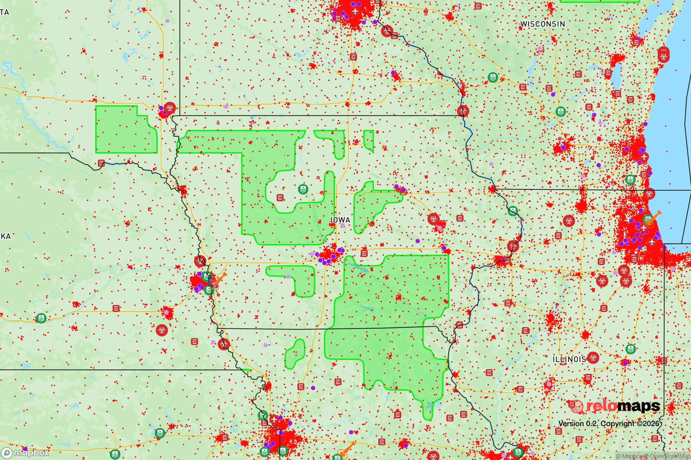
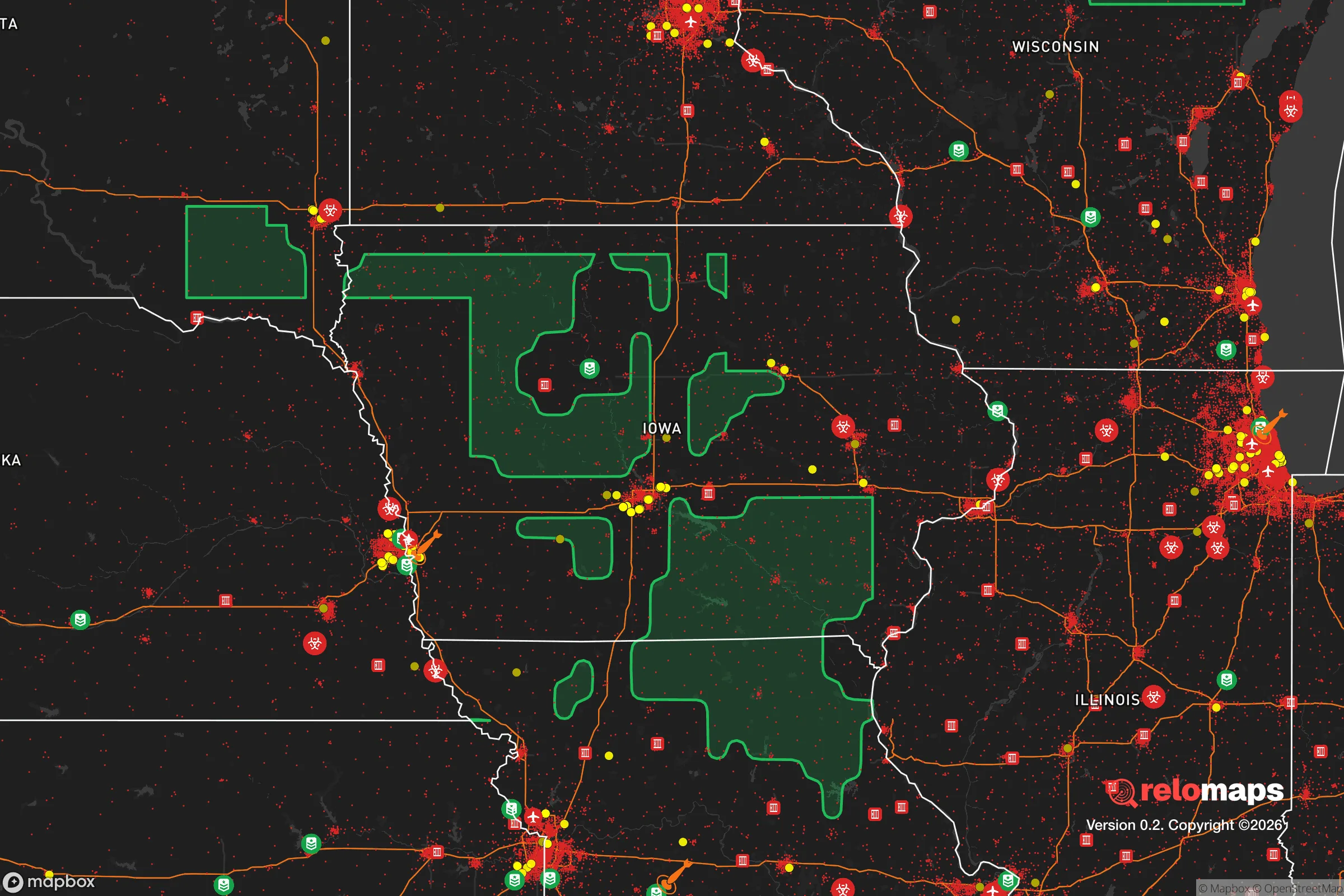


Important Note: For informational purposes only. This does not mean nothing bad ever happens in the green zones. Please use common sense. This is based on public data and modeled with AI. We tried to take a conservative approach but mistakes happen. We update this regularly as new information becomes available.
Solar Generator Recommendations
Backup power matters more here than in safer locations. We've picked three solar generators across budgets and capacity tiers — start with the budget unit if you only need a few essentials, or step up if you want to run a fridge and HVAC for days at a time.

Jackery Portable Power Station Explorer 300
Budget OptionPower on the Go: Weighing only 11 lbs, it's convenient to set up and store with book-sized foldable solar panels

BLUETTI Portable Power Station AC180
Designed for both indoor and outdoor scenarios, AC180 is highly capable as it has a robost capacity and continuous output power.

EF ECOFLOW DELTA Pro Ultra Power Station
Upgraded PickEcoFlow DELTA Pro Ultra is a whole-home energy system designed to grow with your family. Integrated with the Smart Home Panel 2, it scales to meet your evolving energy needs — keeping your home powered, intelligent, and secure through every stage of life.
We earn a commission, at no additional cost to you.
Strategic Assessment Analysis
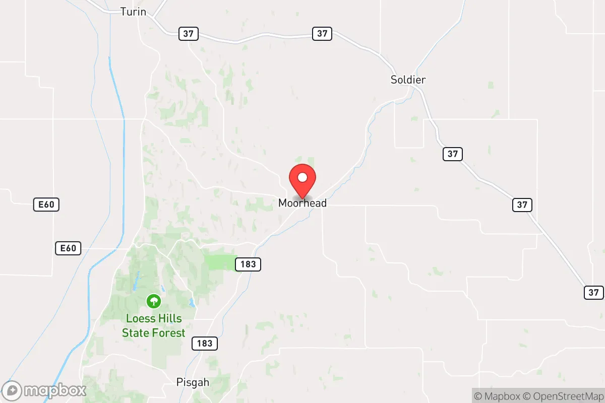
Moorhead, Iowa, sits in a position that demands a clear-eyed look for anyone prioritizing disaster readiness and self-sufficiency. Located in Monona County in the western part of the state, roughly 40 miles north of Council Bluffs and the Nebraska border, this small agricultural community of fewer than 200 residents offers a mix of genuine strategic advantages and notable vulnerabilities. For a relocator weighing resilience, Moorhead’s low population density and distance from major metropolitan centers provide a baseline of security, but its proximity to the Missouri River valley and certain regional infrastructure requires careful consideration.
Geographic position and natural advantages for self-sufficiency
Moorhead’s primary geographic strength is its location in the Loess Hills region, a narrow band of wind-deposited soil that creates elevated, well-drained terrain compared to the flat floodplains to the east and west. This topography offers natural defensibility—the hills provide visual cover and limit line-of-sight from main roads, while the elevation reduces the risk of riverine flooding that plagues communities directly along the Missouri River, such as nearby Onawa or Sioux City. The area sits roughly 1,100 feet above sea level, with the Loess Hills rising another 200 feet locally, giving residents a modest but meaningful height advantage for radio communications and line-of-sight observation. The surrounding Monona County is among the least densely populated in Iowa, with about 8 people per square mile, which translates to fewer neighbors competing for resources in a crisis. The region’s agricultural base is a concrete asset: corn, soybeans, and hay are the dominant crops, and the Missouri River alluvial plain to the west provides some of the most fertile soil in the state. For a relocator aiming for food self-sufficiency, the local growing season runs roughly from mid-April to early October, with an average of 155 frost-free days—adequate for most garden vegetables and small grains. The area’s water table is generally accessible via shallow wells (30-60 feet deep in the Loess Hills), though yields can vary with the loess soil’s permeability. The nearby Missouri River, about 10 miles west, is a reliable surface water source, but its heavy silt load and agricultural runoff mean any direct use would require robust filtration or treatment.
Risks, exposures, and proximity to fallout-relevant landmarks
The most significant risk for Moorhead is its location relative to potential man-made hazards. The area lies within roughly 100 miles of Offutt Air Force Base near Omaha, Nebraska—a major U.S. Strategic Command (STRATCOM) headquarters and a high-priority target in any conflict involving nuclear weapons. In a worst-case scenario, prevailing winds in this region typically blow from the west-southwest, meaning fallout from a strike on Offutt or the Omaha-Council Bluffs metropolitan area could drift directly over Monona County. The distance provides some attenuation, but the risk is non-trivial: fallout patterns from a ground burst could deposit hazardous particles within 24-48 hours depending on wind speed and precipitation. Additionally, the Fort Calhoun Nuclear Power Plant, about 35 miles south-southeast of Moorhead, was permanently shut down in 2016, but spent fuel remains stored on-site in dry casks—a potential, if lower-probability, hazard. On the natural disaster side, the Missouri River floodplain to the west is a recurring threat. While Moorhead’s elevation in the Loess Hills protects the town itself, the 2011 Missouri River floods demonstrated that prolonged high water can isolate communities and disrupt supply chains for weeks. The region also sits in Tornado Alley’s northern fringe; Monona County averages about 6 tornadoes per decade, with the most recent significant event being an EF-2 that struck near Whiting in 2022. Severe thunderstorms with damaging straight-line winds are more common, occurring several times per year. Winter storms can be severe, with average snowfall around 30 inches annually and occasional blizzards that can shut down rural roads for days. The area’s low population density is a double-edged sword: it reduces exposure to cascading urban failures, but it also means emergency services are thin—the nearest hospital is in Onawa (12 miles), with a Level IV trauma center, while the closest major medical facility is in Council Bluffs (40 miles). For a relocator, the key takeaway is that Moorhead’s primary risk is man-made and regional, not local; the natural hazards are manageable with standard rural preparedness.
Practical resilience for a relocator: food, water, energy, and defensibility
For someone serious about self-sufficiency, Moorhead offers a workable but not effortless foundation. Food: The agricultural environment is a clear advantage. Local farmers raise cattle, hogs, and poultry, and the Monona County Fairgrounds in Onawa host regular livestock auctions. For a relocator, establishing a garden is straightforward given the fertile loess soil, though it requires amendment with organic matter to improve water retention. The growing season supports cool-season crops (lettuce, peas, root vegetables) and warm-season staples (tomatoes, squash, beans). Deer and wild turkey are abundant in the Loess Hills, providing a protein source for those with hunting skills and proper licensing. Water: The most critical resilience factor. The municipal water supply for Moorhead comes from groundwater wells, but in a grid-down scenario, private wells are the primary option. Drilling a new well in the Loess Hills typically costs $5,000-$10,000 and can yield 5-15 gallons per minute—adequate for a household. Rainwater catchment is viable, with annual precipitation averaging 30 inches; a 1,000-square-foot roof can collect roughly 600 gallons per inch of rain. However, the loess soil’s fine texture means surface water ponds quickly during heavy rain, so proper drainage around any homestead is essential. Energy: The area has decent solar potential, with about 200 sunny days per year and an average of 4.5 peak sun hours daily. A modest 5 kW solar array can cover a typical household’s baseline needs, though winter cloud cover and snow accumulation reduce output. Wood is a practical heating fuel—the Loess Hills are forested with oak, hickory, and walnut, and firewood permits on state land are inexpensive. Propane is widely available for backup generation, with local suppliers in Onawa and Mapleton. Defensibility: The Loess Hills terrain provides natural cover, but the town itself is not fortified. Moorhead’s layout—a few blocks of homes along a grid—offers limited tactical advantage. For a relocator, a homestead on the hills’ backslopes, away from main roads (Highway 175 and 183), would provide better security through obscurity. The nearest law enforcement is the Monona County Sheriff’s Office in Onawa, with a response time of 15-30 minutes to Moorhead. The local population is predominantly older and conservative, which can be a social asset in a crisis—neighbors are likely to be armed and familiar with rural living—but it also means the community may lack the younger labor pool needed for collective defense or large-scale projects. The nearest National Guard armory is in Council Bluffs, 40 miles away, which is a positive in that military assets are not local but a negative in that response to a regional emergency would be delayed.
The overall strategic picture for Moorhead is one of moderate resilience with specific trade-offs. Its location in the Loess Hills offers genuine natural advantages—elevation, defensible terrain, and fertile soil—that support a self-sufficient lifestyle better than the surrounding flatlands. The low population density and agricultural base are strong positives for a relocator seeking to minimize dependence on fragile supply chains. However, the proximity to Offutt Air Force Base and the Omaha metro area introduces a non-trivial man-made risk that cannot be ignored, particularly given prevailing wind patterns. The natural hazards—flooding, tornadoes, winter storms—are manageable with standard rural preparedness, but the thin emergency services mean that self-reliance is not optional but mandatory. For a conservative-leaning individual or family who values independence, has the skills to manage a rural property, and is willing to accept the trade-off of isolation for security, Moorhead is a viable option. It is not a fortress, but it is a place where a prepared person can build a resilient life—provided they understand the risks and plan accordingly. The key is to treat Moorhead not as a retreat from the world, but as a base from which to engage it on your own terms, with eyes wide open to both the opportunities and the exposures.

* Values derived from national, state, county, city and local statistics and may differ in a specific area. Last updated: 2026-10-17T20:07:41.000Z
Narrative content on this page is AI-generated and may contain mistakes. Verify any details that matter before acting on them.
ReloMaps may earn a commission from affiliate links at no extra cost to you.

