
Photo: Wikipedia
Strategic Assessment of Stearns County
Workable tactical position. Some exposure to population density or targets, but generally defensible in a crisis.
What does the Strategic Assessment tell us?
Our Strategic Assessment grades tactical survivability of an area. Major population centers, military targets, fallout zones, natural disasters, and border exposure all drive risk — lower exposure means a more defensible position in a crisis.
This is heavily inspired by Joel Skousen's Strategic Relocation book. Highly recommended you checkout the book ($)What does this tell us?
Our Strategic Assessment grades tactical survivability of an area. Major population centers, military targets, fallout zones, natural disasters, and border exposure all drive risk — lower exposure means a more defensible position in a crisis.
This is heavily inspired by Joel Skousen's Strategic Relocation book. Highly recommended you checkout the book ($)Strategic Pillars

Key Distances
Strategic Assessment Analysis
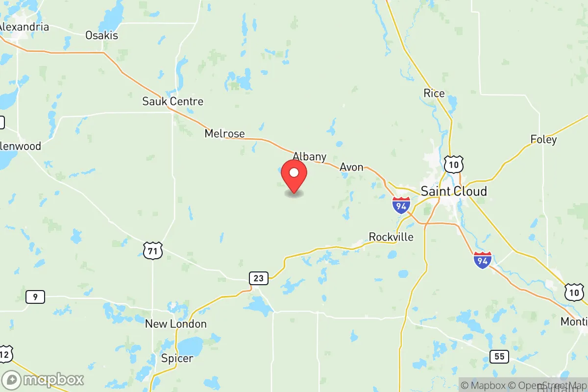
Stearns County, anchored by the city of St. Cloud, offers a strategic blend of Midwestern stability, economic diversity, and geographic insulation that makes it a compelling option for relocators prioritizing long-term resilience. Located roughly 70 miles northwest of the Minneapolis-St. Paul metro area, the county sits far enough from a major population center to avoid the worst-case fallout scenarios associated with a dense urban target, yet remains close enough to access critical medical and supply infrastructure when conditions are stable. The region's position along the Mississippi River and its status as a regional hub for healthcare, manufacturing, and agriculture provide a layered foundation for self-sufficiency that is rare in the Upper Midwest.
Geographic position and natural advantages for long-term stability
Stearns County occupies a transitional zone between the fertile agricultural plains of western Minnesota and the forested lake country to the north, giving it a diversified natural resource base. The Mississippi River forms its eastern border, providing a reliable surface water source that runs through the cities of St. Cloud, Sartell, and Sauk Rapids. This river corridor is a double-edged asset — it supports municipal water supplies and potential hydropower, but also concentrates infrastructure along a predictable axis. The county's interior is characterized by rolling moraines, numerous small lakes, and mixed hardwood forests, which offer natural cover, dispersed settlement patterns, and multiple microclimates that buffer against total crop failure. The presence of the St. Cloud Regional Airport and the intersection of Interstates 94 and Highway 23 make the area logistically accessible without being a primary transit chokepoint. For a relocator, the key advantage is that Stearns County sits outside the 50-mile blast and immediate fallout zone of the Twin Cities, while still being within a day's drive of that region's medical and industrial resources if needed.
Risk exposure, natural hazards, and proximity to potential fallout-relevant landmarks
While Stearns County avoids the highest-risk urban targeting scenarios, it is not without exposure. The county lies within Tornado Alley's northern fringe, and severe weather — including EF2+ tornadoes, derechos, and straight-line wind events — is a recurring seasonal threat. The flat-to-rolling terrain offers little natural windbreak, so property hardening and below-grade shelter are practical necessities rather than optional upgrades. Winter storms can produce prolonged power outages, with ice accumulation on power lines being a particular vulnerability in the Albany and Melrose areas. In terms of man-made risks, the county's most notable exposure is the Monticello Nuclear Generating Plant, located roughly 15 miles southeast of St. Cloud in adjacent Wright County. While the plant has a solid safety record, its presence places Stearns County within the 10-mile ingestion exposure pathway zone, meaning that a major incident could disrupt local agriculture and water supplies for weeks. Additionally, the county's rail corridors — used extensively for grain and ethanol transport — pass through Waite Park and St. Joseph, creating a modest but real risk of hazardous material spills or derailments near residential areas.
Practical resilience for a relocator: food, water, energy, and defensibility
Stearns County's agricultural base is its strongest resilience asset. The county is a top producer of corn, soybeans, and dairy in Minnesota, with a dense network of family farms, local grain elevators, and processing facilities that ensure food availability even during supply chain disruptions. The St. Cloud Farmers Market and numerous CSAs provide direct-to-consumer channels that bypass grocery distribution networks. Water access is excellent: the Mississippi River and the Sauk River system provide surface water, while the underlying Quaternary and Cretaceous aquifers offer reliable groundwater at moderate depths — most rural wells hit potable water between 50 and 150 feet. Energy infrastructure is moderately resilient. Xcel Energy and Great River Energy serve the region, with transmission lines that are above ground and vulnerable to ice and wind, but the presence of the St. Cloud Energy Center (a natural gas peaking plant) and multiple backup diesel generators at hospitals and the St. Cloud VA Medical Center provide localized generation capacity. For defensibility, the county's dispersed rural settlement pattern — with many homes on 5- to 40-acre parcels separated by agricultural fields — naturally limits the spread of civil unrest or resource conflicts. The Stearns County Sheriff's Office and local police departments in St. Cloud, Sartell, and Sauk Rapids maintain a visible presence, and the region's strong community ties and volunteer fire departments create a social fabric that supports mutual aid without relying on distant state resources.
The overall strategic picture for Stearns County is one of moderate-to-high resilience with manageable trade-offs. It offers the food security of a top agricultural county, the water abundance of a major river system, and the geographic buffer of being 70 miles from a primary target zone. The primary liabilities are the Monticello nuclear plant's proximity, seasonal severe weather, and the vulnerability of above-ground power infrastructure. For a relocator who is willing to invest in a storm shelter, maintain backup power, and establish relationships with local farmers and well drillers, Stearns County provides a defensible, resource-rich base that can sustain a household through most regional disruptions without requiring complete isolation from modern amenities.

* Values derived from national, state, county, city and local statistics and may differ in a specific area. Last updated: 2026-07-02T22:52:18.000Z
Narrative content on this page is AI-generated and may contain mistakes. Verify any details that matter before acting on them.
ReloMaps may earn a commission from affiliate links at no extra cost to you.

