
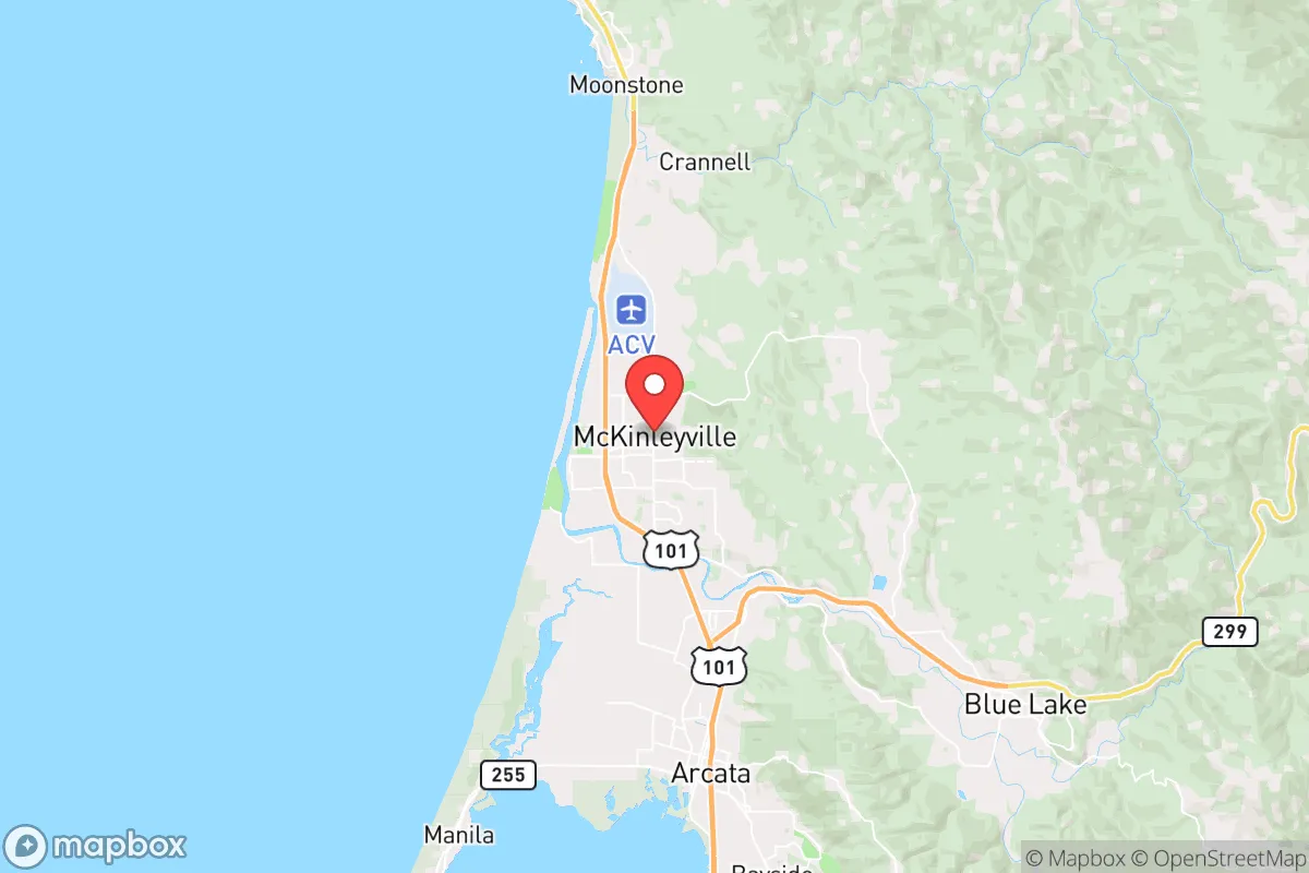
Strategic Assessment of McKinleyville, CA
Workable tactical position. Some exposure to population density or targets, but generally defensible in a crisis.
What does the Strategic Assessment tell us?
Our Strategic Assessment grades tactical survivability of an area. Major population centers, military targets, fallout zones, natural disasters, and border exposure all drive risk — lower exposure means a more defensible position in a crisis.
This is heavily inspired by Joel Skousen's Strategic Relocation book. Highly recommended you checkout the book ($)What does this tell us?
Our Strategic Assessment grades tactical survivability of an area. Major population centers, military targets, fallout zones, natural disasters, and border exposure all drive risk — lower exposure means a more defensible position in a crisis.
This is heavily inspired by Joel Skousen's Strategic Relocation book. Highly recommended you checkout the book ($)Strategic Pillars

Key Distances
Regional Safe Places
Below is our recommended "safe zones" in California and the surrounding area based on our strategic heuristics. For most people, it's unrealistic to live in a “safe zone” full-time due to work, family or other personal reasons. They tend to be more rural. However, many of these areas are perfect for second homes and retreat properties that double as a vacation home or even a short-term rental.




Important Note: For informational purposes only. This does not mean nothing bad ever happens in the green zones. Please use common sense. This is based on public data and modeled with AI. We tried to take a conservative approach but mistakes happen. We update this regularly as new information becomes available.
Solar Generator Recommendations
Backup power matters more here than in safer locations. We've picked three solar generators across budgets and capacity tiers — start with the budget unit if you only need a few essentials, or step up if you want to run a fridge and HVAC for days at a time.

Jackery Portable Power Station Explorer 300
Budget OptionPower on the Go: Weighing only 11 lbs, it's convenient to set up and store with book-sized foldable solar panels

BLUETTI Portable Power Station AC180
Designed for both indoor and outdoor scenarios, AC180 is highly capable as it has a robost capacity and continuous output power.

EF ECOFLOW DELTA Pro Ultra Power Station
Upgraded PickEcoFlow DELTA Pro Ultra is a whole-home energy system designed to grow with your family. Integrated with the Smart Home Panel 2, it scales to meet your evolving energy needs — keeping your home powered, intelligent, and secure through every stage of life.
We earn a commission, at no additional cost to you.
Strategic Assessment Analysis
McKinleyville, California, occupies a strategic position on the far North Coast that offers a rare combination of natural insulation and practical self-sufficiency potential. Located roughly 10 miles north of Eureka and 30 miles south of the Oregon border, this unincorporated community of about 15,000 residents sits on a coastal terrace between the Pacific Ocean and the dense forests of the Six Rivers National Forest. For a relocator prioritizing disaster readiness and long-term resilience, McKinleyville presents a mixed picture: genuine geographic advantages in terms of remoteness and resource access, offset by significant exposure to seismic hazards and the logistical challenges of a narrow, isolated transportation corridor.
Geographic position and natural advantages for long-term security
McKinleyville's primary resilience asset is its location within a region that is far removed from major population centers and the concentrated risks they carry. The nearest major metropolitan area, the San Francisco Bay Area, lies over 250 miles to the south, connected only by the winding, often-closed Highway 101. This distance provides a meaningful buffer against the fallout of a major urban disaster—whether natural, economic, or man-made. The community itself is not a primary target for any plausible strategic threat, and its low population density reduces the pressure on local resources during a crisis. The surrounding landscape offers abundant natural resources: the Pacific provides a virtually inexhaustible source of protein and transport, while the adjacent forests supply timber for construction and fuel. The Mad River, which forms the southern boundary of the area, and the smaller Redwood Creek to the north, offer reliable freshwater sources, though both are subject to seasonal fluctuations. The climate is a temperate maritime one—cool, wet winters and mild, dry summers—which eliminates the extreme heat or cold that stresses off-grid systems in other parts of the country. Annual rainfall averages around 40-50 inches, concentrated from October through April, which supports robust local agriculture and makes rainwater catchment a viable strategy for most of the year. The area's soils, while acidic and often clay-heavy, can support vegetable gardens and small orchards with amendment, and the long growing season (roughly March through November) allows for significant food production.
Risks, exposures, and proximity to fallout-relevant landmarks
The most serious vulnerability for McKinleyville is its position within the Cascadia Subduction Zone, a fault line capable of generating a magnitude 9.0+ earthquake and a subsequent tsunami. The community sits at an elevation of roughly 40-60 feet above sea level, which places much of it above the projected inundation zone for a worst-case tsunami, but the coastal bluffs and low-lying areas near the Mad River mouth are at risk. A major seismic event would almost certainly destroy the only road and rail links to the south—Highway 101 through the Eureka area and the railroad along the coast—effectively isolating the region for weeks or months. The same event would likely damage the local water and power infrastructure, which is already aging and vulnerable. Beyond seismic risk, the area faces periodic winter storms that can bring flooding, landslides, and tree falls, often knocking out power for days at a time. Wildfire risk is moderate compared to interior California, but the surrounding forests are dry by late summer, and a wind-driven fire could threaten the community's eastern edge. From a man-made risk perspective, McKinleyville's proximity to the Humboldt Bay nuclear power plant (decommissioned but still containing spent fuel) is a concern. The plant, located about 15 miles south near Eureka, houses spent fuel in dry cask storage; a major earthquake could compromise these casks, potentially releasing radioactive material that prevailing northwesterly winds could carry toward McKinleyville. The community is also within 100 miles of the Oregon coast, which hosts no major strategic targets, but the general isolation means that any large-scale disaster affecting the broader region would leave McKinleyville largely on its own for an extended period.
Practical resilience for a relocator: food, water, energy, and defensibility
For a relocator serious about self-sufficiency, McKinleyville offers a workable but not effortless path. Water is the strongest asset: the Mad River and local groundwater are generally clean and abundant, though a private well or a rainwater catchment system with adequate storage (at least 1,000 gallons per person) is essential for independence from the municipal supply, which is vulnerable to seismic disruption. Food production is feasible but requires effort. The climate supports year-round vegetable gardening with season extension (hoop houses, cold frames), and the area has a strong local food culture with farmers' markets and a handful of small farms. However, the soil is poor and requires significant amendment with compost and lime. Hunting (deer, elk, waterfowl) and fishing (salmon, steelhead, crab) are viable and culturally accepted, but require licenses and knowledge of local regulations. For long-term storage, the cool, damp climate makes root cellaring and dehydrating more practical than canning, which requires energy. Energy independence is achievable but capital-intensive. Solar is viable, but the frequent coastal fog and winter cloud cover reduce generation significantly; a system sized for winter production (roughly 3-4 peak sun hours in December) will be oversized for summer. A backup generator running on propane or diesel is nearly mandatory for extended grid outages, which are common. Wind power is an option on the exposed coastal bluffs, but small-scale turbines have mixed reliability. Defensibility is moderate. McKinleyville is a spread-out, unincorporated area with no centralized police force; the Humboldt County Sheriff's Office provides coverage, but response times can be long in a crisis. The community's layout—a mix of suburban subdivisions, rural parcels, and forested lots—means that a prepared relocator can choose a property with good sight lines, limited access points, and distance from main roads. The local population is generally rural and self-reliant, which can be a positive for community mutual aid, but also means that a newcomer should expect to build relationships and demonstrate competence before being fully accepted. The nearest hospital, Mad River Community Hospital in Arcata, is about 10 miles south, and the nearest trauma center is in Eureka; both would be overwhelmed in a major event, so medical self-sufficiency (training, supplies, and a plan for serious injury) is critical.
The overall strategic picture for McKinleyville is one of a high-potential but high-maintenance location. Its isolation from major population centers and strategic targets is a genuine advantage for a relocator seeking to avoid the fallout of urban collapse or a large-scale disaster. The abundance of water, the moderate climate, and the access to marine and forest resources provide a solid foundation for long-term self-sufficiency. However, the seismic risk is real and cannot be mitigated by location alone—anyone moving here must accept that a major earthquake is a when, not an if, and that the aftermath will involve complete isolation for an extended period. The practical work of building resilience—digging a well, installing solar, amending soil, storing supplies, and learning to hunt and fish—is entirely doable but requires upfront capital, time, and a willingness to live with the damp and the fog. For the right person—someone who values remoteness, is comfortable with hard work, and has a realistic understanding of the risks—McKinleyville offers a defensible, resource-rich base that is far from the chaos of the cities. It is not a retreat for the unprepared, but a solid option for the serious strategist.

* Values derived from national, state, county, city and local statistics and may differ in a specific area. Last updated: 2026-09-04T20:51:47.000Z
Narrative content on this page is AI-generated and may contain mistakes. Verify any details that matter before acting on them.
ReloMaps may earn a commission from affiliate links at no extra cost to you.

