Photo: Wikipedia
Strategic Assessment of Hampden County
Multiple tactical vulnerabilities. Population density, target proximity, or disaster risk are likely compounding. A retreat property and exit planning is required.
What does the Strategic Assessment tell us?
Our Strategic Assessment grades tactical survivability of an area. Major population centers, military targets, fallout zones, natural disasters, and border exposure all drive risk — lower exposure means a more defensible position in a crisis.
This is heavily inspired by Joel Skousen's Strategic Relocation book. Highly recommended you checkout the book ($)What does this tell us?
Our Strategic Assessment grades tactical survivability of an area. Major population centers, military targets, fallout zones, natural disasters, and border exposure all drive risk — lower exposure means a more defensible position in a crisis.
This is heavily inspired by Joel Skousen's Strategic Relocation book. Highly recommended you checkout the book ($)Strategic Pillars

Key Distances
Strategic Assessment Analysis
Hampden County, Massachusetts, presents a mixed strategic picture for the relocation-minded reader prioritizing resilience and self-sufficiency. While the county benefits from a robust water supply, a diversified local economy, and a location that is not a primary target for major strategic strikes, it sits within the densely populated Boston-to-Washington corridor and carries its own set of vulnerabilities tied to aging infrastructure and proximity to regional choke points. For a conservative-leaning individual or family weighing disaster readiness, the county offers a workable balance of access to resources and manageable risk, provided one chooses a specific town carefully and plans for the region’s inherent constraints.
Geographic position and natural advantages for long-term stability
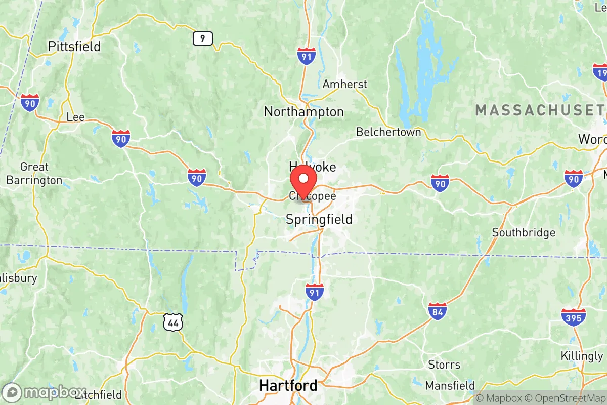
Hampden County’s geography is defined by the Connecticut River Valley, which provides a reliable freshwater artery and fertile agricultural land. The county is roughly 90 miles west of Boston and 30 miles north of Hartford, Connecticut, placing it outside the immediate blast radius of a major metropolitan strike while still within a day’s drive of critical supply chains. The terrain transitions from the flat, flood-prone river bottomlands to the steeper, wooded hills of the western part of the county, offering defensible positions in towns like Blandford and Tolland. The county’s position in the Pioneer Valley means it benefits from a moderate climate with four distinct seasons, reducing the risk of extreme weather events like hurricanes or wildfires compared to coastal or western states. The Quabbin Reservoir, located just to the northeast in neighboring Hampshire County, is a primary water source for much of eastern Massachusetts, but Hampden County itself draws from the Connecticut River and local groundwater, giving it a degree of water independence. For a relocator, the key natural advantage is the combination of a major river, arable land, and a topography that allows for both rural retreat and access to regional services.
Risks, exposures, and proximity to fallout-relevant landmarks
The primary strategic risk for Hampden County is its location within the Northeast Corridor, a high-value target area in any major conflict scenario. While the county itself does not host a major military base, it is roughly 60 miles from the Westover Air Reserve Base in Chicopee (just north of the county line) and 90 miles from the Naval Submarine Base New London in Groton, Connecticut. The county is also within 100 miles of the Pilgrim Nuclear Power Station (decommissioned but still containing spent fuel) and the Seabrook Station nuclear plant in New Hampshire. More immediately, the county contains the Springfield Armory National Historic Site, a symbolic landmark, and the city of Springfield itself is a regional transportation and logistics hub with rail yards and interstate junctions (I-90 and I-91) that could be secondary targets. The Connecticut River, while a resource, also presents a flood risk; the 2011 and 2013 floods caused significant damage in West Springfield and Agawam. For a reader concerned about fallout, the county’s distance from primary targets like Boston, New York, or Washington D.C. is a positive, but the presence of regional infrastructure and the prevailing wind patterns (typically west to east) mean that fallout from a strike on the New York City metro area could theoretically reach the county within hours. The risk is moderate but not negligible, and a relocator should consider a home with a basement or access to a community shelter, particularly in the eastern towns closer to the I-91 corridor.
Practical resilience for a relocator: food, water, energy, and defensibility
For a family or individual serious about self-sufficiency, Hampden County offers several concrete advantages. The Connecticut River Valley is one of New England’s most productive agricultural regions, with a strong network of farms, farmers’ markets, and community-supported agriculture (CSA) programs in towns like Hadley (just north of the county), Southwick, and Granby. The county’s soil and climate support a wide range of crops, from apples and corn to vegetables and dairy, meaning local food security is achievable. Water access is straightforward: the Connecticut River is the primary source, but many rural properties have private wells, and the county’s groundwater is generally reliable. The major vulnerability is energy. The county is served by Eversource and National Grid, and the grid is aging and susceptible to storm-related outages. Winter ice storms and occasional hurricanes (like the remnants of Hurricane Irene in 2011) can knock out power for days. Solar adoption is growing, but the region’s cloud cover and shorter winter days reduce its effectiveness compared to sunnier states. A relocator should plan for backup power, likely a generator or a well-insulated home with a wood stove. Defensibility varies dramatically by town. The urban core of Springfield, Holyoke, and Chicopee is dense and presents challenges for security and community cohesion in a crisis. However, the hill towns of the western part of the county—Blandford, Tolland, Russell, and Montgomery—offer low population density, limited road access, and a culture of rural self-reliance. These towns have active volunteer fire departments, local hunting and fishing traditions, and a general wariness of outsiders, which can be both a positive (strong community bonds) and a negative (difficulty integrating for newcomers). For a relocator, the strategic play is to buy land in a western hill town while maintaining a job or business in the Springfield area, creating a two-location resilience strategy.
The overall strategic picture for Hampden County is one of moderate resilience with clear trade-offs. The county is not a high-risk target, but it is not a remote redoubt either. Its strengths—abundant fresh water, productive farmland, a moderate climate, and a mix of urban and rural zones—make it a viable option for a relocator who wants to stay within driving distance of New England’s job markets and healthcare systems while building a self-sufficient homestead. The weaknesses—aging grid infrastructure, flood risk along the river, and the potential for fallout from a strike on the Northeast Corridor—are manageable with proper planning. The best towns for a conservative-leaning, preparedness-minded family are likely the western hill towns (Blandford, Tolland, Russell) or the more rural eastern towns like Wales and Holland, which offer low taxes, minimal government overreach, and a community that values independence. Avoid the urban core and the flood-prone river towns unless you have a specific reason to be there. Hampden County won’t be the safest place in a worst-case scenario, but it’s a solid, practical choice for someone who wants to be prepared without moving to the middle of nowhere.

* Values derived from national, state, county, city and local statistics and may differ in a specific area. Last updated: 2026-06-14T23:01:35.000Z
Narrative content on this page is AI-generated and may contain mistakes. Verify any details that matter before acting on them.
ReloMaps may earn a commission from affiliate links at no extra cost to you.

