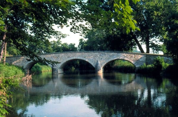
Photo: Wikipedia
Strategic Assessment of Washington County
Meaningful friction. Expect exposure to either population pressure, blast zones, or natural disaster risk. Consider buying a retreat property.
What does the Strategic Assessment tell us?
Our Strategic Assessment grades tactical survivability of an area. Major population centers, military targets, fallout zones, natural disasters, and border exposure all drive risk — lower exposure means a more defensible position in a crisis.
This is heavily inspired by Joel Skousen's Strategic Relocation book. Highly recommended you checkout the book ($)What does this tell us?
Our Strategic Assessment grades tactical survivability of an area. Major population centers, military targets, fallout zones, natural disasters, and border exposure all drive risk — lower exposure means a more defensible position in a crisis.
This is heavily inspired by Joel Skousen's Strategic Relocation book. Highly recommended you checkout the book ($)Strategic Pillars

Key Distances
Strategic Assessment Analysis
Washington County, Maryland, occupies a strategic position in the Great Valley region, offering a blend of geographic resilience and practical self-sufficiency that appeals to relocation-minded individuals and families with a conservative, preparedness-oriented outlook. Its location along the I-81 corridor, roughly 70 miles from both the Baltimore-Washington metropolitan area and the Pennsylvania state line, provides a buffer from dense urban centers while maintaining access to critical infrastructure. The county’s topography—rolling hills, limestone valleys, and the Potomac River frontage—creates natural defensibility and resource advantages that are rare in the Mid-Atlantic. For a reader weighing disaster readiness and long-term stability, Washington County presents a credible option, but one that requires a clear-eyed assessment of its exposure to both natural and man-made risks.
Geographic position and natural advantages for long-term stability
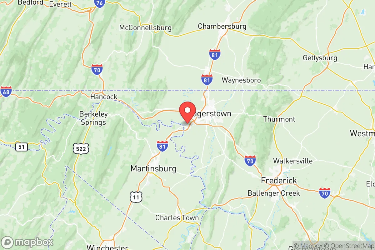
Washington County sits at the eastern edge of the Appalachian Ridge and Valley region, a geological transition zone that offers distinct defensive and resource benefits. The county’s western half, including the towns of Hancock and Clear Spring, is characterized by forested ridges and narrow valleys, while the eastern portion around Hagerstown and Boonsboro opens into the fertile Hagerstown Valley. This varied terrain provides multiple microclimates and water sources, reducing the risk of a single catastrophic event wiping out local agriculture or water supply. The Potomac River forms the county’s southern border, offering a reliable water source and a natural barrier against approach from the south. The county’s elevation—ranging from roughly 400 feet in the valley to over 1,800 feet on South Mountain—means it is less prone to the flooding that plagues lower-lying areas along the Chesapeake Bay. The presence of the Chesapeake and Ohio Canal National Historical Park and the Potomac River itself provides both recreational access and a potential emergency water supply, though treatment would be required. For a relocator, the key takeaway is that Washington County’s geography offers a mix of defensible high ground, fertile soil, and reliable water—assets that are increasingly valuable in an era of climate volatility and infrastructure strain.
Risks, exposures, and proximity to fallout-relevant landmarks
While Washington County’s location is a net positive for resilience, it is not immune to risks, and a serious assessment must account for its proximity to potential man-made threats. The county lies roughly 70 miles northwest of Washington, D.C., a primary target for any large-scale conflict or terrorist attack. This distance provides a meaningful buffer—fallout patterns from a D.C. event would likely drift east or northeast with prevailing winds, sparing the county from direct contamination—but it is not a guarantee. More immediately concerning is the county’s position along the I-81 corridor, a major north-south freight route that carries hazardous materials, including chemicals and fuels, through the heart of the county. A derailment or truck accident near Hagerstown or Williamsport could disrupt transportation and pose localized contamination risks. Additionally, the county is within 100 miles of the Three Mile Island nuclear facility in Pennsylvania (now decommissioned but still storing spent fuel) and the Calvert Cliffs nuclear plant in Maryland, though prevailing winds generally carry any potential plume away from the county. Natural risks are moderate: the area experiences occasional severe thunderstorms, flash flooding in low-lying areas near the Potomac, and the rare winter storm that can knock out power for days. Earthquakes are negligible. The overall risk profile is moderate—lower than the urban core but higher than remote rural areas in the West or Upper Midwest. For a relocator, the key concern is not a direct strike but the secondary effects of a major event in the D.C. metro area, such as refugee flows, supply chain disruptions, and economic shockwaves.
Practical resilience for a relocator: food, water, energy, and defensibility
Washington County offers a solid foundation for practical self-sufficiency, though it requires active effort to realize. The county’s agricultural base is strong: Washington County is one of Maryland’s top producers of dairy, poultry, and grain, with over 1,200 farms covering roughly 40% of the land area. Farmers’ markets in Hagerstown, Boonsboro, and Sharpsburg operate seasonally, and local food co-ops and CSAs are available. For a family looking to grow their own food, the growing season runs from April to October, with well-drained limestone soils that are productive for vegetables, fruit trees, and small grains. Water access is generally good: the Potomac River and its tributaries (Antietam Creek, Conococheague Creek) provide surface water, while groundwater is accessible via wells in most rural areas, though yields vary. The county’s water utility, Washington County Water and Sewer, serves the urbanized areas, but rural properties typically rely on private wells, which is a plus for self-sufficiency. Energy resilience is mixed: the county is served by Potomac Edison (part of FirstEnergy), and power outages are common during storms, especially in the western ridges. Solar potential is moderate—the area receives about 200 sunny days per year, less than the Southwest but enough for a well-sized off-grid system. Wood heating is viable, with ample forest cover in the western half of the county. Defensibility is a standout feature: the county’s terrain—narrow valleys, forested ridges, and the Potomac River—offers natural chokepoints and observation points. The South Mountain ridge, which runs north-south through the county, provides a natural defensive line and a retreat area. The county’s population density is low outside of Hagerstown (roughly 150,000 total population), meaning that a determined relocator can find a property with good visibility and limited approach routes. However, the I-81 corridor and the proximity to D.C. mean that a collapse scenario could bring significant numbers of people moving through the area, making community-level preparedness and mutual aid networks essential.
The overall strategic picture for Washington County is one of cautious optimism for a prepared relocator. It offers a rare combination of geographic defensibility, agricultural capacity, and water access within a region that is otherwise dominated by dense urban corridors. The county’s conservative lean—Washington County has voted Republican in every presidential election since 2000, with a strong local culture of self-reliance and gun ownership—aligns well with a preparedness-minded audience. The risks are real but manageable: the primary threat is not a direct event but the secondary effects of a crisis in the D.C. metro area, which would test the county’s infrastructure and social cohesion. For a single individual or family willing to invest in off-grid capabilities (solar, well, wood heat, food storage) and build local connections, Washington County represents a solid, defensible base. It is not a remote bunker—it is a working landscape with towns, farms, and a functioning economy—but that very fact makes it more sustainable for long-term habitation than a truly isolated location. The key is to choose a property wisely: avoid the I-81 corridor and the Hagerstown urban fringe, and instead look to the western valleys or the South Mountain foothills, where the terrain and community offer the best balance of access and security.

* Values derived from national, state, county, city and local statistics and may differ in a specific area. Last updated: 2026-07-25T16:23:46.000Z
Narrative content on this page is AI-generated and may contain mistakes. Verify any details that matter before acting on them.
ReloMaps may earn a commission from affiliate links at no extra cost to you.

