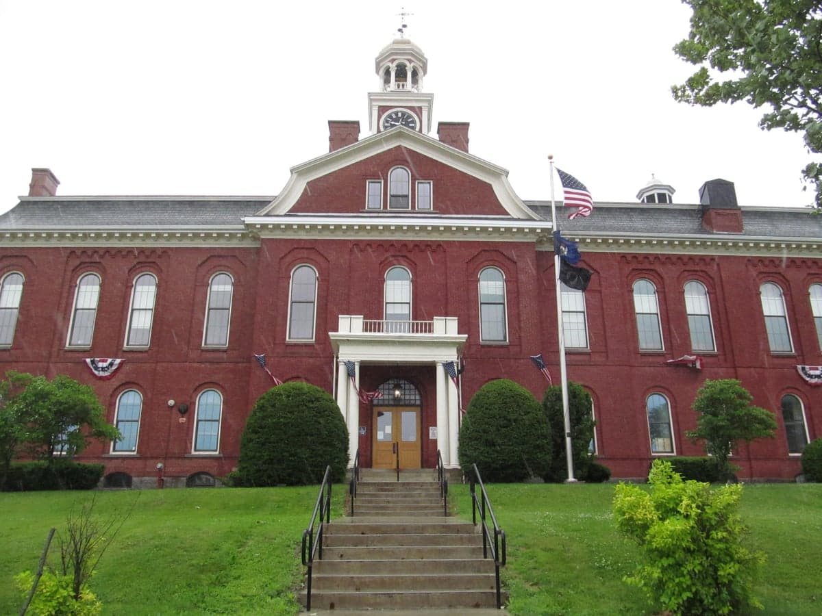
Photo: Wikipedia
Strategic Assessment of Aroostook County
Workable tactical position. Some exposure to population density or targets, but generally defensible in a crisis.
What does the Strategic Assessment tell us?
Our Strategic Assessment grades tactical survivability of an area. Major population centers, military targets, fallout zones, natural disasters, and border exposure all drive risk — lower exposure means a more defensible position in a crisis.
This is heavily inspired by Joel Skousen's Strategic Relocation book. Highly recommended you checkout the book ($)What does this tell us?
Our Strategic Assessment grades tactical survivability of an area. Major population centers, military targets, fallout zones, natural disasters, and border exposure all drive risk — lower exposure means a more defensible position in a crisis.
This is heavily inspired by Joel Skousen's Strategic Relocation book. Highly recommended you checkout the book ($)Strategic Pillars

Key Distances
Strategic Assessment Analysis
Aroostook County, often called "The Crown of Maine," offers a distinct strategic advantage for those prioritizing resilience and self-sufficiency: extreme geographic isolation paired with robust natural resources. This vast, rural county—larger than Connecticut and Rhode Island combined—sits directly on the Canadian border, far from major population centers like Boston or New York, which dramatically reduces exposure to both natural disaster cascades and man-made threats. For a relocator seeking a buffer from the vulnerabilities of dense urban and suburban life, Aroostook County presents a compelling, if demanding, option where space, water, and a degree of defensibility are built into the landscape.
Geographic position and natural advantages: What makes the location defensible
Aroostook County’s primary resilience asset is its sheer distance from high-risk zones. The nearest major city, Bangor, is roughly 150 miles to the south; Montreal is about 220 miles west. This remoteness places it well outside the primary blast and fallout zones of any conceivable scenario involving targets like the oil refineries in Portland or the population density of the Boston-Washington corridor. The county is bounded by the St. John and Allagash Rivers to the north and east, which act as natural barriers and offer immense freshwater resources. The presence of Loring Commerce Centre (the former Loring Air Force Base) near Limestone is a notable landmark—while decommissioned, its legacy as a strategic bomber base means the area was historically on target lists, but its current status and low activity levels significantly reduce its strategic value as a target today. Key population centers include Presque Isle, Caribou, Fort Kent, and Houlton, each serving as small logistical hubs with their own airports, hospitals, and supply corridors. The St. John Valley’s topography—primarily rolling hills and dense forests—offers numerous choke points along rural roads, making unauthorized movement more difficult than in flat, open terrain. The entire region is a designated USDA "hardiness zone" 3b-4a, which limits the growing season, but the county’s massive freshwater reserves—including the Aroostook River and the Saint John River system—provide reliable hydration even during droughts.
Risks, exposures, and proximity to fallout-relevant landmarks: What threats remain
While isolated, Aroostook County is not risk-free. Its most significant exposure is its proximity to the New Brunswick border, particularly the Canadian side of the Point Lepreau Nuclear Generating Station (about 100 miles from the county line). In a worst-case scenario involving that facility, prevailing winds could carry fallout across the St. John Valley. Additionally, the primary transportation routes—US Route 1 and Interstate 95 (which terminates in Houlton)—are single-point-of-failure corridors for ground supply re-supply. A hazmat spill or large-scale accident on these narrow roads could cripple logistics for days. The county also lies within a modest seismic zone; while not active like California, the Northeast can experience unusual temblors (e.g., the 2012 magnitude 4.0 near Waterville). Severe winter storms are the most common recurring hazard, with annual snowfall averaging 100-120 inches in the north, which can collapse structures and isolate communities for days. Notably, the Armed Forces Reserve Center in Bangor and the Maine Army National Guard facilities in Houlton and Presque Isle are modest military presences, but their low profile compared to major bases (e.g., Fort Drum to the south) means they are unlikely to be primary targets in a conflict. The absence of refineries, large air force bases, major ports, or significant semiconductor or defense manufacturing plants makes the county a very low-value target for any adversary. The biggest real threat here is not a bomb but a prolonged power grid failure during winter—without generators, the cold becomes a critical survival challenge.
Practical resilience for a relocator: Food, water, energy, and defensibility
For someone serious about self-sufficiency, Aroostook County offers tangible advantages. Water is abundant—most rural properties sit on aquifers, and the county’s lakes and rivers provide surface water year-round, though filtration is advisable due to agricultural runoff. Food production is viable but constrained by the short growing season (roughly 90-110 days). Potatoes and hardy greens (like kale and chard) are staples, and the region’s extensive forests offer wild game (deer, moose, bear) and forage (mushrooms, berries). Local agriculture is dominated by commercial potato farms centered around Caribou and Mars Hill, but smaller farms and farmer’s markets exist densely in the Aroostook Valley. Energy self-sufficiency is achievable: wood and pellet stoves are common, and solar panels are effective even in northern latitudes due to long summer days. However, backup generators or propane heating are near-essential for winter grid failures. Defensibility is moderate—the landscape offers natural concealment (thick forest, rolling terrain) and few points of ingress/egress along US-1 and I-95. Distances between towns (e.g., 50 miles from Houlton to Presque Isle) mean population density is among the lowest east of the Mississippi, reducing the risk of social collapse from mass migration. The trade-off is that emergency services response times can exceed 30 minutes, and specialized medical care requires transport to Bangor or even farther. The region’s economic reliance on agriculture and a small service sector means jobs are limited, but land is cheap—acreage can be found for under $2,000 per acre—making it attractive for those with remote work or savings. The community culture is distinctly independent and self-reliant, with a deep tradition of hunting, trapping, and home preservation.
Overall, Aroostook County presents a graded strategic picture: outstanding for those seeking genuine isolation from major threats and rich natural resources, but demanding in terms of climate, practical skills, and financial cushion. The lack of high-value targets nearby dramatically reduces man-made risks compared to counties near military bases or industrial corridors. For a single individual or family willing to invest in a wood stove, solar panels, a well pump, and winter-ready housing, the county offers one of the best natural buffers in the contiguous US. The main vulnerability remains the harsh winter—preparedness must account for months of sub-zero temperatures and potential isolation. For the resilience-focused relocator who values space, water security, and low strategic exposure over convenience and temperate weather, Aroostook County deserves serious, careful consideration as a long-term refuge.

* Values derived from national, state, county, city and local statistics and may differ in a specific area. Last updated: 2026-07-01T05:27:24.000Z
Narrative content on this page is AI-generated and may contain mistakes. Verify any details that matter before acting on them.
ReloMaps may earn a commission from affiliate links at no extra cost to you.

