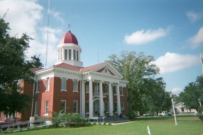
Photo: Wikipedia
Strategic Assessment of Lucedale, MS
Workable tactical position. Some exposure to population density or targets, but generally defensible in a crisis.
What does the Strategic Assessment tell us?
Our Strategic Assessment grades tactical survivability of an area. Major population centers, military targets, fallout zones, natural disasters, and border exposure all drive risk — lower exposure means a more defensible position in a crisis.
This is heavily inspired by Joel Skousen's Strategic Relocation book. Highly recommended you checkout the book ($)What does this tell us?
Our Strategic Assessment grades tactical survivability of an area. Major population centers, military targets, fallout zones, natural disasters, and border exposure all drive risk — lower exposure means a more defensible position in a crisis.
This is heavily inspired by Joel Skousen's Strategic Relocation book. Highly recommended you checkout the book ($)Strategic Pillars

Key Distances
Regional Safe Places
Below is our recommended "safe zones" in Mississippi and the surrounding area based on our strategic heuristics. For most people, it's unrealistic to live in a “safe zone” full-time due to work, family or other personal reasons. They tend to be more rural. However, many of these areas are perfect for second homes and retreat properties that double as a vacation home or even a short-term rental.
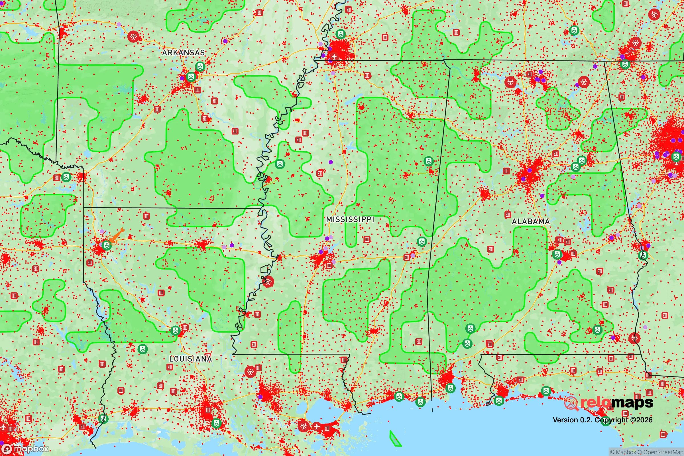
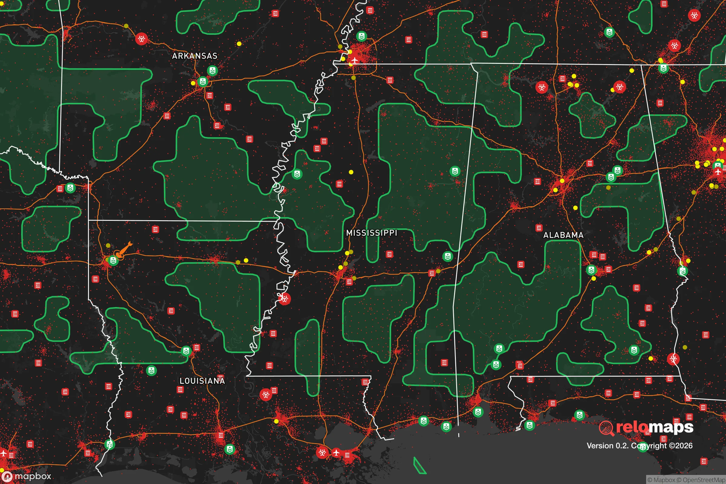


Important Note: For informational purposes only. This does not mean nothing bad ever happens in the green zones. Please use common sense. This is based on public data and modeled with AI. We tried to take a conservative approach but mistakes happen. We update this regularly as new information becomes available.
Solar Generator Recommendations
Backup power matters more here than in safer locations. We've picked three solar generators across budgets and capacity tiers — start with the budget unit if you only need a few essentials, or step up if you want to run a fridge and HVAC for days at a time.
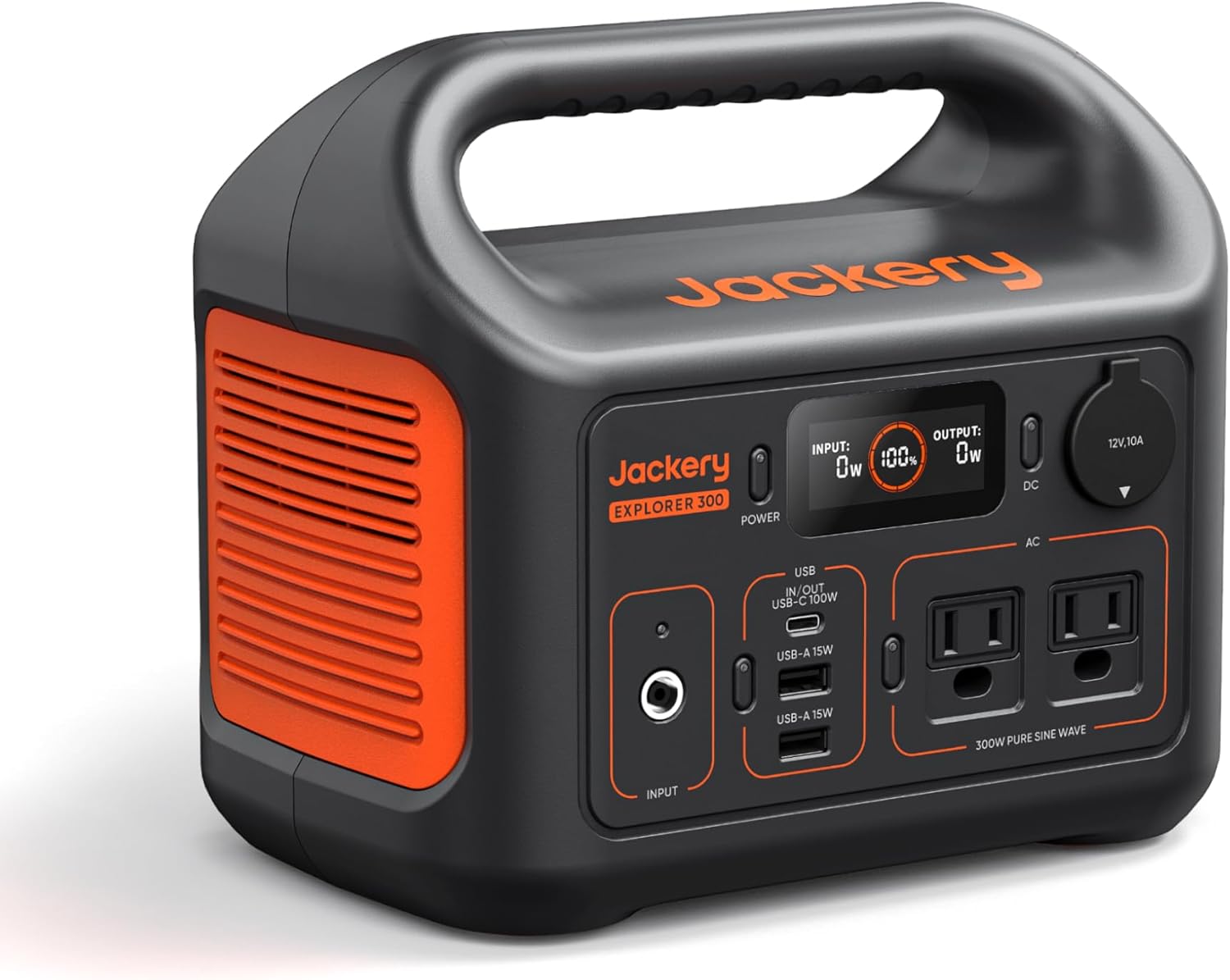
Jackery Portable Power Station Explorer 300
Budget OptionPower on the Go: Weighing only 11 lbs, it's convenient to set up and store with book-sized foldable solar panels

BLUETTI Portable Power Station AC180
Designed for both indoor and outdoor scenarios, AC180 is highly capable as it has a robost capacity and continuous output power.

EF ECOFLOW DELTA Pro Ultra Power Station
Upgraded PickEcoFlow DELTA Pro Ultra is a whole-home energy system designed to grow with your family. Integrated with the Smart Home Panel 2, it scales to meet your evolving energy needs — keeping your home powered, intelligent, and secure through every stage of life.
We earn a commission, at no additional cost to you.
Strategic Assessment Analysis
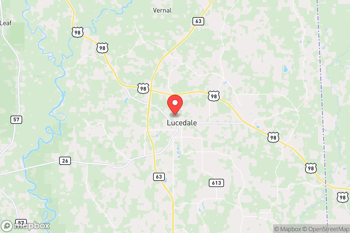
Lucedale sits at the crossroads of George County in southeast Mississippi, roughly 35 miles north of the Gulf Coast and about 60 miles northeast of Mobile, Alabama. For a reader weighing disaster readiness and self-sufficiency, that inland position is the town's core strategic asset: it keeps Lucedale out of the coastal surge zone and hurricane landfall corridor while remaining close enough to Interstate 10 and U.S. Highway 98 for practical access. The trade-off is that George County is exposed to the same severe weather, timber-industry economics, and rural infrastructure limits that shape most of the Pine Belt — advantages and vulnerabilities that deserve an honest look before anyone buys land here.
Where Lucedale sits and why the inland Gulf Coast location matters
Lucedale is the county seat of George County, a rural jurisdiction of roughly 25,000 people that borders Mobile County, Alabama, to the east. The town anchors a landscape of pine timber, cattle pasture, and small farms on the Pascagoula River watershed, with the Leaf and Chickasawhay rivers converging nearby to form one of the largest undammed river systems in the lower 48. That geography delivers several concrete resilience benefits:
- Inland distance from the Gulf reduces exposure to storm surge and the worst of hurricane wind fields compared with Gulfport, Biloxi, or Pascagoula, though tropical systems still bring wind and flooding rain.
- Freshwater abundance from the Pascagoula system and local aquifers supports wells and small-scale agriculture without the water-stress concerns of the Southwest.
- Productive land — the county's timber and cattle base means acreage for gardens, livestock, and food production is affordable and available.
- Regional access via U.S. 98 and I-10 puts Mobile, Hattiesburg, and the coast within roughly an hour, useful for supplies and medical care in normal times.
The flip side of rural abundance is thin redundancy: a single hospital (George Regional in Lucedale), limited big-box retail, and a small tax base mean the county leans on outside systems for specialized services.
Risks, exposures, and proximity to fallout-relevant landmarks
The most significant man-made exposure in the region is the industrial corridor around Pascagoula and Moss Point, roughly 40 miles south, home to the Chevron Pascagoula Refinery — one of the largest refineries in the United States — plus Ingalls Shipbuilding and a cluster of chemical and LNG facilities. A major industrial accident, fire, or release there would be a downwind concern depending on wind direction, and Lucedale's inland position is a modest buffer rather than a guarantee. The broader Gulf Coast corridor, including Mobile's port and heavy industry about 60 miles east, adds to the regional hazard profile.
On the nuclear front, the region's nearest commercial plant is Plant Vogtle near Waynesboro, Georgia, well over 200 miles away, and the Grand Gulf Nuclear Station near Port Gibson, Mississippi, sits roughly 150 miles to the northwest — far enough that direct fallout risk is low, though prevailing weather patterns and the concentration of Gulf Coast industry and military installations (including Keesler Air Force Base in Biloxi and Naval Construction Battalion Center Gulfport) make the wider region a strategic target cluster. Natural hazards are the more immediate concern: hurricanes and tropical storms, tornadoes, and riverine flooding are recurring events, and the county's timber economy means extended power outages after major storms are a realistic scenario. Wildfire risk is moderate given the pine forests, and summer heat and humidity are a genuine health factor for anyone without reliable power.
Practical resilience for a relocator: food, water, energy, and defensibility
For a family or individual serious about preparedness, Lucedale's practical strengths are land, water, and community scale. Rural acreage in George County is inexpensive by national standards, and a few acres support a serious garden, poultry, and a small herd — the county's agricultural extension and 4-H networks are active, and local farm supply stores stock the basics. Water is the standout: private wells are common outside town, rainfall is abundant (roughly 60 inches a year), and the Pascagoula River system provides a backup surface source with treatment. Energy resilience requires planning — the grid is exposed to storm outages, so a generator, propane storage, or a modest solar array with battery backup is a sensible investment, and the long cooling season makes redundancy for refrigeration and air conditioning a priority rather than a luxury.
Defensibility is a mixed picture. The area's low population density and strong church- and family-based social networks are real assets — rural Mississippi communities tend to self-organize after storms, and neighbors helping neighbors is the norm. On the other hand, the county's poverty rate runs well above the national average, property crime is a persistent concern in parts of the region, and emergency services are volunteer-heavy with longer response times outside Lucedale's core. A defensible property here means visible sightlines, a secure perimeter, a reliable firearm and training if that fits your household, and — most importantly — relationships with neighbors. Practically, newcomers should also budget for the realities of rural life: a vehicle you can maintain yourself, stored fuel, a deep pantry, and a documented plan for medications and medical care, since the nearest full-service hospital network is in Mobile or Hattiesburg.
Strategically, Lucedale is a solid but not exceptional choice for a resilience-minded relocator. It earns high marks on land affordability, freshwater, food-production potential, and distance from the coastal surge zone and major industrial targets, and it offers a low-density, socially cohesive setting that tends to function well in extended outages. It loses points on hurricane and tornado exposure, storm-driven grid fragility, limited local medical and retail infrastructure, and the downwind proximity — however buffered — to the Pascagoula refinery complex and the broader Gulf Coast target cluster. For a reader who wants a rural, self-sufficient base within reach of the Gulf but not on it, Lucedale is a reasonable candidate; for someone seeking maximum distance from industrial and strategic hazards, the interior of the state or the Pine Belt further north offers more separation at similar cost.

* Values derived from national, state, county, city and local statistics and may differ in a specific area. Last updated: 2026-11-03T10:23:38.000Z
Narrative content on this page is AI-generated and may contain mistakes. Verify any details that matter before acting on them.
ReloMaps may earn a commission from affiliate links at no extra cost to you.

