Photo: Wikipedia
Strategic Assessment of Livingston, MT
Workable tactical position. Some exposure to population density or targets, but generally defensible in a crisis.
What does the Strategic Assessment tell us?
Our Strategic Assessment grades tactical survivability of an area. Major population centers, military targets, fallout zones, natural disasters, and border exposure all drive risk — lower exposure means a more defensible position in a crisis.
This is heavily inspired by Joel Skousen's Strategic Relocation book. Highly recommended you checkout the book ($)What does this tell us?
Our Strategic Assessment grades tactical survivability of an area. Major population centers, military targets, fallout zones, natural disasters, and border exposure all drive risk — lower exposure means a more defensible position in a crisis.
This is heavily inspired by Joel Skousen's Strategic Relocation book. Highly recommended you checkout the book ($)Strategic Pillars

Key Distances
Regional Safe Places
Below is our recommended "safe zones" in Montana and the surrounding area based on our strategic heuristics. For most people, it's unrealistic to live in a “safe zone” full-time due to work, family or other personal reasons. They tend to be more rural. However, many of these areas are perfect for second homes and retreat properties that double as a vacation home or even a short-term rental.
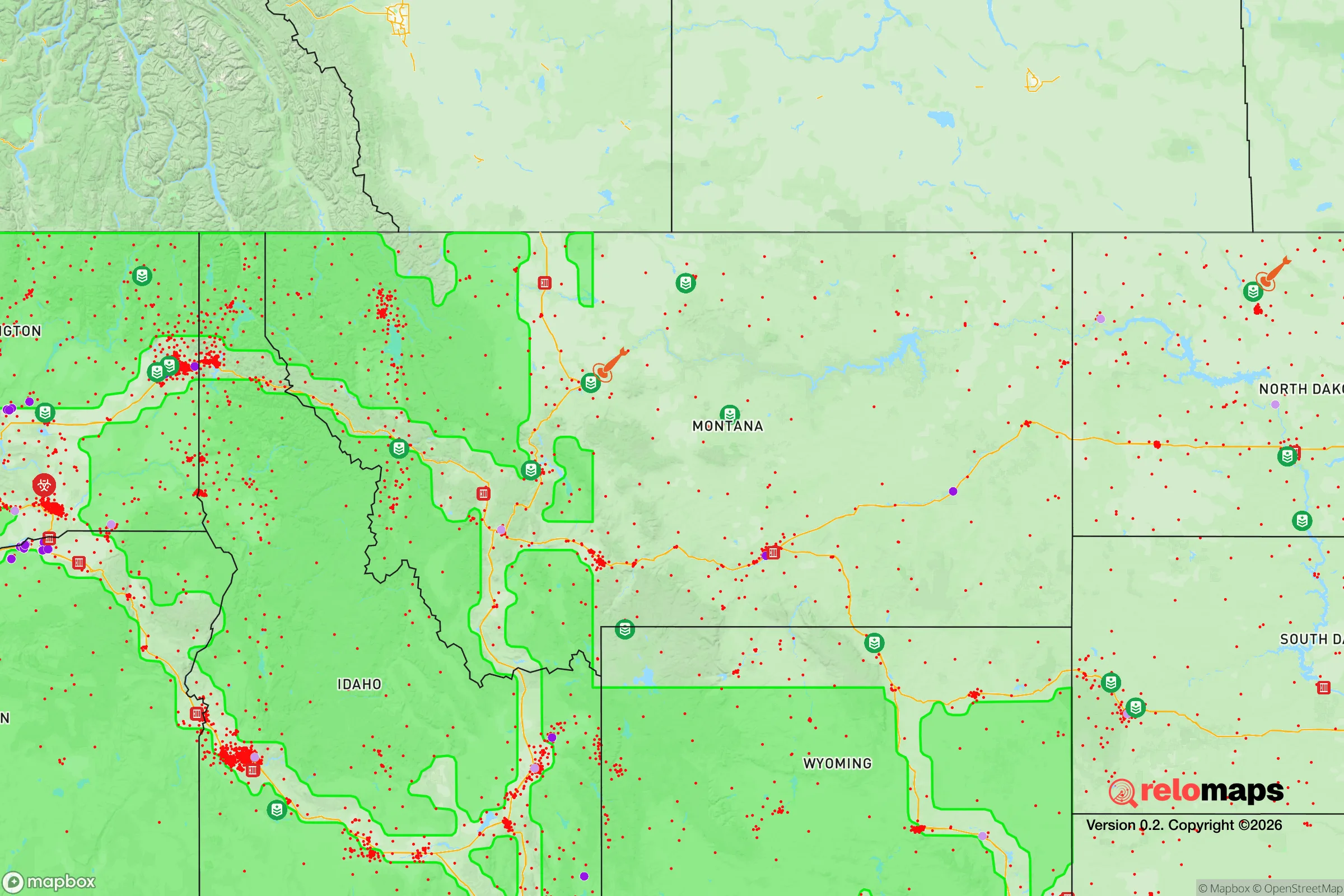

Important Note: For informational purposes only. This does not mean nothing bad ever happens in the green zones. Please use common sense. This is based on public data and modeled with AI. We tried to take a conservative approach but mistakes happen. We update this regularly as new information becomes available.
Solar Generator Recommendations
Backup power matters more here than in safer locations. We've picked three solar generators across budgets and capacity tiers — start with the budget unit if you only need a few essentials, or step up if you want to run a fridge and HVAC for days at a time.

Jackery Portable Power Station Explorer 300
Budget OptionPower on the Go: Weighing only 11 lbs, it's convenient to set up and store with book-sized foldable solar panels

BLUETTI Portable Power Station AC180
Designed for both indoor and outdoor scenarios, AC180 is highly capable as it has a robost capacity and continuous output power.

EF ECOFLOW DELTA Pro Ultra Power Station
Upgraded PickEcoFlow DELTA Pro Ultra is a whole-home energy system designed to grow with your family. Integrated with the Smart Home Panel 2, it scales to meet your evolving energy needs — keeping your home powered, intelligent, and secure through every stage of life.
We earn a commission, at no additional cost to you.
Strategic Assessment Analysis
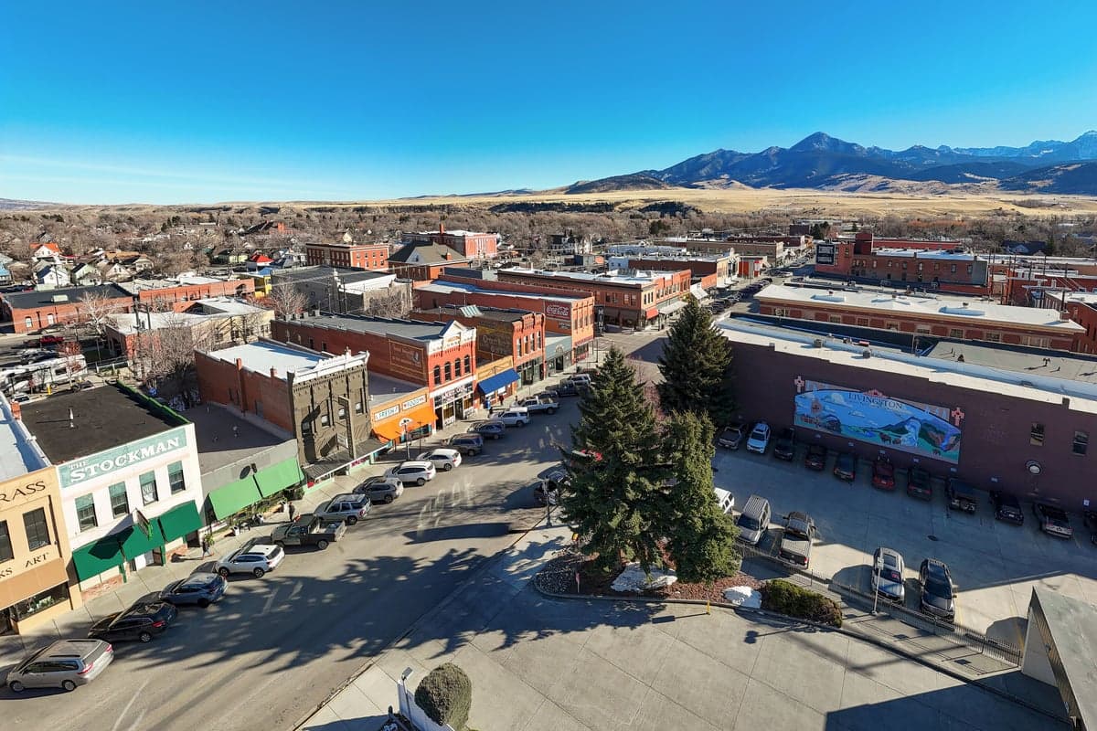
Livingston, Montana, sits in a sweet spot that few other towns in the Lower 48 can claim: it’s far enough from major population centers to avoid the worst of cascading collapse, yet close enough to critical infrastructure and natural resources to matter when things go sideways. Nestled at the northern edge of the Paradise Valley, with the Yellowstone River running through town and the Absaroka-Beartooth Wilderness at its back, Livingston offers a rare combination of defensible geography, water abundance, and relative isolation from the chaos that will likely engulf the coasts and the I-5/I-95 corridors. For a relocator thinking in terms of decades, not election cycles, this is a place where the strategic calculus tilts heavily in your favor—provided you understand the trade-offs.
Geographic position and natural advantages for long-term security
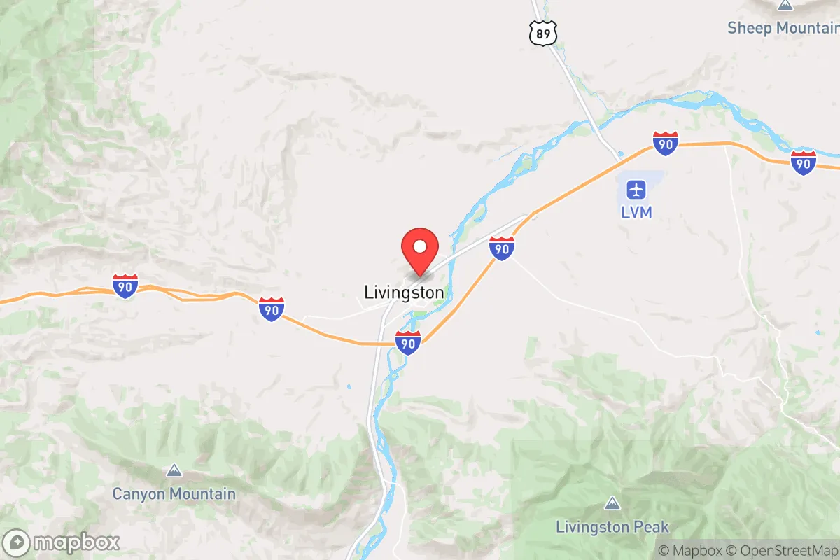
Livingston’s location is its primary asset. It sits at the junction of Interstates 90 and 89, roughly 25 miles east of Bozeman and 55 miles west of Big Timber, but the real value is what lies to the south: the Absaroka-Beartooth Wilderness, one of the largest contiguous roadless areas in the Lower 48. That wilderness provides a natural buffer against any large-scale movement of people or resources, and it’s a reliable source of game, water, and timber if supply chains falter. The Yellowstone River, which runs through town, is a perennial water source that doesn’t depend on snowpack alone—it’s fed by the largest high-elevation lake in North America (Yellowstone Lake) and flows year-round. For a prepper, that’s a non-negotiable advantage. The surrounding valley is also prime agricultural land, with a growing season long enough for cold-hardy crops like potatoes, carrots, and kale, and the nearby ranches produce beef and hay that could sustain a local food network long after the grocery store shelves go bare. The elevation (4,500 feet) and dry climate mean fewer disease vectors than the humid South or the Pacific Northwest, and the winter cold—while harsh—actually works in your favor by limiting the mobility of any unprepared population that might try to move inland from the coasts.
Risks, exposures, and proximity to fallout-relevant landmarks
No place is a fortress, and Livingston has its share of vulnerabilities. The most obvious is its proximity to Bozeman, which has exploded in population over the last decade and now sits at roughly 55,000 people. In a crisis, that population will look to the surrounding rural areas for resources, and Livingston is the first logical stop along I-90 heading east. The Gallatin Valley’s growth has also brought in a wave of wealthy transplants who may not have the skills or mindset to survive a prolonged disruption—meaning they’ll become a liability, not an asset. Further out, the Yellowstone Caldera (the supervolcano under Yellowstone National Park) is a low-probability, high-consequence risk. An eruption would devastate the entire region, but the ashfall pattern would likely deposit the heaviest material to the east and northeast, sparing Livingston from the worst. More immediate concerns are the rail lines that run through town—the Montana Rail Link mainline carries hazardous materials, including crude oil and chemicals, through the heart of Livingston. A derailment or targeted attack could contaminate the river or force an evacuation. On the plus side, there are no major military installations, nuclear power plants, or large-scale industrial targets within a 100-mile radius. Malmstrom Air Force Base (missile fields) is 200 miles north, and the nearest major city with strategic value is Billings (120 miles east) or Butte (90 miles west). For a relocator worried about nuclear fallout or EMP effects, Livingston’s distance from these targets is a significant advantage—you’re not on anyone’s first-strike list.
Practical resilience for a relocator: food, water, energy, and defensibility
Water is the first thing to lock down, and Livingston has it in spades. The Yellowstone River is a Class I water source, meaning it requires minimal treatment for drinking, and the town’s municipal supply comes from wells tapping into the alluvial aquifer. For a private well, the water table sits at about 20-40 feet in most of the valley, so a hand pump or solar-powered pump is a realistic backup. Food security is more complicated. The local growing season runs from late May to early September—about 100 days—which is tight for corn or tomatoes but fine for root vegetables, greens, and grains. The Paradise Valley is dotted with small farms and ranches, and the Livingston Farmers Market is a good entry point for building relationships with producers. But don’t expect to buy bulk grain or seed stock at the local co-op; you’ll need to plan ahead and store at least a year’s worth of staples. Energy is a mixed bag. Livingston is served by Northwestern Energy, which relies on a mix of coal, hydro, and natural gas. The grid is relatively stable, but winter storms can knock out power for days. Solar is viable—the area gets about 300 sunny days per year—but you’ll need battery storage to get through the long winter nights. Wood heat is the most reliable backup, and the national forest permits firewood cutting for a small fee. Defensibility is where Livingston really shines. The town itself is compact, with a grid layout that’s easy to patrol, and the surrounding hills provide natural observation points. The Paradise Valley narrows to a choke point just south of town, meaning any large group approaching from the south would be funneled into a kill zone. The north side is open to the Shields River Valley, but that’s sparsely populated and easily monitored. For a small group or family, a property on the edge of town with a clear line of sight to the main roads is ideal.
The overall strategic picture for Livingston is one of high potential with manageable risk. It’s not a bug-out location for a weekend warrior—it’s a place to build a life that can withstand the shocks that are coming. The isolation works for you, but it also means you need to be self-sufficient in ways that suburban preppers never consider. You’ll need to learn to process your own meat, maintain a wood stove, and navigate a local political culture that is deeply independent but not uniformly friendly to outsiders. The conservative lean of the area is genuine—Park County voted +18 for Trump in 2020—but it’s a libertarian conservatism that values self-reliance over collectivism. If you show up with skills, a plan, and a willingness to contribute, you’ll be welcomed. If you show up expecting the government to save you, you’ll be a liability. Livingston is a place where the strategic calculus works, but only if you do the work. The river flows, the mountains stand, and the town waits. The question is whether you’re ready to meet it on its own terms.
* Values derived from national, state, county, city and local statistics and may differ in a specific area. Last updated: 2026-04-30T00:18:01.000Z
Narrative content on this page is AI-generated and may contain mistakes. Verify any details that matter before acting on them.
ReloMaps may earn a commission from affiliate links at no extra cost to you.