Photo: Wikipedia
Strategic Assessment of Lexington Park, MD
Meaningful friction. Expect exposure to either population pressure, blast zones, or natural disaster risk. Consider buying a retreat property.
What does the Strategic Assessment tell us?
Our Strategic Assessment grades tactical survivability of an area. Major population centers, military targets, fallout zones, natural disasters, and border exposure all drive risk — lower exposure means a more defensible position in a crisis.
This is heavily inspired by Joel Skousen's Strategic Relocation book. Highly recommended you checkout the book ($)What does this tell us?
Our Strategic Assessment grades tactical survivability of an area. Major population centers, military targets, fallout zones, natural disasters, and border exposure all drive risk — lower exposure means a more defensible position in a crisis.
This is heavily inspired by Joel Skousen's Strategic Relocation book. Highly recommended you checkout the book ($)Strategic Pillars

Key Distances
Regional Safe Places
Below is our recommended "safe zones" in Maryland and the surrounding area based on our strategic heuristics. For most people, it's unrealistic to live in a “safe zone” full-time due to work, family or other personal reasons. They tend to be more rural. However, many of these areas are perfect for second homes and retreat properties that double as a vacation home or even a short-term rental.
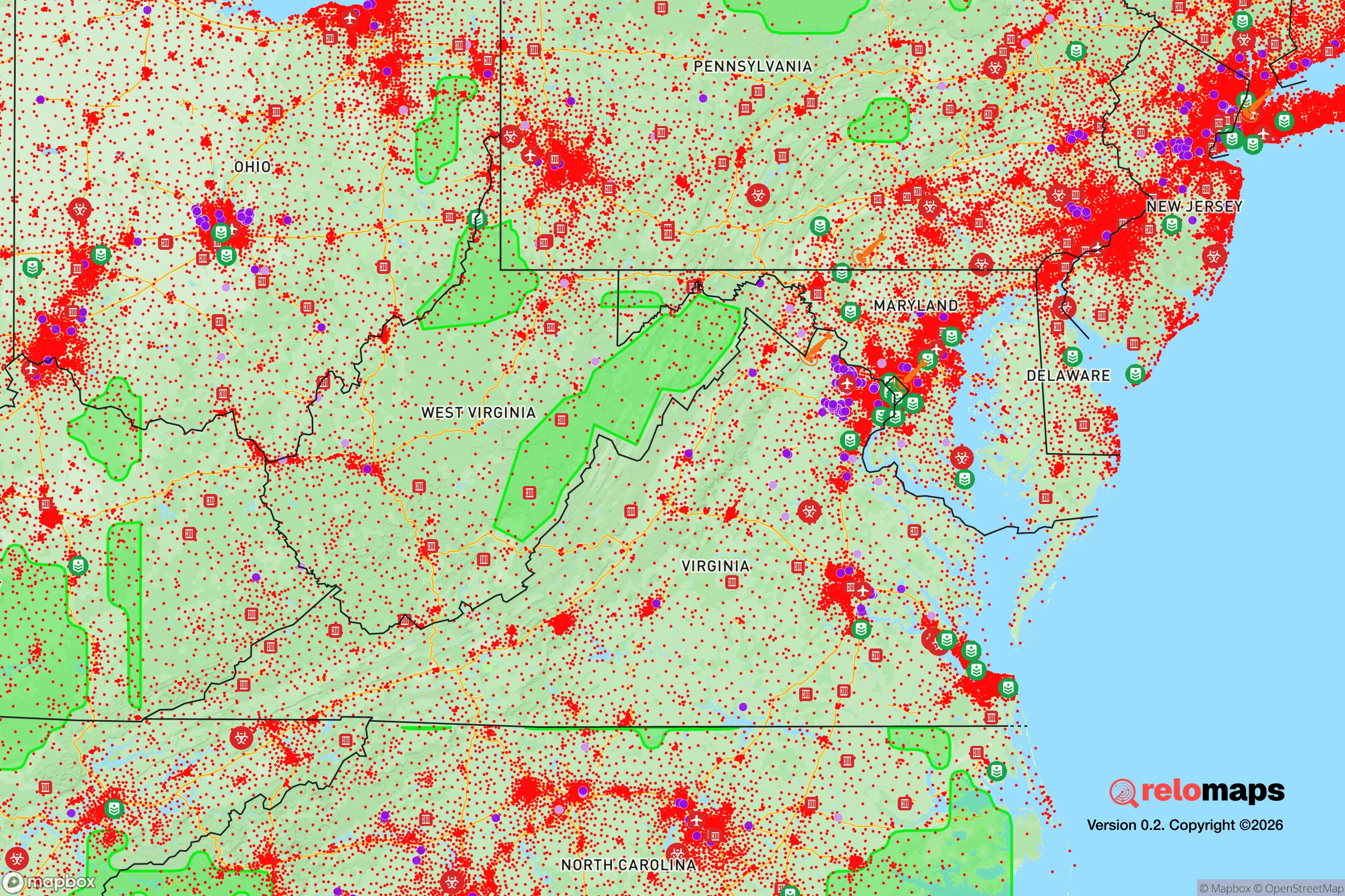
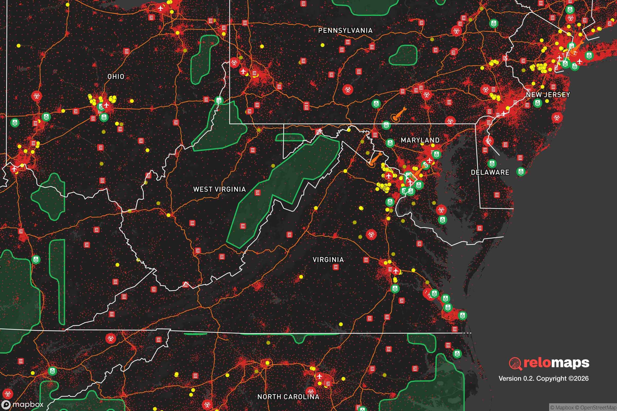


Important Note: For informational purposes only. This does not mean nothing bad ever happens in the green zones. Please use common sense. This is based on public data and modeled with AI. We tried to take a conservative approach but mistakes happen. We update this regularly as new information becomes available.
Solar Generator Recommendations
Backup power matters more here than in safer locations. We've picked three solar generators across budgets and capacity tiers — start with the budget unit if you only need a few essentials, or step up if you want to run a fridge and HVAC for days at a time.

Jackery Portable Power Station Explorer 300
Budget OptionPower on the Go: Weighing only 11 lbs, it's convenient to set up and store with book-sized foldable solar panels

BLUETTI Portable Power Station AC180
Designed for both indoor and outdoor scenarios, AC180 is highly capable as it has a robost capacity and continuous output power.

EF ECOFLOW DELTA Pro Ultra Power Station
Upgraded PickEcoFlow DELTA Pro Ultra is a whole-home energy system designed to grow with your family. Integrated with the Smart Home Panel 2, it scales to meet your evolving energy needs — keeping your home powered, intelligent, and secure through every stage of life.
We earn a commission, at no additional cost to you.
Strategic Assessment Analysis
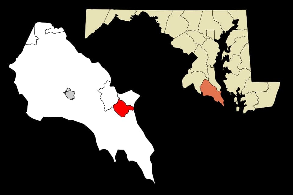
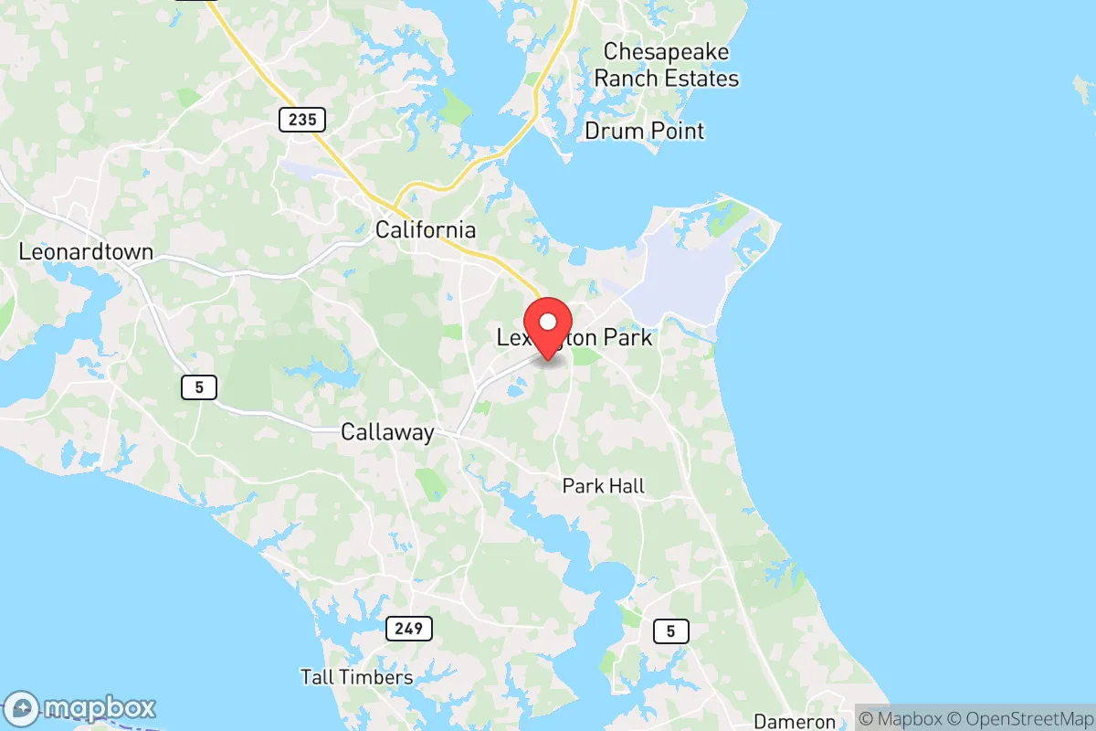
Lexington Park, Maryland, sits at the southern tip of St. Mary’s County on a peninsula where the Patuxent River meets the Chesapeake Bay, offering a mix of strategic advantages and notable vulnerabilities for a relocator focused on resilience and self-sufficiency. Its location roughly 60 miles southeast of Washington, D.C., and 70 miles south of Baltimore places it within the orbit of major metropolitan areas, but the surrounding water and rural buffer zones create a distinct separation that can be leveraged. For a conservative-leaning individual or family weighing disaster readiness, Lexington Park presents a workable base—provided you understand its exposure to both natural forces and the concentrated risks that come with proximity to high-value government and military infrastructure.
Geographic position and natural advantages for self-sufficiency
The peninsula geography of St. Mary’s County is a double-edged sword. On the plus side, Lexington Park is bounded by the Patuxent River to the east and the Potomac River to the west, with the Chesapeake Bay to the south. This water-rich environment provides abundant access to fresh and brackish water sources, which is a critical asset for long-term self-sufficiency. The area’s moderate climate—with average highs in the 80s during summer and lows in the 20s in winter—supports year-round gardening and livestock, and the growing season typically runs from April through October. The county’s low population density (roughly 115 people per square mile, compared to over 4,000 in nearby Arlington) means more space for private wells, septic systems, and small-scale agriculture. The land is generally flat to gently rolling, with sandy loam soils that drain well, making it suitable for raised-bed gardening and small orchards. For a relocator, the ability to tap into groundwater and grow food without heavy infrastructure is a tangible advantage. Additionally, the area’s limited through-traffic—only two major routes (MD-235 and MD-4) connect the peninsula to the rest of the state—creates natural chokepoints that can be monitored or controlled in a crisis, though this also means limited egress options if those routes are compromised.
Risks, exposures, and proximity to fallout-relevant landmarks
The most significant risk for Lexington Park is its proximity to the Naval Air Station Patuxent River (NAS Pax River), a major U.S. Navy flight-test and research facility that is a high-value target in any conflict scenario. The base employs over 20,000 personnel and houses sensitive programs like the F-35 Joint Strike Fighter testing. In a conventional war or terrorist event, this concentration of military assets makes the immediate area a likely target for stand-off weapons, sabotage, or cyberattacks. The fallout risk is not just from a direct strike but from secondary effects—disruption of power grids, supply chains, and emergency services that could cascade across the peninsula. Furthermore, Lexington Park’s location downwind of the Washington, D.C., metropolitan area means that a radiological or chemical event in the capital could deposit fallout across St. Mary’s County, depending on prevailing winds (which are typically from the northwest). The county’s limited hospital capacity—only one major hospital, MedStar St. Mary’s, with about 100 beds—is a vulnerability for mass casualty events. Natural risks include hurricane storm surge from the Chesapeake Bay, which can push water up the Patuxent River and flood low-lying areas near the shoreline. The county has experienced flooding from hurricanes Isabel (2003) and Sandy (2012), and sea-level rise projections suggest a 1-2 foot increase by 2050, which could affect coastal properties and road access. Tornadoes are rare but possible, and the area’s flat terrain offers little natural shelter from severe weather.
Practical resilience for a relocator: food, water, energy, and defensibility
For a relocator serious about self-sufficiency, Lexington Park offers a mixed bag. Water access is excellent: the county’s aquifer is generally reliable, and private wells are common in rural areas outside the town center. However, the groundwater in some parts of St. Mary’s County has elevated levels of iron and manganese, requiring filtration for drinking. Rainwater harvesting is feasible, with an average annual rainfall of about 44 inches. Food production is viable: the county has a strong agricultural heritage, with local farms producing corn, soybeans, and livestock. Farmers’ markets operate in Lexington Park and nearby Leonardtown, and the St. Mary’s County Master Gardeners program offers resources for home food production. Hunting and fishing are legal and accessible—the Patuxent River offers striped bass, bluefish, and crabs, while deer hunting is popular on public lands like the St. Mary’s River State Park. For energy, the grid is moderately reliable but vulnerable to outages from storms and infrastructure strain. Solar panels are a viable option, with the area receiving about 4.5 peak sun hours per day, and net metering is available through the local utility, SMECO. Backup generators are common among rural residents. Defensibility is a challenge: the peninsula’s limited road access (primarily MD-4 and MD-235) means that a single accident, bridge failure, or deliberate blockage could isolate the area. The Governor Thomas Johnson Bridge, which connects St. Mary’s to Calvert County, is a critical chokepoint and has been subject to closures for maintenance. For a family, the best strategy is to locate on a dead-end road or near a secondary water route (e.g., a creek or river access) that provides an alternative exit. The local law enforcement presence is modest—the St. Mary’s County Sheriff’s Office has about 200 sworn deputies—so community-based security and neighborhood watch are more realistic than relying on rapid response.
The overall strategic picture for Lexington Park is one of moderate resilience with specific, manageable vulnerabilities. Its water abundance, agricultural potential, and relative isolation from the densest urban corridors are genuine assets for a self-sufficient lifestyle. But the presence of NAS Pax River as a high-value target, the peninsula’s limited egress, and the risk of fallout from D.C. mean that a relocator must plan for both natural and man-made contingencies. For a conservative-leaning family that values preparedness, the area can work—if you invest in a well, solar backup, and a solid community network. The key is to treat Lexington Park not as a fortress, but as a defensible base with clear escape routes and a realistic understanding of its exposure. It’s a place where a thoughtful, proactive approach to resilience can pay off, but it’s not a place to let your guard down.

* Values derived from national, state, county, city and local statistics and may differ in a specific area. Last updated: 2026-11-12T16:37:17.000Z
Narrative content on this page is AI-generated and may contain mistakes. Verify any details that matter before acting on them.
ReloMaps may earn a commission from affiliate links at no extra cost to you.

