
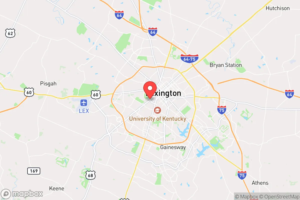

Strategic Assessment of Lexington Fayette Urban County, KY
Multiple tactical vulnerabilities. Population density, target proximity, or disaster risk are likely compounding. A retreat property and exit planning is required.
What does the Strategic Assessment tell us?
Our Strategic Assessment grades tactical survivability of an area. Major population centers, military targets, fallout zones, natural disasters, and border exposure all drive risk — lower exposure means a more defensible position in a crisis.
This is heavily inspired by Joel Skousen's Strategic Relocation book. Highly recommended you checkout the book ($)What does this tell us?
Our Strategic Assessment grades tactical survivability of an area. Major population centers, military targets, fallout zones, natural disasters, and border exposure all drive risk — lower exposure means a more defensible position in a crisis.
This is heavily inspired by Joel Skousen's Strategic Relocation book. Highly recommended you checkout the book ($)Strategic Pillars

Key Distances
Regional Safe Places
Below is our recommended "safe zones" in Kentucky and the surrounding area based on our strategic heuristics. For most people, it's unrealistic to live in a “safe zone” full-time due to work, family or other personal reasons. They tend to be more rural. However, many of these areas are perfect for second homes and retreat properties that double as a vacation home or even a short-term rental.
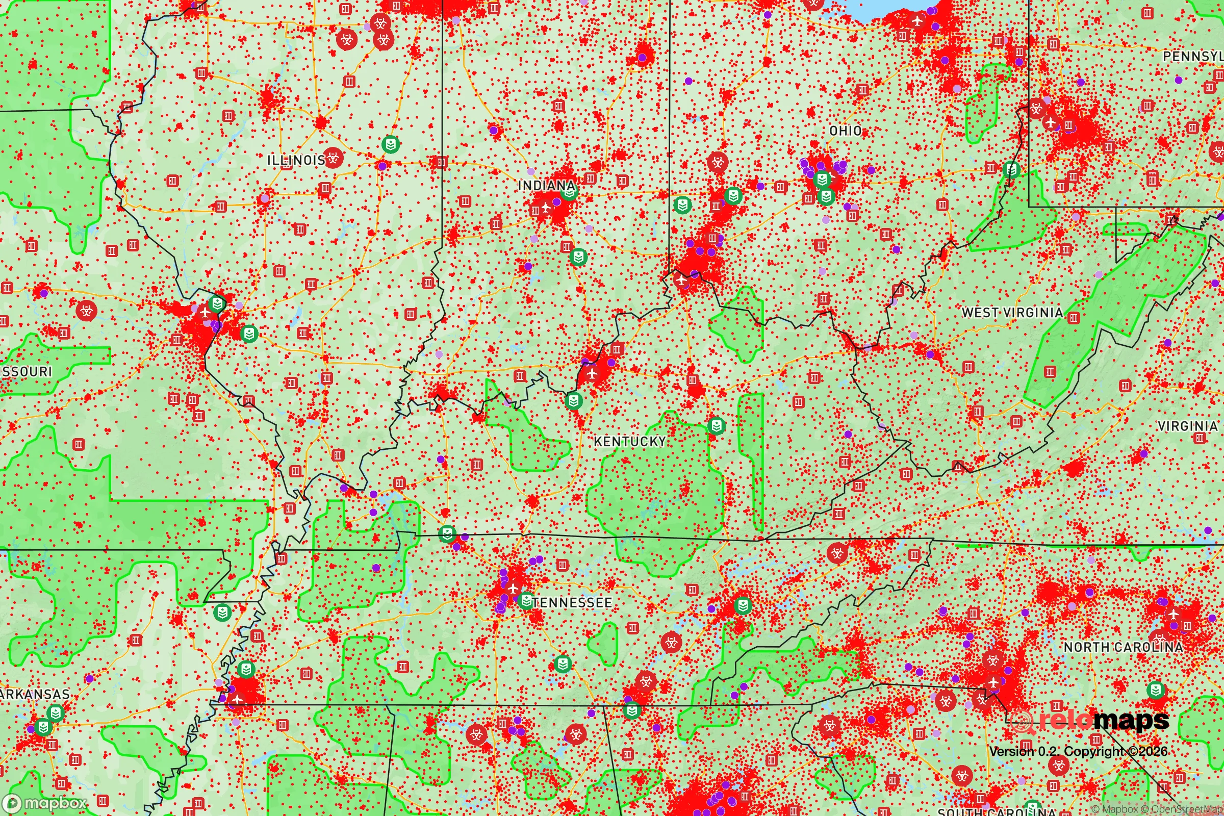
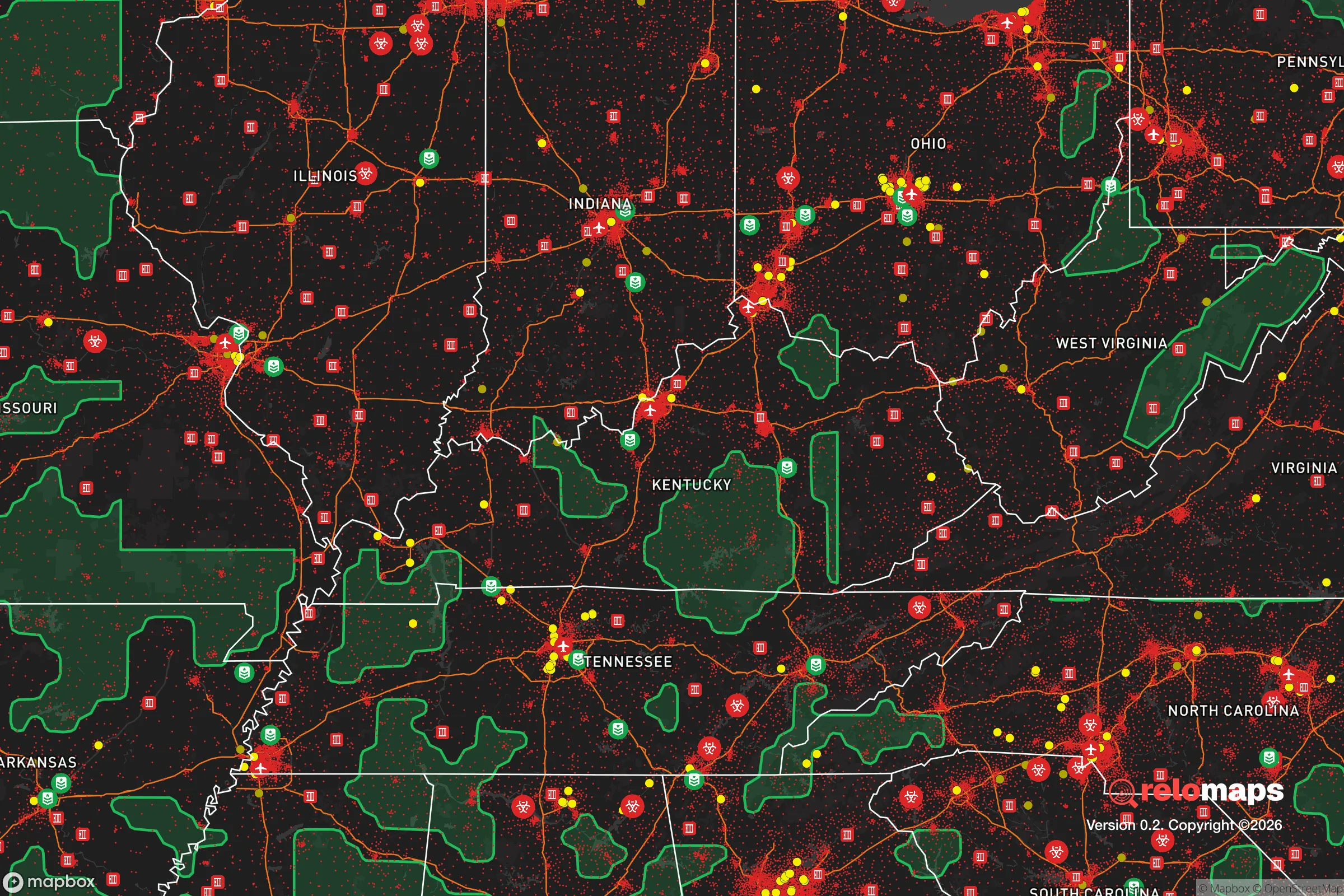


Important Note: For informational purposes only. This does not mean nothing bad ever happens in the green zones. Please use common sense. This is based on public data and modeled with AI. We tried to take a conservative approach but mistakes happen. We update this regularly as new information becomes available.
Solar Generator Recommendations
Backup power matters more here than in safer locations. We've picked three solar generators across budgets and capacity tiers — start with the budget unit if you only need a few essentials, or step up if you want to run a fridge and HVAC for days at a time.

Jackery Portable Power Station Explorer 300
Budget OptionPower on the Go: Weighing only 11 lbs, it's convenient to set up and store with book-sized foldable solar panels

BLUETTI Portable Power Station AC180
Designed for both indoor and outdoor scenarios, AC180 is highly capable as it has a robost capacity and continuous output power.

EF ECOFLOW DELTA Pro Ultra Power Station
Upgraded PickEcoFlow DELTA Pro Ultra is a whole-home energy system designed to grow with your family. Integrated with the Smart Home Panel 2, it scales to meet your evolving energy needs — keeping your home powered, intelligent, and secure through every stage of life.
We earn a commission, at no additional cost to you.
Strategic Assessment Analysis
Lexington-Fayette Urban County offers a surprisingly strong strategic position for those prioritizing disaster readiness and self-sufficiency, largely because it sits at a sweet spot of regional connectivity without the extreme density and target risk of major metropolises. The area benefits from a diversified economy anchored by healthcare, education, and logistics, which provides a buffer against single-sector collapse, while its inland location and robust agricultural surroundings create a foundation for long-term resilience. For a relocator weighing preparedness against daily livability, Lexington presents a credible middle-ground option that avoids the vulnerabilities of both deep rural isolation and dense urban target zones.
Geographic position and natural advantages for long-term security
Lexington's location in the heart of the Bluegrass region provides several inherent strategic benefits. The area sits on the Lexington Plain, a relatively flat to gently rolling plateau that is less prone to the flooding, landslides, and seismic activity that affect other parts of Kentucky and the broader region. The underlying geology of the Inner Bluegrass region, with its deep limestone bedrock and karst topography, creates a natural water filtration system through the aquifer, though it also means surface water can be scarce and well-dependent properties require careful assessment. The climate is temperate continental, with four distinct seasons and no extreme weather patterns that would regularly threaten infrastructure — tornadoes are possible but not at the frequency seen in the Plains states, and the area is far enough inland to avoid hurricane storm surge while still receiving adequate rainfall for agriculture. The surrounding countryside is some of the most productive farmland in the United States, with the famous limestone-enriched soil supporting world-class horse farms and row crops alike, meaning local food production capacity is genuinely high. Lexington's position roughly 75 miles south of Cincinnati, 80 miles east of Louisville, and 200 miles from both Nashville and Indianapolis places it within a day's drive of major distribution hubs while remaining far enough from any single metropolitan center to avoid being caught in the immediate fallout zone of a major event targeting those cities.
Risk exposure and proximity to potential fallout-relevant landmarks
While Lexington avoids many of the natural disaster extremes that plague coastal and seismic zones, it is not without meaningful risk exposure that a preparedness-minded relocator should weigh. The area sits within the New Madrid Seismic Zone's extended impact radius — a major earthquake along that fault system, which historically produced magnitude 7+ events in 1811-1812, could cause significant ground shaking and liquefaction in the Ohio River Valley, though Lexington's distance from the epicenter (roughly 200 miles) means damage would likely be moderate rather than catastrophic. More immediately relevant to a strategic assessment is Lexington's proximity to several infrastructure and industrial sites that could become liabilities in a crisis. The Blue Grass Army Depot in nearby Richmond stores chemical weapons awaiting destruction, and while the destruction program is ongoing and security is high, the presence of such a facility is a non-zero risk factor. The area is also within roughly 150 miles of the Paducah Gaseous Diffusion Plant, a former uranium enrichment facility that remains a Superfund site, and within 200 miles of the Oak Ridge National Laboratory in Tennessee, a major nuclear research and production facility. For those concerned about electromagnetic pulse (EMP) or cyberattack scenarios, Lexington's role as a regional logistics and communications hub means it has more critical infrastructure than a purely rural area, including major data centers and the Blue Grass Airport, which hosts a Kentucky Air National Guard base. The city's position along Interstates 64 and 75, while excellent for normal commerce, also makes it a potential chokepoint or target in a prolonged disruption scenario, as these corridors would be critical for regional movement of goods and personnel.
Practical resilience for a relocator: food, water, energy, and defensibility
For a relocator assessing day-to-day survivability in a prolonged disruption, Lexington offers a mixed but generally favorable picture. Food security is arguably the area's strongest card — the surrounding Bluegrass region is one of the most productive agricultural zones in the eastern United States, with thousands of acres of row crops, pasture, and orchards within a 30-mile radius. The local food system is supported by a strong farmers' market network, including the Lexington Farmers' Market which operates year-round, and the presence of large-scale food processing and distribution facilities tied to the horse and livestock industries. Water security is more nuanced — Lexington draws its municipal water from the Kentucky River and Jacobson Reservoir, both of which are reliable under normal conditions, but the karst geology means groundwater is vulnerable to contamination from surface sources, and private wells in the surrounding county require regular testing and maintenance. The area's energy grid is served by Kentucky Utilities and is connected to the regional Eastern Interconnection, which is generally stable but has shown vulnerability during extreme winter weather events, as seen during the 2021 ice storms that left thousands without power for days. Solar potential is moderate — the region receives about 200 sunny days per year, which is below the national average but sufficient for supplemental solar generation with battery storage. Defensibility is a mixed consideration: Lexington's urban core is spread out and lacks natural defensive terrain, but the surrounding countryside offers numerous options for rural properties with good sightlines, creek access, and limited road access. The Fayette County Sheriff's Office and Lexington Police Department maintain a visible presence, and the area's relatively low violent crime rate (compared to similarly sized cities) suggests a baseline of social order that would likely persist in a crisis, though urban areas always carry higher risks of civil unrest than deep rural locations.
The overall strategic picture for Lexington-Fayette Urban County is one of calculated moderation — it offers genuine advantages in food security, inland positioning, and economic diversity that make it a credible choice for the preparedness-minded relocator, but it does not provide the extreme isolation or self-sufficiency of a remote mountain or off-grid property. The area's greatest strength is its agricultural base and moderate climate, which together create a foundation for long-term food and water resilience that few urban areas can match. Its greatest vulnerability is its position as a regional hub with critical infrastructure that could become a liability in a major national disruption, and its proximity to industrial and military sites that carry their own risk profiles. For a single individual or family looking to balance preparedness with access to employment, healthcare, and education, Lexington represents a defensible middle path — not a bug-out destination, but a place where a well-prepared household with some land, stored supplies, and community connections could ride out a wide range of scenarios while maintaining a normal quality of life in the meantime.

* Values derived from national, state, county, city and local statistics and may differ in a specific area. Last updated: 2026-06-22T21:16:39.000Z
Narrative content on this page is AI-generated and may contain mistakes. Verify any details that matter before acting on them.
ReloMaps may earn a commission from affiliate links at no extra cost to you.

