 Popular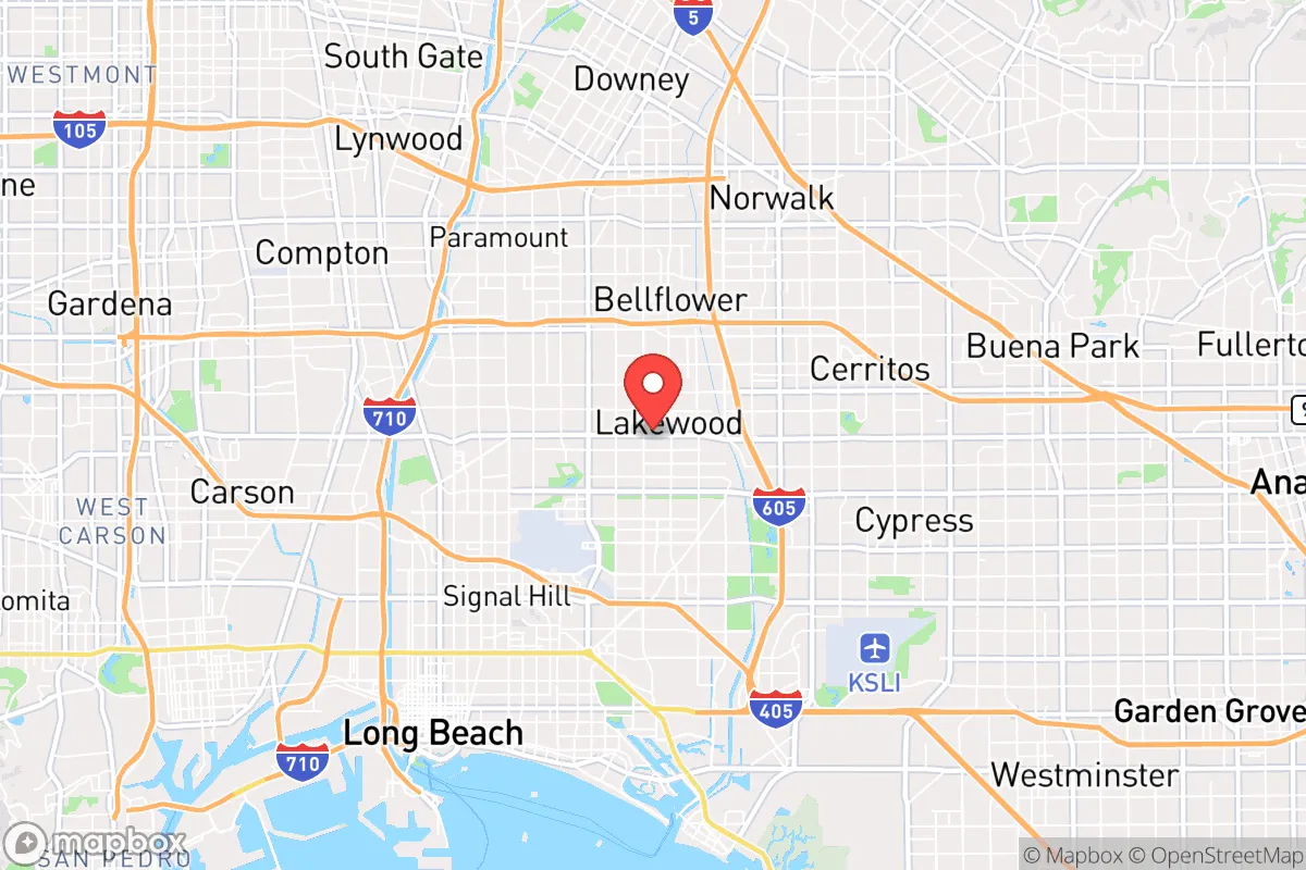
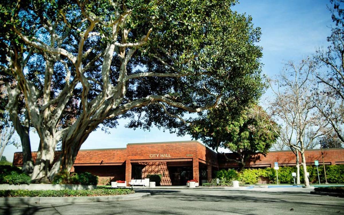
Photo: Wikipedia
Strategic Assessment of Lakewood, CA
High tactical risk. This location is likely close to major population centers, strategic targets, or sits in a high-disaster corridor. A retreat property and careful exit planning is required.
What does the Strategic Assessment tell us?
Our Strategic Assessment grades tactical survivability of an area. Major population centers, military targets, fallout zones, natural disasters, and border exposure all drive risk — lower exposure means a more defensible position in a crisis.
This is heavily inspired by Joel Skousen's Strategic Relocation book. Highly recommended you checkout the book ($)What does this tell us?
Our Strategic Assessment grades tactical survivability of an area. Major population centers, military targets, fallout zones, natural disasters, and border exposure all drive risk — lower exposure means a more defensible position in a crisis.
This is heavily inspired by Joel Skousen's Strategic Relocation book. Highly recommended you checkout the book ($)Strategic Pillars

Key Distances
Regional Safe Places
Below is our recommended "safe zones" in California and the surrounding area based on our strategic heuristics. For most people, it's unrealistic to live in a “safe zone” full-time due to work, family or other personal reasons. They tend to be more rural. However, many of these areas are perfect for second homes and retreat properties that double as a vacation home or even a short-term rental.




Important Note: For informational purposes only. This does not mean nothing bad ever happens in the green zones. Please use common sense. This is based on public data and modeled with AI. We tried to take a conservative approach but mistakes happen. We update this regularly as new information becomes available.
Solar Generator Recommendations
Backup power matters more here than in safer locations. We've picked three solar generators across budgets and capacity tiers — start with the budget unit if you only need a few essentials, or step up if you want to run a fridge and HVAC for days at a time.

Jackery Portable Power Station Explorer 300
Budget OptionPower on the Go: Weighing only 11 lbs, it's convenient to set up and store with book-sized foldable solar panels

BLUETTI Portable Power Station AC180
Designed for both indoor and outdoor scenarios, AC180 is highly capable as it has a robost capacity and continuous output power.

EF ECOFLOW DELTA Pro Ultra Power Station
Upgraded PickEcoFlow DELTA Pro Ultra is a whole-home energy system designed to grow with your family. Integrated with the Smart Home Panel 2, it scales to meet your evolving energy needs — keeping your home powered, intelligent, and secure through every stage of life.
We earn a commission, at no additional cost to you.
Strategic Assessment Analysis
Lakewood, California, presents a mixed strategic picture for the relocation-minded individual or family prioritizing resilience and self-sufficiency. Located in Los Angeles County, approximately 20 miles southeast of downtown Los Angeles, Lakewood sits within a densely populated, highly developed corridor that offers certain logistical advantages but carries significant exposure to both natural and man-made risks. For a conservative-leaning reader focused on preparedness, the area’s primary value lies in its access to regional infrastructure and its position relative to major transportation networks, though these same features amplify vulnerability in a crisis scenario.
Geographic position and natural advantages for long-term stability
Lakewood’s geography is defined by its flat coastal plain setting, roughly 10 miles inland from the Pacific Ocean. This location provides a moderate Mediterranean climate with mild, wet winters and dry summers, reducing the risk of extreme temperature-related infrastructure failures that plague inland desert or mountain communities. The area’s elevation—averaging around 50 feet above sea level—places it above immediate tsunami risk zones, though it remains within the broader coastal floodplain. The nearby Los Angeles and San Gabriel Rivers, channelized and managed by the U.S. Army Corps of Engineers, offer controlled drainage but also represent a flood hazard during intense winter storms, particularly in low-lying neighborhoods near the San Gabriel River channel. For a relocator, the natural advantage here is the absence of wildfire risk—Lakewood is not in a designated Very High Fire Hazard Severity Zone, unlike much of the surrounding hillsides. This is a meaningful plus for property insurance stability and day-to-day safety. However, the region’s seismic activity is a constant factor: Lakewood sits within the Los Angeles Basin, crisscrossed by active faults including the nearby Newport-Inglewood Fault zone. A major earthquake would disrupt utilities, transportation, and supply chains for weeks to months, making personal preparedness essential rather than optional.
Risks, exposures, and proximity to fallout-relevant landmarks
The most significant strategic liability for Lakewood is its location within the greater Los Angeles metropolitan area, a high-value target for both natural disaster cascades and man-made threats. The city is roughly 15 miles from the Port of Long Beach and the Port of Los Angeles, the busiest container port complex in the Western Hemisphere. In a national emergency or conflict scenario, these ports would be primary targets for disruption, and their proximity means Lakewood would experience immediate secondary effects—supply chain collapse, population displacement, and potential security concerns. Additionally, Lakewood lies within 25 miles of several major military installations, including Joint Forces Training Base Los Alamitos (adjacent to the city) and Naval Weapons Station Seal Beach. While these facilities provide some local employment and security presence, they also elevate the area’s strategic significance in a conflict scenario. For the preparedness-minded relocator, this proximity to critical infrastructure is a double-edged sword: it offers economic stability in peacetime but increases the likelihood of being in a secondary impact zone during a major event. The city’s dense population—over 80,000 residents in roughly 9.5 square miles—means that any large-scale evacuation would face severe congestion on the major arteries: Interstate 405, Interstate 605, and State Route 91. These freeways are already among the most congested in the nation during normal conditions; in a crisis, they would become impassable chokepoints. The presence of the Los Angeles International Airport (LAX) and Long Beach Airport within 15 miles adds air traffic and potential debris hazards, though these are lower-priority concerns compared to ground-level risks.
Practical resilience for a relocator: food, water, energy, and defensibility
For a family or individual serious about self-sufficiency, Lakewood’s urban character presents both obstacles and opportunities. The city is built out with single-family homes on standard suburban lots, typically 6,000 to 7,500 square feet. This allows for modest backyard gardening, rainwater catchment, and small-scale livestock (chickens are permitted with restrictions), but the lot sizes limit significant food production. Community gardens exist but are few; the Lakewood Community Garden on Del Amo Boulevard offers plots, but waitlists are common. For water security, Lakewood relies entirely on imported water from the State Water Project and the Colorado River via the Metropolitan Water District of Southern California. This system is vulnerable to earthquake disruption, drought, and infrastructure failure. A relocator should plan for at least two weeks of stored water per person, with a long-term strategy involving rainwater barrels and possibly a well—though groundwater in the Los Angeles Basin is heavily managed and permits for private wells are rare in urban areas. Energy resilience is more feasible: solar panel installation is common, and net metering policies allow for grid-tied systems. However, during a prolonged grid outage, battery storage (e.g., Tesla Powerwall) becomes critical, as standard solar inverters shut down without grid power for safety reasons. Natural gas is widely available for cooking and heating, but a major earthquake could disrupt gas lines for weeks. Defensibility is Lakewood’s weakest point. The city’s grid-like street layout, with few natural barriers, makes it difficult to secure a perimeter in a breakdown scenario. The presence of the Lakewood Center mall and other commercial hubs could become focal points for looting or resource competition. For a relocator, the best approach is to choose a home on a quieter cul-de-sac or near a park that offers some buffer, and to invest in robust home security—physical barriers, reinforced doors, and a neighborhood watch network—rather than relying on law enforcement, which would be stretched thin in a crisis. The Los Angeles County Sheriff’s Department provides policing, but response times would degrade rapidly in a widespread emergency.
The overall strategic picture for Lakewood is one of calculated trade-offs. It offers a stable, family-friendly environment with good schools (the Long Beach Unified School District serves the area), a low crime rate relative to surrounding cities, and access to the economic engine of Southern California. For the conservative-leaning relocator who values community, local governance, and a suburban lifestyle, Lakewood is a defensible choice in peacetime. But for those prioritizing true self-sufficiency and disaster resilience, the area’s density, reliance on fragile infrastructure, and proximity to high-value targets make it a less ideal long-term base. The practical recommendation is to treat Lakewood as a location for building a resilient household—stockpiling supplies, establishing local networks, and developing skills—while maintaining a contingency plan for relocation to a lower-density area inland or to the Central Valley if conditions deteriorate. It is not a bug-out location, but it can be a viable home base for the prepared family that acknowledges its vulnerabilities and plans accordingly.

* Values derived from national, state, county, city and local statistics and may differ in a specific area. Last updated: 2026-09-25T04:28:24.000Z
Narrative content on this page is AI-generated and may contain mistakes. Verify any details that matter before acting on them.
ReloMaps may earn a commission from affiliate links at no extra cost to you.

