
Photo: Wikipedia
Strategic Assessment of Warren County
Workable tactical position. Some exposure to population density or targets, but generally defensible in a crisis.
What does the Strategic Assessment tell us?
Our Strategic Assessment grades tactical survivability of an area. Major population centers, military targets, fallout zones, natural disasters, and border exposure all drive risk — lower exposure means a more defensible position in a crisis.
This is heavily inspired by Joel Skousen's Strategic Relocation book. Highly recommended you checkout the book ($)What does this tell us?
Our Strategic Assessment grades tactical survivability of an area. Major population centers, military targets, fallout zones, natural disasters, and border exposure all drive risk — lower exposure means a more defensible position in a crisis.
This is heavily inspired by Joel Skousen's Strategic Relocation book. Highly recommended you checkout the book ($)Strategic Pillars

Key Distances
Strategic Assessment Analysis
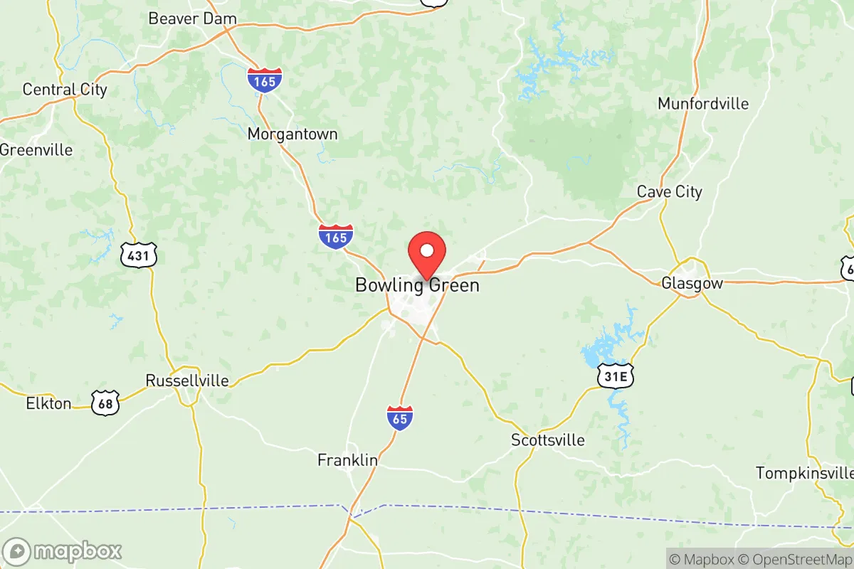
Warren County, Kentucky, anchored by the city of Bowling Green, presents a compelling case for relocation-minded readers who prioritize strategic resilience without sacrificing access to modern infrastructure. Its position roughly 65 miles north of Nashville and 110 miles south of Louisville places it in a sweet spot—close enough to major metropolitan resources for supply runs and medical access, yet far enough to avoid the immediate fallout zones and congestion of those population centers. The area’s economic stability, anchored by a diverse manufacturing base and the presence of Fort Knox just 45 miles to the north, offers a buffer against the boom-and-bust cycles that plague single-industry towns. For a family or individual weighing long-term security, Warren County’s combination of inland geography, robust local food production, and a growing but not overcrowded population makes it a serious contender in the resilience-minded relocation landscape.
Geographic position and natural advantages for long-term security
Warren County sits in the Pennyroyal Plateau region of south-central Kentucky, a landscape characterized by rolling hills, limestone bedrock, and abundant freshwater springs. This geology is a double-edged sword—it provides excellent natural drainage and reduces flood risk compared to river-bottom counties, but it also means the area sits atop the Mammoth Cave karst system, which can create sinkhole risks in localized areas. The county’s position in the interior Southeast means it is largely insulated from hurricane storm surge, with the Gulf Coast over 400 miles to the south. Tornado risk is moderate—Kentucky sits on the northern fringe of Dixie Alley—but Warren County has not experienced the catastrophic EF-4 or EF-5 events seen in western Kentucky or Alabama in recent decades. The Barren River runs through the county, providing a reliable surface water source, and the surrounding Barren River Lake (a U.S. Army Corps of Engineers project) offers both recreational water access and a significant reservoir for drought contingency. The area’s elevation, averaging around 500 feet, provides no defensive high ground but also avoids the floodplain vulnerabilities of lower-lying communities. For a relocator, the key takeaway is that Warren County offers a moderate-risk natural environment—no hurricanes, low seismic activity, and manageable tornado exposure—while sitting in a region with historically reliable rainfall patterns.
Risks, exposures, and proximity to fallout-relevant landmarks
No strategic assessment is complete without a clear-eyed look at man-made and infrastructure risks. Warren County’s most significant exposure comes from its proximity to Fort Knox, a major U.S. Army installation that houses the U.S. Bullion Depository and extensive armored vehicle training areas. While the base itself is a potential target in a conflict scenario, its 45-mile distance from Bowling Green provides a meaningful buffer—fallout patterns from a conventional strike on the base would likely drift east-northeast with prevailing winds, sparing Warren County the worst. More immediately relevant is the county’s position relative to the Tennessee Valley Authority (TVA) nuclear facilities: the Browns Ferry Nuclear Plant in Alabama is about 150 miles south, and the Sequoyah Nuclear Plant near Chattanooga is roughly 170 miles southeast. Neither poses a direct fallout risk under normal conditions, but in a cascading disaster scenario, Warren County’s inland location means it would be downwind of any release from the south or southeast. The Bowling Green-Warren County Regional Airport is a general aviation facility with no commercial passenger service, which reduces the risk of a major aviation incident but also limits evacuation options. On the industrial front, the county hosts several automotive and plastics manufacturing plants—including a General Motors Corvette Assembly Plant and a Fruit of the Loom distribution center—but lacks the heavy chemical refineries or petrochemical complexes found in the Gulf Coast corridor. The nearest major refinery is the Marathon Petroleum facility in Catlettsburg, Kentucky, over 200 miles east, meaning Warren County is not in the immediate blast or fallout zone of critical energy infrastructure. For a relocator, the risk profile is moderate: no single catastrophic threat dominates, but the cumulative exposure to military and nuclear infrastructure within a 200-mile radius warrants a basic preparedness plan, including potassium iodide and a reliable air filtration system.
Practical resilience for a relocator: food, water, energy, and defensibility
Warren County’s practical resilience is where it truly shines for the self-sufficiency-minded reader. The county sits in the heart of Kentucky’s agricultural belt, with over 1,200 farms producing corn, soybeans, tobacco, and livestock within its borders. The Bowling Green Farmers Market operates year-round, and the surrounding countryside offers ample opportunities for small-scale homesteading on affordable land—acreage prices in the county’s rural precincts (like Rich Pond or Plum Springs) remain significantly lower than comparable land in Tennessee or Ohio. Water access is a strong point: the Barren River and its tributaries provide surface water, and the county’s limestone aquifer yields reliable well water at depths of 100-300 feet. The Bowling Green Municipal Utilities system draws from the Barren River and maintains a 30-million-gallon-per-day treatment plant, but a relocator should note that the system is grid-dependent—a long-term power outage would disrupt municipal water pressure. Energy resilience is more mixed: the county is served by the Tennessee Valley Authority grid, which is generally reliable but has experienced rolling blackouts during extreme winter storms (notably the 2021 ice storm that left parts of Kentucky without power for weeks). Natural gas is available in the Bowling Green urban area, but rural properties often rely on propane or heating oil. Solar potential is moderate—Kentucky averages about 4.5 peak sun hours per day, slightly below the national average but sufficient for a well-designed off-grid system with battery storage. Defensibility is the weakest link: the county’s rolling terrain offers no natural chokepoints, and the major highways—I-65 running north-south and US 231 running east-west—make the area accessible but also vulnerable to refugee flow from Nashville or Louisville during a crisis. A relocator should prioritize a property with a long driveway, tree cover, and a defensible perimeter rather than relying on the county’s geography for protection. The Warren County Sheriff’s Office maintains a professional force of about 80 deputies, but response times in rural areas can exceed 20 minutes, reinforcing the need for personal security measures.
The overall strategic picture for Warren County is one of balanced opportunity with manageable trade-offs. It offers a genuine middle-ground for the relocator who wants to be within a day’s drive of major medical centers (Vanderbilt University Medical Center in Nashville is 65 miles south) and supply hubs, while maintaining a rural lifestyle with access to local food, water, and energy resources. The county’s biggest vulnerability is its position along the I-65 corridor, which could become a liability during a mass evacuation event from the Nashville metro area. However, for the reader who is serious about disaster readiness—who is willing to invest in a well-drilled well, a solar array, and a solid perimeter fence—Warren County provides a foundation that is far more resilient than a suburban subdivision in a coastal or nuclear-target zone. The presence of Western Kentucky University in Bowling Green adds a layer of community stability and medical research capacity that many rural counties lack. For a family or individual looking to plant roots in a place that can weather both economic downturns and natural disasters without being a primary target, Warren County, Kentucky, deserves a hard look—just come prepared to build your own resilience rather than relying on the county’s infrastructure to save you.

* Values derived from national, state, county, city and local statistics and may differ in a specific area. Last updated: 2026-07-23T04:52:05.000Z
Narrative content on this page is AI-generated and may contain mistakes. Verify any details that matter before acting on them.
ReloMaps may earn a commission from affiliate links at no extra cost to you.

