
Photo: Wikipedia
Strategic Assessment of Scott County
Workable tactical position. Some exposure to population density or targets, but generally defensible in a crisis.
What does the Strategic Assessment tell us?
Our Strategic Assessment grades tactical survivability of an area. Major population centers, military targets, fallout zones, natural disasters, and border exposure all drive risk — lower exposure means a more defensible position in a crisis.
This is heavily inspired by Joel Skousen's Strategic Relocation book. Highly recommended you checkout the book ($)What does this tell us?
Our Strategic Assessment grades tactical survivability of an area. Major population centers, military targets, fallout zones, natural disasters, and border exposure all drive risk — lower exposure means a more defensible position in a crisis.
This is heavily inspired by Joel Skousen's Strategic Relocation book. Highly recommended you checkout the book ($)Strategic Pillars

Key Distances
Strategic Assessment Analysis
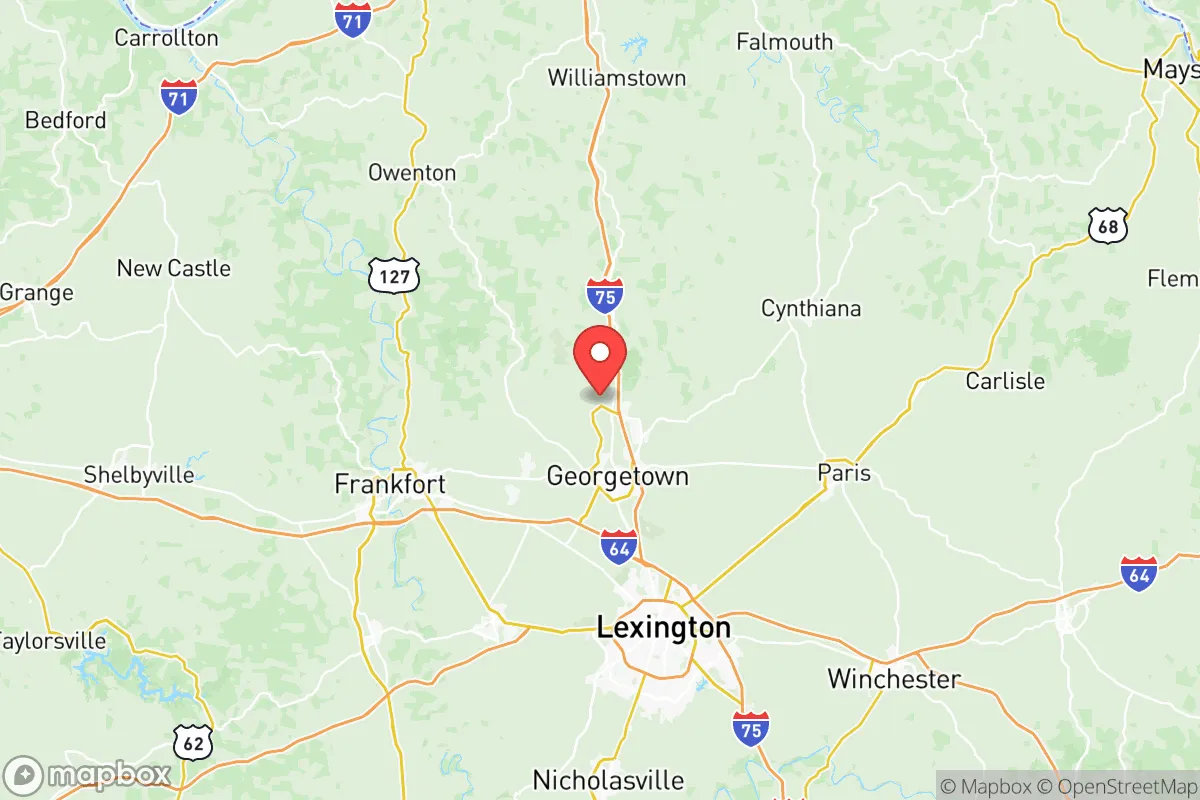
Scott County, Kentucky, presents a compelling case for relocation-minded individuals and families who prioritize strategic depth and long-term resilience over the immediate conveniences of a major metro area. Anchored by Georgetown, the county has quietly built a reputation for economic stability and community preparedness, largely insulated from the volatility that plagues larger urban centers. Its position along the I-75 corridor offers a critical balance: close enough to Lexington and Cincinnati for supply access and employment, yet far enough to avoid the cascading failure risks inherent to dense population hubs. For a reader thinking seriously about disaster readiness and self-sufficiency, Scott County’s combination of manufacturing diversity, agricultural capacity, and inland geography makes it a defensible choice in an increasingly uncertain landscape.
Geographic position and natural advantages for long-term stability
Scott County sits in the heart of the Bluegrass region, a landscape defined by rolling limestone hills, fertile soil, and a temperate climate that rarely produces catastrophic weather events. Unlike areas prone to hurricanes, wildfires, or seismic activity, this part of Kentucky experiences relatively mild seasonal extremes, with average annual snowfall under 15 inches and summer highs that seldom exceed 90°F. The county’s elevation, averaging around 900 feet, provides natural drainage and reduces flood risk compared to river-bottom communities. The Kentucky River forms part of the county’s western boundary, offering a reliable freshwater source, while the Elkhorn Creek watershed supports groundwater recharge and local agriculture. For a relocator assessing natural resilience, Scott County’s inland position—over 500 miles from the Gulf Coast and 400 miles from the Atlantic—eliminates storm surge and hurricane threats entirely. The area’s karst topography, characterized by limestone bedrock and underground aquifers, also means that well water is generally accessible and of good quality, a critical factor for off-grid water planning. Georgetown’s historic downtown sits on a natural rise, and the surrounding rural townships—Stamping Ground, Sadieville, and Oxford—offer even greater topographic separation from floodplains. This geographic stability, combined with a growing season of roughly 190 days, makes Scott County one of the more naturally defensible locations in the upper South.
Risk exposure and proximity to fallout-relevant landmarks
No resilience assessment is complete without an honest accounting of man-made risks, and Scott County has several that demand attention. The most significant is its proximity to the Blue Grass Army Depot in neighboring Madison County, roughly 20 miles southeast of Georgetown. This facility stores chemical munitions and conventional explosives, and while the depot’s destruction program has reduced the most hazardous stockpiles, the site remains a high-consequence target in any conflict scenario. Additionally, the county lies within 60 miles of the Louisville Metro area and its Ohio River industrial corridor, which includes chemical plants, refineries, and the McAlpine Locks and Dam—critical infrastructure that could become a secondary target or point of failure during a national emergency. The I-75 corridor itself, while an economic asset, also functions as a potential chokepoint and evacuation route, meaning that a major incident in Lexington or Cincinnati could produce significant refugee flow through Scott County. On the natural disaster front, the region faces occasional tornado risk, with Scott County falling within the western edge of the traditional Dixie Alley. The 1974 Super Outbreak produced an F4 tornado that struck near Sadieville, and more recent events in 2012 and 2021 have demonstrated that severe weather can materialize quickly. However, the county’s rolling hills and tree cover provide more natural windbreaks than the open plains of the Midwest. For a relocator weighing these factors, the key takeaway is that Scott County’s risks are primarily man-made and infrastructure-related, not environmental—a distinction that favors those who prepare with situational awareness and decentralized resources.
Practical resilience for relocators: food, water, energy, and defensibility
Scott County’s practical resilience is anchored by its agricultural base and relatively low population density. The county supports over 1,000 farms, with a strong emphasis on row crops (corn, soybeans, and wheat), livestock (beef and poultry), and the famous Bluegrass thoroughbred industry. For a family seeking food security, this means local food production is not a niche hobby but a mainstream economic activity. Farmers’ markets in Georgetown and Stamping Ground operate seasonally, and the county’s agricultural extension service offers workshops on canning, gardening, and livestock management. Water access is similarly favorable: the Georgetown Municipal Water and Sewer Service draws from the Kentucky River and multiple groundwater wells, while rural properties commonly have private wells with yields of 10–30 gallons per minute. The limestone aquifer provides natural filtration, reducing dependence on chemical treatment. Energy infrastructure is more mixed. Duke Energy Kentucky supplies electricity via a grid that connects to the regional transmission network, but the county has seen growing interest in residential solar, with several local installers now operating in Georgetown. Natural gas is available in urbanized areas, but rural properties often rely on propane or heating oil, which creates a supply-chain vulnerability during widespread disruptions. Defensibility is where Scott County truly distinguishes itself. The county’s layout—a compact urban core surrounded by expansive rural acreage—allows for both community cohesion and operational security. The Elkhorn Creek and North Elkhorn Creek form natural barriers along parts of the county, and the network of county roads offers multiple egress routes that bypass the I-75 corridor. For a relocator prioritizing self-sufficiency, the ideal property would be a 10–20 acre parcel in the northern or western parts of the county, away from the interstate and within walking distance of a perennial stream. The local culture, rooted in farming and hunting, also means that neighbors are more likely to possess practical skills—welding, veterinary care, mechanical repair—than in a typical suburban subdivision.
Overall, Scott County offers a strategic picture that is neither utopian nor alarming, but rather grounded in measurable advantages and acknowledged vulnerabilities. Its inland geography, agricultural capacity, and moderate climate provide a solid foundation for long-term resilience, while its proximity to the Blue Grass Army Depot and the I-75 corridor introduces risks that demand preparation rather than complacency. For the relocator who values community stability, access to fresh water and local food, and a defensible position within a day’s drive of major supply hubs, Scott County represents a rational choice—one that balances the trade-offs of rural self-sufficiency with the practical benefits of proximity to Lexington and Cincinnati. The key is to arrive with eyes open, a well-stocked pantry, and a willingness to engage with the local networks that make this corner of Kentucky quietly resilient.

* Values derived from national, state, county, city and local statistics and may differ in a specific area. Last updated: 2026-06-16T13:54:03.000Z
Narrative content on this page is AI-generated and may contain mistakes. Verify any details that matter before acting on them.
ReloMaps may earn a commission from affiliate links at no extra cost to you.

