
Photo: Wikipedia
Strategic Assessment of Madison County
Meaningful friction. Expect exposure to either population pressure, blast zones, or natural disaster risk. Consider buying a retreat property.
What does the Strategic Assessment tell us?
Our Strategic Assessment grades tactical survivability of an area. Major population centers, military targets, fallout zones, natural disasters, and border exposure all drive risk — lower exposure means a more defensible position in a crisis.
This is heavily inspired by Joel Skousen's Strategic Relocation book. Highly recommended you checkout the book ($)What does this tell us?
Our Strategic Assessment grades tactical survivability of an area. Major population centers, military targets, fallout zones, natural disasters, and border exposure all drive risk — lower exposure means a more defensible position in a crisis.
This is heavily inspired by Joel Skousen's Strategic Relocation book. Highly recommended you checkout the book ($)Strategic Pillars

Key Distances
Strategic Assessment Analysis
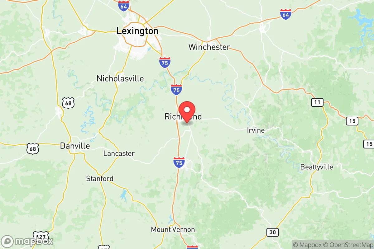
Madison County, Kentucky, occupies a strategic middle ground that appeals to relocators seeking a balance between rural self-sufficiency and access to regional infrastructure. Anchored by the city of Richmond and the smaller town of Berea, the county sits along Interstate 75, roughly 30 miles south of Lexington and 120 miles southeast of Louisville. This positioning offers a degree of geographic insulation from major metropolitan targets while still providing practical connectivity for supply runs, employment, and medical care. For a reader weighing disaster readiness and long-term resilience, Madison County presents a mixed but generally favorable picture — one where natural advantages are tempered by proximity to certain man-made risks.
Geographic position and natural advantages for self-sufficiency
Madison County’s location in the Bluegrass region provides a foundation of fertile soils and moderate climate that supports small-scale agriculture and homesteading. The Kentucky River forms part of the county’s western boundary, offering a reliable surface water source, while numerous creeks and springs — including Taylor Fork and Silver Creek — supply additional water access for those with proper filtration or well systems. The terrain is gently rolling, with elevations ranging from roughly 700 to 1,200 feet, which reduces flood risk compared to low-lying areas along the Ohio River. The county sits outside the New Madrid Seismic Zone’s highest-risk corridor, though moderate shaking is possible in a major event. Winters are mild by national standards, with average January lows around 25°F, and the growing season extends from mid-April to mid-October — long enough for a productive garden or small farm. The city of Richmond itself is situated on a plateau, which provides natural drainage and defensible high ground relative to the surrounding river valleys. For a relocator prioritizing food production and water security, the county’s agricultural capacity and water availability are genuine assets.
Risks, exposures, and proximity to fallout-relevant landmarks
The most significant risk factor for Madison County is its proximity to Lexington’s Blue Grass Army Depot, located roughly 25 miles north near Richmond, Kentucky. This depot stores conventional munitions and, historically, chemical weapons — though the chemical stockpile was destroyed by 2023. In a conflict scenario, the depot could be a target for conventional or asymmetric attack, with potential fallout or secondary hazards affecting downwind areas, including parts of Madison County. Additionally, the county lies within 100 miles of the Tennessee Valley Authority’s Sequoyah Nuclear Plant near Chattanooga, Tennessee, and the now-decommissioned but still monitored Paducah Gaseous Diffusion Plant in western Kentucky. While neither poses an immediate daily threat, a major accident or strike at either facility could produce a plume that reaches Madison County under prevailing westerly winds. Interstate 75, a major north-south artery, runs directly through the county, which is a double-edged sword: it provides evacuation routes and supply lines but also makes the area a potential chokepoint or target during a crisis. The county’s distance from major population centers like Louisville, Lexington, and Cincinnati — each a plausible target for nuclear or EMP attack — is a relative advantage, but the 30-mile proximity to Lexington means that fallout from a strike on that city could reach Madison County within hours, depending on wind direction. For a relocator, the key takeaway is that Madison County is not a remote wilderness refuge; it is a semi-rural buffer zone with moderate exposure to regional risks.
Practical resilience for a relocator: food, water, energy, and defensibility
On the practical side, Madison County offers several advantages for a household aiming to build resilience. The local food system is robust: Madison County is home to over 1,200 farms, with a strong presence of livestock, row crops, and vegetable production. The Berea Farmers Market and Richmond’s Madison County Farmers Market operate seasonally, and the area has a growing network of CSAs and small-scale producers. For those looking to grow their own food, the soil in the Kentucky River floodplain is rich in limestone-derived nutrients, and the county’s extension office provides resources for soil testing and crop planning. Water access is generally good, with most rural properties relying on private wells that tap into the Kentucky River aquifer. However, well depth and yield vary significantly by location — properties near the river or in the eastern part of the county tend to have better groundwater availability than those on the higher ridges. The county’s electric grid is served by Kentucky Utilities, which draws primarily from coal and natural gas plants, with some renewable energy from the nearby E.W. Brown Generating Station in Mercer County. For off-grid energy, the region’s average solar insolation is moderate — roughly 4.5 peak sun hours per day — making solar panels viable but not optimal without battery storage. Wood heating is practical, given the county’s 45% forest cover, with ample hardwood species like oak and hickory available for sustainable harvest. Defensibility is a mixed picture: the county’s rolling terrain and scattered woodlots provide natural cover and chokepoints, but the I-75 corridor and the presence of Eastern Kentucky University in Richmond mean that a significant population concentration exists. In a prolonged crisis, the county’s population of roughly 95,000 could strain local resources, particularly if Lexington evacuees move south. For a relocator, the most defensible properties are likely those in the southern and eastern parts of the county, away from the interstate and closer to the Daniel Boone National Forest, which offers a remote buffer zone.
Overall, Madison County represents a pragmatic choice for the disaster-conscious relocator who values agricultural potential and moderate proximity to infrastructure but is willing to accept some exposure to regional risks. Its strengths — fertile soil, reliable water, a moderate climate, and a location that is neither too remote nor too exposed — make it a viable base for a self-sufficient household. The weaknesses — proximity to the Blue Grass Army Depot, the I-75 corridor, and Lexington — are real but manageable with proper planning, such as selecting a property with good water access, establishing a food storage buffer, and developing a evacuation plan that accounts for potential fallout from the north. For a family or individual seeking a balance between rural resilience and practical access to jobs, schools, and healthcare, Madison County deserves serious consideration — but it is not a bug-out location for those seeking complete isolation from man-made threats.

* Values derived from national, state, county, city and local statistics and may differ in a specific area. Last updated: 2026-07-23T04:02:29.000Z
Narrative content on this page is AI-generated and may contain mistakes. Verify any details that matter before acting on them.
ReloMaps may earn a commission from affiliate links at no extra cost to you.

