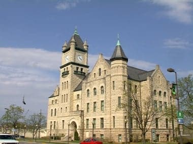
Photo: Wikipedia
Strategic Assessment of Douglas County
Workable tactical position. Some exposure to population density or targets, but generally defensible in a crisis.
What does the Strategic Assessment tell us?
Our Strategic Assessment grades tactical survivability of an area. Major population centers, military targets, fallout zones, natural disasters, and border exposure all drive risk — lower exposure means a more defensible position in a crisis.
This is heavily inspired by Joel Skousen's Strategic Relocation book. Highly recommended you checkout the book ($)What does this tell us?
Our Strategic Assessment grades tactical survivability of an area. Major population centers, military targets, fallout zones, natural disasters, and border exposure all drive risk — lower exposure means a more defensible position in a crisis.
This is heavily inspired by Joel Skousen's Strategic Relocation book. Highly recommended you checkout the book ($)Strategic Pillars

Key Distances
Strategic Assessment Analysis
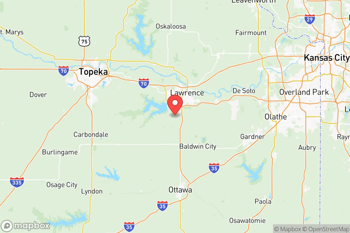
Douglas County, Kansas, offers a compelling mix of Midwestern stability and strategic depth for those prioritizing resilience and self-sufficiency. Anchored by the city of Lawrence and the University of Kansas, the county sits far enough from major metropolitan targets like Kansas City (about 40 miles east) and Topeka (about 20 miles west) to avoid the worst of any urban disruption, yet close enough to access critical supply chains and medical infrastructure. Its position along the Kansas River and within the broader Flint Hills region provides natural advantages in water access, agricultural potential, and defensible terrain that make it a serious contender for relocation-minded individuals and families.
Geographic position and natural advantages for long-term stability
Douglas County’s location in eastern Kansas places it within the Kansas River Valley, a broad floodplain that offers fertile soil and reliable surface water. The Kansas River itself runs through the heart of the county, providing a year-round water source that is less vulnerable to drought than the western parts of the state. The county is bordered by the Wakarusa River to the south, creating a natural buffer zone and additional water access. The terrain is a mix of rolling hills and open prairie, with the Flint Hills rising just to the west—this region’s shallow limestone bedrock and tallgrass prairie ecosystem are historically resistant to large-scale wildfire and offer excellent drainage for building sites. The county’s position in the central United States also means it is far from both coasts, reducing exposure to hurricane storm surge, sea-level rise, or earthquake fault lines. Winters are cold but manageable, with average snowfall around 20 inches annually, and summers are hot and humid, supporting a growing season of roughly 170 days—enough for substantial home gardening and small-scale farming.
Risk exposure: natural hazards and proximity to fallout-relevant landmarks
While Douglas County avoids many coastal and seismic threats, it is not without risks. The primary natural hazard is tornado activity, as the county sits within the traditional "Tornado Alley." Lawrence experienced a devastating EF5 tornado in 2003, and the area averages about 10 tornado warnings per year. Flooding along the Kansas and Wakarusa rivers is a recurring concern, particularly in low-lying areas near Lawrence’s downtown and the unincorporated community of Lecompton. For the resilience-minded relocator, the more significant risk is man-made: Douglas County lies within 50 miles of several potential fallout-relevant landmarks. Kansas City’s industrial corridor, including the BNSF rail yards and the oil storage facilities in the Kansas City metropolitan area, is roughly 40 miles east. The Sunflower Army Ammunition Plant, a former government explosives facility in nearby De Soto (Johnson County), is about 15 miles southeast and remains a site of environmental concern. Additionally, the Wolf Creek Nuclear Generating Station in Burlington, Kansas, is approximately 70 miles south—well within the 50-mile ingestion exposure zone. Fort Leavenworth, a major U.S. Army base, is about 30 miles north, and while not a nuclear target itself, it could become a secondary objective in a conflict scenario. The county’s proximity to Interstate 70 and the Union Pacific rail line also means it lies along a high-value transportation corridor that could be disrupted or targeted in a major event.
Practical resilience for a relocator: food, water, energy, and defensibility
For those serious about self-sufficiency, Douglas County offers a strong baseline. The Kansas River provides a reliable surface water source that can be treated with basic filtration or boiling, and groundwater is accessible via wells in most rural areas, with typical depths of 50-150 feet. The county’s agricultural heritage means local food production is viable: the surrounding farmland produces corn, soybeans, and wheat, and there is a growing network of small farms and farmers’ markets in Lawrence, Baldwin City, and Eudora. The University of Kansas’s agricultural extension office provides resources for home gardening, livestock, and soil testing. Energy infrastructure is moderately resilient: the county is served by Evergy, which operates a mix of coal, natural gas, and wind generation, but the grid is vulnerable to ice storms and tornado damage. Solar potential is good, with an average of 210 sunny days per year, and many rural properties already have backup generators or propane tanks. Defensibility is a mixed picture. The open prairie offers long sightlines but limited natural cover; however, the wooded river valleys and the hilly terrain near Clinton Lake (a U.S. Army Corps of Engineers reservoir) provide more defensible positions for those willing to live outside the city limits. The county’s population density is low outside Lawrence—about 60 people per square mile in rural areas—which reduces competition for resources in a crisis. The presence of the Douglas County Sheriff’s Office and a well-funded emergency management department adds a layer of organized response, but the county’s reliance on the Kansas Turnpike and I-70 for supply routes is a vulnerability if those roads are compromised.
Overall, Douglas County presents a balanced strategic picture for the resilience-focused relocator. It avoids the extreme risks of coastal or metropolitan areas while offering tangible advantages in water access, agricultural potential, and a moderate climate. The primary trade-offs are the tornado and flood risks, which can be mitigated through proper site selection and construction, and the proximity to Kansas City and other potential targets, which requires a realistic assessment of fallout exposure and supply chain disruption. For a family or individual willing to invest in a well, solar panels, and a storm shelter, and who chooses a rural property away from the river bottoms and major highways, Douglas County offers a credible foundation for long-term self-sufficiency in the American heartland.

* Values derived from national, state, county, city and local statistics and may differ in a specific area. Last updated: 2026-07-07T06:07:47.000Z
Narrative content on this page is AI-generated and may contain mistakes. Verify any details that matter before acting on them.
ReloMaps may earn a commission from affiliate links at no extra cost to you.

