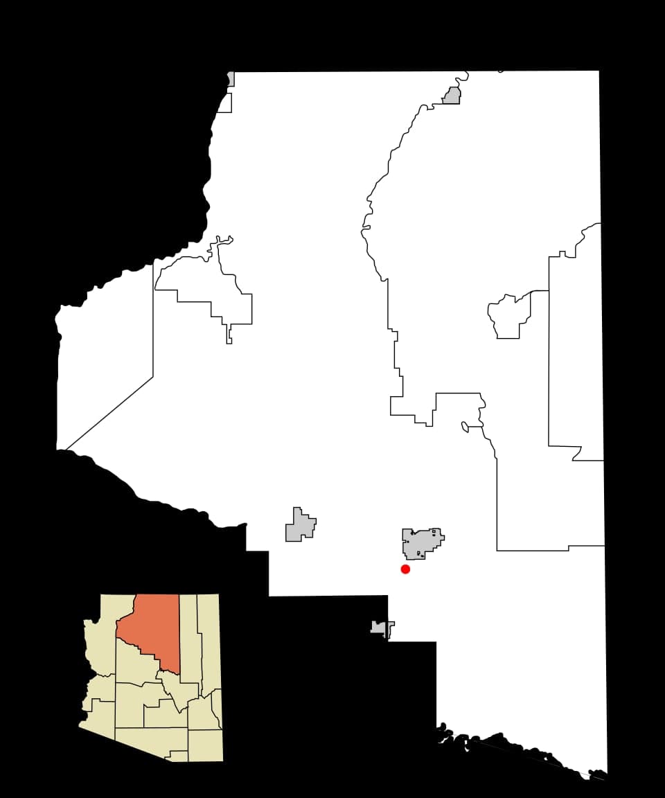
Photo: Wikipedia
Strategic Assessment of Kachina Village, AZ
Workable tactical position. Some exposure to population density or targets, but generally defensible in a crisis.
What does the Strategic Assessment tell us?
Our Strategic Assessment grades tactical survivability of an area. Major population centers, military targets, fallout zones, natural disasters, and border exposure all drive risk — lower exposure means a more defensible position in a crisis.
This is heavily inspired by Joel Skousen's Strategic Relocation book. Highly recommended you checkout the book ($)What does this tell us?
Our Strategic Assessment grades tactical survivability of an area. Major population centers, military targets, fallout zones, natural disasters, and border exposure all drive risk — lower exposure means a more defensible position in a crisis.
This is heavily inspired by Joel Skousen's Strategic Relocation book. Highly recommended you checkout the book ($)Strategic Pillars

Key Distances
Regional Safe Places
Below is our recommended "safe zones" in Arizona and the surrounding area based on our strategic heuristics. For most people, it's unrealistic to live in a “safe zone” full-time due to work, family or other personal reasons. They tend to be more rural. However, many of these areas are perfect for second homes and retreat properties that double as a vacation home or even a short-term rental.
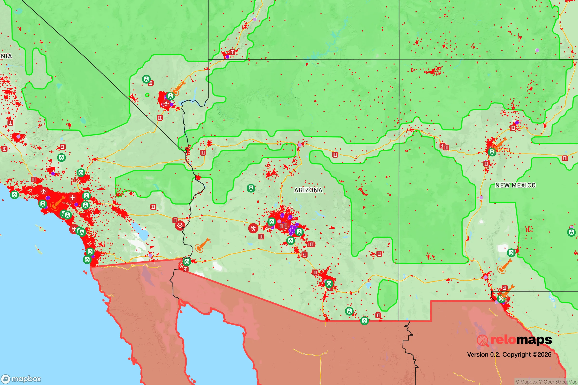
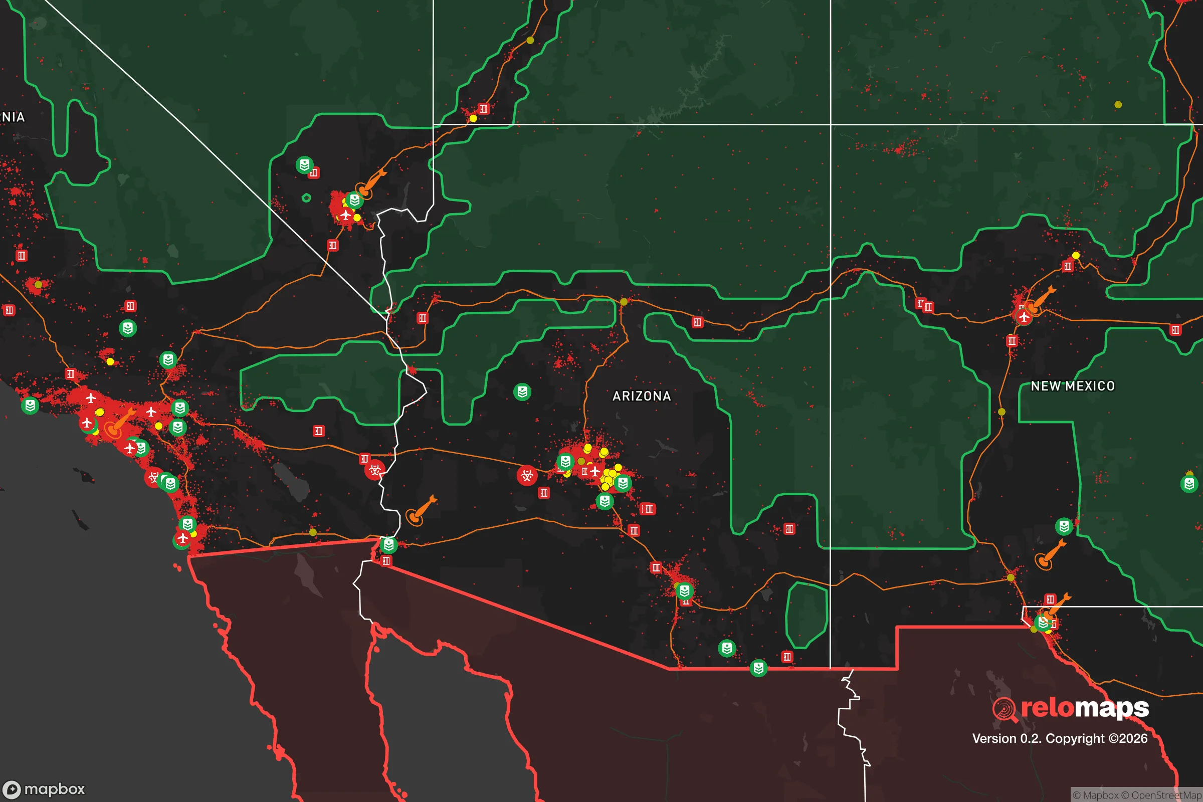


Important Note: For informational purposes only. This does not mean nothing bad ever happens in the green zones. Please use common sense. This is based on public data and modeled with AI. We tried to take a conservative approach but mistakes happen. We update this regularly as new information becomes available.
Solar Generator Recommendations
Backup power matters more here than in safer locations. We've picked three solar generators across budgets and capacity tiers — start with the budget unit if you only need a few essentials, or step up if you want to run a fridge and HVAC for days at a time.

Jackery Portable Power Station Explorer 300
Budget OptionPower on the Go: Weighing only 11 lbs, it's convenient to set up and store with book-sized foldable solar panels

BLUETTI Portable Power Station AC180
Designed for both indoor and outdoor scenarios, AC180 is highly capable as it has a robost capacity and continuous output power.

EF ECOFLOW DELTA Pro Ultra Power Station
Upgraded PickEcoFlow DELTA Pro Ultra is a whole-home energy system designed to grow with your family. Integrated with the Smart Home Panel 2, it scales to meet your evolving energy needs — keeping your home powered, intelligent, and secure through every stage of life.
We earn a commission, at no additional cost to you.
Strategic Assessment Analysis
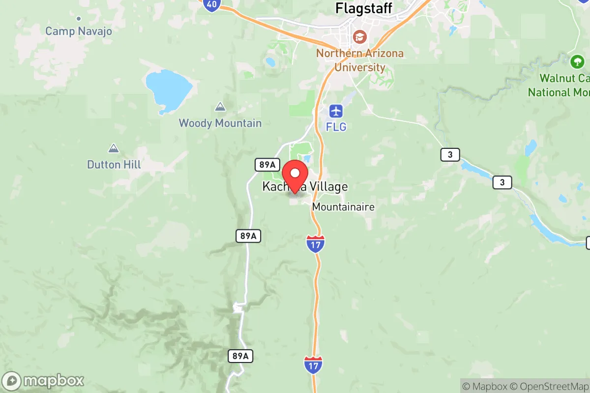
Kachina Village, Arizona, offers a compelling strategic position for those prioritizing disaster readiness and self-sufficiency, balancing proximity to Flagstaff’s resources with a more insulated, forested setting. Located roughly 10 miles south of Flagstaff along Interstate 17, this unincorporated community sits at approximately 6,800 feet elevation on the Colorado Plateau, providing natural advantages in terms of climate, water access, and defensibility. For a relocator thinking seriously about resilience, Kachina Village presents a mixed picture: strong geographic buffers against many common risks, but real exposure to wildfire and the vulnerabilities that come with being within an hour’s drive of a regional population center and critical infrastructure.
Geographic position and natural advantages for self-sufficiency
Kachina Village’s location on the southern slope of the San Francisco Peaks provides several strategic benefits. The elevation ensures a cooler, drier climate than the desert valleys below, reducing heat-related risks and supporting more reliable water availability through snowmelt and seasonal precipitation. The area sits within the Coconino National Forest, surrounded by ponderosa pine forests and volcanic terrain, which offers natural barriers to large-scale population movement and provides ample space for off-grid living. The proximity to the San Francisco Peaks also means access to multiple microclimates and ecosystems within a short drive, from alpine tundra to high desert, which can be advantageous for diversified food production and resource gathering. Groundwater in the region is generally plentiful, with the Coconino aquifer underlying much of the area, though well depths vary and should be verified property by property. The community’s layout—spread-out lots, many with mature tree cover—offers natural concealment and reduces the density that makes urban areas vulnerable to cascading failures.
Risks, exposures, and proximity to fallout-relevant landmarks
The most significant natural risk in Kachina Village is wildfire. The surrounding ponderosa pine forest is highly flammable, and the area has experienced several major fires in recent decades, including the 2010 Schultz Fire that burned over 15,000 acres just north of Flagstaff. Kachina Village itself sits in a Wildland-Urban Interface (WUI) zone, meaning residents must maintain defensible space and be prepared for evacuation orders during dry, windy conditions. Beyond wildfire, the region faces moderate earthquake risk from nearby fault lines, though major seismic events are rare. From a man-made risk perspective, Kachina Village’s location is a double-edged sword. It lies roughly 130 miles from the Palo Verde Nuclear Generating Station near Phoenix, one of the largest nuclear plants in the country, and about 180 miles from the Nevada National Security Site (formerly the Nevada Test Site). While these distances provide a substantial buffer against direct fallout, prevailing winds from the southwest could carry airborne contaminants toward the area in a worst-case scenario. More immediately, the community’s proximity to Flagstaff (population ~77,000) and its position along I-17—a major evacuation route from Phoenix—means that in a regional crisis, Kachina Village could see significant through-traffic and potential strain on local resources. The presence of the U.S. Naval Observatory Flagstaff Station and Lowell Observatory, while not direct targets, are part of the area’s infrastructure profile that could draw attention in a conflict scenario.
Practical resilience for a relocator: food, water, energy, and defensibility
For a relocator focused on self-sufficiency, Kachina Village offers a mixed but workable foundation. Water is the strongest asset: the Coconino aquifer provides reliable groundwater, and many properties have existing wells or the potential to drill. Annual precipitation averages around 20-25 inches, enough to support rainwater catchment systems for supplemental use. The growing season is short (roughly 100-120 frost-free days), but cold-hardy crops like potatoes, carrots, kale, and root vegetables do well, and the nearby San Francisco Peaks offer grazing and foraging opportunities. Energy independence is achievable: the area receives over 280 sunny days per year, making solar power viable, though winter snow can reduce panel efficiency. Wood heating is common and practical given the forested surroundings, but requires proper stove maintenance and fuel storage. Food security is bolstered by Flagstaff’s multiple grocery stores and farmers’ markets within a 15-minute drive, but local food production is limited by the short season and rocky soils. For long-term resilience, building greenhouse capacity and establishing perennial food systems (fruit trees, berries, nut trees) is advisable. Defensibility is moderate: the forested terrain provides cover and chokepoints, but the community’s layout along winding roads and its proximity to I-17 mean that controlling access would be difficult without coordinated neighborhood efforts. The area’s low population density (roughly 200-300 residents) and lack of major industrial targets are advantages, but the lack of a formal community emergency plan or mutual aid network means resilience is largely individual or household-based.
Overall, Kachina Village presents a viable but not ideal strategic relocation option for the disaster-conscious reader. Its strengths lie in water availability, climate moderation, and natural buffers against urban chaos, while its weaknesses center on wildfire risk, proximity to a major evacuation corridor, and the logistical challenges of mountain living. For a single individual or family willing to invest in fire mitigation, off-grid energy systems, and food production infrastructure, the area offers a solid foundation for long-term resilience. However, those seeking maximum isolation and minimal exposure to man-made risks would need to look farther from Flagstaff and the I-17 corridor. Kachina Village is best understood as a balanced middle ground: close enough to access resources and community, but far enough to avoid the worst of urban collapse scenarios—provided you prepare for the specific threats the forest brings.

* Values derived from national, state, county, city and local statistics and may differ in a specific area. Last updated: 2026-10-24T16:48:27.000Z
Narrative content on this page is AI-generated and may contain mistakes. Verify any details that matter before acting on them.
ReloMaps may earn a commission from affiliate links at no extra cost to you.

