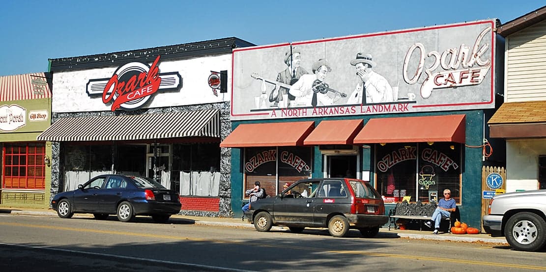
Photo: Wikipedia
Strategic Assessment of Jasper, AR
Strong survivability profile. Good buffer from population centers, with manageable environmental and tactical risks.
What does the Strategic Assessment tell us?
Our Strategic Assessment grades tactical survivability of an area. Major population centers, military targets, fallout zones, natural disasters, and border exposure all drive risk — lower exposure means a more defensible position in a crisis.
This is heavily inspired by Joel Skousen's Strategic Relocation book. Highly recommended you checkout the book ($)What does this tell us?
Our Strategic Assessment grades tactical survivability of an area. Major population centers, military targets, fallout zones, natural disasters, and border exposure all drive risk — lower exposure means a more defensible position in a crisis.
This is heavily inspired by Joel Skousen's Strategic Relocation book. Highly recommended you checkout the book ($)Strategic Pillars

Key Distances
Regional Safe Places
Below is our recommended "safe zones" in Arkansas and the surrounding area based on our strategic heuristics. For most people, it's unrealistic to live in a “safe zone” full-time due to work, family or other personal reasons. They tend to be more rural. However, many of these areas are perfect for second homes and retreat properties that double as a vacation home or even a short-term rental.
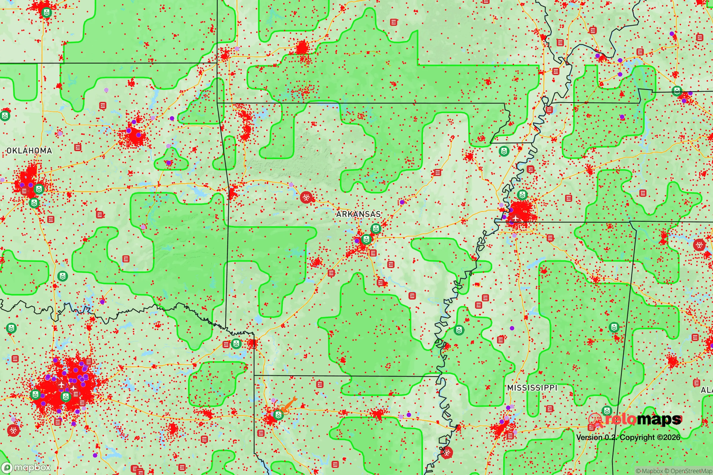
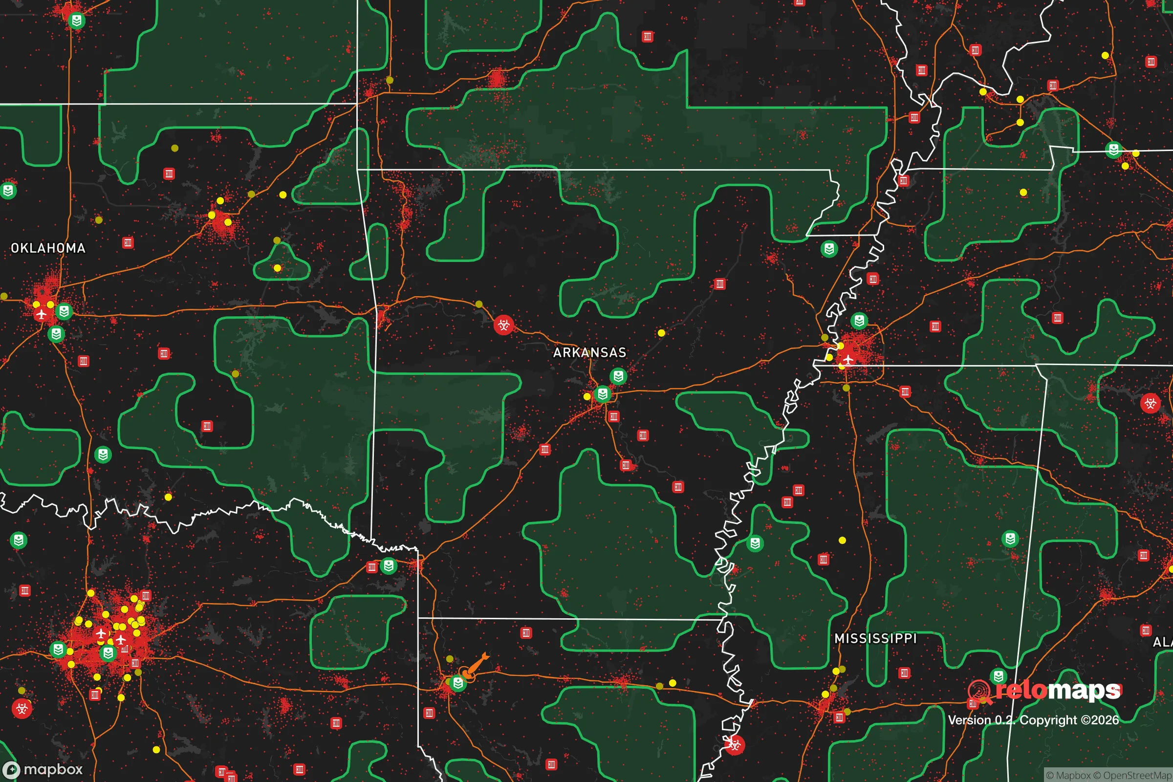


Important Note: For informational purposes only. This does not mean nothing bad ever happens in the green zones. Please use common sense. This is based on public data and modeled with AI. We tried to take a conservative approach but mistakes happen. We update this regularly as new information becomes available.
Solar Generator Recommendations
Backup power matters more here than in safer locations. We've picked three solar generators across budgets and capacity tiers — start with the budget unit if you only need a few essentials, or step up if you want to run a fridge and HVAC for days at a time.

Jackery Portable Power Station Explorer 300
Budget OptionPower on the Go: Weighing only 11 lbs, it's convenient to set up and store with book-sized foldable solar panels

BLUETTI Portable Power Station AC180
Designed for both indoor and outdoor scenarios, AC180 is highly capable as it has a robost capacity and continuous output power.

EF ECOFLOW DELTA Pro Ultra Power Station
Upgraded PickEcoFlow DELTA Pro Ultra is a whole-home energy system designed to grow with your family. Integrated with the Smart Home Panel 2, it scales to meet your evolving energy needs — keeping your home powered, intelligent, and secure through every stage of life.
We earn a commission, at no additional cost to you.
Strategic Assessment Analysis
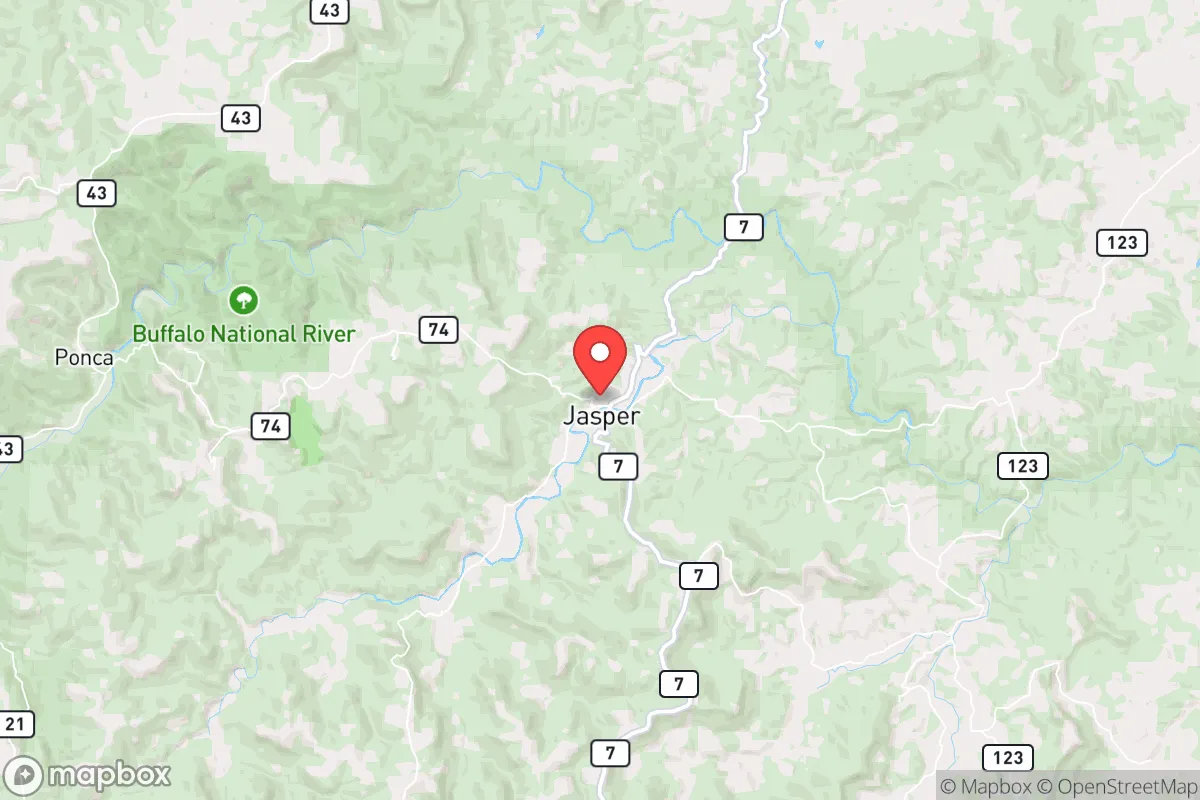
Jasper, Arkansas, sits in a sweet spot that few relocators fully appreciate: it’s remote enough to dodge the chaos of metropolitan collapse, yet close enough to real infrastructure that you’re not completely on your own. Tucked into the Boston Mountains of the Ozark Plateau, this Newton County seat offers a combination of topographic shielding, low population density, and hard-to-reach geography that makes it a serious contender for anyone building a resilience-focused life. For a single person or family weighing disaster readiness against practical livability, Jasper deserves a hard look — not because it’s perfect, but because its weaknesses are manageable and its strengths are structural.
Geographic position and natural defensive advantages
Jasper’s core strategic asset is the terrain itself. The town sits at roughly 850 feet elevation, surrounded by the Buffalo National River and the Ozark National Forest, with the Boston Mountains rising to 2,000+ feet within a few miles. That means natural choke points on every approach — the main routes in (AR-7 from the south, AR-74 from the east, AR-123 from the west) are winding, narrow, and easily monitored. In a grid-down or civil-unrest scenario, this is about as close to a defensible position as you’ll find in the lower 48 without going full off-grid in Montana.
The population density is the second pillar. Newton County has roughly 7,200 residents spread over 823 square miles — about 8.7 people per square mile, versus the national average of 93. That’s not just quiet; it’s a functional buffer. You’re 45 minutes from Harrison (pop. 13,000) and about 2 hours from both Fayetteville and Springfield, Missouri. The nearest interstate (I-40) is 70 miles south. In a crisis, that distance works for you: it filters out the unprepared, the panicked, and the looters who won’t burn fuel to reach a town with no big-box retail.
Water is the third advantage. The Buffalo River runs through the county, and dozens of perennial springs and creeks drain the limestone bluffs. Unlike much of the western U.S., this region gets 45–50 inches of annual rainfall, and the Ozark aquifer system provides reliable well water at depths of 100–300 feet. For a relocator, that means you’re not dependent on municipal supply or trucked-in water — you can drill, gravity-feed from a spring, or harvest roof runoff with relatively modest investment.
Risks, exposures, and proximity to fallout-relevant landmarks
No location is risk-free, and Jasper has three categories of exposure worth weighing honestly. First, natural hazards: the area sits in a moderate seismic zone (the New Madrid fault is 200 miles east), and tornado risk is real but lower than the flatlands to the west. The bigger day-to-day threat is winter ice storms — Jasper’s elevation and mountain roads mean power outages of 3–7 days are routine in bad winters, and some remote homes have gone two weeks without grid power in the past decade. Wildfire risk is low but not zero, given the dense hardwood forest.
Second, man-made risks. The most significant is proximity to the North Arkansas Regional Medical Center in Harrison — a hospital, yes, but also a concentration point for emergency traffic. More relevant for the resilience-minded: Jasper is roughly 90 miles from the Entergy Arkansas nuclear plant at Russellville (a single-unit pressurized water reactor). In a worst-case release, prevailing winds would carry fallout northeast, not toward Jasper, but it’s not a zero-risk distance. The bigger man-made concern is the I-40 corridor — a primary east-west freight and fuel artery. If that corridor is disrupted (EMP, fuel shortage, civil unrest), Jasper won’t see the violence, but it will feel the supply chain pinch.
Third, the human factor. Newton County is one of the poorest in Arkansas (median household income around $40,000), which cuts both ways. On one hand, there’s less wealth to attract organized crime or looting. On the other, a significant portion of the local population lives paycheck-to-paycheck and may not be well-prepared themselves — meaning in a prolonged crisis, you’re not surrounded by preppers, you’re surrounded by neighbors who may need help. That’s a community-building opportunity, but also a resource-drain risk if you’re not careful about your own buffer.
Practical resilience for a relocator: food, water, energy, and defensibility
For someone serious about self-sufficiency, Jasper’s practical fundamentals are strong but require deliberate setup. Food: the growing season runs roughly April through October (zone 6b/7a), with good yields of tomatoes, squash, beans, and root crops. The limestone soil is alkaline and rocky — raised beds or terraced gardens are almost mandatory. Local livestock options are solid: cattle, goats, and poultry are common, and the Buffalo River watershed supports fishing (smallmouth bass, trout in the tailwaters). For long-term storage, the nearest bulk suppliers are in Harrison, so plan to lay in a 6–12 month pantry before you need it.
Water and energy: this is where Jasper shines. Well drilling runs $8,000–$15,000 for a 200-foot domestic well, and the water quality is generally excellent (hard, but potable). Solar is viable — the region gets about 200 sunny days per year, slightly below the national average but workable with a modest array. The real energy win is wood heat: the national forest offers firewood permits at minimal cost, and a well-insulated cabin can be heated all winter with 3–4 cords. Propane is the backup of choice; local suppliers in Jasper and Vendor deliver, but a 500-gallon tank with a 6-month supply is the prudent baseline.
Defensibility and community: Jasper’s layout is compact — the town proper is about 1.5 square miles with a few hundred residents. The courthouse square is the natural rally point, and the surrounding ridges offer clear sightlines. For a family, the practical play is to buy 5–20 acres on a dead-end county road (many available under $3,000/acre), where you control the approach. The local culture is hunting-and-fishing oriented, so firearms ownership is normalized and neighbors are generally self-reliant. The Newton County Sheriff’s Office is small (roughly 10 deputies for the whole county), so response times in rural areas are 15–30 minutes — you are your own first responder, which is exactly the mindset this analysis assumes.
The overall strategic picture for a relocator
Jasper is not a bug-out location; it’s a live-here-and-be-ready location. Its strengths — terrain, water, low density, and a self-reliant local culture — are exactly what you want for long-term resilience. Its weaknesses — winter ice storms, moderate distance from medical care, and a low-income local economy — are manageable with planning. The nuclear plant at Russellville and the I-40 corridor are real but distant concerns, not immediate threats. For a single person or family willing to invest in a well, solar, wood heat, and a serious pantry, Jasper offers one of the best strategic positions in the mid-South: hard to reach, harder to besiege, and genuinely capable of sustaining a household indefinitely. The trade-off is isolation and a slower pace of life — but for the reader who’s asking these questions, that’s likely the point.

* Values derived from national, state, county, city and local statistics and may differ in a specific area. Last updated: 2026-10-12T12:28:49.000Z
Narrative content on this page is AI-generated and may contain mistakes. Verify any details that matter before acting on them.
ReloMaps may earn a commission from affiliate links at no extra cost to you.

