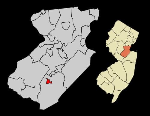
Photo: Wikipedia
Strategic Assessment of Jamesburg, NJ
High tactical risk. This location is likely close to major population centers, strategic targets, or sits in a high-disaster corridor. A retreat property and careful exit planning is required.
What does the Strategic Assessment tell us?
Our Strategic Assessment grades tactical survivability of an area. Major population centers, military targets, fallout zones, natural disasters, and border exposure all drive risk — lower exposure means a more defensible position in a crisis.
This is heavily inspired by Joel Skousen's Strategic Relocation book. Highly recommended you checkout the book ($)What does this tell us?
Our Strategic Assessment grades tactical survivability of an area. Major population centers, military targets, fallout zones, natural disasters, and border exposure all drive risk — lower exposure means a more defensible position in a crisis.
This is heavily inspired by Joel Skousen's Strategic Relocation book. Highly recommended you checkout the book ($)Strategic Pillars

Key Distances
Regional Safe Places
Below is our recommended "safe zones" in New Jersey and the surrounding area based on our strategic heuristics. For most people, it's unrealistic to live in a “safe zone” full-time due to work, family or other personal reasons. They tend to be more rural. However, many of these areas are perfect for second homes and retreat properties that double as a vacation home or even a short-term rental.
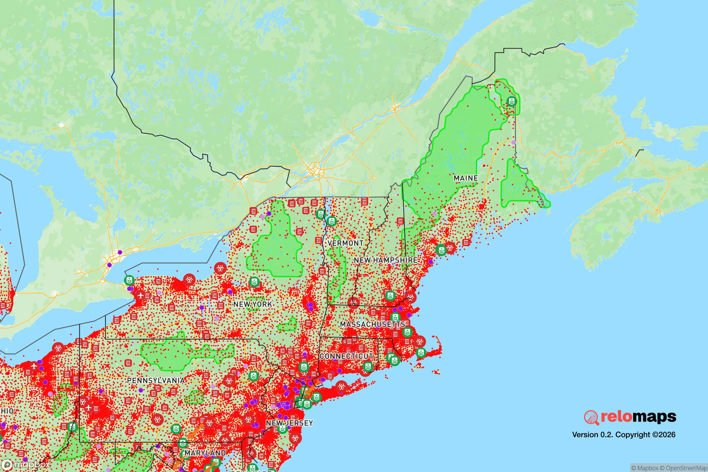
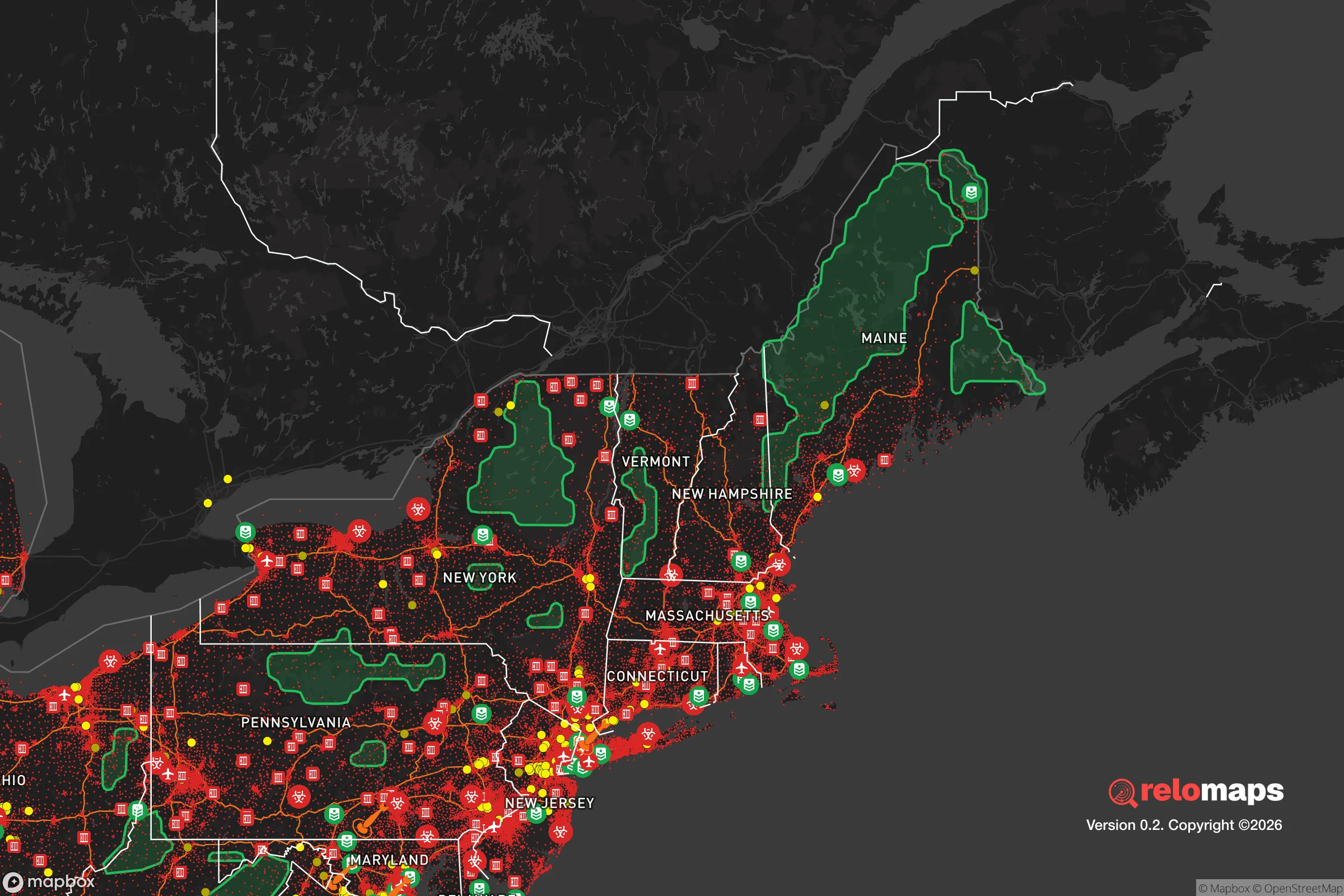


Important Note: For informational purposes only. This does not mean nothing bad ever happens in the green zones. Please use common sense. This is based on public data and modeled with AI. We tried to take a conservative approach but mistakes happen. We update this regularly as new information becomes available.
Solar Generator Recommendations
Backup power matters more here than in safer locations. We've picked three solar generators across budgets and capacity tiers — start with the budget unit if you only need a few essentials, or step up if you want to run a fridge and HVAC for days at a time.

Jackery Portable Power Station Explorer 300
Budget OptionPower on the Go: Weighing only 11 lbs, it's convenient to set up and store with book-sized foldable solar panels

BLUETTI Portable Power Station AC180
Designed for both indoor and outdoor scenarios, AC180 is highly capable as it has a robost capacity and continuous output power.

EF ECOFLOW DELTA Pro Ultra Power Station
Upgraded PickEcoFlow DELTA Pro Ultra is a whole-home energy system designed to grow with your family. Integrated with the Smart Home Panel 2, it scales to meet your evolving energy needs — keeping your home powered, intelligent, and secure through every stage of life.
We earn a commission, at no additional cost to you.
Strategic Assessment Analysis
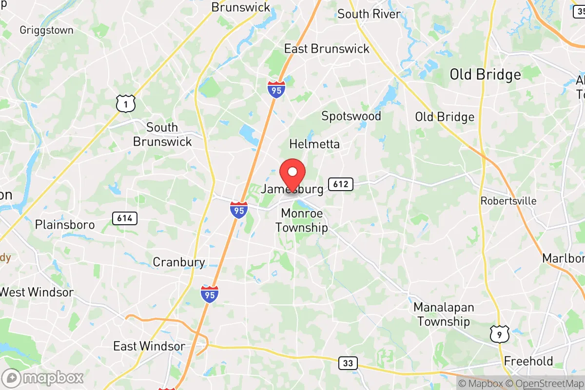
Jamesburg sits in a sweet spot for a relocator who wants serious disaster resilience without abandoning the Northeast corridor. The borough’s position in central Middlesex County — roughly 12 miles from the Jersey Shore, 35 miles from Philadelphia, and 45 miles from Manhattan — gives you a buffer from the densest urban fallout zones while keeping major logistics hubs within a day’s drive. The area’s real strategic value is its combination of solid infrastructure, a working agricultural belt to the south and west, and a population density that is high enough to maintain services but low enough to avoid the worst of a grid-down scramble.
Geographic position and natural advantages for long-term stability
Jamesburg’s geography is flatter and more inland than most people assume for New Jersey, which cuts down on some weather-related risks. The borough sits on the Inner Coastal Plain, an area that drains reasonably well compared to the Meadowlands or the Passaic River basin. You are not in a floodplain here — the nearest significant waterway, the Manalapan Brook, runs along the eastern edge and has a history of nuisance flooding during heavy rain, but it is not a catastrophic riverine threat like the Raritan to the north. The elevation, roughly 80 to 100 feet above sea level, puts you well above any realistic storm-surge scenario, even with accelerated sea-level rise. That is a meaningful advantage over coastal towns like Sayreville or South Amboy, which face regular tidal flooding during nor’easters.
The surrounding farmland is the quiet strategic asset. Monroe Township, which surrounds Jamesburg on three sides, still has active agricultural operations and nurseries, and the broader Middlesex-Somerset-Mercer county triangle is one of the most productive non-industrial farming zones in the state. For a family thinking about food security, that means local produce, dairy, and poultry are available within a 10- to 20-mile radius even in normal times, and the supply chain is shorter than almost anywhere else in the New York metro area. The proximity to the Delaware & Raritan Canal and the Millstone River watershed to the west also gives you a secondary water source option, though you would need your own filtration and pumping setup to use it practically.
Risk profile: what could actually go wrong in central New Jersey
The honest assessment is that Jamesburg’s man-made risk exposure is moderate, not severe, but it is not zero. The biggest single concern is the region’s concentration of chemical and refining infrastructure along the Raritan Bay and the New Jersey Turnpike corridor, roughly 10 to 15 miles northeast. The Phillips 66 Bayway refinery in Linden and the sprawling chemical complexes in Carteret and Woodbridge are the kind of facilities that, in a worst-case event, could produce a toxic plume that drifts southwest — which is the prevailing wind direction in this area. That is a low-probability, high-consequence scenario, and it is worth knowing your evacuation route west on Route 130 or the Turnpike before you need it.
On the fallout-relevant side, Jamesburg is far enough from the major population centers to avoid the immediate blast and thermal effects of a nuclear detonation in Manhattan or Philadelphia, but it is not far enough to be out of the radioactive plume zone. A surface burst in midtown Manhattan would put central New Jersey downwind of the fallout pattern, and the borough would likely see measurable contamination within hours. The practical takeaway is not that Jamesburg is unsafe — it is that you need a shelter-in-place plan with at least two weeks of supplies and a way to seal your home, because evacuation during a radiological event is often worse than sheltering. The nearby McGuire Air Force Base in Burlington County, about 20 miles southwest, is a potential secondary target, but it is a logistics hub rather than a strategic bomber base, which lowers its priority for an adversary.
Natural hazards are more predictable. Severe thunderstorms and microbursts are the most common events, and the area gets occasional tornado warnings — the 2021 tornado that touched down in nearby Monroe Township is a reminder that these are not just coastal phenomena. Winter storms can knock out power for several days, and the region’s aging tree canopy along Route 522 and Perrineville Road is the main culprit. Hurricane remnants, like Ida in 2021, produce flash flooding in low-lying spots, but Jamesburg’s core is generally safe if you avoid basements and low-lying streets near the brook.
Practical resilience: food, water, energy, and defensibility for a relocator
For a family or single individual serious about preparedness, Jamesburg offers a workable baseline that requires modest upgrades rather than a full off-grid build. Municipal water comes from the New Jersey American Water system, which draws from the Raritan Basin and is generally reliable, but the distribution network is vulnerable to long-duration power outages. A 1,000-gallon cistern or rain catchment system is feasible on most residential lots here, and well water is an option on the larger lots in the surrounding Monroe Township farm belt — though you would need to drill, which runs $15,000 to $25,000 in this area. The local water table is high, so wells are productive, but they do require electric pumps, so a backup generator or solar array with battery storage is the critical piece.
Energy resilience is the weakest link. The borough is served by Jersey Central Power & Light, and the grid here is average by New Jersey standards — expect 1- to 3-day outages during major storms, and longer in the more rural stretches toward Cranbury and Hightstown. Natural gas is available in most of Jamesburg proper, which is a genuine advantage for heating and cooking during an outage, but it does nothing for you if the grid is down and you need electricity. A whole-home generator, or at minimum a dual-fuel portable unit, is the single highest-value investment for this area. Solar is viable — the region gets about 4.2 peak sun hours per day — and net metering is available, but you should pair it with battery storage if you want true grid independence.
Defensibility is a mixed picture. Jamesburg is a compact borough of roughly 6,000 people, with a traditional street grid and multiple entry points, which makes it hard to seal off in a security scenario. The surrounding Monroe Township developments are more suburban and spread out, with cul-de-sacs that are easier to control. For a family, the better play is a property on the western or southern edge of the borough, where you have farmland as a buffer and only one or two access roads. The local police department is small but professional, and the Middlesex County Sheriff’s Office provides backup, but in a prolonged emergency you should assume self-reliance for the first 72 hours at minimum. The proximity to Route 130 and the Turnpike is a double-edged sword: it gives you fast egress, but it also means that in a regional evacuation, those roads will clog quickly — have a secondary route through Cranbury and Plainsboro planned in advance.
The strategic bottom line for a preparedness-minded relocator
Jamesburg is not a bug-out location, and it is not a prepper’s paradise. It is a pragmatic middle-ground choice: close enough to jobs, hospitals, and supply chains to function normally, but with enough agricultural buffer and inland positioning to ride out most regional disruptions. The realistic threat matrix here is dominated by extended power outages, winter storms, and the low-probability but real risk of chemical or radiological events from the industrial corridor to the northeast. If you come in with a solid water storage plan, a backup power source, and a shelter-in-place kit, you will be ahead of 95 percent of your neighbors. The area’s true resilience advantage is its location in the middle of one of the most productive food-producing regions in the Northeast — in a prolonged crisis, that is the asset that matters most.

* Values derived from national, state, county, city and local statistics and may differ in a specific area. Last updated: 2026-11-13T09:13:52.000Z
Narrative content on this page is AI-generated and may contain mistakes. Verify any details that matter before acting on them.
ReloMaps may earn a commission from affiliate links at no extra cost to you.

