Photo: Wikipedia
Strategic Assessment of Woodbury County
Workable tactical position. Some exposure to population density or targets, but generally defensible in a crisis.
What does the Strategic Assessment tell us?
Our Strategic Assessment grades tactical survivability of an area. Major population centers, military targets, fallout zones, natural disasters, and border exposure all drive risk — lower exposure means a more defensible position in a crisis.
This is heavily inspired by Joel Skousen's Strategic Relocation book. Highly recommended you checkout the book ($)What does this tell us?
Our Strategic Assessment grades tactical survivability of an area. Major population centers, military targets, fallout zones, natural disasters, and border exposure all drive risk — lower exposure means a more defensible position in a crisis.
This is heavily inspired by Joel Skousen's Strategic Relocation book. Highly recommended you checkout the book ($)Strategic Pillars

Key Distances
Strategic Assessment Analysis
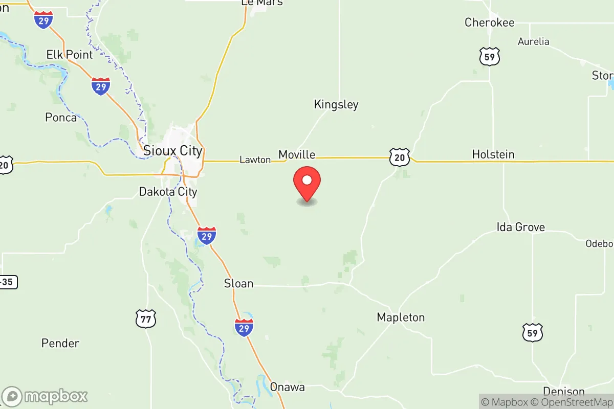
Woodbury County, anchored by Sioux City at the confluence of the Missouri, Big Sioux, and Floyd Rivers, offers a strategic relocation option for those prioritizing geographic buffering and logistical self-sufficiency. Its position in Iowa's far northwest corner places it over 100 miles from any major metropolitan center like Omaha, Des Moines, or Sioux Falls, providing a meaningful separation from the congestion and concentrated risk profiles of larger urban areas. The county's historical role as a transportation and agricultural hub — with rail lines, interstate access via I-29 and I-129, and the Missouri River barge channel — gives it a structural resilience that smaller, more isolated towns lack, making it a viable base for a household or small community preparing for long-term disruption.
Geographic position and natural advantages for long-term stability
Woodbury County sits on the eastern edge of the Great Plains, where the Missouri River Valley meets the rolling Loess Hills. This topography offers a mix of flat, fertile bottomlands and steep, wooded bluffs that provide natural drainage and defensible building sites. The Loess Hills, a unique formation of wind-deposited silt, rise 200 feet above the floodplain and offer elevated terrain with good visibility and separation from river-level flood risks — a practical advantage for anyone scouting a homestead or retreat property. The county's position along the Missouri River also provides a reliable surface water source, though the river itself is heavily managed by a series of upstream dams (Gavins Point, Fort Randall) that reduce the risk of catastrophic flooding compared to unregulated watersheds. The surrounding region is sparsely populated: the nearest cities of comparable size are Sioux Falls (80 miles north) and Omaha (95 miles south), meaning Woodbury County is not a natural target for population displacement or cascading infrastructure failures originating from those hubs. The county's agricultural land — primarily corn and soybeans — is among the most productive in the state, and the presence of the Sioux City metropolitan statistical area (population roughly 145,000) means that essential services, medical facilities, and supply chains are close enough to be useful but not so dense as to create a single point of failure.
Risks, exposures, and proximity to fallout-relevant landmarks
No location is without vulnerabilities, and Woodbury County has several that a serious relocator should weigh. The most prominent is the presence of the Sioux City Railroad Bridge and the Union Pacific rail yard, which handle significant freight traffic including hazardous materials. A derailment or industrial accident involving chemicals or fuels could affect the river corridor, though the prevailing winds from the northwest would push any airborne contaminants away from most residential areas. The county also lies within 150 miles of Offutt Air Force Base near Omaha, a major command and control center for U.S. Strategic Command. In a conflict scenario involving strategic assets, Offutt is a high-priority target, and Woodbury County sits within the outer band of potential fallout patterns depending on wind direction. Additionally, the Missouri River levee system, while well-maintained, is aging in sections, and a catastrophic failure during a prolonged flood event could threaten low-lying areas of Sioux City, particularly the Riverside and Morningside neighborhoods. Tornado risk is real but not exceptional for the region — the county averages 6-8 tornado warnings per year, with the most active period from May to July. The county's position relative to the Fort Dodge and Sioux Falls ethanol plants and the Port Neal Power Plant (a coal and natural gas facility just south of Sioux City) means that industrial accidents, though rare, are a non-zero concern. For a relocator, the key takeaway is that Woodbury County's risks are primarily industrial and weather-related, not geopolitical or demographic — it is far enough from major cities and military targets to avoid the worst-case scenarios that drive relocation decisions.
Practical resilience for a relocator: food, water, energy, and defensibility
For a household or small group looking to establish a resilient base, Woodbury County offers strong fundamentals in the four critical domains. Food: The county is part of Iowa's most productive agricultural region, with thousands of acres of row crops and a robust local livestock sector. The Sioux City Farmers Market operates from May through October, and the presence of multiple grain elevators, feed mills, and the AGP soybean processing plant means that bulk food supplies and agricultural inputs are locally available. For those planning to garden or raise animals, the growing season runs roughly 150 days (mid-April to mid-October), and the soil in the Loess Hills is well-drained and fertile. Water: The Missouri River is the county's primary water source, treated by the Sioux City Water Treatment Plant, which has backup generator capacity. Private wells are common in rural areas, with groundwater quality generally good, though shallow wells in the river valley may be vulnerable to agricultural runoff. A relocator should budget for a deep well (200+ feet) if purchasing rural property. Energy: The county is served by MidAmerican Energy, which operates the Port Neal Power Plant (coal and natural gas) and the Sioux City Station (natural gas). There is also growing wind generation capacity in the surrounding counties, and net metering policies make solar panel installation viable for off-grid or grid-tied setups. Wood is abundant in the Loess Hills for heating, though hardwood stands are limited. Defensibility: The Loess Hills provide natural chokepoints and elevated positions for those choosing a rural property. The county's low population density outside of Sioux City means that a well-chosen homestead can have significant standoff distance from roads and neighbors. The Woodbury County Sheriff's Office has a response time of 15-30 minutes in rural areas, so self-reliance in security is a practical necessity. The county's strong hunting culture (deer, turkey, waterfowl) means that firearms ownership and proficiency are common, and there are multiple public shooting ranges and private clubs for training.
The overall strategic picture for Woodbury County is one of moderate, grounded resilience. It is not a remote mountain redoubt, nor is it a densely populated corridor with cascading failure risks. It occupies a middle ground: close enough to a regional hub (Sioux City) for medical care, supply runs, and community support, but far enough from major cities and strategic targets to avoid the worst fallout scenarios. The county's agricultural productivity, water access, and varied terrain give a relocator the raw materials for long-term self-sufficiency, while its existing infrastructure and transportation links prevent the isolation that can become a liability in a prolonged disruption. For a conservative-leaning individual or family who values preparedness but does not want to live entirely off-grid, Woodbury County represents a defensible, sustainable option in the Upper Midwest — one that balances access with separation, and productivity with protection.

* Values derived from national, state, county, city and local statistics and may differ in a specific area. Last updated: 2026-06-26T15:41:10.000Z
Narrative content on this page is AI-generated and may contain mistakes. Verify any details that matter before acting on them.
ReloMaps may earn a commission from affiliate links at no extra cost to you.

