
Photo: Wikipedia
Strategic Assessment of Marion County
Strong survivability profile. Good buffer from population centers, with manageable environmental and tactical risks.
What does the Strategic Assessment tell us?
Our Strategic Assessment grades tactical survivability of an area. Major population centers, military targets, fallout zones, natural disasters, and border exposure all drive risk — lower exposure means a more defensible position in a crisis.
This is heavily inspired by Joel Skousen's Strategic Relocation book. Highly recommended you checkout the book ($)What does this tell us?
Our Strategic Assessment grades tactical survivability of an area. Major population centers, military targets, fallout zones, natural disasters, and border exposure all drive risk — lower exposure means a more defensible position in a crisis.
This is heavily inspired by Joel Skousen's Strategic Relocation book. Highly recommended you checkout the book ($)Strategic Pillars

Key Distances
Strategic Assessment Analysis
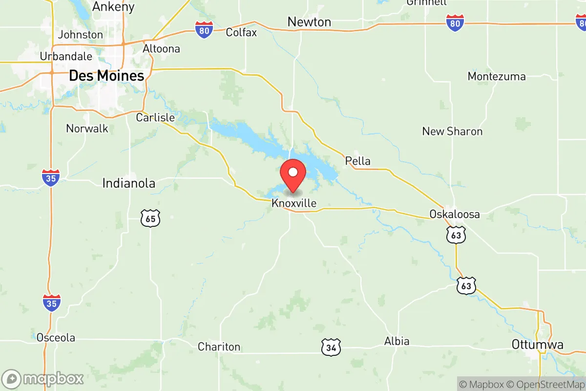
Marion County, Iowa, offers a compelling strategic position for relocators prioritizing resilience and self-sufficiency, balancing rural stability with practical access to regional infrastructure. Located in south-central Iowa, the county sits roughly 40 miles southeast of Des Moines and 60 miles northeast of the Missouri border, placing it outside the immediate blast or fallout zones of major metropolitan targets while remaining within a reasonable distance of supply chains and medical centers. The county seat of Knoxville, along with the towns of Pella, Pleasantville, and Bussey, anchor a landscape of working farms, rolling hills, and the Lake Red Rock reservoir, providing a mix of defensible terrain and natural resources that supports a long-term preparedness mindset.
Geographic position and natural advantages for long-term security
Marion County’s location in the Southern Iowa Drift Plain gives it a distinct topographical advantage over the flatter, more exposed regions to the north and west. The terrain is characterized by moderate hills, wooded creek valleys, and scattered bluffs, which offer natural cover, drainage, and defensible building sites. The county is bisected by the Des Moines River and its major impoundment, Lake Red Rock — the largest lake in Iowa at over 15,000 acres — which serves as a reliable surface water source and a buffer against drought. The lake is managed by the U.S. Army Corps of Engineers for flood control, meaning the area benefits from reduced flood risk downstream while maintaining a massive freshwater reservoir. For a relocator assessing water security, this is a significant asset: Lake Red Rock holds enough capacity to sustain a local population through extended dry periods, and the surrounding watershed is not heavily industrialized, reducing contamination risk. The county’s position also places it outside the primary tornado alley corridors that hammer central Oklahoma and Kansas, though severe weather remains a factor. Winter storms and occasional derecho events are the more consistent natural threats, but the terrain and tree cover mitigate wind exposure compared to open prairie counties.
Risks, exposures, and proximity to fallout-relevant landmarks
From a man-made risk standpoint, Marion County benefits from its distance to high-value strategic targets. The nearest major military installation is Camp Dodge in Johnston, Iowa, roughly 50 miles north — a state-level training facility that is not a primary nuclear target. The county is over 200 miles from Offutt Air Force Base near Omaha and over 300 miles from Whiteman Air Force Base in Missouri, both of which are more likely to be targeted in a major conflict. There are no refineries, major ports, or large-scale chemical plants within Marion County itself. The closest industrial complex of note is the Pella Corporation headquarters and manufacturing plant in Pella, which produces windows and doors — a conventional industrial site but not a high-priority fallout target. The Des Moines International Airport and the city’s urban core are roughly 40 miles northwest, placing Marion County outside the most severe blast and thermal radiation zones for a strike on the state capital. However, prevailing winds from the west and southwest mean that fallout from a strike on Offutt or Whiteman could potentially drift over the region, though the distance and dispersion would significantly reduce particulate concentration. For a relocator concerned with nuclear preparedness, Marion County’s primary exposure is not direct targeting but secondary fallout from distant strikes, which can be managed with basic sheltering and filtration. The county’s lack of high-density population centers also reduces the risk of civil unrest or resource competition during a crisis, compared to suburban Des Moines or the I-35 corridor.
Practical resilience for a relocator: food, water, energy, and defensibility
Marion County’s agricultural base is a core resilience asset. The county is dominated by row-crop agriculture — corn and soybeans — with a strong presence of livestock operations, particularly hog and cattle farms. For a relocator seeking food security, this means local access to grain, meat, and dairy without reliance on long-distance supply chains. The Pella Farmers Market and Knoxville’s local food networks provide direct-to-consumer channels, and the county’s rural zoning allows for small-scale animal husbandry and gardening on parcels as small as one to five acres. Water access is robust: beyond Lake Red Rock, the county sits atop the Jordan Aquifer, a deep sandstone aquifer that supplies municipal and private wells with consistent, high-quality groundwater. Many rural properties already have private wells, and the water table is shallow enough in most areas to permit hand-pump retrofits for off-grid scenarios. Energy infrastructure is mixed. MidAmerican Energy provides grid electricity, and natural gas lines run through Knoxville and Pella, but rural areas rely on propane or heating oil. Solar potential is moderate — Iowa averages about 200 sunny days per year — and the county’s hillsides offer good southern exposure for panel placement. Wood heating is viable given the extensive timber along the Des Moines River valley. Defensibility is aided by the terrain: the hills, creek crossings, and limited road network create natural chokepoints, and the county’s low population density (roughly 33,000 residents across 570 square miles) means that a prepared household can maintain operational security without constant neighborly pressure. The county has a strong tradition of hunting and firearms ownership, which aligns with a self-defense mindset, and the local sheriff’s office in Knoxville maintains a visible but non-intrusive presence.
The overall strategic picture for Marion County is one of balanced, low-profile resilience. It lacks the dramatic defensive geography of mountain redoubts or the resource abundance of coastal regions, but it compensates with reliable water, productive soil, and a position that is close enough to Des Moines for supply runs and medical care yet far enough to avoid the worst of a metropolitan collapse. The county’s risks are manageable: tornadoes and winter storms are the primary natural threats, and man-made risks are limited to secondary fallout from distant targets. For a relocator who values quiet preparedness over isolationist extremes, Marion County offers a defensible, self-sufficient base with a functioning local economy and a community that is accustomed to rural problem-solving. It is not a bug-out location for the end of the world — it is a place to live well while being ready for the worst.

* Values derived from national, state, county, city and local statistics and may differ in a specific area. Last updated: 2026-07-26T11:16:35.000Z
Narrative content on this page is AI-generated and may contain mistakes. Verify any details that matter before acting on them.
ReloMaps may earn a commission from affiliate links at no extra cost to you.

