
Photo: Wikipedia
Strategic Assessment of Whitley County
Workable tactical position. Some exposure to population density or targets, but generally defensible in a crisis.
What does the Strategic Assessment tell us?
Our Strategic Assessment grades tactical survivability of an area. Major population centers, military targets, fallout zones, natural disasters, and border exposure all drive risk — lower exposure means a more defensible position in a crisis.
This is heavily inspired by Joel Skousen's Strategic Relocation book. Highly recommended you checkout the book ($)What does this tell us?
Our Strategic Assessment grades tactical survivability of an area. Major population centers, military targets, fallout zones, natural disasters, and border exposure all drive risk — lower exposure means a more defensible position in a crisis.
This is heavily inspired by Joel Skousen's Strategic Relocation book. Highly recommended you checkout the book ($)Strategic Pillars

Key Distances
Strategic Assessment Analysis
Whitley County, Indiana, offers a strategic blend of Midwestern stability and practical self-sufficiency that appeals to relocation-minded individuals weighing long-term resilience. Anchored by the county seat of Columbia City and the smaller community of Churubusco, the area sits roughly 20 miles west of Fort Wayne, giving residents access to urban infrastructure without the concentration of risks found in a major metropolitan core. The county’s agricultural base, low population density, and distance from primary strategic targets make it a defensible choice for those prioritizing preparedness over convenience.
Geographic position and natural advantages for long-term stability
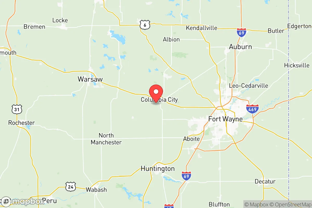
Whitley County’s location in northeast Indiana places it in a sweet spot: far enough from major population centers to reduce exposure to cascading urban failures, yet close enough to regional resources that isolation doesn’t become a liability. Fort Wayne, the state’s second-largest city, sits about 25 miles to the southeast, while the smaller towns of Warsaw and Huntington are within a 30-40 minute drive. This positioning means residents can access Level 1 trauma centers, major retail distribution, and rail infrastructure in Fort Wayne when needed, but they don’t live within the blast radius or immediate fallout plume of a major metropolitan target.
The county’s topography is gently rolling glacial till, with the Eel River and numerous small lakes—including the notable Chain O’Lakes near Columbia City—providing natural water sources. Soils are rich and well-drained, supporting a robust agricultural sector dominated by corn, soybeans, and livestock operations. For a relocator thinking about food security, this is not abstract: the county is surrounded by working farmland, and the local economy is deeply tied to production agriculture. The presence of the Bicentennial Nature Center and numerous county parks also indicates that green space and natural buffers are woven into the landscape, offering both recreational value and practical resources like firewood and game.
Climate-wise, Whitley County experiences the full range of Midwest seasons—cold winters with meaningful snowfall, humid summers, and a spring storm season that occasionally produces severe weather. Tornado risk is moderate, similar to most of Indiana, but the county’s flat, open terrain means warning times are generally adequate. The area is not prone to earthquakes, hurricanes, or wildfires, which narrows the list of natural threats a resident must plan for.
Risk exposure and proximity to fallout-relevant landmarks
No location in the continental United States is entirely free of risk, and Whitley County has its own set of exposures that a serious relocator should weigh. The most significant is the proximity to Fort Wayne, which hosts the Fort Wayne Air National Guard Base at the city’s airport. While not a major strategic nuclear target on the scale of an ICBM silo field or a major naval port, the base’s presence means the city carries a higher risk profile than a purely civilian metro area. A detonation aimed at Fort Wayne would produce fallout that could reach Whitley County depending on wind direction—typically a matter of hours, not minutes, given the 25-mile separation.
Industrial infrastructure is another consideration. The county itself is home to several manufacturing operations, including a large Dana Incorporated axle plant in Fort Wayne’s outskirts and various agricultural processing facilities in Columbia City. However, the more consequential industrial landmarks are outside the county: the BP Whiting Refinery on Lake Michigan, roughly 120 miles northwest, and the extensive petrochemical complex along the Chicago-Gary corridor. These are plausible secondary targets in a conflict scenario, and while Whitley County is well outside their immediate blast zones, prevailing westerly winds could carry particulate fallout across northern Indiana in a worst-case event. The same applies to the Palisades Nuclear Plant in Michigan, decommissioned but still storing spent fuel, located about 90 miles northeast.
On balance, Whitley County’s risk profile is moderate-low. It is not adjacent to any major military installation, nuclear power plant, or strategic port. The nearest significant military presence is the Air National Guard base in Fort Wayne, and the nearest nuclear facility is the Cook Nuclear Plant in Bridgman, Michigan, roughly 100 miles away. For a relocator whose baseline concern is avoiding primary and secondary target zones, this county offers a meaningful buffer.
Practical resilience for a relocator: food, water, energy, and defensibility
The practical question for any relocation decision is whether daily life can be sustained during a disruption. Whitley County scores well on food security because it is a net producer, not a net consumer. The county’s farms, grain elevators, and livestock operations mean that local food supply chains are short and robust. Columbia City hosts a weekly farmers market from spring through fall, and the surrounding countryside is dotted with roadside stands and u-pick operations. For a family looking to supplement store-bought groceries with local procurement, this is one of the better counties in the region.
Water is similarly favorable. The Eel River watershed and the county’s numerous glacial lakes provide surface water, while groundwater is accessible through private wells in most rural areas. Columbia City’s municipal water system draws from deep aquifers, and the county’s rural residents commonly rely on private wells—a resilience advantage over suburban areas dependent on centralized, fragile distribution networks. A relocator should verify well depth and water quality on any prospective property, but the underlying hydrogeology is sound.
Energy resilience is a mixed picture. The county is served by the regional grid operated by Northeastern REMC and Indiana Michigan Power, and power outages from winter storms or summer thunderstorms are a routine occurrence. However, the rural character of the county means that most homes have space for backup generation, and the prevalence of outbuildings and workshops makes solar panel installation or battery storage a practical retrofit. Natural gas is available in Columbia City and Churubusco, but rural properties often rely on propane or heating oil, which requires proactive storage planning. For a relocator serious about energy independence, the county’s low-density layout is an asset: there is room for solar arrays, wood stoves, and generator sheds without neighbor disputes.
Defensibility is where Whitley County’s geography works in a relocator’s favor. The county’s road network is a grid of county roads and state highways, with U.S. 30 running east-west through the southern portion and State Road 9 providing a north-south corridor. This creates multiple egress routes in an emergency, unlike a canyon or coastal area with limited exits. The rural landscape offers natural chokepoints and sightlines, and the dispersed population means that a family on a 5-10 acre parcel has inherent privacy and buffer. The county’s sheriff’s department and the Columbia City Police Department are professional and well-equipped, but the reality is that rural Indiana communities expect residents to be the first line of their own defense—a cultural norm that aligns well with a preparedness-minded relocator.
The overall strategic picture for Whitley County is one of quiet, unglamorous resilience. It lacks the dramatic mountain redoubts of the West or the coastal isolation of the Northeast, but it offers something arguably more valuable: a working agricultural economy, abundant fresh water, moderate climate risk, and a location that is off the main targeting list for any plausible conflict scenario. The trade-offs are real—winters are cold, cultural amenities are limited, and the nearest major airport is an hour away—but for a family or individual whose priority is a defensible, self-sufficient base within reach of regional infrastructure, Whitley County represents a rational, grounded choice. It is not a bunker; it is a farm community with the practical bones to weather disruption, and that may be the more honest and sustainable form of preparedness.

* Values derived from national, state, county, city and local statistics and may differ in a specific area. Last updated: 2026-10-23T01:06:39.000Z
Narrative content on this page is AI-generated and may contain mistakes. Verify any details that matter before acting on them.
ReloMaps may earn a commission from affiliate links at no extra cost to you.

